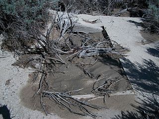
Silver Peak is an unincorporated community and census-designated place (CDP) in Esmeralda County, Nevada, United States. It lies along State Route 265, 20 miles (32 km) south of U.S. Route 6 and 30 miles (48 km) west of Goldfield, the county seat of Esmeralda County. It has a post office, with the ZIP code of 89047. The population of Silver Peak was 142 as of 2019.

Midas is a small unincorporated community in Elko County, Nevada. Although its population has fluctuated greatly over the years and it often appears on internet ghost town lists, it has never been completely abandoned, and one can meet many of the living citizenry at the aptly named Ghost Town Saloon, its sole business. Alongside Jarbidge, the town was known as one of the biggest twentieth-century gold mining towns in Elko County.
Belleville, Nevada, in Mineral County, Nevada, United States, was a mining town that rose up around the milling of ore shipped in from nearby mines. Today it is a ghost town.

Gold Hill is an unincorporated community in far western Tooele County, Utah, located near the Nevada state line.
Ticaboo is an unincorporated community in far southeastern Garfield County, Utah, United States.
Mohrland is a ghost town located in Emery County, Utah, United States. Lying in Cedar Creek Canyon near the Carbon County line, Mohrland was Emery County's largest coal mining town, with a history more typical of Carbon County's coal camps than of most Emery County communities.
La Plata is a ghost town on the southern end of Cache County, Utah, United States. Located in the Bear River Mountains on a small tributary of the east fork of the Little Bear River, La Plata was a short-lived silver mining boomtown in the 1890s.

Newhouse is a ghost town located on the eastern edge of the Wah Wah Valley in Beaver County, Utah, United States. A silver mining town based on the Cactus Mine on the western slopes of the San Francisco Mountains, Newhouse was smaller and quieter than Frisco, 5 miles (8.0 km) to the southeast.
Grass Creek is a ghost town in Summit County, Utah, United States. Lying some 8 miles (13 km) northeast of Coalville, it was once an important coal mining town. Grass Creek was inhabited circa 1860–1940.
Poeville, also known as Peavine until 1863, is the site of a historical mining town, established in 1864. John Poe, a professional promoter from Michigan allegedly related to Edgar Allan Poe, discovered rich gold and silver veins in 1862 on the slopes of Peavine Mountain. After the discovery of ore, Poe announced that the veins comprised the next Comstock Lode; he presented extracted ore at the state fair of 1864 as rich in content. As a result, the former mining camp, called Poe City (Poeville) or Podunk (Poedunk), grew to 200 people by 1864. Ore production in the mining district and population peaked around 1873-1874 with several hundred people living in town, supported by three hotels and a post office. The post office, named "Poeville", operated between September 1, 1874, and March 24, 1878.

Peerless is a ghost town in Carbon County, Utah, United States. It is located just 3 miles (4.8 km) west of Helper.
Dragon is a ghost town in Uintah County, at the extreme eastern edge of Utah, United States. Founded in about 1888 as a Gilsonite mining camp, Dragon boomed in the first decade of the 20th century as the end-of-line town for the Uintah Railway. Although it declined when the terminus moved farther north in 1911, Dragon survived as the largest of the Gilsonite towns. It was abandoned after its mining operations stopped in 1938 and the Uintah Railway went out of business in 1939.
Roach is a ghost town and railroad siding in Clark County, Nevada, United States. It is located along the Union Pacific Railroad, between Jean, Nevada and Nipton, California.
Rioville, Nevada was a settlement founded by Latter-day Saints in what they thought was Utah Territory in 1869, now under Lake Mead and within Clark County, Nevada.

El Dorado Canyon is a canyon in southern Clark County, Nevada famed for its rich silver and gold mines. The canyon was named in 1857 by steamboat entrepreneur Captain George Alonzo Johnson when gold and silver was discovered here. It drains into the Colorado River at the former site of Nelson's Landing.
Goldville is a ghost town in the Eureka County, state of Nevada, in the United States.
Potosi or Potosi Camp, was called Crystal City in the 1870s, a mining ghost town in Clark County, Nevada. It lies at an elevation of 5705 feet.

Bowen is an extinct town in Las Animas County, in the U.S. state of Colorado. The 1911 Colorado Business Directory describes the town as "Coal mining town and station", population 200, on the Colorado and Southern Railway.
Eagleville is a former populated place in Mineral County, Nevada that is now a ghost town.
White Plains is a ghost town in Churchill County, in the U.S. state of Nevada.


