Lund, Nevada | |
---|---|
Census-designated place | |
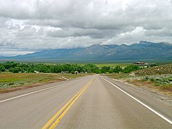
![]() Lund from northbound Nevada State Route 318 | |
Coordinates: 38°51′42″N115°00′22″W / 38.86167°N 115.00611°W | |
Country | United States |
State | ![]() |
County | White Pine |
Area | |
• Total | 1.97 sq mi (5.10 km2) |
• Land | 1.97 sq mi (5.10 km2) |
• Water | 0.00 sq mi (0.00 km2) |
Elevation | 5,574 ft (1,699 m) |
Population (2020) | |
• Total | 211 |
• Density | 107.22/sq mi (41.39/km2) |
Time zone | UTC-8 (Pacific (PST)) |
• Summer (DST) | UTC-7 (PDT) |
ZIP codes | 89317 |
Area code | 775 |
FIPS code | 32-43400 |
GNIS feature ID | 2583940 [2] |
Lund is a small town and census-designated place in White Pine County, Nevada, United States. The population of Lund as of 2020 was 211. [3]
Lund was named for Anthon H. Lund, a Mormon church official. [4]
In the early 1870s, the Plane family established the first enduring settlement in what is now Lund, Nevada. Their success stemmed from managing farmland, breeding horses, running a dairy, and operating a waystation. Later, James R. Withington gained ownership of Tom Plane's ranch and built White Pine County's first flour mill at the Tom Plane's spring head.
Lund was settled in 1898 on land that the United States government had given the Church of Jesus Christ of Latter-day Saints (LDS Church) in lieu of land that had been confiscated under the Edmunds–Tucker Act. The first settlers were Latter-day Saints, [5] and the LDS Church still has a ward in Lund.
On June 24, 2020, the Brown Fire threatened Lund, resulting in residents on the south side being evacuated from their homes. Residents were allowed to return that evening. The Brown Fire burned over 8,000 acres (3,237 ha). [6] [7]
The co-located Lund Elementary School (K-5) and Lund High School (6-12) operate as Lund Combined Schools, part of the White Pine County School District. [8] Lund Grade School, built in 1915, operated for 90 years until 2005. The school building was added to the National Register of Historic Places in 2018 after being nominated by local residents. [9]
Lund is served by Nevada State Route 318 which passes through the town.
Census | Pop. | Note | %± |
---|---|---|---|
2010 | 282 | — | |
2020 | 211 | −25.2% | |
U.S. Decennial Census [10] |
![]() | This section needs expansion. You can help by adding to it. (September 2022) |
Climate data for Lund, Nevada (1991–2020 normals, extremes 1957–2018) | |||||||||||||
---|---|---|---|---|---|---|---|---|---|---|---|---|---|
Month | Jan | Feb | Mar | Apr | May | Jun | Jul | Aug | Sep | Oct | Nov | Dec | Year |
Record high °F (°C) | 68 (20) | 75 (24) | 80 (27) | 83 (28) | 94 (34) | 99 (37) | 104 (40) | 104 (40) | 95 (35) | 90 (32) | 78 (26) | 69 (21) | 104 (40) |
Mean maximum °F (°C) | 55.8 (13.2) | 61.0 (16.1) | 68.7 (20.4) | 76.9 (24.9) | 85.3 (29.6) | 92.2 (33.4) | 97.0 (36.1) | 95.3 (35.2) | 89.0 (31.7) | 80.1 (26.7) | 68.6 (20.3) | 58.0 (14.4) | 97.9 (36.6) |
Mean daily maximum °F (°C) | 42.5 (5.8) | 46.0 (7.8) | 54.4 (12.4) | 60.6 (15.9) | 69.9 (21.1) | 80.8 (27.1) | 88.3 (31.3) | 86.6 (30.3) | 78.4 (25.8) | 65.9 (18.8) | 52.9 (11.6) | 42.2 (5.7) | 64.0 (17.8) |
Daily mean °F (°C) | 28.1 (−2.2) | 31.7 (−0.2) | 38.6 (3.7) | 44.0 (6.7) | 52.3 (11.3) | 61.3 (16.3) | 68.4 (20.2) | 66.7 (19.3) | 58.9 (14.9) | 47.6 (8.7) | 36.4 (2.4) | 27.5 (−2.5) | 46.8 (8.2) |
Mean daily minimum °F (°C) | 13.7 (−10.2) | 17.5 (−8.1) | 22.7 (−5.2) | 27.3 (−2.6) | 34.8 (1.6) | 41.9 (5.5) | 48.6 (9.2) | 46.9 (8.3) | 39.5 (4.2) | 29.3 (−1.5) | 20.0 (−6.7) | 12.9 (−10.6) | 29.6 (−1.3) |
Mean minimum °F (°C) | −0.3 (−17.9) | 1.6 (−16.9) | 10.0 (−12.2) | 15.0 (−9.4) | 23.7 (−4.6) | 32.0 (0.0) | 41.0 (5.0) | 38.7 (3.7) | 29.4 (−1.4) | 18.0 (−7.8) | 5.2 (−14.9) | −1.3 (−18.5) | −6.2 (−21.2) |
Record low °F (°C) | −20 (−29) | −12 (−24) | −2 (−19) | −3 (−19) | 13 (−11) | 23 (−5) | 33 (1) | 32 (0) | 19 (−7) | 5 (−15) | −11 (−24) | −17 (−27) | −20 (−29) |
Average precipitation inches (mm) | 0.94 (24) | 0.96 (24) | 0.96 (24) | 0.80 (20) | 0.91 (23) | 0.74 (19) | 0.52 (13) | 0.77 (20) | 0.75 (19) | 0.88 (22) | 0.57 (14) | 0.70 (18) | 9.50 (241) |
Average snowfall inches (cm) | 6.0 (15) | 4.1 (10) | 2.7 (6.9) | 0.8 (2.0) | 0.1 (0.25) | 0.0 (0.0) | 0.0 (0.0) | 0.0 (0.0) | 0.0 (0.0) | 0.0 (0.0) | 1.3 (3.3) | 6.6 (17) | 21.6 (55) |
Average precipitation days (≥ 0.01 in) | 5.9 | 5.8 | 5.8 | 5.6 | 6.0 | 3.0 | 4.1 | 4.5 | 3.2 | 4.0 | 3.7 | 4.8 | 56.4 |
Average snowy days (≥ 0.1 in) | 2.1 | 1.9 | 1.2 | 0.4 | 0.1 | 0.0 | 0.0 | 0.0 | 0.0 | 0.0 | 0.6 | 2.0 | 8.3 |
Source: NOAA (mean maxima/minima 1981–2010) [11] [12] |
Preston is a city in Franklin County, Idaho, United States. The population was 5,591 at the 2020 census, up from 5,204 at the 2010 census. The city is the county seat of Franklin County. It is part of the Logan, Utah-Idaho Metropolitan Statistical Area.
Nauvoo is a small city in Hancock County, Illinois, United States, on the Mississippi River near Fort Madison, Iowa. The population of Nauvoo was 950 at the 2020 census. Nauvoo attracts visitors for its historic importance and its religious significance to members of several groups: The Church of Jesus Christ of Latter-day Saints; the Community of Christ, formerly the Reorganized Church of Jesus Christ of Latter-day Saints (RLDS); other groups stemming from the Latter Day Saint movement; and the Icarians. The city and its immediate surrounding area are listed on the National Register of Historic Places as the Nauvoo Historic District.
Brigham City is a city in Box Elder County, Utah, United States. The population was 19,650 at the 2020 census, up from the 2010 figure of 17,899. It is the county seat of Box Elder County. It lies on the western slope of the Wellsville Mountains, a branch of the Wasatch Range at the western terminus of Box Elder Canyon. It is near the former headquarters of ATK Thiokol, now Northrop Grumman, the company that created the solid rocket boosters for the Space Shuttle.
Richmond is a city in Cache County, Utah, United States. The population was 2,733 at the 2020 census. It is included in the Logan metropolitan area.
Santa Clara is a town / city in Washington County, in southwestern Utah, and is a part of the St. George Metropolitan Area. The population has grown considerably in the last three decades, and was at 7,553 counted in the 2020 U.S. Decennial Census, up from 6,003 at the previous 2010 U.S. Decennial Census, and 4,630 at the earlier 2000 U.S. Decennial Census. The region and county borders the states of Arizona to the south and Nevada to the west. The town is a western suburb of the nearby county seat and larger city of St. George, Utah
St. Thomas, Nevada is a ghost town in Clark County, Nevada, United States, near where the Muddy River flows into the Colorado River. St. Thomas was purchased by the US Federal Government and abandoned as the waters of Lake Mead submerged the town in the 1930s.
The Church of Jesus Christ of Latter-day Saints in Nevada refers to the Church of Jesus Christ of Latter-day Saints and its members in Nevada. Nevada has the 7th most church members of any U.S. state, and the fifth-highest percentage of members. The LDS Church is the 2nd largest denomination in Nevada, behind the Roman Catholic Church.
The Ely LDS Stake Tabernacle was built by the Church of Jesus Christ of Latter-day Saints in 1927-1928 as a church and community center in Ely, Nevada. The two-story Colonial Revival building is now owned by White Pine County and is used as a community meeting hall. The contractor for the project was Joseph Don Carlos Young, grandson of Brigham Young.
The Georges Fire was a wildfire in Inyo County, California in the United States. The fire was reported on July 8, 2018 in a rural area north of Lone Pine and west of Manzanar. The fire was started by a lightning strike and impacted recreational activities in the Inyo National Forest, as well as the habitat for Sierra Nevada bighorn sheep, an endangered species. The fire burned 2,883 acres (12 km2), before burning out on July 18.
The Taboose Fire was a wildfire burning in Inyo National Forest, southwest of Big Pine and northwest of Aberdeen in Inyo County in the state of California, in the United States. The fire started September 4, 2019 and on October 7, it had burned 10,296 acres (4,167 ha) and was 75 percent contained. The cause of the fire was lightning. Select trails, campgrounds and roads in Inyo National Forest, Sequoia National Park and Kings Canyon National Park had been closed due to the fire. The community of Baxter Ranch was under mandatory evacuation.
The Mangum Fire was a wildfire in Kaibab National Forest in Arizona in the United States. The fire, which started on June 8, 2020 approximately 16 miles north of the North Rim of Grand Canyon National Park, burned a total of 71,450 acres (28,915 ha). The fire threatened the community of Jacob Lake, Arizona, resulting in its evacuation. Select highways were closed, including Highway 67, which resulted in closure of the North Rim of the Grand Canyon. Additionally, areas of the Paria Canyon-Vermilion Cliffs Wilderness were inaccessible due to closures. Four buildings were destroyed, including two historic cabins. The exact cause of the fire remains under investigation, however, fire officials have confirmed it was human caused.
The Brown Fire was a wildfire that burned in Lund, Nevada in the United States. First reported on June 24, 2020, the Brown Fire burned 8,268 acres (3,346 ha) and was contained on June 30, 2020. The fire skirted along Highway 318 and threatened the south side of Lund, resulting in the mandatory evacuation of residents in the southern part of the community. The cause of the fire remains under investigation.
The Numbers Fire was a wildfire that burned in the Pine Nut Mountains, near Gardnerville, Nevada, in the United States. The fire was reported on July 6, 2020, and burned 18,342 acres (7,423 ha). It was contained on July 14, 2020. The fire threatened the communities of Ruhenstroth, Pine View Estates and Bodie Flats, totaling approximately 1,000 homes. It resulted in the mandatory evacuations of Pine View Estates and Bodie Flats and the closure of a 15-mile stretch of Highway 395. Forty structures were destroyed, including three homes. The fire was started by a truck with mechanical issues which discharged particles which ignited the fire.
The Pine Gulch Fire was a wildfire that burned in Mesa County and Garfield County, Colorado in the United States. The fire was started by a lightning strike and first reported on July 31, 2020, and quickly grew, resulting in the fire being named the largest wildfire in Colorado history, surpassing the 2002 Hayman Fire. Almost seven weeks later, it was surpassed by the Cameron Peak Fire in Larimer County.
The Lake Fire was a wildfire that burned during the 2020 California wildfire season in the Angeles National Forest in Los Angeles County in the state of California in the United States. The fire, which was first reported on August 12, 2020, burned 31,089 acres (12,581 ha) near Lake Hughes. It was fully contained on September 28. The cause of the fire remains unknown. The fire has damaged 3 structures, destroyed 12 structures and 21 outbuildings, and injured 4 firefighters.
The 2020 Creek Fire was a very large wildfire in central California's Sierra National Forest, in Fresno and Madera counties. One of the most significant fires of California's record-setting 2020 wildfire season, it began on September 4, 2020, and burned 379,895 acres (153,738 ha) over several months until it was declared 100% contained on December 24, 2020. The Creek Fire is the sixth-largest wildfire in recorded California history and the third-largest single fire—i.e. not part of a larger wildfire complex—following the 2021 Dixie Fire.
The Mountain View Fire was a fire that erupted near Walker, California, on November 17, 2020. As of December 11, 2020, the fire was fully contained, and claimed one life. The fire crossed the Nevada border into Douglas County. The fire was a ground fire and there was little activity due to snow. The fire destroyed 70 Homes.
The Tamarack Fire was a wildfire that burned 68,637 acres (27,776 ha), primarily in the Mokelumne Wilderness in Alpine County, California, Douglas County, Nevada and Lyon County, Nevada, as part of the 2021 California wildfire season.
The McFarland Fire was a very large wildfire that burned in the Shasta-Trinity National Forest north of Wildwood in Trinity County, Shasta County, and Tehama County, California in the United States. Started by a lightning strike, the fire was first reported on July 29, 2021 on McFarland Ridge south of Highway 36. As of September 16, 2021, the fire had burned 122,653 acres (49,636 ha) and destroyed 46 structures.
The Beckwourth Complex was a wildfire complex that burned in the Plumas National Forest in Plumas and Lassen counties. The two major fires of the complex, the Dotta Fire and the Sugar Fire, started on June 30 and July 2 northeast of Beckwourth, California. Started by lightning strikes, the two fires collectively burned 105,670 acres (42,763 ha). The complex resulted in the evacuation of numerous residential areas and the closure of portions of Plumas National Forest. In the community of Doyle, California, 33 homes were destroyed.