Humboldt County | |
|---|---|
 Humboldt County Courthouse in Winnemucca | |
 Flag | |
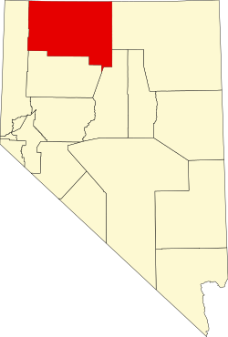 Location within the U.S. state of Nevada | |
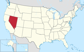 Nevada's location within the U.S. | |
| Coordinates: 41°25′N118°07′W / 41.41°N 118.12°W | |
| Country | |
| State | |
| Founded | 1856 |
| Named after | Humboldt River |
| Seat | Winnemucca |
| Largest city | Winnemucca |
| Area | |
• Total | 9,658 sq mi (25,010 km2) |
| • Land | 9,641 sq mi (24,970 km2) |
| • Water | 17 sq mi (44 km2) 0.2% |
| Population (2020) | |
• Total | 17,285 |
| • Density | 1.793/sq mi (0.6922/km2) |
| Time zone | UTC−8 (Pacific) |
| • Summer (DST) | UTC−7 (PDT) |
| Congressional district | 2nd |
| Website | hcnv |
Humboldt County is a county in the U.S. state of Nevada. As of the 2020 Census, the population was 17,285. [1] It is a largely rural county that is sparsely populated with the only major city being Winnemucca which has a population of 8,431. [2] Humboldt County comprises the Winnemucca, NV Micropolitan Statistical Area and serves as an important crossroads in the national transportation network. Interstate 80 travels through the southeastern corner of the county, meeting US 95 in Winnemucca that serves as a primary freight corridor between Northern Nevada and Boise, Idaho and the Interstate 84 freight corridor that links much of the Pacific Northwest. The original transcontinental railway, constructed by the Central Pacific Railroad, reached Humboldt County on September 16, 1868. [3] The Western Pacific Railroad would reach Humboldt County by November 1909, [4] providing two mainline rail links to California and the Eastern United States. Both railroads have since been acquired by the Union Pacific Railroad, who continues to serve the region today.
Contents
- History
- Geography
- Adjacent counties
- National protected areas
- Reservations
- Demographics
- 2000 census
- 2010 census
- Education
- Law enforcement
- Politics
- Economy
- Lithium mine
- Transportation
- Major highways
- Communities
- City
- Census-designated places
- Unincorporated communities
- See also
- References
- External links
The county contains several areas of land belonging to regionally significant Native American communities including the Fort McDermitt Paiute and Shoshone Tribe and the Winnemucca Indian Colony of Nevada.
Largely a region with ranchers and farmers, the county came under increased attention after the 2017 proposal of the Thacker Pass Lithium Mine. The mine has been controversial locally and in the national press—as it would be the first major lithium clay mine to open in the United States and be important to the local economy but threatens local ecosystems and indigenous heritage sites. [5] [6]


