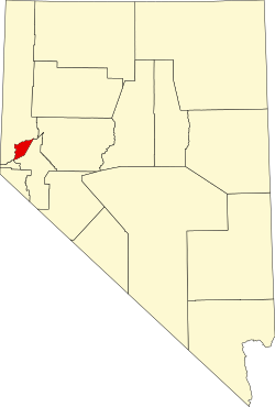
Storey County is a county located in the U.S. state of Nevada. As of the 2020 census, the population was 4,104,[1] making it the third-least populous county, but one of the fastest-growing economies in Nevada. In 2018, over 18,000 people were employed in the county.[2] Its area is 264 square miles (680 square kilometers), making it the smallest county in Nevada in terms of area (though the independent city of Carson City is smaller). Its county seat is Virginia City.[3] Storey County is part of the Reno-Sparks metropolitan area. The population of the county has fluctuated significantly throughout the years, from a high of 16,115 in 1880 to a low of 568 in 1960.[4]
The county population collapsed after the Comstock Lode was fully mined and hit a low of 568 in the 1960 census. Since then, its population has partially recovered because of its relative proximity to Reno.
Geography
According to the U.S. Census Bureau, the county has a total area of 264 square miles (680km2), of which 263 square miles (680km2) are land and 0.7sqmi (1.8km2) (0.3%) is covered by water.[6]
U.S. Decennial Census[8] 1790–1960[9] 1900–1990[10] 1990–2000[11] 2010–2020[1]
2020 census
As of the 2020 census, the county had a population of 4,104; the median age was 54.2 years, 15.1% of residents were under the age of 18, and 29.4% were 65 years of age or older. For every 100 females there were 98.7 males, and for every 100 females age 18 and over there were 101.1 males age 18 and over. 10.9% of residents lived in urban areas while 89.1% lived in rural areas.[12]
Storey County, Nevada – Racial and ethnic composition Note: the US Census treats Hispanic/Latino as an ethnic category. This table excludes Latinos from the racial categories and assigns them to a separate category. Hispanics/Latinos may be of any race.
There were 1,807 households in the county, of which 22.5% had children under the age of 18 living with them and 20.5% had a female householder with no spouse or partner present. About 26.6% of all households were made up of individuals and 14.1% had someone living alone who was 65 years of age or older.[17]
There were 1,987 housing units, of which 9.1% were vacant. Among occupied housing units, 87.0% were owner-occupied and 13.0% were renter-occupied. The homeowner vacancy rate was 1.3% and the rental vacancy rate was 7.5%.[17]
2010 census
At the 2010 census, 4,010 people, 1,742 households, and 1,141 families were living in the county.[18] The population density was 15.3 inhabitants per square mile (5.9/km2). The 1,990 housing units averaged 7.6 unitsper square mile (2.9 units/km2).[19] The racial makeup of the county was 92.1% White, 1.6% Asian, 1.6% American Indian, 1.0% Black or African American, 0.4% Pacific Islander, 1.1% from other races, and 2.2% from two or more races. Those of Hispanic or Latino origin made up 5.7% of the population.[18] In terms of ancestry, 20.9% were German, 20.1% were Irish, 11.5% were English, 7.2% were Italian, and 2.6% were American.[20]
Of the 1,742 households, 23.1% had children under the age of 18 living with them, 53.6% were married couples living together, 7.6% had a female householder with no husband present, 34.5% were non-families, and 26.0% of households were made up of individuals. The average household size was 2.30 and the average family size was 2.76. The median age was 50.5 years.[18]
The median household income was $61,525 and the median family income was $65,121. Males had a median income of $53,936 versus $34,208 for females. The per capita income for the county was $31,079. About 0.4% of families and 5.6% of the population were below the poverty line, including 2.6% of those under age 18 and 0.0% of those age 65 or over.[21]
2000 census
At the 2000 census, 3,399 people, 1,462 households, and 969 families were living in the county. The population density was 13 peopleper square mile (5.0 people/km2). The 1,596 housing units averaged 6 unitsper square mile (2.3 units/km2). The racial makeup of the county was 93.0% White, 0.3% Black or African American, 1.4% Native American, 1.0% Asian, 0.15% Pacific Islander, 1.7% from other races, and 2.4% from two or more races. About 5.1% of the population was Hispanic or Latino of any race.[22]
Of the 1,462 households, 21.8% had children under the age of 18 living with them, 54.6% were married couples living together, 7.5% had a female householder with no husband present, and 33.7% were non-families. 25.6% of households were one person and 6.9% were one person aged 65 or older. The average household size was 2.32, and the average family size was 2.74.
In the county, the population was distributed as 19.7% under the age of 18, 4.7% from 18 to 24, 26.8% from 25 to 44, 35.7% from 45 to 64, and 13.1% 65 or older. The median age was 44 years. For every 100 females, there were 107.6 males. For every 100 females age 18 and over, there were 103.1 males.
The median income for a household was $45,490 and for a family was $57,095. Males had a median income of $40,123 versus $26,417 for females. The per capita income for the county was $23,642; 5.8% of the population and 2.5% of families were below the poverty line. Out of the total people living in poverty, 4.2% were under the age of 18 and 4.8% were 65 or older.
Technology, manufacturing and logistics are the main sectors.[23] In 2010, manufacturing jobs were less than 500, increasing to over 11,000 by 2019, many of them making battery storage.[24] Logistics jobs increased from 1,300 to 4,000 in the same period.[25] In 2014, 5,000 people were working in the county,[26] increasing to over 18,000 by 2018, mostly in the Tahoe Reno Industrial Center.[23] The Tesla Gigafactory 1 had been constructed there.
Storey County has legal prostitution, which provided a significant portion of the tax base. The county is also trying to lure high-technology businesses.[27]
In May 2018, U.S. Treasury Secretary Steven Mnuchin had instructed his staff to accept a tract in the county as an opportunity zone under the Tax Cuts and Jobs Act of 2017, though it had not qualified as low-income.[28]Michael Milken, who had attended multiple events with and given a private flight to Mnuchin leading up to the designation, was already an investor in the tract.[28]
Politics
Storey County leans towards the Republican Party, with it voting for every Republican since 1980, with the exception being in 1992, when it voted for Independent Ross Perot. It was the only county in the state to do so.
United States presidential election results for Storey County, Nevada[29]
This page is based on this Wikipedia article Text is available under the CC BY-SA 4.0 license; additional terms may apply. Images, videos and audio are available under their respective licenses.