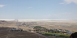
West Wendover, Nevada

Last updated

West Wendover
2013-07-04 14 10 07 View of West Wendover in Nevada from a hill to the west.jpg
West Wendover, Nevada viewed from a hill west of town
Flag of West Wendover, Nevada.gif
Nickname(s): 
A Young City... An Old History, [1] Where the West Begins [2]
Motto: 
Come Grow with Us [1]
Elko County Nevada Incorporated and Unincorporated areas West Wendover Highlighted.svg
Location of West Wendover, Nevada
USA Nevada location map.svg
Red pog.svg
West Wendover
Usa edcp location map.svg
Red pog.svg
West Wendover
Coordinates: 40°44′52″N114°04′42″W / 40.74778°N 114.07833°W / 40.74778; -114.07833
Country Flag of the United States (23px).png  United States
State Flag of Nevada.svg  Nevada
County Elko
Area
[3]
  Total7.48 sq mi (19.37 km2)
  Land7.48 sq mi (19.37 km2)
  Water0.00 sq mi (0.00 km2)
Elevation
[4]
4,524 ft (1,379 m)
Population
 (2020)
  Total4,512
  Density603.37/sq mi (232.97/km2)
Time zone UTC−7 (Mountain (MST))
  Summer (DST) UTC−6 (MDT)
ZIP code
89883
Area code 775
FIPS code 32-83730
GNIS feature ID2412232 [4]
Website Official website

West Wendover is a small city in Elko County, Nevada, United States. The population was 4,512 at the 2020 census. It is part of the Elko micropolitan area. West Wendover is located on the eastern border of Nevada and the western edge of the Great Salt Lake Desert and is contiguous with Wendover, Utah, with which it is sometimes confused. It is home to five casinos and a cannabis dispensary which attract many visitors from neighboring Utah, [5] where both casino gambling and non-medical cannabis are illegal. Interstate 80 runs just north of the cities, while Interstate 80 Business (Wendover Boulevard) runs through the two cities.

Contents

History

United States Army Air Force Monument in West Wendover USAAF Monument in West Wendover, Nevada.jpg
United States Army Air Force Monument in West Wendover

West Wendover began to develop in the 1930s and 1940s with the introduction of legalized gambling in the state of Nevada. William "Bill" Smith founded a small cobblestone service station for travelers crossing the desert terrain of western Utah and eastern Nevada. Today this facility is known as the Wendover Nugget. It held the record as the oldest continually operated gaming license for a casino in the State of Nevada for over 66 years, until December 2001, when the former State Line Casino and Hotel came under new ownership.

Through the 1970s and 1980s, West Wendover began to emerge as a destination resort. Additional business arrived constructing more casinos, hotels and other service establishments, as well as recreational venues, such as the Toana Vista Golf Course. As growth continued to spiral up, the citizens of West Wendover, Nevada, then a township of Elko County, elected to incorporate under self-rule. On July 1, 1991, the city of West Wendover, Nevada, came into existence. Amber S Holt named the city seal of West Wendover encouraging people to "Come Grow With Us." [6]

In October 1999, the U.S. Department of Transportation moved West Wendover out of the Pacific Time Zone due to the strong economic ties between West Wendover and neighboring Utah. This made the city of West Wendover the only portion of Nevada legally in the Mountain Time Zone. [7] The communities of Jackpot, Jarbidge, Mountain City, and Owyhee in northern Elko County also observe Mountain Time, but only on an unofficial basis.

West Wendover has thrived under a lucrative gambling industry in Nevada, which has generated tax revenue for city services and better schools.

Residents in both cities have voted to annex Wendover into Nevada, saying they are one community that has been divided for too long. Some politicians in both the State of Utah and the State of Nevada have endorsed the idea, but the U.S. House of Representatives resolution permitting Wendover to leave Utah and join Nevada was stalled in the U.S. Senate in 2002 and did not become law. [8] However, the politicians in Wendover, Utah, placed a permanent halt to the annexation process through a vote on November 15, 2006. The motion made was to halt the annexation process. The vote was a tie, with two Council Members voting to halt the process and two Council Members supporting the continuation of the process. The tie vote was broken up by a vote of Wendover, Utah, Mayor Brett Shelton who voted to discontinue the annexation process. Previously, West Wendover had decided to halt any further work after Wendover, Utah, indicated they were going to discuss and make a decision as to whether or not they would proceed. [9] Article IV, Section 3 of the U.S. Constitution requires that any change in state boundaries be approved by the U.S. Congress as well as by the two state legislatures. [10]

In December 2019, West Wendover's first recreational cannabis dispensary opened. Because cannabis is illegal in bordering Utah, the dispensary mainly serves Utah residents visiting the town. [11]

Geography

West Wendover is located at 40°44′22″N114°4′11″W / 40.73944°N 114.06972°W / 40.73944; -114.06972 (40.739512, -114.069796). [12]

According to the United States Census Bureau, the city has a total area of 7.5 sq mi (19 km2), all land.

Climate

Wendover and West Wendover have a cool arid climate (Köppen BWk) with hot summers, freezing winters, and substantial diurnal temperature ranges. The cities’ location east of the Ruby Mountains makes them the driest in the Great Basin, averaging only 4.58 inches or 116 millimetres of precipitation per year, or about half that of nearby Ely or Elko. It affects snowfall even more dramatically: Wendover and West Wendover average only 5.5 inches or 0.14 metres of snow, one-eighth to one-tenth the snowfall of the two nearby county seats.

Climate data for West Wendover Air Force Base
MonthJanFebMarAprMayJunJulAugSepOctNovDecYear
Record high °F (°C)64
(18)
80
(27)
81
(27)
92
(33)
103
(39)
105
(41)
112
(44)
110
(43)
103
(39)
90
(32)
78
(26)
65
(18)
112
(44)
Mean daily maximum °F (°C)35.8
(2.1)
42.9
(6.1)
53.1
(11.7)
62.5
(16.9)
72.7
(22.6)
82.9
(28.3)
92.5
(33.6)
89.9
(32.2)
78.9
(26.1)
63.7
(17.6)
47.6
(8.7)
37.0
(2.8)
63.3
(17.4)
Mean daily minimum °F (°C)18.7
(−7.4)
24.4
(−4.2)
32.0
(0.0)
40.1
(4.5)
49.4
(9.7)
58.4
(14.7)
67.0
(19.4)
64.4
(18.0)
53.3
(11.8)
41.3
(5.2)
28.9
(−1.7)
20.5
(−6.4)
41.5
(5.3)
Record low °F (°C)−16
(−27)
−12
(−24)
8
(−13)
19
(−7)
26
(−3)
31
(−1)
43
(6)
36
(2)
28
(−2)
18
(−8)
5
(−15)
−18
(−28)
−18
(−28)
Average precipitation inches (mm)0.28
(7.1)
0.28
(7.1)
0.37
(9.4)
0.48
(12)
0.72
(18)
0.51
(13)
0.25
(6.4)
0.34
(8.6)
0.34
(8.6)
0.47
(12)
0.29
(7.4)
0.25
(6.4)
4.58
(116)
Average snowfall inches (cm)1.6
(4.1)
1.4
(3.6)
0.5
(1.3)
0.2
(0.51)
0.0
(0.0)
0.0
(0.0)
0.0
(0.0)
0.0
(0.0)
0.0
(0.0)
0.1
(0.25)
0.4
(1.0)
1.3
(3.3)
5.5
(14.06)
Source: [13]

Demographics

Quote from Harry S. Truman on USAAF Monument Text of monument, WW, NV.jpg
Quote from Harry S. Truman on USAAF Monument
Historical population
CensusPop.Note
1990 2,007
2000 4,721135.2%
2010 4,410−6.6%
2020 4,5122.3%
U.S. Decennial Census [14]

As of the 2010 United States census West Wendover had a population of 4,410. The racial and ethnic makeup of the population was 61.7% Hispanic or Latino, 33.8% non-Hispanic white, 0.3% non-Hispanic black, 1.2% non-Hispanic Native American, 1.3% non-Hispanic Asians, 0.7% non-Hispanic Pacific Islanders, 0.2% non-Hispanics reporting some other race and 4.1% reporting two or more races.

As of the census [15] of 2000, there were 4,721 people, 1,363 households, and 1,046 families residing in the city. The population density was 629.8 inhabitants per square mile (243.2/km2). There were 1,626 housing units at an average density of 216.9 units per square mile (83.7 units/km2). The racial makeup of the city was 70.96% White, 0.68% African American, 2.27% Native American, 0.59% Asian, 0.04% Pacific Islander, 22.75% from other races, and 2.71% from two or more races. Hispanic or Latino of any race were 56.85% of the population.

There were 1,363 households, out of which 55.3% had children under the age of 18 living with them, 58.0% were married couples living together, 10.1% had a female householder with no husband present, and 23.2% were non-families. 17.5% of all households were made up of individuals, and 2.1% had someone living alone who was 65 years of age or older. The average household size was 3.46 and the average family size was 3.97.

In the city, the population was spread out, with 39.0% under the age of 18, 12.6% from 18 to 24, 30.3% from 25 to 44, 16.1% from 45 to 64, and 2.1% who were 65 years of age or older. The median age was 24 years. For every 100 females, there were 109.9 males. For every 100 females age 18 and over, there were 108.6 males.

The median income for a household in the city was $34,116, and the median income for a family was $34,297. Males had a median income of $23,281 versus $18,105 for females. The per capita income for the city was $12,013. About 17.4% of families and 16.9% of the population were below the poverty line, including 19.5% of those under age 18 and 3.9% of those age 65 or over.

Education

Its school district is the Elko County School District.

West Wendover has a public library, a branch of the Elko-Lander-Eureka County Library System. [16]

Casino industry

West Wendover has five main casino hotels:

See also

Related Research Articles

<span class="mw-page-title-main">Las Vegas</span> Largest city in Nevada, United States

Las Vegas, often known as Sin City or simply Vegas, is the most populous city in the U.S. state of Nevada and the seat of Clark County. The Las Vegas Valley metropolitan area is the largest within the greater Mojave Desert, and second-largest in the Southwestern United States. Las Vegas is an internationally renowned major resort city, known primarily for its gambling, shopping, fine dining, entertainment, and nightlife, with most venues centered on downtown Las Vegas and more to the Las Vegas Strip just outside city limits. The Las Vegas Valley as a whole serves as the leading financial, commercial, and cultural center for Nevada. According to the United States Census Bureau, the city had 641,903 residents in 2020, with a metropolitan population of 2,227,053, making it the 25th-most populous city in the United States.

<span class="mw-page-title-main">Box Elder County, Utah</span> County in Utah, United States

Box Elder County is a county at the northwestern corner of Utah, United States. At the 2020 census, the population was 57,666, up from the 2010 figure of 49,975. Its county seat and largest city is Brigham City. The county was named for the box elder trees that abound in the county.

<span class="mw-page-title-main">Beaver County, Utah</span> County in Utah, United States

Beaver County is a county in west central Utah, United States. As of the 2020 United States Census, the population was 7,072, up from the 2010 figure of 6,629. Its county seat and largest city is Beaver. The county was named for the abundance of beaver in the area.

<span class="mw-page-title-main">Tooele County, Utah</span> County in Utah, United States

Tooele County is a county in the U.S. state of Utah. As of the 2020 United States Census, the population was 72,698. Its county seat and largest city is Tooele. The county was created in 1850 and organized the following year.

<span class="mw-page-title-main">White Pine County, Nevada</span> County in Nevada, United States

White Pine County is a largely rural, mountain county along the central eastern boundary of the U.S. state of Nevada. As of the 2020 census, the population was 9,080. Its county seat is Ely. The name "(Rocky Mountain) white pine" is an old name for the limber pine, a common tree in the county's mountains.

<span class="mw-page-title-main">Lincoln County, Nevada</span> County in Nevada, United States

Lincoln County is a county in the U.S. state of Nevada. As of the 2020 census, the population was 4,499, making it the fourth-least populous county in Nevada. Its county seat is Pioche. Like many counties in Nevada, it is dry and sparsely populated, though notable for containing the Area 51 government Air Force base.

<span class="mw-page-title-main">Humboldt County, Nevada</span> County in Nevada, United States

Humboldt County is a county in the U.S. state of Nevada. As of the 2020 Census, the population was 17,285. It is a largely rural county that is sparsely populated with the only major city being Winnemucca which has a population of 8,431. Humboldt County comprises the Winnemucca, NV Micropolitan Statistical Area and serves as an important crossroads in the national transportation network. Interstate 80 travels through the southeastern corner of the county, meeting US 95 in Winnemucca that serves as a primary freight corridor between Northern Nevada and Boise, Idaho and the Interstate 84 freight corridor that links much of the Pacific Northwest. The original transcontinental railway, constructed by the Central Pacific Railroad, reached Humboldt County on September 16, 1868. The Western Pacific Railroad would reach Humboldt County by November 1909, providing two mainline rail links to California and the Eastern United States. Both railroads have since been acquired by the Union Pacific Railroad, who continues to serve the region today.

<span class="mw-page-title-main">Eureka County, Nevada</span> County in Nevada, United States

Eureka County is a county in the U.S. state of Nevada. As of the 2020 census, the population was 1,855, making it the second-least populous county in Nevada. Its county seat is Eureka.

<span class="mw-page-title-main">Elko County, Nevada</span> County in Nevada, United States

Elko County is a county in the northeastern corner of Nevada, United States. As of the 2020 census, the population was 53,702. Its county seat is Elko. The county was established on March 5, 1869, from Lander County.

<span class="mw-page-title-main">Adelanto, California</span> Incorporated city in the state of California, United States

Adelanto is a city in San Bernardino County, California, United States. It is approximately 9 miles (14 km) northwest of Victorville in the Victor Valley area of the Mojave Desert, in the northern region of the Inland Empire. The population was 38,046 at the 2020 census.

<span class="mw-page-title-main">Dinosaur, Colorado</span> Town in Colorado, United States

Dinosaur is a statutory town in Moffat County, Colorado, United States. As of the 2020 census, the population was 243, down from 339 at the 2010 census.

<span class="mw-page-title-main">Carlin, Nevada</span> City in Nevada, United States

Carlin is a small city located near the western border of Elko County in northeast Nevada, 23 miles (37 km) west of the city of Elko. It is part of the Elko Micropolitan Statistical Area. Carlin sits along Interstate 80 at an elevation of approximately 4,900 feet (1,500 m). As of the 2010 census, its population was 2,368, up from 2,161 at the 2000 census. The city was named for Civil War general William Passmore Carlin. Its slogan is "Where the Train Stops...And the Gold Rush Begins".

<span class="mw-page-title-main">Elko, Nevada</span> City in Nevada, United States

Elko is a city in the U.S. state of Nevada and the county seat of Elko County. As of the official 2020 U.S. Census, the city has a population of 20,564. Elko serves as the center of the Ruby Valley, a region with a population of over 55,000. Elko is 21 miles (34 km) from Lamoille Canyon and the Ruby Mountains, providing year-round access to recreation, including hiking, skiing, hunting, and more than 20 alpine lakes. The city straddles the Humboldt River. Spring Creek, Nevada, serves as a bedroom community 6 miles (10 km) from the city with a population of 13,805.

<span class="mw-page-title-main">Owyhee, Nevada</span> Census-designated place in Nevada, United States

Owyhee is a census-designated place (CDP) in Elko County, Nevada, United States, along the banks of the Owyhee River. The population was 953 at the 2010 census. It is part of the Elko Micropolitan Statistical Area. It is the primary town of the federally recognized Shoshone-Paiute tribe's Duck Valley Indian Reservation, which covers portions of northern Nevada and southern Idaho, and the majority of its population are Native American.

<span class="mw-page-title-main">Spring Creek, Nevada</span> CDP in Nevada, United States

Spring Creek is a census-designated place (CDP) in central Elko County, in northeastern Nevada in the western United States. It mainly serves as a bedroom community for the businesses and industries in and around the nearby city of Elko. It is part of the Elko Micropolitan Statistical Area. The population was 12,361 at the 2010 census.

<span class="mw-page-title-main">Wells, Nevada</span> City in Nevada, United States

Wells is a small city in Elko County, in northeast Nevada in the western United States. The population was 1,292 at the 2010 census. Wells is located at the junction of Interstate 80 and U.S. Route 93, approximately 50 miles (80 km) east of Elko and is part of the Elko micropolitan area.

<span class="mw-page-title-main">Ontario, Oregon</span> City in Oregon, United States

Ontario is the largest city in Malheur County, Oregon, United States. It lies along the Snake River at the Idaho border. The population was 11,645 at the 2020 census. The city is the largest community in the region of far eastern Oregon, also known as the Western Treasure Valley.

<span class="mw-page-title-main">Wendover, Utah</span> City in Utah, United States

Wendover is a city on the western edge of Tooele County, Utah, United States. The population was 1,115 at the 2020 census.

<span class="mw-page-title-main">Jackpot, Nevada</span> Census-designated place in Nevada, United States

Jackpot is an unincorporated community and census-designated place (CDP) in Elko County, Nevada, United States. The population was 855 as of the 2020 census. Located less than one mile (1.6 km) from the Idaho border on US 93, Jackpot has been a popular casino gaming destination for residents of Idaho and other neighboring states since its founding.

<span class="mw-page-title-main">Verdi, Nevada</span> Census-designated place in Nevada, United States

Verdi is a census-designated place (CDP) in Washoe County, Nevada, United States. It is on the western side of the Reno–Sparks Metropolitan Statistical Area, near Interstate 80 and stretches eastward towards its neighborhood-exclave of Lawton, Nevada surrounded by Reno, Nevada west of Mae Anne Avenue. The CDP of Verdi, California lies immediately adjacent across the state line. Both are in the shadow of California's Verdi Range. In 2010, the population was 1,415. Prior to 2010, the community was listed by the U.S. Census Bureau as part of the Verdi-Mogul CDP.

References

  1. 1 2 "Official City Website". Westwendovercity.com. Retrieved September 12, 2013.
  2. "Wendover Will History Page". West Wendover, NV. September 20, 2011. Retrieved August 27, 2022.
  3. "ArcGIS REST Services Directory". United States Census Bureau. Retrieved September 19, 2022.
  4. 1 2 U.S. Geological Survey Geographic Names Information System: West Wendover, Nevada
  5. Deep in Trump country, Nevada's first openly gay, Latino mayor leads a blue-leaning city, nbcnews.com, 29-11-2020
  6. "West Wendover: Visitor's Guide: Historical". December 30, 2012. Archived from the original on April 2, 2015. Retrieved October 9, 2015.
  7. "CFR 2013 Title 49 Volume 1 Part 71 STANDARD TIME ZONE BOUNDARIES" (PDF). www.gpo.gov. Archived (PDF) from the original on July 14, 2014. Retrieved July 5, 2014.
  8. "Actions - H.R.2054 - 107th Congress (2001-2002): To give the consent of Congress to an agreement or compact between Utah and Nevada regarding a change in the boundaries of those States, and for other purposes". Congress.gov. Library of Congress. June 12, 2002. Retrieved March 29, 2020.
  9. "West Wendover puts off decision". Deseret News. Associated Press. March 8, 2006. Archived from the original on April 6, 2008.
  10. "Article IV". U.S. Constitution. Cornell University Legal Information Institute. Retrieved March 17, 2011.
  11. Utahns buying pot from new West Wendover shop will probably break the law
  12. "US Gazetteer files: 2010, 2000, and 1990". United States Census Bureau. February 12, 2011. Retrieved April 23, 2011.
  13. "WENDOVER USAF AUX FLD, UTAH (429382)". Western Regional Climate Center. Retrieved June 5, 2016.
  14. "Census of Population and Housing". Census.gov. Retrieved June 4, 2015.
  15. "U.S. Census website". United States Census Bureau . Retrieved May 14, 2011.
  16. "Nevada Public Libraries". PublicLibraries.com. Retrieved June 14, 2019.

Wikivoyage-Logo-v3-icon.svg West Wendover travel guide from Wikivoyage