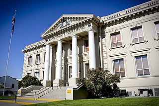
Elko County is a county in the northeastern corner of Nevada, United States. As of the 2020 census, the population was 53,702. Its county seat is Elko. The county was established on March 5, 1869, from Lander County. Elko County is the fourth-largest county by area in the contiguous United States, ranking lower when the boroughs of Alaska are included. It is one of only 10 counties in the U.S. with more than 10,000 square miles (25,900 km2) of area. Elko County is the second-largest county by area in Nevada, with only Nye County being larger. Elko County is part of the Elko micropolitan statistical area. It contains 49.8 percent of the Duck Valley Indian Reservation, set up in the late 19th century for the Shoshone-Paiute peoples; they are a federally recognized tribe. Although slightly more than 50% of the reservation is across the border in Owyhee County, Idaho, the majority of tribal members live on the Nevada side. The reservation's land area is 450.391 square miles (1,166.5 km2).

Elko is a city in the U.S. state of Nevada and the county seat of Elko County. As of the official 2020 U.S. Census, the city has a population of 20,564. Elko serves as the center of the Ruby Valley, a region with a population of over 55,000. Elko is 21 miles (34 km) from Lamoille Canyon and the Ruby Mountains, providing year-round access to recreation, including hiking, skiing, hunting, and more than 20 alpine lakes. The city straddles the Humboldt River. Spring Creek, Nevada, serves as a bedroom community 6 miles (10 km) from the city with a population of 13,805.
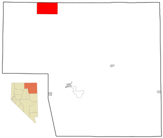
Owyhee is a census-designated place (CDP) in Elko County, Nevada, United States, along the banks of the Owyhee River. The population was 953 at the 2010 census. It is part of the Elko Micropolitan Statistical Area. It is the primary town of the federally recognized Shoshone-Paiute tribe's Duck Valley Indian Reservation, which covers portions of northern Nevada and southern Idaho, and the majority of its population are Native American.

Spring Creek is a census-designated place (CDP) in central Elko County, in northeastern Nevada in the western United States. It mainly serves as a bedroom community for the businesses and industries in and around the nearby city of Elko. It is part of the Elko Micropolitan Statistical Area. The population was 12,361 at the 2010 census.
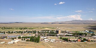
Jackpot is an unincorporated community and census-designated place (CDP) in Elko County, Nevada, United States. The population was 855 as of the 2020 census. Located less than one mile (1.6 km) from the Idaho border on US 93, Jackpot has been a popular casino gaming destination for residents of Idaho and other neighboring states since its founding.
The Shoshone or Shoshoni are a Native American tribe with four large cultural/linguistic divisions:

Edward Peter Carville was an American politician. He was the 18th Governor of Nevada and a Senator from Nevada. He was a member of the Democratic Party.

Lamoille is a rural census-designated place in Elko County in the northeastern section of the state of Nevada in the western United States. As of the 2020 census it had a population of 276. It is located 19 miles (31 km) southeast of Elko at the base of the Ruby Mountains and is part of the Elko Micropolitan Statistical Area.

Seitz Lake is a glacial tarn in the Ruby Mountains, in Elko County in the northeastern part of the state of Nevada. It is located near the head of Seitz Canyon at approximately 40°38.2′N115°27.4′W, and at an elevation of 8,915 feet. It has an area of approximately 17 acres, and a depth of up to 20 feet.

Griswold Lake is a glacial tarn in the Ruby Mountains of Elko County, Nevada, United States. It is within the Ruby Mountains Ranger District of the Humboldt-Toiyabe National Forest. The lake is located at the head of Hennen Canyon, at approximately 40°38.1′N115°29.2′W, and at an elevation of 9,222 feet. It has an area of approximately 17 acres, and a depth of up to 20 feet.
State Route 225 is a state highway in Elko County, Nevada, United States. Known as the Mountain City Highway, it connects the city of Elko to the town of Owyhee near the southwestern Idaho border via Mountain City. The route provides connections to Mountain Home, Idaho and Interstate 84 via Idaho State Highway 51.

State Route 230 (SR 230) is a state highway central Elko County, Nevada, United States. It is a southern loop route off of Interstate 80 (I‑80) between Elko and Wells, serving the communities of Deeth and Welcome and various ranches within Starr Valley. The road follows a U-shaped path and passes close to the East Humboldt Range. The road was constructed by 1962, but was not designated as a state highway until 1992.
State Route 232 is a state highway in Elko County, Nevada. It covers the majority of Clover Valley Road south of Wells.

Jiggs is an unincorporated community in Elko County, Nevada, United States, in the Mound Valley at the south end of State Route 228.

Oasis is a census-designated place (CDP) located in eastern Elko County, Nevada, United States, at the junction of State Route 233 and Interstate 80, 31 miles (50 km) northwest of the Utah border and 77 miles (124 km) east of Elko. As of the 2008 American Community Survey it had a population of 34. As of 2020, Oasis had a population of just four.

State Route 767 is a short state highway in the Ruby Valley region of Elko County, Nevada. It follows a portion of Ruby Valley Road.

The Duck Valley Indian Reservation was established in the 19th century for the federally recognized Shoshone-Paiute Tribe. It is isolated in the high desert of the western United States, and lies on the state line, the 42nd parallel, between Idaho and Nevada.
Ruby Valley is an unincorporated community in Ruby Valley, in Elko County, Nevada, United States.
Cornucopia is an extinct town located in Elko County, Nevada. The town used to be well-known for its mining district area, which was established in 1873. Cornucopia was also known under several names, including Milltown and Kaufmanville.


