
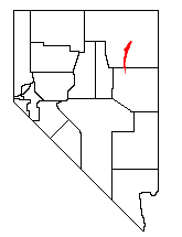
Elko County is a county in the northeastern corner of Nevada, United States. As of the 2020 census, the population was 53,702. Its county seat is Elko. The county was established on March 5, 1869, from Lander County.
Owyhee County is a county in the southwestern corner of the U.S. state of Idaho. As of the 2020 census, the population was 11,913. The county seat is Murphy, and its largest city is Homedale. In area it is the second-largest county in Idaho, behind Idaho County.

Elko is the largest city in and county seat of Elko County, Nevada, United States. With a 2020 population of 20,564, Elko is currently growing at a rate of 0.31% annually and its population has increased by 11.86% since the 2010 Census, which recorded a population of 18,297. Elko serves as the economic hub of the Ruby Valley, a region with a population of over 55,000. Elko is 21 miles (34 km) from Lamoille Canyon and the Ruby Mountains, dubbed the Swiss Alps of Nevada, providing year round access to recreation including hiking, skiing, hunting, and more than 20 alpine lakes. The city straddles the Humboldt River. Spring Creek, Nevada, serves as a bedroom community 6 miles (9.7 km) from the city with a population of 13,805.

Spring Creek is a census-designated place (CDP) in central Elko County, in northeastern Nevada in the western United States. It mainly serves as a bedroom community for the businesses and industries in and around the nearby city of Elko. It is part of the Elko Micropolitan Statistical Area. The population was 12,361 at the 2010 census.

The Humboldt–Toiyabe National Forest (HTNF) is the principal U.S. National Forest in the U.S. state of Nevada, and has a smaller portion in Eastern California. With an area of 6,289,821 acres (25,454.00 km2), it is the largest U.S. National Forest outside of Alaska.
The Shoshone or Shoshoni are a Native American tribe with four large cultural/linguistic divisions:

Austin is an unincorporated small town in, and former county seat of, Lander County, Nevada, United States. In 2020, the census-designated place of Austin had a population of 167. It is located on the western slopes of the Toiyabe Range at an elevation of 6,575 feet (2,004 m). U.S. Route 50 passes through the town.
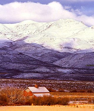
The Ruby Mountains are a mountain range, primarily located within Elko County with a small extension into White Pine County, in Nevada, United States. Most of the range is included within the Humboldt-Toiyabe National Forest. The range reaches a maximum elevation of 11,387 feet (3,471 m) on the summit of Ruby Dome. To the north is Secret Pass and the East Humboldt Range, and from there the Rubies run south-southwest for about 80 miles (130 km). To the east lies Ruby Valley, and to the west lie Huntington and Lamoille Valleys. The Ruby Mountains are the only range of an introduced bird, the Himalayan snowcock, in North America.

Lamoille is a rural census-designated place in Elko County in the northeastern section of the state of Nevada in the western United States. As of the 2020 census it had a population of 276. It is located 19 miles (31 km) southeast of Elko at the base of the Ruby Mountains at an elevation of 5,889 feet (1,795 m) and is part of the Elko Micropolitan Statistical Area.
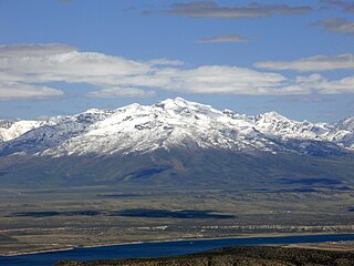
Ruby Dome is the highest mountain in both the Ruby Mountains and Elko County, in Nevada, United States. It is the twenty-seventh-highest mountain in the state, and also ranks as the thirteenth-most topographically prominent peak in the state. The peak is located about 21 miles (34 km) southeast of the city of Elko within the Ruby Mountains Ranger District of the Humboldt-Toiyabe National Forest. The mountain rises from a base elevation of about 6,000 feet (1,800 m) to a height of 11,387 feet (3,471 m). It is the highest mountain for over 90 miles in all directions.
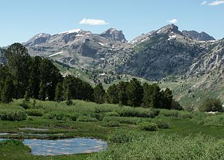
The Ruby Mountains Wilderness is a protected wilderness area in the Ruby Mountains of Elko County, Nevada, United States. It covers an area of approximately 90,000 acres (36,000 ha), and is administered by the Humboldt–Toiyabe National Forest.
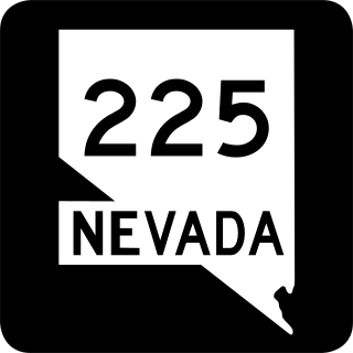
State Route 225 is a state highway in Elko County, Nevada, United States. Known as the Mountain City Highway, it connects the city of Elko to the town of Owyhee near the southwestern Idaho border via Mountain City. The route provides connections to Mountain Home, Idaho and Interstate 84 via Idaho State Highway 51.

Tuscarora is an unincorporated community in Elko County, Nevada, United States. The community lies on the east side of the Tuscarora Mountains approximately 40 miles north of Carlin. Tuscarora is part of the Elko Micropolitan Statistical Area. Far from being a ghost town, as several websites proclaim, Tuscarora is home to two schools, a library, a post office and a bar and grill, as well as homes for its very much alive residents.

Midas is a small unincorporated community in Elko County, Nevada. Although its population has fluctuated greatly over the years and it often appears on internet ghost town lists, it has never been completely abandoned, and one can meet many of the living citizenry at the aptly named Ghost Town Saloon, its sole business. Alongside Jarbidge, the town was known as one of the biggest twentieth-century gold mining towns in Elko County.

Metropolis, Nevada is a ghost town in Elko County, Nevada, 12 mi (19 km) northwest of Wells.

Ruby Hill is a ghost town in Eureka County, in the central part of the U.S. state of Nevada, approximately 2.6 mi (4.2 km) west of the town of Eureka, Nevada. In 1910, the Ruby Hill Railroad was washed out, after which there were only three businesses in town.

Pequop or Pequop Siding is a ghost town in Elko County, Nevada, United States. It was located west of Toano on the route around the north end of the Pequop Mountains between Cobre and Wells. It was first a stop station of the Central Pacific Railroad and later a non-agency station on the Southern Pacific Railroad. Several buildings were erected to house section crews.
Shanty Town is an unincorporated community in Elko County, Nevada, United States.
Excelsior is a ghost town in Elko County, in the U.S. state of Nevada.
Cornucopia is an extinct town located in Elko County, Nevada. The town used to be well-known for its mining district area, which was established in 1873. Cornucopia was also known under several names, including Milltown and Kaufmanville.


