Deeth, Nevada

Last updated

Deeth, Nevada
2015-03-31 18 52 31 Buildings along Deeth-O'Neil Road (Elko County Route 753) in Deeth, Nevada.JPG
Buildings in Deeth
USA Nevada location map.svg
Red pog.svg
Deeth, Nevada
Location within the state of Nevada
Coordinates: 41°03′56″N115°16′29″W / 41.06556°N 115.27472°W / 41.06556; -115.27472
Country United States
State Nevada
County Elko
Elevation
[1]
5,341 ft (1,628 m)
Time zone UTC-8 (Pacific (PST))
  Summer (DST) UTC-7 (PDT)
ZIP code
89823 [2]
Area code 775
GNIS feature ID845424 [1]

Deeth (Shoshoni language: Teai [3] ) is an unincorporated community and census-designated place near the intersection of Interstate 80 and Nevada State Route 230 in Elko County, Nevada, United States.

Contents

History

When the Central Pacific started running past this site in 1869, a branch line station with telegraph was established. In 1875, a post office was established for nearby ranches and farms. The community was named after a pioneer citizen. [4] [5]

As ranching and mining activity increased in the area the town grew in size. The Western Pacific began running through Deeth in 1910. At the time, the community had mercantile stores, a Mormon chapel, livery stables, hotels, saloons, a blacksmith and a population of approximately 250. Many dairies and farms were in the county and this town served as a depot to ship cattle and a trading center for local ranchers and ranchers from nearby counties. [5]

In 1915, a fire destroyed most of the town. The post office has been in operation at Deeth since 1875. [6] [7] Little remains of the original community. [8]

Climate

According to the Köppen Climate Classification system, Deeth has a warm-summer humid continental climate, abbreviated "Dfb" on climate maps.

Climate data for Deeth, Nevada, 1991–2020 normals, 1951-2020 extremes: 5340ft (1628m)
MonthJanFebMarAprMayJunJulAugSepOctNovDecYear
Record high °F (°C)63
(17)
69
(21)
79
(26)
84
(29)
93
(34)
99
(37)
101
(38)
100
(38)
98
(37)
93
(34)
75
(24)
62
(17)
101
(38)
Mean maximum °F (°C)48
(9)
54
(12)
65
(18)
74
(23)
84
(29)
90
(32)
96
(36)
95
(35)
90
(32)
80
(27)
65
(18)
50
(10)
95
(35)
Mean daily maximum °F (°C)35.1
(1.7)
39.5
(4.2)
51.6
(10.9)
58.9
(14.9)
69.0
(20.6)
78.6
(25.9)
88.2
(31.2)
87.3
(30.7)
77.8
(25.4)
64.3
(17.9)
48.1
(8.9)
37.2
(2.9)
61.3
(16.3)
Daily mean °F (°C)22.6
(−5.2)
27.0
(−2.8)
36.7
(2.6)
43.0
(6.1)
51.6
(10.9)
59.4
(15.2)
66.5
(19.2)
64.2
(17.9)
55.5
(13.1)
43.8
(6.6)
32.2
(0.1)
24.0
(−4.4)
43.9
(6.6)
Mean daily minimum °F (°C)10.0
(−12.2)
14.5
(−9.7)
21.7
(−5.7)
27.2
(−2.7)
34.3
(1.3)
40.2
(4.6)
44.7
(7.1)
41.0
(5.0)
33.2
(0.7)
23.3
(−4.8)
16.4
(−8.7)
10.7
(−11.8)
26.4
(−3.1)
Mean minimum °F (°C)−17
(−27)
−10
(−23)
3
(−16)
14
(−10)
21
(−6)
29
(−2)
34
(1)
29
(−2)
18
(−8)
8
(−13)
−3
(−19)
−14
(−26)
−21
(−29)
Record low °F (°C)−36
(−38)
−31
(−35)
−22
(−30)
5
(−15)
9
(−13)
19
(−7)
26
(−3)
18
(−8)
8
(−13)
−5
(−21)
−18
(−28)
−42
(−41)
−42
(−41)
Average precipitation inches (mm)1.23
(31)
1.08
(27)
1.18
(30)
1.67
(42)
1.74
(44)
0.81
(21)
0.34
(8.6)
0.48
(12)
0.63
(16)
1.03
(26)
1.00
(25)
1.16
(29)
12.35
(311.6)
Source 1: NOAA [9]
Source 2: XMACIS2 (records) [10]
Climate data for Deeth
MonthJanFebMarAprMayJunJulAugSepOctNovDecYear
Record high °F (°C)63
(17)
69
(21)
78
(26)
84
(29)
93
(34)
99
(37)
101
(38)
100
(38)
98
(37)
86
(30)
75
(24)
62
(17)
101
(38)
Mean daily maximum °F (°C)35.5
(1.9)
40.2
(4.6)
48.7
(9.3)
58.9
(14.9)
68.3
(20.2)
77.6
(25.3)
87.9
(31.1)
86.3
(30.2)
77.6
(25.3)
64.9
(18.3)
47.9
(8.8)
36.8
(2.7)
60.9
(16.1)
Mean daily minimum °F (°C)8.8
(−12.9)
13.5
(−10.3)
20.5
(−6.4)
26.5
(−3.1)
33.9
(1.1)
39.7
(4.3)
43.3
(6.3)
40.6
(4.8)
32.2
(0.1)
23.1
(−4.9)
16.9
(−8.4)
9.6
(−12.4)
25.7
(−3.5)
Record low °F (°C)−36
(−38)
−31
(−35)
−22
(−30)
5
(−15)
9
(−13)
19
(−7)
26
(−3)
18
(−8)
8
(−13)
−5
(−21)
−18
(−28)
−42
(−41)
−42
(−41)
Average precipitation inches (mm)1.16
(29)
0.87
(22)
1.19
(30)
1.38
(35)
1.69
(43)
1.13
(29)
0.41
(10)
0.47
(12)
0.75
(19)
0.83
(21)
1.12
(28)
1.03
(26)
12.02
(305)
Average snowfall inches (cm)5.9
(15)
3
(7.6)
3.2
(8.1)
1.9
(4.8)
0.4
(1.0)
0
(0)
0
(0)
0
(0)
0
(0)
0.3
(0.76)
1.8
(4.6)
5
(13)
21.6
(55)
Average precipitation days76877533346665
Source: WRCC [11]

Related Research Articles

<span class="mw-page-title-main">Owyhee, Nevada</span> Census-designated place in Nevada, United States

Owyhee is a census-designated place (CDP) in Elko County, Nevada, United States, along the banks of the Owyhee River. The population was 953 at the 2010 census. It is part of the Elko Micropolitan Statistical Area. It is the primary town of the federally recognized Shoshone-Paiute tribe's Duck Valley Indian Reservation, which covers portions of northern Nevada and southern Idaho, and the majority of its population are Native American.

<span class="mw-page-title-main">Hiko, Nevada</span> Unincorporated community in the state of Nevada, United States

Hiko is a small, agrarian community in the Tonopah Basin on State Route 318 in Lincoln County, Nevada, United States. It is a census-designated place, with a population of 119 at the 2010 census.

<span class="mw-page-title-main">Golconda, Nevada</span> Census-designated place in Nevada, United States

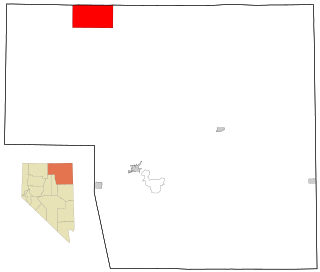
Golconda is a census-designated place in southeastern Humboldt County, Nevada, United States. As of the 2020 census it has a population of 182. It is located along Interstate 80 on the Humboldt River in the northwestern part of the state. Golconda has a post office, which has been in operation since 1869.

<span class="mw-page-title-main">Dyer, Nevada</span> Census-designated place in Nevada, United States

Dyer is an unincorporated town, located in Fish Lake Valley, Esmeralda County, Nevada, United States. It had a population of 324 as of the 2018 American Community Survey. The town serves the surrounding area's sparse rural population of mainly ranchers and indigenous Paiute people. The town has a gas station/store, cafe, post office and airport.

<span class="mw-page-title-main">Tuscarora, Nevada</span> Unincorporated community in the state of Nevada, United States

Tuscarora is an unincorporated community in Elko County, Nevada, United States. The community lies on the east side of the Tuscarora Mountains approximately 40 miles north of Carlin. Tuscarora is part of the Elko Micropolitan Statistical Area. Far from being a ghost town, as several websites proclaim, Tuscarora is home to two schools, a library, a post office and a bar and grill, as well as homes for its remaining residents.

<span class="mw-page-title-main">Montello, Nevada</span> Census-designated place in Nevada, United States

Montello is a small desert village in Elko County, Nevada, United States. It is home to Montello Elementary School, which is part of the Elko County School District. The population of Montello was 50 as of the 2018 American Community Survey. Various cattle ranching operations surround the area.

<span class="mw-page-title-main">San Jacinto, Nevada</span> Ghost town in Nevada, United States

San Jacinto is a ghost town in along Salmon Falls Creek in northern Elko County, Nevada, United States. It is part of the Elko Micropolitan Statistical Area.

<span class="mw-page-title-main">Ashwood, Oregon</span> Unincorporated community in Oregon, United States

Ashwood is a ghost town in Jefferson County, Oregon, United States, 32 miles (51 km) northeast of Madras.

<span class="mw-page-title-main">Garrison, Utah</span> Unincorporated community in the state of Utah, United States

Garrison is an unincorporated community in western Millard County, Utah, United States. It is home to a Utah Department of Transportation yard and office, but other than that, offers no services.

<span class="mw-page-title-main">Stege, California</span> Unincorporated community in United States

Stege, founded in 1876, was an unincorporated community in western Contra Costa County, California, United States. The town has now been annexed and absorbed by the cities of Richmond and El Cerrito, California. It was located on the Southern Pacific Railroad 1.5 miles (2.4 km) south-southeast of downtown Richmond, at an elevation of 23 feet. The site is now located in the area known as the Richmond Annex, at coordinates: 37°55′00″N122°19′38″W.

<span class="mw-page-title-main">Halleck, Nevada</span> Unincorporated community in Nevada, U.S.

Halleck is an unincorporated community in central Elko County, northeastern Nevada, in the Western United States.

<span class="mw-page-title-main">Dobbins, California</span> Census-designated place in California, United States

Dobbins is a census-designated place in Yuba County, California.

Potts is a ghost town and abandoned ranching property in Monitor Valley, Nye County, Nevada, approximately 2 miles east of Nevada State Route 82.

Schellbourne, formerly known as Fort Schellbourne and Schell Creek Station is a ghost town located in the Schell Creek Range in White Pine County in Nevada, United States, located 43 miles (69 km) north of Ely. The town was a stopover along the Central Overland Route, Pony Express and original routing of the Lincoln Highway. It is today Nevada Historical Marker number 51. The site was listed on the National Register of Historic Places in 1972. Its boundaries were increased in 1977.

Rowland is a ghost town in northern Elko County, Nevada, United States.

Twin Sisters is an unincorporated community in western Blanco County, Texas, United States. According to the Handbook of Texas, the community had a population of 78 in 2000.

Excelsior is a ghost town in Elko County, in the U.S. state of Nevada.

<span class="mw-page-title-main">Bullionville, Nevada</span> Ghost town in Nevada, United States

Bullionville is a ghost town in Lincoln County, Nevada, United States, 1/4 mile east of U.S. Route 93, one mile north of Panaca and 10 miles (16 km) south of Pioche. The town prospered between 1870 and 1882, and is now abandoned.

Aleman is a locale, a formerly populated place in Sierra County, New Mexico, United States. It lies at an elevation of 4,669 feet.

References

  1. 1 2 U.S. Geological Survey Geographic Names Information System: Deeth, Nevada
  2. "Deeth ZIP Code". zipdatamaps.com. 2022. Retrieved November 18, 2022.
  3. Crum, B., Crum, E., & Dayley, J. P. (2001). Newe Hupia: Shoshoni Poetry Songs. University Press of Colorado. Pg. 200 doi.org/10.2307/j.ctt46nz00
  4. Federal Writers' Project (1941). Origin of Place Names: Nevada (PDF). W.P.A. p. 23.
  5. 1 2 Paher, Stanley (1970). Nevada Ghost Towns and Mining Camps. Howell North. p. 220.
  6. "Post Offices". Jim Forte Postal History. Retrieved April 10, 2018.
  7. U.S. Geological Survey Geographic Names Information System: Deeth Post Office
  8. "Deeth". Ghosttowns.com. Retrieved April 10, 2018.
  9. "Deeth, Nevada 1991-2020 Monthly Normals" . Retrieved November 11, 2023.
  10. "xmACIS". National Oceanic and Atmospheric Administration. Retrieved November 11, 2023.
  11. "DEETH, NEVADA (262189)". Western Regional Climate Center. Retrieved July 1, 2016.