Midas is a small unincorporated community in Elko County, Nevada. Although its population has fluctuated greatly over the years and it often appears on ghost town lists, it has never been completely abandoned.

Carp, Nevada is an extinct town in Lincoln County, Nevada, United States located 35 miles (56 km) south of Caliente. It sits on the Meadow Valley Wash, which empties into Lake Mead.
Cobre is a ghost town in Elko County, Nevada, United States.
Crystal is a former unincorporated community in Clark County, Nevada, United States. It lied along the Union Pacific Railroad and had a population of 10 in 1941. It is now the site of a highway rest stop.

Moores Flat is a former settlement in Nevada County, California. It is situated at an elevation of 4,144 ft (1,263 m) above sea level. Moores Flat is located 4.25 miles (6.8 km) north-northeast of North Bloomfield.
Nyala is an extinct town in Nye County, in the U.S. state of Nevada.

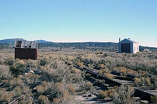
Pequop or Pequop Siding is a ghost town in Elko County, Nevada, United States. It was located west of Toano on the route around the north end of the Pequop Mountains between Cobre and Wells. It was first a stop station of the Central Pacific Railroad and later a non-agency station on the Southern Pacific Railroad. Several buildings were erected to house section crews.
Sprucemont is an ghost town in Elko County, in the U.S. state of Nevada. The GNIS classifies it as a populated place.
Huntington is a ghost town in Elko County, Nevada, United States.
Fenelon is an extinct town in Elko County, in the U.S. state of Nevada. The GNIS classifies it as a populated place.

Gold Creek is an extinct town in Elko County, Nevada, United States.
Loray is an extinct town in Elko County in Nevada. The GNIS classifies it as a populated place.
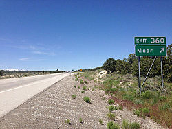
Moleen is an extinct town in Elko County, in the U.S. state of Nevada. The GNIS classifies it as a populated place.
Silver Zone is an extinct town in Elko County, in the U.S. state of Nevada. The GNIS classifies it as a populated place.
Tulasco is an extinct town in Elko County, in the U.S. state of Nevada.
White Rock is an extinct town in Elko County, in the U.S. state of Nevada.
Birch is an extinct town in Eureka County, in the U.S. state of Nevada. Birch is located to the west of the Diamond Mountains, 26 miles northeast of Eureka.
Acoma is an extinct town in Lincoln County, in the U.S. state of Nevada.
Brown is an extinct settlement and former railroad siding in Lincoln County, in the U.S. state of Nevada.
Millett is an extinct town in Nye County, in the U.S. state of Nevada. The GNIS classifies it as a populated place.