
Nevada is a state in the Western United States. It is bordered by Oregon to the northwest, Idaho to the northeast, California to the west, Arizona to the southeast, and Utah to the east. Nevada is the 7th most extensive, the 32nd most populous, but the 9th least densely populated of the U.S. states. Nearly three-quarters of Nevada's people live in Clark County, which contains the Las Vegas–Paradise metropolitan area, including three of the state's four largest incorporated cities. Nevada's capital is Carson City.
Twin cities are a special case of two cities or urban centres that are founded in close geographic proximity and then grow into each other over time, losing most of their mutual buffer zone.

Elko County is a county in the northeastern corner of Nevada, United States. As of the 2010 census, the population was 48,818. Its county seat is Elko. The county was established on March 5, 1869, from Lander County.

Nevada City is the county seat of Nevada County, California, United States, located 60 miles (97 km) northeast of Sacramento, 84 miles (135 km) southwest of Reno and 147 miles (237 km) northeast of San Francisco. The population was 3,068 as of the 2010 Census.

Twin Falls is the county seat and largest city of Twin Falls County, Idaho, United States. The city had a population of 44,125 as of the 2010 census.

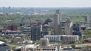
Laughlin is an unincorporated town and census-designated place in Clark County, Nevada, United States. It is located on the Colorado River, directly across from the much larger Bullhead City, Arizona. Laughlin lies 90 miles (140 km) south of Las Vegas, in the far southern tip of Nevada, and is known for its gaming and water recreation. As of the 2010 census, the population was 7,323. The nearby communities of Bullhead City, Arizona; Needles, California; Fort Mohave, Arizona; and Mohave Valley, Arizona, bring the area's total population to about 100,000. Laughlin is also 286 miles (460 km) northeast of Los Angeles.

U.S. Route 93 (US 93) is a major north–south United States highway in the western United States. The southern terminus is at US 60 in Wickenburg, Arizona. The northern terminus is at the Canada–US border north of Eureka in Lincoln County, Montana, where the roadway continues into Roosville, British Columbia, as Highway 93. Major cities that US 93 travels through include: Las Vegas, Nevada; Twin Falls, Idaho; Missoula, Montana; and Kalispell, Montana.

Donal Neil "Mike" O'Callaghan was an American politician who served as the 23rd Governor of Nevada from 1971 to 1979. He is a member of the Democratic Party.

The Twin Ports of Duluth, Minnesota and Superior, Wisconsin, are located at the western part of Lake Superior and together are considered the largest freshwater port in the world. They are twin cities and seaports, connected to the Atlantic Ocean through the Great Lakes and the Saint Lawrence Seaway.

The Mike O'Callaghan–Pat Tillman Memorial Bridge is an arch bridge in the United States that spans the Colorado River between the states of Arizona and Nevada. The bridge is located within the Lake Mead National Recreation Area approximately 30 miles (48 km) southeast of Las Vegas, and carries Interstate 11 and U.S. Route 93 over the Colorado River. Opened in 2010, it was the key component of the Hoover Dam Bypass project, which rerouted US 93 from its previous routing along the top of Hoover Dam and removed several hairpin turns and blind curves from the route. It is jointly named for Mike O'Callaghan, Governor of Nevada from 1971–1979, and Pat Tillman, an American football player who left his career with the Arizona Cardinals to enlist in the United States Army and was killed in Afghanistan in 2004 by friendly fire.

The National Register of Historic Places in the United States is a register including buildings, sites, structures, districts, and objects. The Register automatically includes all National Historic Landmarks as well as all historic areas administered by the U.S. National Park Service. Since its introduction in 1966, more than 90,000 separate listings have been added to the register.

This is a list of properties and historic districts in Arkansas that are listed on the National Register of Historic Places. There are more than 2,600 listings in the state, including at least 8 listings in each of Arkansas's 75 counties.

The South Fork Humboldt River is a river in Elko County, Nevada, United States.

Horsetail Falls is a waterfall in the Sierra Nevada mountain range, to the west of Lake Tahoe in the Desolation Wilderness of El Dorado County, California, United States. It falls in stages for nearly 500ft. It can be reached by hiking north out of the Twin Bridges trailhead on U.S. Route 50. There is a forest service parking area designated to the area.
Lake Aloha is a large shallow backcountry reservoir located at an elevation of 8,116 feet in the Sierra Nevada Range, west of Lake Tahoe in El Dorado County, in eastern California.

In the U.S. state of Nevada, U.S. Route 93 is a major United States Highway traversing the eastern edge of the state. The highway connects the Las Vegas area to the Great Basin National Park, and provides further connections to Ely and Wells. US 93 also provides the majority of the most direct connection from the major metropolitan areas of Las Vegas and Phoenix to the Boise, Idaho Metropolitan Area with a final connection to Boise via Interstate 84 from Twin Falls, Idaho.

Pearl Harbor is an American lagoon harbor on the island of Oahu, Hawaii, west of Honolulu. It has been long visited by the Naval fleet of the United States, before it was acquired from the Hawaiian Kingdom by the U.S. with the signing of the Reciprocity Treaty of 1875. Much of the harbor and surrounding lands is now a United States Navy deep-water naval base. It is also the headquarters of the United States Pacific Fleet. The U.S. government first obtained exclusive use of the inlet and the right to maintain a repair and coaling station for ships here in 1887. Its surprise attack by the Imperial Japanese Navy on December 7, 1941, promptly led The United States to declare war on the Empire of Japan making the Attack on Pearl Harbor the immediate cause of the United States' entry into World War II.

The Galena Creek Bridge is a twin-span concrete arch bridge in Washoe County, Nevada. The bridge carries Interstate 580 and U.S. Route 395 over the Galena Creek between Carson City and Reno. It was opened to traffic in late August 2012.

Spanish Creek is a stream in the Sierra Nevada of Plumas County, California and is a tributary of the Feather River system. It flows east from headwaters in the Plumas National Forest, through Meadow Valley to Quincy where it traverses the American Valley. At the east end of the valley it turns north, flowing through a canyon towards Paxton where it joins with Indian Creek to form the East Branch North Fork Feather River.

The Old Bridge Ranch was a legal brothel near Sparks in Washoe County, Nevada, United States that was open from 1967 to the summer of 2008.

