Elko County, Nevada

Last updated

Elko County
Elko County Courthouse (Elko, Nevada).jpg
Flag of Elko County, Nevada.svg
Map of Nevada highlighting Elko County.svg
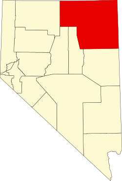
Location within the U.S. state of Nevada
Nevada in United States.svg
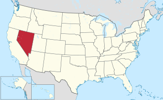
Nevada's location within the U.S.
Coordinates: 41°08′N115°21′W / 41.13°N 115.35°W / 41.13; -115.35
CountryFlag of the United States.svg United States
StateFlag of Nevada.svg  Nevada
Founded1869;155 years ago (1869)
Named for Elko
Seat Elko
Largest cityElko
Area
  Total17,203 sq mi (44,560 km2)
  Land17,170 sq mi (44,500 km2)
  Water33 sq mi (90 km2)  0.2%
Population
 (2020)
  Total53,702
  Density3.1/sq mi (1.2/km2)
Time zones
Majority of county [1] UTC−8 (Pacific)
  Summer (DST) UTC−7 (PDT)
West Wendover [2] UTC−7 (Mountain)
  Summer (DST) UTC−6 (MDT)
Congressional district 2nd
Website elkocountynv.net

Elko County is a county in the northeastern corner of Nevada, United States. As of the 2020 census, the population was 53,702. [3] Its county seat is Elko. [4] The county was established on March 5, 1869, from Lander County.

Contents

Elko County is the fourth-largest county by area in the contiguous United States, ranking lower when the boroughs of Alaska are included. It is one of only 10 counties in the U.S. with more than 10,000 square miles (25,900 km2) of area.

Elko County is part of the Elko, NV Micropolitan Statistical Area. It contains 49.8 percent of the Duck Valley Indian Reservation, set up in the late 19th century for the Shoshone-Paiute peoples; they are a federally recognized tribe. Although slightly more than 50% of the reservation is across the border in Owyhee County, Idaho, the majority of tribal members live on the Nevada side. The reservation's land area is 450.391 square miles (1,166.5 km2).

History

This area was long inhabited by Native American tribes of the Plateau, particularly the Western Shoshone, Northern Paiute, and Bannock peoples. Their traditional ways were disrupted after European-American settlement, as the two cultures competed for resources and had differing conceptions of land use and property.

Elko County was established in 1869 from Lander County; the name was taken from the name of the county seat, Elko.

In 1877 what became known as the Duck Valley Indian Reservation was established by presidential executive order for the Western Shoshone in this area, after they signed treaties with the United States. Later the Paiute became involved in the Bannock War, but after they were allowed to return from exile in Washington State, in 1886 another executive order was used to expand the reservation to accommodate them. The federally recognized tribe of the two peoples together conducts farming and ranching in this high desert territory.

The population of the county increased markedly in the late 20th century as the economy improved.

On March 14, 2014, the Bureau of Land Management sold 29 oil and gas leases for $1.27 million to a collection of six companies that included Noble Energy. The transaction was the first such in Nevada. [5]

Geography

Sagebrush steppe in Elko County, Nevada along US 93. This view is characteristic of most of the county. 2013-07-04 15 37 14 Sagebrush-steppe along U.S. Route 93 in central Elko County in Nevada.jpg
Sagebrush steppe in Elko County, Nevada along US 93. This view is characteristic of most of the county.

According to the U.S. Census Bureau, the county has a total area of 17,203 square miles (44,560 km2), of which 17,170 square miles (44,500 km2) is land and 33 square miles (85 km2) (0.2%) is water. [6] Not counting Alaska's boroughs (four of which are also larger), it is the fourth-largest county in area in the United States (behind San Bernardino County, California, Coconino County, Arizona, and Nye County, Nevada). [7] The elevation ranges from about 4,300 feet (1,300 m) at the edge of the salt flats of the Great Salt Lake Desert, to 11,387 feet (3,471 m) on the summit of Ruby Dome in the Ruby Mountains. [8] The most topographically prominent mountain in Elko County is Pilot Peak.

The county has three physiographic sections (70% Great Basin section, 20% Payette, 10% Snake River Plain) and 4 watersheds (45% Humboldt River, 30% Upper Snake River, 20% central Nevada desert, 5% Pilot-Thousand Springs).

Lightning-sparked wildfires are common occurrences in Elko County. 2011-08-04 20 00 00 Susie Fire in the Adobe Range west of Elko Nevada.jpg
Lightning-sparked wildfires are common occurrences in Elko County.

National protected areas

Adjacent counties

Time zones

Except for West Wendover which is in the Mountain Time Zone, the county is in the Pacific Time Zone, though other communities such as Owyhee, Mountain City, Jarbidge and Jackpot unofficially observe Mountain Time as well due to their proximity to, and economic connections with, neighboring areas of Idaho.

Demographics

Historical population
CensusPop.Note
1870 3,447
1880 5,71665.8%
1890 4,794−16.1%
1900 5,68818.6%
1910 8,13343.0%
1920 8,083−0.6%
1930 9,96023.2%
1940 10,9129.6%
1950 11,6546.8%
1960 12,0113.1%
1970 13,95816.2%
1980 17,26923.7%
1990 33,53094.2%
2000 45,29135.1%
2010 48,8187.8%
2020 53,70210.0%
2023 (est.)54,293 [9] 1.1%
U.S. Decennial Census [10]
1790-1960 [11] 1900-1990 [12]
1990-2000 [13] 2010-2018 [3]

2000 census

As of the census [14] of 2000, there were 45,291 people, 15,638 households, and 11,493 families living in the county. The population density was 3 people per square mile (1.2 people/km2). There were 18,456 housing units at an average density of 1 units per square mile (0.39/km2). The racial makeup of the county was 82.04% White, 0.59% Black or African American, 5.30% Native American, 0.68% Asian, 0.11% Pacific Islander, 8.50% from other races, and 2.78% from two or more races. 19.73% of the population were Hispanic or Latino of any race.

There were 15,638 households, out of which 43.00% had children under the age of 18 living with them, 59.30% were married couples living together, 8.40% had a female householder with no husband present, and 26.50% were non-families. 20.90% of all households were made up of individuals, and 4.80% had someone living alone who was 65 years of age or older. The average household size was 2.85 and the average family size was 3.33.

In the county, the population was spread out, with 32.50% under the age of 18, 8.80% from 18 to 24, 31.50% from 25 to 44, 21.30% from 45 to 64, and 5.90% who were 65 years of age or older. The median age was 31 years. For every 100 females, there were 108.80 males. For every 100 females age 18 and over, there were 109.40 males.

The median income for a household in the county was $48,383, and the median income for a family was $52,206. Males had a median income of $41,322 versus $24,653 for females. The per capita income for the county was $18,482. About 7.00% of families and 8.90% of the population were below the poverty line, including 9.50% of those under age 18 and 7.60% of those age 65 or over.

2010 census

As of the 2010 United States Census, there were 48,818 people, 17,442 households, and 12,441 families living in the county. [15] The population density was 2.8 inhabitants per square mile (1.1/km2). There were 19,566 housing units at an average density of 1.1 per square mile (0.42/km2). [16] The racial makeup of the county was 79.4% white, 5.3% Native American, 0.9% Asian, 0.8% black or African American, 0.1% Pacific islander, 10.3% from other races, and 3.2% from two or more races. Those of Hispanic or Latino origin made up 22.9% of the population [15] in terms of ancestry. [17]

Of the 17,442 households, 39.8% had children under the age of 18 living with them, 55.7% were married couples living together, 9.1% had a female householder with no husband present, 28.7% were non-families, and 22.5% of all households were made up of individuals. The average household size was 2.77 and the average family size was 3.26. The median age was 33.4 years. [15]

The median income for a household in the county was $67,038 and the median income for a family was $75,171. Males had a median income of $56,528 versus $34,464 for females. The per capita income for the county was $26,879. About 5.8% of families and 7.1% of the population were below the poverty line, including 8.0% of those under age 18 and 9.0% of those age 65 or over. [18]

Government and politics

Elko is a highly conservative area. In 2011, all eleven of the partisan county officials were Republican. [19] In the 2004 Presidential Election, George W. Bush won 78% of the county's vote, while 20% voted for John F. Kerry. [20] In 2008 voters in Elko County chose John McCain by 69%, with 28% voting for Barack Obama.

Both former President Jimmy Carter and then-President George W. Bush made visits to the city of Elko during the 2006 mid-term election. William McKinley visited in 1901; Herbert Hoover made his final campaign broadcast as president from a railroad car in Elko in 1932; Franklin D. Roosevelt spoke in Carlin in 1938 during his whistle stop tour; and Barack Obama visited while campaigning in 2008. President Donald Trump arrived in Elko on October 20, 2018, to campaign for Senator Dean Heller during the 2018 midterm elections. In addition, many other high-profile political figures have come to Elko, including former Vice President Dick Cheney. In 2016 Donald Trump Jr. campaigned in Elko during the primary campaign.

United States presidential election results for Elko County, Nevada [21]
Year Republican Democratic Third party
No.%No.%No.%
2020 16,74176.21%4,55720.74%6693.05%
2016 13,55173.02%3,40118.33%1,6078.66%
2012 12,01475.15%3,51121.96%4612.88%
2008 10,96968.47%4,54128.35%5093.18%
2004 11,93877.98%3,05019.92%3212.10%
2000 11,02577.75%2,54217.93%6134.32%
1996 6,51254.92%3,14926.56%2,19618.52%
1992 5,20843.67%2,78223.33%3,93633.00%
1988 5,72268.35%2,31027.59%3404.06%
1984 5,11074.48%1,56622.82%1852.70%
1980 4,39370.89%1,29620.91%5088.20%
1976 3,29360.32%1,95535.81%2113.87%
1972 3,88672.59%1,46727.41%00.00%
1968 2,68754.48%1,68634.18%55911.33%
1964 1,85639.99%2,78560.01%00.00%
1960 2,42749.31%2,49550.69%00.00%
1956 2,98163.20%1,73636.80%00.00%
1952 3,10463.88%1,75536.12%00.00%
1948 1,68344.63%2,02653.73%621.64%
1944 1,64241.87%2,28058.13%00.00%
1940 1,78337.15%3,01662.85%00.00%
1936 1,06526.94%2,88873.06%00.00%
1932 1,32534.09%2,56265.91%00.00%
1928 1,87656.54%1,44243.46%00.00%
1924 1,11338.81%60421.06%1,15140.13%
1920 1,36954.30%1,02940.82%1234.88%
1916 1,07232.01%2,02060.32%2577.67%
1912 39819.82%84341.98%76738.20%
1908 73744.45%80448.49%1177.06%
1904 71854.07%50838.25%1027.68%

Transportation

A number of highways maintained by the Nevada Department of Transportation, some national in prominence, cross Elko County. The county also maintains a network of county routes; however, many of them are unpaved and receive limited, if any, winter maintenance.

Transportation by means other than road vehicle is limited within Elko County. Commercial air service is available only at the Elko Regional Airport in Elko; the only destination currently served is Salt Lake City International Airport. Other public airports in Elko County include Jackpot Airport, Owyhee Airport and Wells Municipal Airport.

Amtrak passenger service is available from the unstaffed Elko station. Service is via the California Zephyr and is either eastbound or westbound, once a day.

Major highways

Communities

Cities

Census-designated places

Unincorporated communities

Ghost towns

Education

Its school district is the Elko County School District.

See also

Related Research Articles

<span class="mw-page-title-main">White Pine County, Nevada</span> County in Nevada, United States

White Pine County is a largely rural, mountain county along the central eastern boundary of the U.S. state of Nevada. As of the 2020 census, the population was 9,080. Its county seat is Ely. The name "(Rocky Mountain) white pine" is an old name for the limber pine, a common tree in the county's mountains.

<span class="mw-page-title-main">Pershing County, Nevada</span> County in Nevada, United States

Pershing County is a county in the U.S. state of Nevada. As of the 2020 census, the population was 6,650. Its county seat is Lovelock. The county was named after army general John J. Pershing (1860–1948). It was formed from Humboldt County in 1919, and the last county to be established in Nevada. The Black Rock Desert, location for the annual Burning Man event, is partially in the county. The county is listed as Nevada Historical Marker 17. The marker is at the courthouse in Lovelock.

<span class="mw-page-title-main">Lincoln County, Nevada</span> County in Nevada, United States

Lincoln County is a county in the U.S. state of Nevada. As of the 2020 census, the population was 4,499, making it the fourth-least populous county in Nevada. Its county seat is Pioche. Like many counties in Nevada, it is dry and sparsely populated, though notable for containing the Area 51 government Air Force base.

<span class="mw-page-title-main">Lander County, Nevada</span> County in Nevada, United States

Lander County is a county in the U.S. state of Nevada. As of the 2020 census, the population was 5,734. Its county seat is Battle Mountain.

<span class="mw-page-title-main">Humboldt County, Nevada</span> County in Nevada, United States

Humboldt County is a county in the U.S. state of Nevada. As of the 2020 Census, the population was 17,285. It is a largely rural county that is sparsely populated with the only major city being Winnemucca which has a population of 8,431. Humboldt County comprises the Winnemucca, NV Micropolitan Statistical Area and serves as an important crossroads in the national transportation network. Interstate 80 travels through the southeastern corner of the county, meeting US 95 in Winnemucca that serves as a primary freight corridor between Northern Nevada and Boise, Idaho and the Interstate 84 freight corridor that links much of the Pacific Northwest. The original transcontinental railway, constructed by the Central Pacific Railroad, reached Humboldt County on Sept. 16, 1868. The Western Pacific Railroad would reach Humboldt County by November 1909, providing two mainline rail links to California and the Eastern United States. Both railroads have since been acquired by the Union Pacific Railroad, who continues to serve the region today.

<span class="mw-page-title-main">Eureka County, Nevada</span> County in Nevada, United States

Eureka County is a county in the U.S. state of Nevada. As of the 2020 census, the population was 1,855, making it the second-least populous county in Nevada. Its county seat is Eureka.

<span class="mw-page-title-main">Twin Falls County, Idaho</span> County in Idaho, United States

Twin Falls County is a county in the south central part of the U.S. state of Idaho. As of the 2020 census, the population was 90,046, making it the fifth-most populous county in Idaho. The county seat and largest city is Twin Falls. Twin Falls County is part of the Twin Falls, ID Twin Falls Metropolitan Statistical Area.

<span class="mw-page-title-main">Owyhee County, Idaho</span> County in Idaho, United States

Owyhee County is a county in the southwestern corner of the U.S. state of Idaho. As of the 2020 census, the population was 11,913. The county seat is Murphy, and its largest city is Homedale. In area it is the second-largest county in Idaho, behind Idaho County.

<span class="mw-page-title-main">Elmore County, Idaho</span> County in Idaho, United States

Elmore County is a county in the U.S. state of Idaho. As of the 2020 census, the population was 28,666. The largest city and county seat is Mountain Home.

<span class="mw-page-title-main">Marsing, Idaho</span> City in Owhyee County, Idaho, United States

Marsing is a city in Owyhee County, Idaho, United States. The population was 1,031 at the time of the 2010 census. It is part of the Boise metropolitan area.

<span class="mw-page-title-main">Elko, Nevada</span> City in Nevada, United States

Elko is a city in the U.S. state of Nevada and the county seat of Elko County. As of the official 2020 U.S. Census, the city has a population of 20,564. Elko serves as the center of the Ruby Valley, a region with a population of over 55,000. Elko is 21 miles (34 km) from Lamoille Canyon and the Ruby Mountains, providing year round access to recreation including hiking, skiing, hunting, and more than 20 alpine lakes. The city straddles the Humboldt River. Spring Creek, Nevada, serves as a bedroom community 6 miles (10 km) from the city with a population of 13,805.

<span class="mw-page-title-main">Owyhee, Nevada</span> Census-designated place in Nevada, United States

Owyhee is a census-designated place (CDP) in Elko County, Nevada, United States, along the banks of the Owyhee River. The population was 953 at the 2010 census. It is part of the Elko Micropolitan Statistical Area. It is the primary town of the federally recognized Shoshone-Paiute tribe's Duck Valley Indian Reservation, which covers portions of northern Nevada and southern Idaho, and the majority of its population are Native American.

<span class="mw-page-title-main">Spring Creek, Nevada</span> CDP in Nevada, United States

Spring Creek is a census-designated place (CDP) in central Elko County, in northeastern Nevada in the western United States. It mainly serves as a bedroom community for the businesses and industries in and around the nearby city of Elko. It is part of the Elko Micropolitan Statistical Area. The population was 12,361 at the 2010 census.

<span class="mw-page-title-main">Wells, Nevada</span> City in Nevada, United States

Wells is a small city in Elko County, in northeast Nevada in the western United States. The Shoshone name for the area was Toyagadzu, meaning “The end of the set of mountains”. The population was 1,292 at the 2010 census. Wells is located at the junction of Interstate 80 and U.S. Route 93, approximately 50 miles (80 km) east of Elko and is part of the Elko micropolitan area.

<span class="mw-page-title-main">West Wendover, Nevada</span> Place in Nevada, United States

West Wendover is a small city in Elko County, Nevada, United States. The population was 4,512 at the 2020 census. It is part of the Elko micropolitan area. West Wendover is located on the eastern border of Nevada and the western edge of the Great Salt Lake Desert and is contiguous with Wendover, Utah, with which it is sometimes confused. It is home to five casinos and a cannabis dispensary which attract many visitors from neighboring Utah, where both casino gambling and non-medical cannabis are illegal. Interstate 80 runs just north of the cities, while Interstate 80 Business runs through the two cities.

<span class="mw-page-title-main">Wendover, Utah</span> City in Utah, United States

Wendover is a city on the western edge of Tooele County, Utah, United States. The population was 1,115 at the 2020 census.

<span class="mw-page-title-main">Jackpot, Nevada</span> Census-designated place in Nevada, United States

Jackpot is an unincorporated community and census-designated place (CDP) in Elko County, Nevada, United States. The population was 855 as of the 2020 census. Located less than one mile (1.6 km) from the Idaho border on US 93, Jackpot has been a popular casino gaming destination for residents of Idaho and other neighboring states since its founding.

<span class="mw-page-title-main">Jarbidge, Nevada</span> Unincorporated community in Nevada, US

Jarbidge is an unincorporated community in Elko County, Nevada, United States. Located at the bottom of the Jarbidge River's canyon near the north end of the Jarbidge Mountains, it lies within the Jarbidge Ranger District of the Humboldt-Toiyabe National Forest and is near the northwest edge of the Jarbidge Wilderness, approximately 10 miles (16 km) south of the Idaho–Nevada border.

<span class="mw-page-title-main">Mountain City, Nevada</span> Census-designated place in Nevada, United States

Mountain City is a small census-designated place in Elko County, Nevada, United States, within the Mountain City Ranger District of the Humboldt-Toiyabe National Forest. The community, located on State Route 225 approximately 16 miles (26 km) south of the Idaho border, is situated on the Owyhee River at an elevation of approximately 5,620 feet (1,710 m).

Almost all of Nevada is in the Pacific Time Zone. The few exceptions that exist all observe Mountain Time and are close to the borders of Idaho or Utah. Other than these minor exceptions, Nevada is the only non coastal state to be entirely on Pacific Time. Most of Idaho uses Mountain Time, and Arizona is officially on Mountain Time except for the 2/3 of the year when Daylight Saving Time is in effect, which they don't observe.

References

  1. The communities of Jackpot, Jarbidge, Mountain City, and Owyhee in northern Elko County observe Mountain Time, but only on an unofficial basis.
  2. "CFR 2013 Title 49 Volume 1 Part 71 STANDARD TIME ZONE BOUNDARIES" (PDF). www.gpo.gov. Archived (PDF) from the original on July 14, 2014. Retrieved July 5, 2014.
  3. 1 2 "State & County QuickFacts". United States Census Bureau. Archived from the original on June 6, 2011. Retrieved September 23, 2013.
  4. "County Explorer". National Association of Counties. Retrieved June 7, 2011.
  5. "shalereporter.com: "BLM sells 29 oil, gas leases in northeast Nevada"". shalereporter.com. March 14, 2014. Archived from the original on April 15, 2014. Retrieved January 1, 2016.
  6. "2010 Census Gazetteer Files". United States Census Bureau. August 22, 2012. Retrieved December 20, 2014.
  7. "Elko County Public Lands Policy Plan 2008" (PDF). Elko County (Nevada). Archived (PDF) from the original on March 30, 2012. Retrieved August 15, 2011.
  8. "Ruby Dome, Nevada". Peakbagger.com. Retrieved May 19, 2011.
  9. "Annual Estimates of the Resident Population for Counties: April 1, 2020 to July 1, 2023". United States Census Bureau. Retrieved March 26, 2024.
  10. "U.S. Decennial Census". United States Census Bureau. Retrieved December 20, 2014.
  11. "Historical Census Browser". University of Virginia Library. Retrieved December 20, 2014.
  12. "Population of Counties by Decennial Census: 1900 to 1990". United States Census Bureau. Retrieved December 20, 2014.
  13. "Census 2000 PHC-T-4. Ranking Tables for Counties: 1990 and 2000" (PDF). United States Census Bureau. Archived (PDF) from the original on March 27, 2010. Retrieved December 20, 2014.
  14. "U.S. Census website". United States Census Bureau . Retrieved January 31, 2008.
  15. 1 2 3 "DP-1 Profile of General Population and Housing Characteristics: 2010 Demographic Profile Data". United States Census Bureau. Archived from the original on February 13, 2020. Retrieved January 21, 2016.
  16. "Population, Housing Units, Area, and Density: 2010 - County". United States Census Bureau. Archived from the original on February 13, 2020. Retrieved January 21, 2016.
  17. "DP02 SELECTED SOCIAL CHARACTERISTICS IN THE UNITED STATES – 2006-2010 American Community Survey 5-Year Estimates". United States Census Bureau. Archived from the original on February 13, 2020. Retrieved January 21, 2016.
  18. "DP03 SELECTED ECONOMIC CHARACTERISTICS – 2006-2010 American Community Survey 5-Year Estimates". United States Census Bureau. Archived from the original on February 13, 2020. Retrieved January 21, 2016.
  19. "Elko County elected officials" (PDF). Elko County (Nev.). Archived (PDF) from the original on March 30, 2012. Retrieved August 24, 2011.
  20. "Presidential Election Results 2004". CNN. Retrieved January 1, 2016.
  21. Leip, David. "Dave Leip's Atlas of U.S. Presidential Elections". uselectionatlas.org. Retrieved April 6, 2018.

41°08′N115°21′W / 41.13°N 115.35°W / 41.13; -115.35