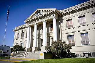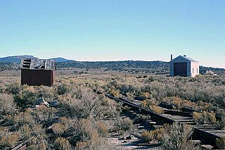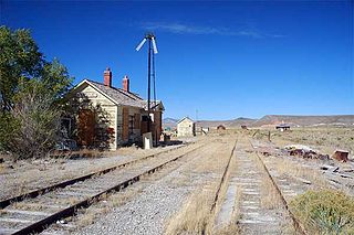
Elko County is a county in the northeastern corner of Nevada, United States. As of the 2020 census, the population was 53,702. Its county seat is Elko. The county was established on March 5, 1869, from Lander County.

Elko is a city in the U.S. state of Nevada and the county seat of Elko County. As of the official 2020 U.S. Census, the city has a population of 20,564. Elko serves as the center of the Ruby Valley, a region with a population of over 55,000. Elko is 21 miles (34 km) from Lamoille Canyon and the Ruby Mountains, providing year-round access to recreation, including hiking, skiing, hunting, and more than 20 alpine lakes. The city straddles the Humboldt River. Spring Creek, Nevada, serves as a bedroom community 6 miles (10 km) from the city with a population of 13,805.

Wells is a small city in Elko County, in northeast Nevada in the western United States. The population was 1,292 at the 2010 census. Wells is located at the junction of Interstate 80 and U.S. Route 93, approximately 50 miles (80 km) east of Elko and is part of the Elko micropolitan area.

Ely is the largest city and county seat of White Pine County, Nevada, United States. Ely was founded as a stagecoach station along the Pony Express and Central Overland Route. In 1906 copper was discovered. Ely's mining boom came later than the other towns along US 50. The railroads connecting the transcontinental railroad to the mines in Austin, Nevada and Eureka, Nevada have long been removed, but the railroad to Ely is preserved as a heritage railway by the Nevada Northern Railway and known as the Ghost Train of Old Ely. As of the 2020 census, the population was 3,924.

Beowawe is a small town in Eureka County, Nevada, United States.

The Nevada Northern Railway was a railroad in the U.S. state of Nevada, built primarily to reach a major copper producing area in White Pine County, Nevada. The railway, constructed in 1905–06, extended northward about 140 miles (230 km) from Ely to connections with the Western Pacific Railroad at Shafter and Southern Pacific Railroad at Cobre. In 1967 NN reported 40 million net ton-miles of revenue freight on 162 miles (261 km) of line.

Tuscarora is an unincorporated community in Elko County, Nevada, United States. The community lies on the east side of the Tuscarora Mountains approximately 40 miles north of Carlin. Tuscarora is part of the Elko Micropolitan Statistical Area. Far from being a ghost town, as several websites proclaim, Tuscarora is home to two schools, a library, a post office and a bar and grill, as well as homes for its remaining residents.

Montello is a small desert village in Elko County, Nevada, United States. It is home to Montello Elementary School, which is part of the Elko County School District. The population of Montello was 50 as of the 2018 American Community Survey. Various cattle ranching operations surround the area.

Metropolis, Nevada is a ghost town in Elko County, Nevada, 12 mi (19 km) northwest of Wells.

Cobre is a ghost town in Elko County, Nevada, United States.
Elko is an unincorporated community in Houston County, Georgia, United States, south of the city of Perry. Founded circa 1890 as a railroad town, Elko prospered in the early 1900s as a local depot and trading center for cotton planters in southern Houston County.

Halleck is an unincorporated community in central Elko County, northeastern Nevada, in the Western United States.
Spenceville was a ranching, farming and mining community located in the southwestern part of Nevada County, California, on Spenceville Road just east of Waldo Road, about 17 miles from Grass Valley. Its elevation was about 400 feet. The former townsite is now part of the Spenceville Wildlife Area.

The Goshute Valley is an endorheic landform of the Great Basin in Elko County, Nevada, United States.
The Clover Valley of Nevada, is a 37-mile (60 km) long valley located in central-southeast Elko County. Wells, Nevada lies at its north end, on I-80.

Pequop or Pequop Siding is a ghost town in Elko County, Nevada, United States. It was located west of Toano on the route around the north end of the Pequop Mountains between Cobre and Wells. It was first a stop station of the Central Pacific Railroad and later a non-agency station on the Southern Pacific Railroad. Several buildings were erected to house section crews.

Shafter is a ghost town in Elko County, Nevada, United States.
Huntington is a ghost town in Elko County, Nevada, United States.
Excelsior is a ghost town in Elko County, in the U.S. state of Nevada.


