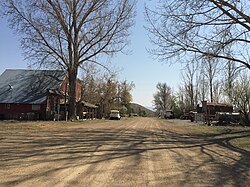
Rhyolite is a ghost town in Nye County, in the U.S. state of Nevada. It is in the Bullfrog Hills, about 120 miles (190 km) northwest of Las Vegas, near the eastern boundary of Death Valley National Park.

Delamar, Nevada, nicknamed The Widowmaker, is a ghost town in central eastern Nevada, USA along the east side of the Delamar Valley. During its heyday, primarily between 1895 and 1900, it produced $13.5 million in gold.

Silver City is a Census Designated Place and small residential community in Lyon County, Nevada, USA, near the Lyon/Carson border. The population as of the 2020 census was 155.

Tuscarora is an unincorporated community in Elko County, Nevada, United States. The community lies on the east side of the Tuscarora Mountains approximately 40 miles north of Carlin. Tuscarora is part of the Elko Micropolitan Statistical Area. Far from being a ghost town, as several websites proclaim, Tuscarora is home to two schools, a library, a post office and a bar and grill, as well as homes for its remaining residents.

Gold Point, Nevada is a ghost town in Esmeralda County, Nevada. The community was named after the local gold-mining industry. Gold Point is the southern terminus of Nevada State Route 774. Its current population is about seven.

Ione, Nevada, is a ghost town in Nye County, Nevada, located approximately 23 miles (37 km) east of Gabbs, Nevada.
Blair, Nevada is a mining ghost town in Esmeralda County, Nevada.

Palmetto, Nevada is a ghost town in Esmeralda County, in the U.S. state of Nevada.

El Dorado Canyon is a canyon in southern Clark County, Nevada famed for its rich silver and gold mines. The canyon was named in 1857 by steamboat entrepreneur Captain George Alonzo Johnson when gold and silver was discovered here. It drains into the Colorado River at the former site of Nelson's Landing.

Treasure Hill is an east-jutting spur of the White Pine Range of White Pine County in the east central region of the U.S. state of Nevada. It lies to the east of Mount Hamilton and to the northwest of Mokomoke Hill. It is noted for a silver mining boom in the late 1860s: between 1867 and 1880, the total production from area mines was valued at $20 million. The rush drew thousands to new towns such as Hamilton, situated at the northern base of the hill, and Treasure City, located near its peak, 2.5 miles (4.0 km) from Hamilton.

Charleston is a ghost town in Elko County, Nevada, United States. It lies along the Bruneau River just south of the Mountain City and Jarbidge Ranger Districts of the Humboldt-Toiyabe National Forest and is near the southwest edge of the Jarbidge Wilderness.
Lander is a ghost town in Lander County in Nevada in the United States. The site is approximately 24 miles southeast of Battle Mountain.
Dutton is a ghost town in Elko County, in the U.S. state of Nevada.
Excelsior is a ghost town in Elko County, in the U.S. state of Nevada.

Cortez is a ghost town in Lander County, in the U.S. state of Nevada. The GNIS classifies it as a populated place.
Farrell is a ghost town in Pershing County, Nevada, United States.

Bullionville is a ghost town in Lincoln County, Nevada, United States, 1/4 mile east of U.S. Route 93, one mile north of Panaca and 10 miles (16 km) south of Pioche. The town prospered between 1870 and 1882, and is now abandoned.
Tempiute is a ghost town in Lincoln County, Nevada United States.

Tenabo is a ghost town in Lander County, Nevada United States.
Cornucopia is an extinct town located in Elko County, Nevada. The town used to be well-known for its mining district area, which was established in 1873. Cornucopia was also known under several names, including Milltown and Kaufmanville.


