Colfax is a city in Placer County, California, at the crossroads of Interstate 80 and State Route 174. The population was 1,963 at the 2010 census. The town is named in honor of U.S. Vice President Schuyler Colfax (1869–73), a bronze statue of whom stands at Railroad Street and Grass Valley Street.

Verdi is a census-designated place (CDP) in Washoe County, Nevada, United States. It is on the western side of the Reno–Sparks Metropolitan Statistical Area, near Interstate 80. The CDP of Verdi, California lies immediately adjacent across the state line. Both are in the shadow of California's Verdi Range. In 2010, the population was 1,415. Prior to 2010, the community was listed by the U.S. Census Bureau as part of the Verdi-Mogul CDP.

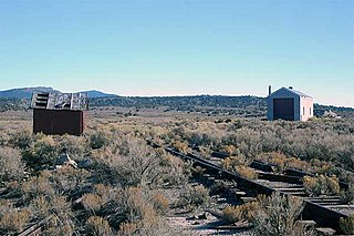
Palisade is located in Eureka County in the northeastern section of the state of Nevada, in the western United States. It is about 10 miles (16 km) south of Carlin, and about 33 miles (53 km) southwest of Elko. Although now a virtual ghost town, it had a rich history following construction of the Transcontinental Railroad. The town takes its name from Palisade Canyon, an important obstacle to the construction and operation of the railroad, which lies to the west.

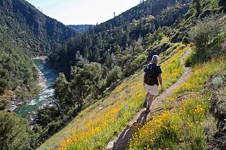
Jarbidge is an unincorporated community in Elko County, Nevada, United States. Located at the bottom of the Jarbidge River's canyon near the north end of the Jarbidge Mountains, it lies within the Jarbidge Ranger District of the Humboldt-Toiyabe National Forest and is near the northwest edge of the Jarbidge Wilderness, approximately 10 miles (16 km) south of the Idaho–Nevada border.

Spruce Mountain is a mountain in Elko County, Nevada, United States. It was named from the spruce timber near the summit. Spruce Mountain ranks twenty-fifth among the most topographically prominent peaks in the state. The summit is at 10,267 feet (3,129 m). Spruce Mountain is on a northeast–southwest trending ridge with a parallel Spruce Ridge to the northwest. To the east, a low section of hills connects the mountain to the south end of the Pequop Mountains. US Route 93 passes the southwest end of the mountain. The peak is on public land administered by the Bureau of Land Management and thus has no access restrictions.

Tuscarora is an unincorporated community in Elko County, Nevada, United States. The community lies on the east side of the Tuscarora Mountains approximately 40 miles north of Carlin. Tuscarora is part of the Elko Micropolitan Statistical Area. Far from being a ghost town, as several websites proclaim, Tuscarora is home to two schools, a library, a post office and a bar and grill, as well as homes for its very much alive residents.

Montello is a census-designated place (CDP) in Elko County, Nevada, United States. It is home to Montello Elementary School, which is part of the Elko County School District. The population of Montello was 50 as of the 2018 American Community Survey. Two small bars and a market/motel selling fuel and sundries comprise the business district. Various cattle ranching operations surround the area.

Metropolis, Nevada is a ghost town in Elko County, Nevada, 12 mi (19 km) northwest of Wells.

San Jacinto is a ghost town in along Salmon Falls Creek in northern Elko County, Nevada, United States. It is part of the Elko Micropolitan Statistical Area.
Cobre is a ghost town in Elko County, Nevada, United States.

Halleck is an unincorporated community in central Elko County, northeastern Nevada, in the Western United States.

Terrace is a ghost town in the Great Salt Lake Desert in west-central Box Elder County, Utah, United States.
Fort Halleck may refer to a U. S. Army fort in the United States:

The Central Corridor is a rail line operated by the Union Pacific Railroad from near Winnemucca, Nevada to Denver, Colorado in the western United States. The line was created after the merger with the Southern Pacific Transportation Company by combining portions of lines built by former competitors. No portion of the line was originally built by the Union Pacific; in fact, some portions were built specifically to compete with the Union Pacific's Overland Route. The line is known for significant feats of engineering while crossing the Wasatch Mountains of Utah and the Rocky Mountains of Colorado. The line features numerous tunnels, the longest and highest of these is the Moffat Tunnel.

Shafter is a ghost town in Elko County, Nevada, United States.
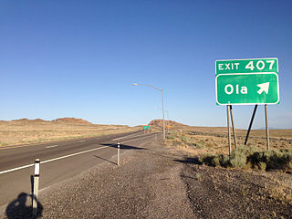
Ola is a ghost town and railroad siding in eastern Elko County, Nevada, United States.
Excelsior is a ghost town in Elko County, in the U.S. state of Nevada.
Tulasco is an extinct town in Elko County, in the U.S. state of Nevada.
The Elko Subdivision is a railway line in Nevada owned and operated by the Union Pacific Railroad running from Weso to the freight yard in Elko. It is part of both the Overland Route and the Central Corridor. The line generally follows the Humboldt River and has several small tunnels while traversing the Palisade and Carlin Canyons, the longest tunnel is called the Carlin Tunnel.


