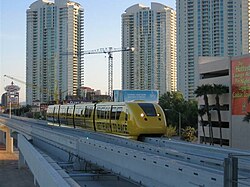
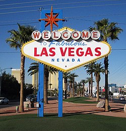
Winchester, Nevada

Last updated
Winchester, Nevada
MonorailAtSahara.JPG
Sahara Hotel Station of the monorail
Clark County Nevada Incorporated Areas Winchester highlighted.svg
Location of Winchester in Clark County, Nevada
Coordinates: 36°8′9″N115°7′15″W / 36.13583°N 115.12083°W / 36.13583; -115.12083
CountryUnited States
State Nevada
County Clark
FoundedApril 23, 1951;72 years ago (1951-04-23)
Founded by Clark County Commission
Area
[1]
  Total4.96 sq mi (12.84 km2)
  Land4.96 sq mi (12.84 km2)
  Water0.00 sq mi (0.00 km2)
Elevation
1,919 ft (585 m)
Population
 (2020)
  Total36,403
  Density7,342.28/sq mi (2,834.66/km2)
Time zone UTC−8 (PST)
  Summer (DST) UTC−7 (PDT)
Area code(s) 702 and 725
FIPS code 32-84600
GNIS feature ID0845753

Winchester is an unincorporated town [2] and census-designated place (CDP) in Clark County, Nevada, United States that contains part of the Las Vegas Strip. It is one of a number of CDPs in the unincorporated urbanized area directly south of Las Vegas. The population was 36,403 at the 2020 census. [3] It is governed by the Clark County Commission with advice from the Winchester Town Advisory Board. "Winchester, NV" does not appear in postal addresses; the United States Postal Service has assigned "Las Vegas, NV" as the place name for the ZIP codes containing Winchester.

Contents

History

The southern part of the Las Vegas Valley was referred to as Paradise Valley as early as 1910, owing to a high water table that made the land particularly fertile for farming. [4] [5] County commissioners established a Paradise school district in 1914. [6]

In 1950, mayor Ernie Cragin of Las Vegas sought to annex the Las Vegas Strip, which was unincorporated territory, in order to expand the city's tax base to fund his ambitious building agenda and pay down the city's rising debt. [7] A group of casino executives, led by Gus Greenbaum of the Flamingo, lobbied the county commissioners for town status, which would prevent the city from annexing the land without the commission's approval. [7] The commission voted to create the unincorporated town of Paradise on December 8, 1950. [8] [9] A month after its establishment, the town was expanded to include the residential areas of Paradise Valley. [10] Months later, however, it was reported that county officials had determined that the town had not been properly established, because the petition for the town's formation had an insufficient number of signatures and because it had violated a state law forbidding formation of a town spanning multiple school districts. [11] On August 20, 1951, county commissioners accepted petitions to create two new towns covering the area of the putative town. [12] Town "A" of Paradise included the areas that lay within a Las Vegas school district, extending from the city limits to a point one mile south, while Town "B" included the areas within the Paradise school district. [11] In 1953, Town A was renamed as Winchester, and Town B became known simply as Paradise. [13] Ultimately, in 1956 state law consolidated all local school districts into a countywide school district, which in the Las Vegas Valley's case is the Clark County School District. [14]

Geography

Winchester sits in the east-central part of the Las Vegas Valley. To the north it borders Las Vegas, to the west and south is the CDP of Paradise, and to the east is Sunrise Manor.

Relative to streets, it is the area bordered by Sahara Avenue on the north, Boulder Highway on the east, Desert Inn Road on the south and the Union Pacific Railroad tracks on the west, with a few additional enclaves west of Interstate 15. [15] The Strip casinos which are part of Winchester include the Sahara, Resorts World Las Vegas, Circus Circus, and the Westgate.

According to the United States Census Bureau, the CDP has a total area of 4.3 square miles (11 km2), all land.

Demographics

Historical population
CensusPop.Note
1970 13,981
1980 19,72841.1%
1990 23,36518.4%
2000 26,95815.4%
2010 27,9783.8%
2020 36,40330.1%
source: [16]
Racial composition2020 [17] 2010 [18] 2000 [19]
Hispanic or Latino 47.9%44.6%29.0%
White (Non-Hispanic) 26.2%37.2%54.9%
Black or African American 12.8%7.8%6.7%
American Indian or Alaska Native 0.4%0.5%0.7%
Asian 7.7%6.8%5.3%
Native Hawaiian or Other Pacific Islander 0.4%0.5%0.4%
Some other race0.8%0.1%0.1%
Two or more races 3.9%2.3%2.9%

At the 2000 census, there were 26,958 people, 11,986 households, and 6,052 families living in the CDP. The population density was 6,253.2 inhabitants per square mile (2,414.4/km2). There were 13,535 housing units at an average density of 3,139.6 inhabitants per square mile (1,212.2/km2). [20]

Of the 11,986 households, 20.2% had children under the age of 18 living with them, 33.3% were married couples living together, 11.7% had a female householder with no husband present, and 49.5% were non-families. 38.7% of households were one person and 14.3% were one person aged 65 or older. The average household size was 2.24 and the average family size was 3.01.

The age distribution was 19.8% under the age of 18, 9.0% from 18 to 24, 29.2% from 25 to 44, 24.5% from 45 to 64, and 17.5% 65 or older. The median age was 40 years. For every 100 females, there were 106.4 males. For every 100 females age 18 and over, there were 105.7 males.

The median household income was $32,251 and the median family income was $39,451. Males had a median income of $27,886 versus $22,453 for females. The per capita income for the CDP was $20,615. About 11.4% of families and 14.0% of the population were below the poverty line, including 19.2% of those under age 18 and 8.5% of those age 65 or over.


See also

Related Research Articles

<span class="mw-page-title-main">Nevada</span> U.S. state

Nevada is a state in the Western region of the United States. It is bordered by Oregon to the northwest, Idaho to the northeast, California to the west, Arizona to the southeast, and Utah to the east. Nevada is the 7th-most extensive, the 32nd-most populous, and the 9th-least densely populated of the U.S. states. Nearly three-quarters of Nevada's people live in Clark County, which contains the Las Vegas–Paradise metropolitan area, including three of the state's four largest incorporated cities. Nevada's capital is Carson City. Las Vegas is the largest city in the state.

<span class="mw-page-title-main">Las Vegas</span> Largest city in Nevada, United States

Las Vegas, often known simply as Vegas, is the 25th-most populous city in the United States, the most populous city in the state of Nevada, and the county seat of Clark County. The Las Vegas Valley metropolitan area is the largest within the greater Mojave Desert, and 2nd-largest in the Southwestern United States. Las Vegas is an internationally renowned major resort city, known primarily for its gambling, shopping, fine dining, entertainment, and nightlife, with most venues centered on downtown Las Vegas and more to the Las Vegas Strip just outside city limits. The Las Vegas Valley as a whole serves as the leading financial, commercial, and cultural center for Nevada.

<span class="mw-page-title-main">Clark County, Nevada</span> County in Nevada, United States

Clark County is a county located in the U.S. state of Nevada. As of the 2020 census, the population was 2,265,461. Most of the county population resides in the Las Vegas Census County Divisions, which hold 2,196,623 people as of the 2020 Census, across 435 square miles (1,130 km2). It is by far the most populous county in Nevada, and the 11th most populous county in the United States. It covers 7% of the state's land area but holds 73% of the state's population, making Nevada the most centralized state in the United States.

<span class="mw-page-title-main">Reader, Arkansas</span> Census-designated place in Arkansas, United States

Reader is an unincorporated census-designated place in Nevada and Ouachita counties in the U.S. state of Arkansas. As of the 2010 census, its population is 66. Per the 2020 census, the population was 40.

<span class="mw-page-title-main">Blue Diamond, Nevada</span> Census-designated place in Clark County, Nevada, United States

Blue Diamond is a census-designated place (CDP) in Clark County, Nevada, United States. The population was 268 at the 2020 census.

<span class="mw-page-title-main">Enterprise, Nevada</span> Unincorporated town in Nevada, United States

Enterprise is an unincorporated town in the Las Vegas Valley in Clark County, Nevada, United States. The population was 221,831 at the 2020 U.S. census, up from 14,676 at the 2000 census. It was founded on December 17, 1996. Like other unincorporated towns in the Las Vegas Valley, it uses Las Vegas ZIP codes for addresses within its boundaries.

<span class="mw-page-title-main">Goodsprings, Nevada</span> Unincorporated community in Nevada, United States

Goodsprings is an unincorporated community in Clark County, Nevada, United States. The population was 229 at the 2010 census.

<span class="mw-page-title-main">Indian Springs, Nevada</span> Unincorporated town in the State of Nevada, United States

Indian Springs is an unincorporated town and a census-designated place located on U.S. Route 95 next to Creech Air Force Base in northwestern Clark County and southern Nevada.

<span class="mw-page-title-main">Laughlin, Nevada</span> Unincorporated community in the state of Nevada, United States

Laughlin is an unincorporated community in Clark County, Nevada, United States. Laughlin lies 90 miles (140 km) south of Las Vegas, in the far southern tip of Nevada. As a resort town, it is known for its gaming and water recreation. As of the 2020 census, the population was 8,658. For statistical purposes, the United States Census Bureau has defined Laughlin as a census-designated place (CDP). It is located on the Colorado River, downstream from the Davis Dam and Lake Mohave, and directly across from the much larger Bullhead City, Arizona. The nearby communities of Bullhead City, Arizona; Needles, California; Fort Mohave, Arizona; and Mohave Valley, Arizona, bring the area's total population to about 100,000. Laughlin is also 286 miles (460 km) northeast of Los Angeles.

<span class="mw-page-title-main">Mesquite, Nevada</span> City in Nevada, United States

Mesquite is a city in Clark County, Nevada, United States adjacent to the Arizona state line and 80 miles (130 km) northeast of Las Vegas on Interstate 15. As of the 2020 census, the city had a population of 20,471. The city is located in the Virgin River valley adjacent to the Virgin Mountains in the northeastern part of the Mojave Desert. It is home to a growing retirement community, as well as several casino resorts and golf courses.

<span class="mw-page-title-main">Moapa, Nevada</span> Census-designated place in Nevada, United States

Moapa is an unincorporated town and census-designated place (CDP) in Clark County, Nevada, United States. The population was 1,025 at the 2010 census. It is the largest town in Clark County by land area. Both the second and the third tallest structures in Nevada, the Moapa Entravision Tower and the Moapa Kemp Tower respectively, are located in Moapa.

<span class="mw-page-title-main">Moapa Valley, Nevada</span> Unincorporated town in the State of Nevada, United States

Moapa Valley is an unincorporated town in Clark County, Nevada, United States. As of the 2010 census, it had a population of 6,924. The valley in which the community lies, also named Moapa Valley, is about 40 miles (64 km) long and lies roughly northwest to southeast.

<span class="mw-page-title-main">Paradise, Nevada</span> Unincorporated town in Nevada, United States

Paradise is an unincorporated town and census-designated place (CDP) in Clark County, Nevada, United States, adjacent to the city of Las Vegas. It was formed on December 8, 1950. Its population was 191,238 at the 2020 census, making it the fifth-most-populous CDP in the United States; if it were an incorporated city, it would be the fifth-largest in Nevada. As an unincorporated town, it is governed by the Clark County Commission with input from the Paradise Town Advisory Board.

<span class="mw-page-title-main">Searchlight, Nevada</span> Unincorporated town in the State of Nevada, United States

Searchlight is an unincorporated town and census-designated place (CDP) in Clark County, Nevada, United States, at the topographic saddle between two mountain ranges. At the 2020 census it had a population of 445.

<span class="mw-page-title-main">Spring Valley, Nevada</span> Unincorporated town in the State of Nevada, United States

Spring Valley is an unincorporated town and census-designated place in Clark County, Nevada, United States, located 2 miles (3 km) west of the Las Vegas Strip. The population was 215,597 at the 2020 census. Spring Valley was formed in May 1981.

<span class="mw-page-title-main">Summerlin South, Nevada</span> CDP in Nevada, United States

Summerlin South, also seen on maps as South Summerlin, is a census-designated place (CDP) in Clark County, Nevada, United States, on the western edge of the Las Vegas Valley and adjacent to the Red Rock Canyon National Conservation Area. It is so named because it is a southward extension of the master-planned community of Summerlin. Nearly all of Summerlin South is in ZIP code 89135. The population was 24,085 at the 2010 Census.

<span class="mw-page-title-main">Sunrise Manor, Nevada</span> Census-designated place in Clark County, Nevada, United States

Sunrise Manor is a census-designated place in Clark County, Nevada, United States, located on the western base of Frenchman Mountain, east of Las Vegas. The population was 205,618 at the 2020 census. If Sunrise Manor were to be incorporated, it would be one of the largest cities in Nevada. Sunrise Manor was formed in May 1957.

<span class="mw-page-title-main">Whitney, Nevada</span> Unincorporated town in the State of Nevada, United States

Whitney is an unincorporated town and census-designated place in Clark County, Nevada, United States. The population was 38,585 at the 2010 census.

<span class="mw-page-title-main">Gardnerville, Nevada</span> Unincorporated town in the State of Nevada, United States

Gardnerville is an unincorporated town in Douglas County, Nevada, adjacent to the county seat of Minden. The population was 6,211 at the 2020 census.

<span class="mw-page-title-main">Gabbs, Nevada</span> Unincorporated town in the State of Nevada, United States

Gabbs is an unincorporated town in Nye County, Nevada, United States. The population was 269 at the 2010 census. Located in northern Nye County, it is part of the Greater Las Vegas, making it at 321 miles (517 km) the most distant community from Las Vegas in the Las Vegas–Henderson combined statistical area.

References

  1. "ArcGIS REST Services Directory". United States Census Bureau. Retrieved September 19, 2022.
  2. "Winchester Town Advisory Board". Archived from the original on 2015-05-01. Retrieved 2015-04-12.
  3. "Census - Geography Profile: Winchester CDP, Nevada". United States Census Bureau . Retrieved May 28, 2022.
  4. F. Andrew Taylor (August 3, 2010). "Origin of many Clark County township names is a mystery". Anthem View. Las Vegas via NewsBank.
  5. "Paradise Valley well named". Las Vegas Age. May 28, 1910.
  6. "County board met Monday". Las Vegas Age. November 7, 1914.
  7. 1 2 Moehring, Eugene P. (2000). Resort City in the Sunbelt: Las Vegas, 1930-2000. University of Nevada Press. p. 87. ISBN   0-87417-356-6.
  8. Steve Kanigher (July 18, 2003). "Las Vegas: Bright lights, but not a big city". Las Vegas Sun. Retrieved 2017-10-28.
  9. "Luxury hotel 'Strip' in Clark becomes town". Reno Gazette-Journal. December 11, 1950 via Newspapers.com.
  10. "New boundary for Paradise". Reno Gazette-Journal. January 16, 1951 via Newspapers.com.
  11. 1 2 John Hoggatt (April 27, 1951). "Paradise revealed as town that never was". Las Vegas Review-Journal. p. 3.
  12. "New town 'richest' in state". Las Vegas Review-Journal. August 21, 1951. p. 1.
  13. "Rich new Nevada town of Winchester founded". Reno Gazette-Journal. October 8, 1953 via Newspapers.com.
  14. "Education's Past". Nevada 150 Education. Retrieved 2021-11-22.
  15. "Map of Winchester" (PDF). Retrieved 2023-10-06.
  16. "CENSUS OF POPULATION AND HOUSING (1790-2000)". U.S. Census Bureau . Retrieved 2010-07-17.
  17. "P9 | HISPANIC OR LATINO, AND NOT HISPANIC OR LATINO BY RACE". Census.gov. Retrieved April 17, 2022.
  18. "P9 | HISPANIC OR LATINO, AND NOT HISPANIC OR LATINO BY RACE". Census.gov. Retrieved 2023-12-28.
  19. "PL002 | HISPANIC OR LATINO, AND NOT HISPANIC OR LATINO BY RACE [73]". Census.gov. Retrieved 2023-12-28.
  20. "U.S. Census website". United States Census Bureau . Retrieved 2008-01-31.