Corn Creek, Nevada

Last updated
Corn Creek
Starr 071225-0688 Prosopis glandulosa.jpg
Corn Creek, Nevada
USA Nevada location map.svg
Red pog.svg
Corn Creek
Usa edcp location map.svg
Red pog.svg
Corn Creek
Coordinates: 36°25′15″N115°22′54″W / 36.42083°N 115.38167°W / 36.42083; -115.38167
Country United States
State Nevada
County Clark
Named for Corn Creek
Elevation
2,854 ft (870 m)
Time zone UTC-8 (Pacific (PST))
  Summer (DST) UTC-7 (PDT)
ZIP code
89124
Area code(s) 702/725
GNIS feature ID859284 [1]

Corn Creek is an unincorporated community in Clark County, Nevada, United States. [1] The community is located along the former Las Vegas and Tonopah Railroad where it had a station. It is approximately 7.5 miles from the Las Vegas city limits by road and is situated south of the Desert National Wildlife Refuge border and bordered to the west, south, and east with the Tule Springs Fossil Beds National Monument.

Contents

Corn Creek is an off-the-grid community, relying on power from propane tanks and solar panels. [2]

Geography

Corn Creek Springs Corn creek springs at desert national wildlife refuge.jpg
Corn Creek Springs

Corn Creek lies on the Las Vegas Wash at an elevation of 2,854 ft (870 m). [1] Visible in the east are the Sheep Range and Fossil Ridge, Castle Rock, and Gass Peak of the Las Vegas Range. To the west are the Spring Mountains.

Climate

Corn Creek has a cool desert climate (Köppen BWk).

Climate data for Desert National Wildlife Refuge, Nevada, 1991–2020 normals, extremes 1940–present
MonthJanFebMarAprMayJunJulAugSepOctNovDecYear
Record high °F (°C)83
(28)
87
(31)
96
(36)
98
(37)
108
(42)
113
(45)
117
(47)
114
(46)
109
(43)
100
(38)
94
(34)
81
(27)
117
(47)
Mean maximum °F (°C)68.9
(20.5)
72.2
(22.3)
81.7
(27.6)
90.9
(32.7)
99.0
(37.2)
107.0
(41.7)
110.8
(43.8)
108.2
(42.3)
102.4
(39.1)
92.9
(33.8)
79.9
(26.6)
68.1
(20.1)
111.4
(44.1)
Average high °F (°C)56.8
(13.8)
60.5
(15.8)
68.0
(20.0)
75.5
(24.2)
85.3
(29.6)
96.1
(35.6)
101.2
(38.4)
99.5
(37.5)
92.0
(33.3)
79.0
(26.1)
65.5
(18.6)
55.6
(13.1)
77.9
(25.5)
Daily mean °F (°C)43.8
(6.6)
47.0
(8.3)
53.6
(12.0)
60.0
(15.6)
69.1
(20.6)
78.5
(25.8)
84.4
(29.1)
82.8
(28.2)
75.0
(23.9)
62.6
(17.0)
50.8
(10.4)
42.8
(6.0)
62.5
(16.9)
Average low °F (°C)30.8
(−0.7)
33.6
(0.9)
39.1
(3.9)
44.6
(7.0)
52.9
(11.6)
60.9
(16.1)
67.6
(19.8)
66.0
(18.9)
58.1
(14.5)
46.2
(7.9)
36.0
(2.2)
30.0
(−1.1)
47.2
(8.4)
Mean minimum °F (°C)20.9
(−6.2)
24.0
(−4.4)
29.3
(−1.5)
34.8
(1.6)
42.3
(5.7)
50.7
(10.4)
58.5
(14.7)
57.2
(14.0)
48.1
(8.9)
35.8
(2.1)
25.4
(−3.7)
20.5
(−6.4)
18.0
(−7.8)
Record low °F (°C)0
(−18)
10
(−12)
17
(−8)
23
(−5)
30
(−1)
36
(2)
43
(6)
43
(6)
38
(3)
19
(−7)
16
(−9)
3
(−16)
0
(−18)
Average precipitation inches (mm)0.58
(15)
0.80
(20)
0.62
(16)
0.25
(6.4)
0.17
(4.3)
0.08
(2.0)
0.46
(12)
0.28
(7.1)
0.26
(6.6)
0.40
(10)
0.27
(6.9)
0.44
(11)
4.61
(117)
Average snowfall inches (cm)trace0.1
(0.25)
0.0
(0.0)
0.0
(0.0)
0.0
(0.0)
0.0
(0.0)
0.0
(0.0)
0.0
(0.0)
0.0
(0.0)
0.0
(0.0)
0.0
(0.0)
0.2
(0.51)
0.3
(0.76)
Average precipitation days (≥ 0.01 in)3.03.72.71.81.20.52.62.01.31.71.42.424.3
Average snowy days (≥ 0.1 in)0.10.10.00.00.00.00.00.00.00.00.00.10.3
Source: NOAA [3] [4]

Recreation

To the northeast up Corn Creek Road is Corn Creek Campsite and the Desert National Wildlife Refuge visitor center and parking lot. [5] Trails and dirt roads from the visitor center provide access to the Sheep Range and Las Vegas Range and Tule Springs Fossil Beds National Monument located further south closer to Las Vegas.

Corn Creek Road

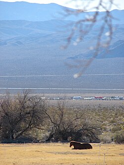
Corn Creek Road is a roughly 4-mile paved road that provides access to the community via Landy Street and the DNWR visitor center and Corn Creek Campsite from U.S. Route 95. The road has a 45 mph speed limit. The western half is located in the Tule Springs Fossil Beds National Monument and the eastern half in the Desert National Wildlife Refuge. [6]

At the end of the road, Alamo Road and Mormon Well Road are accessible as well as Gass Peak Road which spurs off Mormon Well Road further into the wildlife refuge.
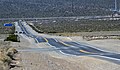
Related Research Articles

<span class="mw-page-title-main">Desert National Wildlife Refuge</span> Large protected area in Nevada, United States

The Desert National Wildlife Refuge is a protected wildlife refuge, administered by the U.S. Fish and Wildlife Service, located north of Las Vegas, Nevada, in northwestern Clark and southwestern Lincoln counties, with much of its land area lying within the southeastern section of the Nevada Test and Training Range. The Desert NWR, created on May 20, 1936, is the largest wildlife refuge in the lower 48 states of the United States, encompassing 1.615 million acres (6,540 km2) of the Mojave Desert in the southern part of Nevada. The refuge was originally established at 2.25 million acres. In 1940 840,000 acres were transferred to the Department of Defense.

<span class="mw-page-title-main">Pahranagat Valley</span>

The Pahranagat Valley is a Tonopah Basin landform in Lincoln County, Nevada.

<span class="mw-page-title-main">Old Las Vegas Mormon Fort State Historic Park</span>

Old Las Vegas Mormon Fort State Historic Park is a state park of Nevada, containing the Old Mormon Fort, the first structure built by people of European heritage in what would become Las Vegas fifty years later. In present-day Las Vegas, the site is at the southeast corner of Las Vegas Boulevard and Washington Avenue, less than one mile north of the downtown area and Fremont Street. This is the only U.S. state park located in a city that houses the first building ever built in that city. The fort was listed on the National Register of Historic Places on February 1, 1972. The site is memorialized with a tablet erected by the Church of Jesus Christ of Latter-day Saints in 1997, along with Nevada Historical Marker #35, and two markers placed by the Daughters of Utah Pioneers.

<span class="mw-page-title-main">Amargosa Desert</span> Desert in Nevada and California, United States

The Amargosa Desert is located in Nye County in western Nevada, United States, along the California–Nevada border, comprising the northeastern portion of the geographic Amargosa Valley, north of the Ash Meadows National Wildlife Refuge.

<span class="mw-page-title-main">Cabeza Prieta National Wildlife Refuge</span> Protected area in Arizona

Cabeza Prieta National Wildlife Refuge (CPNWR) is located in southwestern Arizona in the United States, along 56 miles (90 km) of the Mexico–United States border. It is bordered to the north and to the west by the Barry M. Goldwater Air Force Range, to the south by Mexico's El Pinacate y Gran Desierto de Altar Biosphere Reserve, to the northeast by the town of Ajo, and to the southeast by Organ Pipe Cactus National Monument.

<span class="mw-page-title-main">Corn Creek Campsite</span> United States historic place

Corn Creek Campsite is located in the Desert National Wildlife Range and was used from around 1900–1924 for ranching and is listed on the United States National Register of Historic Places. Nearby is Mormon Well Spring another listed historic place.

<span class="mw-page-title-main">Tule Springs</span>

Tule Springs is one of the larger urban retreats in Las Vegas, Nevada, and the Las Vegas Valley. It is a significant desert ecosystem consisting of a series of small lakes that formed an oasis in this area of the Mojave Desert. Both the springs and the ranch are located within the Floyd Lamb Park at Tule Springs which is operated by the City of Las Vegas.

<span class="mw-page-title-main">Las Vegas Range</span>

The Las Vegas Range is an arid mountain range in Clark County, Nevada. The range is located in the southeast of the Desert National Wildlife Refuge.

Tule is a plant of the sedge family.

<span class="mw-page-title-main">Elizabeth von Till Warren</span> American historian and preservationist (1934–2021)

Elizabeth von Till Warren was an American historian and preservationist. She had expertise in the history of water development in the Mojave Desert and the Las Vegas Valley in particular. She also had expertise in the historical route of the Old Spanish Trail in Southern Nevada.

<span class="mw-page-title-main">Nellis Air Force Base Complex</span>

The Nellis Air Force Base Complex is the southern Nevada military region of federal facilities and lands, e.g., currently and formerly used for military and associated testing and training such as Atomic Energy Commission atmospheric nuclear detonations of the Cold War. The largest land area of the complex is the Nevada Test and Training Range, and numerous Formerly Used Defense Sites remain federal lands of the complex. Most of the facilities are controlled by the United States Air Force and/or the Bureau of Land Management, and many of the controlling units are based at Creech and Nellis Air Force Bases. Initiated by a 1939 military reconnaissance for a bombing range, federal acquisition began in 1940, and McCarran Field became the World War II training area's 1st of 3 Nevada World War II Army Airfields and 10 auxiliary fields. The area's first military unit was initially headquartered in the Las Vegas Federal Building while the WWII Las Vegas Army Airfield buildings were constructed.

<span class="mw-page-title-main">Tule Springs Fossil Beds National Monument</span> United States National Monument

Tule Springs Fossil Beds National Monument, a United States National Monument near Las Vegas, Clark County, Nevada, was established in 2014 to protect Ice Age paleontological discoveries. The 22,650-acre (9,170 ha) monument is administered by the National Park Service.

<span class="mw-page-title-main">Basin and Range National Monument</span> National monument in southeastern Nevada, United States

Basin and Range National Monument is a national monument of the United States spanning approximately 704,000 acres of remote, undeveloped mountains and valleys in Lincoln and Nye counties in southeastern Nevada. It is described as "one of the emptiest spaces in a state famous for its emptiness."

<span class="mw-page-title-main">Gass Peak</span>

Gass Peak is the highest peak in the Las Vegas Range of Southern Nevada with a summit of 6,937 feet. It is easily seen to the north of the Las Vegas Valley, bordering the city of North Las Vegas. The peak is located about 20 miles (32 km) north of Las Vegas and is within the Desert National Wildlife Refuge, administered by the U.S. Fish & Wildlife Service.

Durango Drive is a major north-south road in the Las Vegas metropolitan area, Nevada, United States, located on the west side of the city.

<span class="mw-page-title-main">Centennial Hills, Las Vegas</span> Neighborhood in Las Vegas, Nevada, U.S.

Centennial Hills is a neighborhood in northwest Las Vegas, Nevada, United States. It is bordered by the Snow Mountain Paiute Reservation and Tule Springs Fossil Beds National Monument to the north, Lower Kyle Canyon and the Red Rock Canyon National Conservation Area to the west, Summerlin to the south, and North Las Vegas to the east. The Spring Mountains are visible to the west with Gass Peak in the Las Vegas Range to the north. Lone Mountain lies within the neighborhood.

Ice Age Fossils State Park is a 315-acre state park in North Las Vegas, Nevada, United States, on the northernmost fringe of the metropolitan area. It is located adjacent to the Tule Springs Fossil Beds National Monument near Willie McCool Regional Park. This park is currently under construction and there are no facilities available to the public yet. Grand opening information will be posted to the park website and social media once a date has been determined.

The Yucca Forest is a valley in Clark County, Nevada, United States, located in the Desert National Wildlife Refuge north of Las Vegas. It is surrounded by the Sheep Range to the north and west and Las Vegas Range to the south and east.

References

  1. 1 2 3 "Corn Creek". Geographic Names Information System . United States Geological Survey, United States Department of the Interior.
  2. Segall, Eli (2 July 2021). "Las Vegas homes are selling fast, even as sales totals fall". Las Vegas Review-Journal . Retrieved 21 November 2021.
  3. "NOWData – NOAA Online Weather Data". National Oceanic and Atmospheric Administration. Retrieved December 1, 2022.
  4. "Summary of Monthly Normals 1991–2020". National Oceanic and Atmospheric Administration. Retrieved December 1, 2022.
  5. "Corn Creek". U.S. Fish & Wildlife Service . Retrieved 29 January 2021.
  6. Boone, Jim (21 July 2014). "Corn Creek Road". Bird and Hike. Retrieved 29 January 2021.

Further reading