Dayton, Nevada

Last updated

Dayton, Nevada
Dayton, Nevada Historical Marker No. 7, Dayton, Nevada.jpg
Lyon County Nevada Incorporated and Unincorporated areas Dayton Highlighted.svg
Location of Dayton, Nevada
Coordinates: 39°15′6″N119°33′43″W / 39.25167°N 119.56194°W / 39.25167; -119.56194
Country United States
State Nevada
County Lyon
Area
[1]
  Total34.91 sq mi (90.42 km2)
  Land34.90 sq mi (90.39 km2)
  Water0.01 sq mi (0.03 km2)
Elevation
[2]
4,397 ft (1,340 m)
Population
 (2020)
  Total15,153
  Density434.18/sq mi (167.64/km2)
Time zone UTC-8 (Pacific (PST))
  Summer (DST) UTC-7 (PDT)
ZIP code
89403
Area code 775
FIPS code 32-17500
GNIS feature ID0856226 [2]
Reference no.7

Dayton is an unincorporated community and census-designated place (CDP) in Lyon County, Nevada, United States. The population was 15,153 at the 2020 census. [3] Dayton is the second oldest Nevada settlement. It is home to the oldest hotel in Nevada.

Contents

History

The Carson River in Dayton 2015-10-30 13 07 51 View south up the Carson River from Nevada State Route 822 (Dayton Valley Road) in Dayton, Nevada.jpg
The Carson River in Dayton

Dayton is at the western end of the Twenty-Six Mile Desert at a bend in the Carson River. Immigrants stopping there for water would decide whether to follow the river south or continue west, giving the location its first name, Ponderers Rest. In 1849, Abner Blackburn, while heading for California, discovered a gold nugget in nearby Gold Creek, a tributary of the Carson River.

By 1850, placer miners settled at the mouth of Gold Cañon, working sand bars deposited over the millennia along the path of the creek. At first the settlement was just called "Gold Cañon" or "Gold Cañon Flat". Throughout the 1850s, Dayton served as the commercial hub for miners working in the canyon. In 1857 many Chinese miners came to the area to avoid mining taxes directed at the Chinese in California. With the 1859 discovery of the Comstock Lode, newly founded Gold Hill and Virginia City, 6 miles (10 km) to the north, assumed prominence and most miners headed up the cañon. By 1860 the town was primarily occupied by Chinese miners and it was called "China Town" in the U.S. census of that year. However, soon people began to realize there was more profit in providing milling, goods, and services to the miners and thus came or returned to the area. [4]

Dayton courthouse, built in 1864 Courthouse Dayton Nevada built 1864.jpg
Dayton courthouse, built in 1864

In 1861, the town officially adopted the name "Dayton", after John Day, a local surveyor who was later elected Surveyor General of Nevada in 1868, 1870, and 1874. [5] On November 29, 1861, Dayton became the governmental seat for Lyon County. [6] Because of the availability of water from the Carson River, it soon became the first major milling center of the Comstock, and grew rapidly—from 78 residents in 1860 to 2,500 in 1865. [7] Its 1864 courthouse was one of the first in Nevada.

Union Hotel, Dayton, built in the early 1870s Union Hotel after built 1870 Dayton.jpg
Union Hotel, Dayton, built in the early 1870s

In 1866 and 1870 devastating "Great Fires" in Dayton greatly reduced the size of the town. The 1869 opening of the Virginia and Truckee Railroad shifted ore processing upstream to the Carson River Canyon, but Dayton continued to serve as a lesser center of commerce and government. Nonetheless, in the 1870s it was a much quieter, less prosperous town. The coming of the Carson & Colorado Railroad in 1881 brought back some prosperity to Dayton, but the population nonetheless hovered around 500 residents until after World War I.

In 1909, fire destroyed the Lyon County Courthouse. Residents of the growing agricultural community of Yerington to the south called for a shift of the Lyon County seat, which occurred in 1911, leaving Dayton with a shrinking economy and population. By the 1920s, the Lincoln Highway was bringing some tourists to Dayton, but the town remained a quiet reminder of a time when Nevada's gold and silver strikes captured national attention. It did not surpass its 1865 peak population of 2,500 until 1930. [4]

In 1961, Dayton won fame as a setting for John Huston's film, The Misfits , the last movie appearances of Clark Gable and Marilyn Monroe. Beginning in the 1990s, Dayton experienced phenomenal growth as residential development expanded on the east side of the Carson River. The historic part of Dayton is within the Comstock Historic District, featuring a small but impressive main street, the monumental Odeon Hall, and a charming local museum located in an 1865 schoolhouse—the oldest in Nevada in its original location. [4]

Dayton claims the designation of Nevada's oldest settlement, a title disputed by the residents of Genoa. Dayton points to the fact that when the wagon train of pioneer Lucena Parsons stayed at the mouth of Gold Cañon (today's Dayton) for several weeks waiting for the snow to leave the Sierra Nevada, she recorded in her journal that Colonel Reese and his party passed along the Carson River as they headed for the Sierra foothills to establish Mormon Station (today's Genoa). She had noted also that upon the wagon train's arrival about three weeks earlier, more than 200 miners were working the cañon. Today's residents of Genoa point to the region's first post office and several other aspects of town government, noting that their community deserves the title of "Nevada's first town", a claim that Dayton residents do not care enough to dispute. [4] [8]

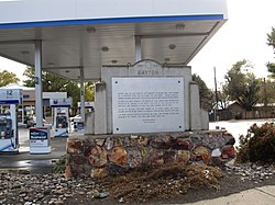
Dayton is listed as Nevada Historical Marker 7. [9]

Geography

Dayton is located in western Lyon County at 39°15′6″N119°33′43″W / 39.25167°N 119.56194°W / 39.25167; -119.56194 (39.251707, -119.561943). [10] It is bordered to the northwest by Silver City and about 12 miles to the east of Carson City, the state capital. U.S. Route 50 passes through the community, leading east 50 miles (80 km) to Fallon and west 12 miles (19 km) to Carson City.

According to the United States Census Bureau, the Dayton CDP has a total area of 31.5 square miles (81.6 km2), of which 0.01 square miles (0.03 km2), or 0.04%, are water. [11]

Demographics

Historical population
CensusPop.Note
1970 826
1980 4,376429.8%
2000 5,907
2010 8,96451.8%
2020 15,15369.0%
U.S. Decennial Census [12]

As of the census [13] of 2000, there were 5,907 people, 2,198 households, and 1,674 families residing in the CDP. The population density was 186.3 inhabitants per square mile (71.9/km2). There were 2,322 housing units at an average density of 73.2 units per square mile (28.3 units/km2). The racial makeup of the CDP was 91.4% White, 0.4% African American, 1.0% Native American, 1.0% Asian, 0.2% Pacific Islander, 3.8% from other races, and 2.2% from two or more races. Hispanic or Latino of any race were 8.8% of the population.

There were 2,198 households, out of which 37.7% had children under the age of 18 living with them, 61.6% were married couples living together, 9.6% had a female householder with no husband present, and 23.8% were non-families. 18.1% of all households were made up of individuals, and 4.6% had someone living alone who was 65 years of age or older. The average household size was 2.69 and the average family size was 3.03.

In the CDP, the population was spread out, with 28.1% under the age of 18, 6.1% from 18 to 24, 29.0% from 25 to 44, 25.0% from 45 to 64, and 11.9% who were 65 years of age or older. The median age was 37 years. For every 100 females, there were 102.6 males. For every 100 females age 18 and over, there were 99.2 males.

The median income for a household in the CDP was $43,599, and the median income for a family was $46,859. Males had a median income of $33,038 versus $26,140 for females. The per capita income for the CDP was $18,417. About 5.3% of families and 6.7% of the population were below the poverty line, including 8.2% of those under age 18 and 5.5% of those age 65 or over.

Economy

As of 2012, the greatest number of workers in Dayton (168) were employed in the retail trade industry followed by the accommodation and food service industry with 138 employees and manufacturing with 56 employees. [14]

The retail trade industry provided $56,637,000 in sales, shipments, receipts or revenue in 2012, which the highest of all industry and is followed by the manufacturing industry, which had a value of $10,562,000 in sales, shipments, receipts or revenue. [14]

Molossia

Following the founding of the Republic of Molossia, a tiny micronation, Dayton has had a large boom in tourism. Several major events regarding Molossia also happened. Since then, other micronations founded and helped boost the tourism industry.

See also

Related Research Articles

<span class="mw-page-title-main">Storey County, Nevada</span> County in Nevada, United States

Storey County is a county located in the U.S. state of Nevada. As of the 2020 census, the population was 4,104, making it the third-least populous county, but one of the fastest-growing economies in Nevada. In 2018, over 18,000 people were employed in the county. Its area is 264 square miles, making it the smallest county in Nevada in terms of area. Its county seat is Virginia City. Storey County is part of the Reno-Sparks metropolitan area.

<span class="mw-page-title-main">Lyon County, Nevada</span> County in Nevada, United States

Lyon County is a county in the U.S. state of Nevada. As of the 2020 census, the population was 59,235. Lyon County comprises the Fernley, NV Micropolitan Statistical Area which is part of the Reno-Carson City-Fernley, NV Combined Statistical Area.

<span class="mw-page-title-main">Black Canyon City, Arizona</span> CDP in Yavapai County, Arizona, US

Black Canyon City is an unincorporated community and census-designated place (CDP) in Yavapai County, Arizona, United States. The population is 2,677 as of the 2020 census.

<span class="mw-page-title-main">Markleeville, California</span> Census-designated place in California, United States

Markleeville is a census-designated place (CDP) and the county seat of Alpine County, California, United States. The population was 191 at the 2020 census, down from 210 at the 2010 census.

<span class="mw-page-title-main">Penrose, Colorado</span> Unincorporated community in Fremont County, Colorado, United States

Penrose is a census-designated place (CDP) and post office located in and governed by Fremont County, Colorado, United States. The CDP is a part of the Cañon City, CO Micropolitan Statistical Area. The Penrose post office has the ZIP Code 81240. At the United States Census 2020, the population of the Penrose CDP was 3,685.

<span class="mw-page-title-main">Blue Diamond, Nevada</span> Census-designated place in Clark County, Nevada, United States

Blue Diamond is a census-designated place (CDP) in Clark County, Nevada, United States. The population was 268 at the 2020 census.

<span class="mw-page-title-main">Goodsprings, Nevada</span> Unincorporated community in Nevada, United States

Goodsprings is an unincorporated community in Clark County, Nevada, United States. The Pioneer Saloon and the Goodsprings School house were both built in 1913 and are still in use to this day. The town was once a prosperous mining town before seeing a significant decline in the population. The population was 229 as of the 2010 census. Due to this, the town of Goodsprings has been characterized as a ghost town.

<span class="mw-page-title-main">Moapa Valley, Nevada</span> Unincorporated town in the State of Nevada, United States

Moapa Valley is an unincorporated town in Clark County, Nevada, United States. As of the 2010 census, it had a population of 6,924. The valley in which the community lies, also named Moapa Valley, is about 40 miles (64 km) long and lies roughly northwest to southeast.

<span class="mw-page-title-main">Sunrise Manor, Nevada</span> Census-designated place in Clark County, Nevada, United States

Sunrise Manor is a census-designated place in Clark County, Nevada, United States, located on the western base of Frenchman Mountain, east of Las Vegas. The population was 205,618 at the 2020 census. If Sunrise Manor were to be incorporated, it would be one of the largest cities in Nevada. Sunrise Manor was formed in May 1957.

<span class="mw-page-title-main">Gardnerville, Nevada</span> Unincorporated town in the State of Nevada, United States

Gardnerville is an unincorporated town in Douglas County, Nevada, adjacent to the county seat of Minden. The population was 6,211 at the 2020 census.

<span class="mw-page-title-main">Silver Springs, Nevada</span> Census-designated place in Nevada, United States

Silver Springs is a census-designated place (CDP) in Lyon County, Nevada, United States at the intersection of US 50 and US 95A. The population was 5,296 at the 2010 census. Lahontan Reservoir, Lahontan State Recreation Area and historic Fort Churchill State Historic Park are all located nearby. The area is served by the Silver Springs Airport.

<span class="mw-page-title-main">Yerington, Nevada</span> City in Nevada, United States

Yerington is a city in Lyon County, Nevada, United States. The population was 3,048 at the 2010 census. It is the current county seat of Lyon County, with the first county seat having been established at Dayton on November 29, 1861. It is named after Henry M. Yerington, superintendent of the Virginia and Truckee Railroad from 1868 to 1910.

<span class="mw-page-title-main">Hawthorne, Nevada</span> Census-designated place in Nevada, United States

Hawthorne is an unincorporated community and census-designated place (CDP) in Mineral County, Nevada, United States. As of the 2020 census, the population was 3,118. It is the county seat of Mineral County. The nearby Hawthorne Army Depot is the primary economic base of the town.

<span class="mw-page-title-main">Beatty, Nevada</span> Unincorporated town in Nevada, United States

Beatty is an unincorporated town along the Amargosa River in Nye County, Nevada, United States. U.S. Route 95 runs through the town, which lies between Tonopah, about 90 miles (140 km) to the north and Las Vegas, about 120 miles (190 km) to the southeast. State Route 374 connects Beatty to Death Valley National Park, about 8 miles (13 km) to the west.

<span class="mw-page-title-main">Incline Village, Nevada</span> Census-designated place in Nevada, United States

Incline Village is an upscale census-designated place (CDP) on the north shore of Lake Tahoe in Washoe County, Nevada, United States. The population was 8,777 at the 2010 census. It is part of the Reno−Sparks Metropolitan Statistical Area. Until the 2010 census, the CDP Crystal Bay, Nevada was counted jointly with Incline Village.

<span class="mw-page-title-main">Dayton, New Jersey</span> Populated place in Middlesex County, New Jersey, US

Dayton is an unincorporated community and census-designated place (CDP) in South Brunswick Township, Middlesex County, New Jersey, in the United States. At the 2020 United States census, the CDP's population was 8,138, up from 7,063 in 2010.

<span class="mw-page-title-main">Glen Lyon, Pennsylvania</span> Census-designated place in Pennsylvania, United States

Glen Lyon is a census-designated place (CDP) in Newport Township, Pennsylvania, United States. The population was 1,877 at the 2020 census.

<span class="mw-page-title-main">Carson, Washington</span> CDP in Washington, United States

Carson is a small census-designated place in the Columbia River Gorge National Scenic Area, north of the Columbia River in Skamania County, in the southwestern part of Washington, United States. The population was 2,323 at the 2020 census.

<span class="mw-page-title-main">Dutch Flat, California</span> Census-designated place in California, United States

Dutch Flat is a small unincorporated community and census-designated place (CDP) in Placer County, California, United States, about 30 miles (48 km) northeast of Auburn along Interstate 80. It was founded by German immigrants in 1851 and was once one of the richest gold mining locations in California. Dutch Flat is now registered as a California Historical Landmark.

<span class="mw-page-title-main">Washoe Valley, Nevada</span> Census-designated place in Nevada, United States

Washoe Valley is a census-designated place (CDP) in Washoe County, Nevada, United States. It corresponds closely to the unincorporated community of New Washoe City. The population was 3,019 at the 2010 census. It is part of the Reno–Sparks Metropolitan Statistical Area. The CDP takes its name from the Washoe Valley, a region between Reno and Carson City centered on Washoe Lake.

References

  1. "ArcGIS REST Services Directory". United States Census Bureau. Retrieved September 19, 2022.
  2. 1 2 U.S. Geological Survey Geographic Names Information System: Dayton, Nevada
  3. "Total Population: Dayton CDP, Nevada - Census Bureau Profile". data.census.gov. U.S. Census Bureau. Retrieved May 5, 2020.
  4. 1 2 3 4 http://www.daytonnvhistory.org/history%5B%5D
  5. Nevada Place Names: A Geographical Dictionary. Reno and Las Vegas, NV: University of Nevada Press. 1974. p. 93.
  6. Laws of the Territory of Nevada passed at the first regular session of the Legislative Assembly. San Francisco, CA: Valentine & Co. 1862. pp. 289–291. Retrieved May 14, 2014.
  7. "History of Nevada;". archive.org. 1881. Retrieved June 8, 2015.
  8. "Dayton". onlinenevada.org. Archived from the original on October 6, 2014. Retrieved June 8, 2015.
  9. "Nevada Historical Markers". Nevada State Historic Preservation Office. Archived from the original on February 4, 2013. Retrieved February 23, 2013.
  10. "US Gazetteer files: 2010, 2000, and 1990". United States Census Bureau. February 12, 2011. Retrieved April 23, 2011.
  11. "U.S. Gazetteer Files: 2019: Places: Nevada". U.S. Census Bureau Geography Division. Retrieved May 5, 2020.
  12. "Explore Census Data".
  13. "U.S. Census website". United States Census Bureau . Retrieved January 31, 2008.
  14. 1 2 "Dayton, CDP. Economy-wide Statistics". U.S. Census Bureau, 2012 Economic Census, 2012 Economic Census of Island Areas, and 2012 Nonemployer Statistics. Archived from the original on February 13, 2020. Retrieved August 11, 2015.