State Route 158, also known as Deer Creek Road, is a state highway in Clark County, Nevada. The route connects Kyle Canyon Road to Lee Canyon Road in the Spring Mountains, in the Humboldt-Toiyabe National Forest.
State Route 401 is a state highway in Pershing County, Nevada. The route, known as Rye Patch Road, serves the Rye Patch State Recreation Area.

State Route 140 is a two-lane state highway in Humboldt County, Nevada. It serves a sparsely populated section of the state, connecting northwestern Nevada to southern Oregon. Most of the highway was originally part of State Route 8A, and was later improved through an effort to provide an all-weather highway linking northern Nevada to the Pacific Northwest.
Interstate 80 (I-80) traverses the northern portion of the U.S. state of Nevada. The freeway serves the Reno–Sparks metropolitan area and passes through the towns of Fernley, Lovelock, Winnemucca, Battle Mountain, Carlin, Elko, Wells and West Wendover on its way through the state.
State Route 223 is a state highway in Elko County, Nevada, United States. Co-signed with Interstate 80 Business, it serves the town of Wells.

State Route 230 (SR 230) is a state highway central Elko County, Nevada, United States. It is a southern loop route off of Interstate 80 (I‑80) between Elko and Wells, serving the communities of Deeth and Welcome and various ranches within Starr Valley. The road follows a "U" shaped path and passes close to the East Humboldt Range. The road was constructed by 1962, but was not designated as a state highway until 1992.

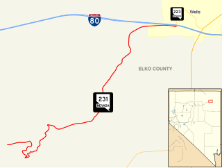
State Route 231 is an unsigned state highway in Elko County, Nevada, United States. Known as Angel Lake Road, the highway connects Angel Lake to the town of Wells. SR 231 is a Nevada Scenic Byway.

State Route 232 is a state highway in Elko County, Nevada. It covers the majority of Clover Valley Road south of Wells.
State Route 289 (SR 289) is a 1.637-mile (2.634 km) state highway in southern Humboldt County, Nevada, United States. The route serves the city of Winnemucca and the route's western end runs concurrent with Interstate 80 Business (I‑80 Bus.).
State Route 290 is a state highway in Humboldt County, Nevada. It serves to connect U.S. Route 95 to the community of Paradise Valley. The road was originally established as State Route 8B by the early 1930s.

State Route 292 is a short state highway on the northern edge of Humboldt County, Nevada, United States, that serves the community of Denio.
State Route 293 is a state highway in Humboldt County, Nevada. It connects the Kings River Valley to U.S. Route 95 at the town of Orovada.
State Route 294 is a 7.973-mile (12.831 km) state highway in southeastern Humboldt County, Nevada, United States, that runs along the northernmost part of Grass Valley Road and connects Winnemucca with the Grass Valley area south of the town.

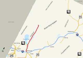
State Route 447 is a state highway in the U.S. state of Nevada. The highway is almost entirely within Washoe County but does for a brief time enter Pershing County, Nevada. The highway connects the town of Gerlach to the remainder of the state via Wadsworth. Though passing through extremely remote and desolate areas of Nevada, the highway has recently gained fame as the primary route to access the Black Rock Desert, the site of the annual Burning Man festival. The state maintained portion ends at Gerlach; however the highway continues as Washoe County Route 447 from Gerlach north to the California state line near Cedarville.
State Route 856 is a state highway in Pershing County, Nevada serving Lovelock. The western portion of the route is also signed as Interstate 80 Business.
State Route 795 is a short state highway in southern Humboldt County, Nevada, United States. One of Nevada's newest state routes, SR 795 primarily serves as a connector road north of Winnemucca.
State Route 789 is a state highway in Humboldt County, Nevada connecting the town of Golconda to nearby mining districts. Much of the route previously existed as State Route 18 prior to 1976.
State Route 806 is a short state highway in Lander County, Nevada connecting the town of Battle Mountain to North Battle Mountain. Prior to 1976, the route was part of a longer State Route 18A.
State Route 794 (SR 794) is a 2.439-mile (3.925 km)state highway in Humboldt County, Nevada, United States. The highway primarily serves as a connector road east of Winnemucca and, for all but the very east end of the route, SR 794 is concurrent with Interstate 80 Business as it runs along East Winnemucca Boulevard.
State Route 787 is a very short state highway along a section of Hanson Street in Winnemucca, Nevada, United States. SR 787 primarily serves as a connector road between Interstate 80 Business/U.S. Route 95 (I‑80 Bus./US 95) and State Route 294 (SR 294) within the city.


