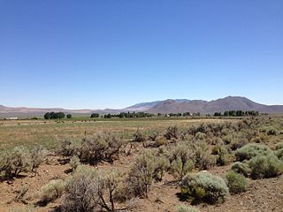
Denio is a census-designated place (CDP) in Humboldt County, Nevada, along the Oregon state line in the United States. The Denio post office was originally north of the state line in Harney County, Oregon, but the residents moved the building into Nevada in the mid-20th century. The population of the CDP, which is entirely in Nevada, was 47 at the 2010 census; additional development considered to be Denio extends into Oregon. The CDP includes a post office, a community center, a library, and the Diamond Inn Bar, the center of the town's social life. Recreational activities in the Denio area include bird watching, photography, off road vehicle use, fishing, recreational black opal mining, rockhounding, hunting, visiting the hot springs, and camping on the Sheldon National Wildlife Refuge.
Stone House is a ghost town in Humboldt County, Nevada, United States.
Etna is a former townsite, now a ghost town, in Pershing County, Nevada.

Fairview is a ghost town in Churchill County, Nevada, in the United States of America.

Charleston is a ghost town in Elko County, Nevada, United States. It lies along the Bruneau River just south of the Mountain City and Jarbidge Ranger Districts of the Humboldt-Toiyabe National Forest and is near the southwest edge of the Jarbidge Wilderness.

Mazuma, Nevada was a small mining town in Pershing County, Nevada where eight people were killed in a flash flood on July 11, 1912.
Rand is an extinct town in Mineral County, in the U.S. state of Nevada. The GNIS classifies Rand as a populated place with a "RR Locale" description. Rand was a station on the Carson and Colorado Railway.

Jungo is a ghost town located on Humboldt County Route 55, between Winnemucca, Nevada and Sulphur, Nevada. At one time, Jungo boasted a hotel, store, filling station and blacksmith's shop, though no buildings remain.
White Plains is a ghost town in Churchill County, in the U.S. state of Nevada.

Seven Troughs is a ghost town in Pershing County, Nevada, United States.
Willow Point is an extinct town in Humboldt County, in the U.S. state of Nevada. Willow Point is located in Paradise Valley, south of the town of Paradise Valley and about 20 miles northeast of Winnemucca.
Johnnie is a populated place in Nye County, in the U.S. state of Nevada about 15 miles north of Pahrump.
Tempiute is a ghost town in Lincoln County, Nevada United States.

Tenabo is a ghost town in Lander County, Nevada United States.
Pleasant Valley, is a ghost town, a historical mining town, and a former populated place in White Pine County, Nevada. There was a post office from March 1892 until April 1894.
Regan is a ghost town, a historical mining town, and a former populated place in White Pine County, Nevada. It had its own Regan post office from August 1906 to November 1907. Its site lies at an elevation of 6,863 feet in Tippett Canyon in the South Mountains.
Pyramid City is a ghost town located south of Sutcliffe, Nevada. This location was also sometimes known as Pyramid and should not be confused with Pyramid, Nevada, located north of Sutcliffe. Pyramid City consisted of two mining camps, Upper Pyramid and Lower Pyramid, also known as Pyramid City.
Oreana is a ghost town in Pershing County, Nevada, United States.


