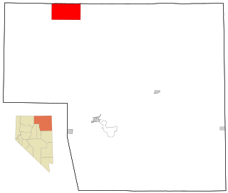
Owyhee is a census-designated place (CDP) in Elko County, Nevada, United States, along the banks of the Owyhee River. The population was 953 at the 2010 census. It is part of the Elko Micropolitan Statistical Area. It is the primary town of the federally recognized Shoshone-Paiute tribe's Duck Valley Indian Reservation, which covers portions of northern Nevada and southern Idaho, and the majority of its population are Native American.

The Northern Paiute people are a Numic tribe that has traditionally lived in the Great Basin region of the United States in what is now eastern California, western Nevada, and southeast Oregon. The Northern Paiutes' pre-contact lifestyle was well adapted to the harsh desert environment in which they lived. Each tribe or band occupied a specific territory, generally centered on a lake or wetland that supplied fish and waterfowl. Communal hunt drives, which often involved neighboring bands, would take rabbits and pronghorn from surrounding areas. Individuals and families appear to have moved freely among the bands.

Walker Lake is a natural lake in the Great Basin in western Nevada in the United States. It is 11 mi (17 km) long and 5 mi (8 km) wide, in northwestern Mineral County along the east side of the Wassuk Range, about 75 mi (120 km) southeast of Reno. The lake is fed from the north by the Walker River and has no natural outlet except absorption and evaporation. The community of Walker Lake is found along the southwest shore.

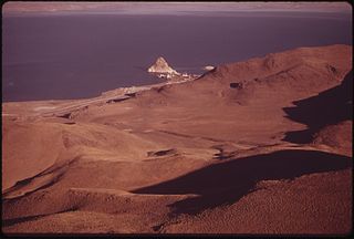
The Pyramid Lake Paiute Tribe Reservation is a United States reservation in northwestern Nevada, approximately 35 miles (56 km) northeast of Reno, in Washoe, Storey, and Lyon counties.

The Walker River Indian Reservation is an Indian reservation located in central Nevada in the United States. It belongs to the Walker River Paiute Tribe, a federally recognized tribe of Northern Paiute people.

The Reno-Sparks Indian Colony in Nevada was established in the early 1900s by members of related tribes who lived near Reno for work; they became a federally recognized tribe in 1934 after forming a government under the Indian Reorganization Act.
The Timbisha are a Native American tribe federally recognized as the Death Valley Timbisha Shoshone Band of California. They are known as the Timbisha Shoshone Tribe and are located in south central California, near the Nevada border. As of the 2010 Census the population of the Village was 124. The older members still speak the ancestral language, also called Timbisha.

The Duck Valley Indian Reservation was established in the 19th century for the federally recognized Shoshone-Paiute Tribe. It is isolated in the high desert of the western United States, and lies on the state line, the 42nd parallel, between Idaho and Nevada.

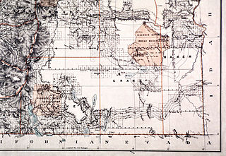
The Malheur Indian Reservation was an American Indian reservation established for the Northern Paiute in eastern Oregon and northern Nevada from 1872 to 1879. The federal government discontinued the reservation after the Bannock War of 1878, under pressure from European-American settlers who wanted the land. This negative recommendation against continuing by its agent William V. Rinehart, led to the internment of more than 500 Paiute on the Yakama Indian Reservation, as well as the reluctance of the Bannock and Paiute to return to the lands after the war.

The Burns Paiute Tribe of the Burns Paiute Indian Colony of Oregon is a federally recognized tribe of Northern Paiute Native Americans in Harney County, Oregon, United States.

The Fort Bidwell Indian Community of the Fort Bidwell Reservation of California is a federally recognized tribe of Northern Paiute Indians in Modoc County in the northeast corner of California.
The Lovelock Paiute Tribe of the Lovelock Indian Colony is a federally recognized tribe of Northern Paiute Indians in Pershing County, Nevada.

The Washoe Tribe of Nevada and California are a federally recognized tribe of Washoe Indians, living in California and Nevada. They are several communities south and east of Lake Tahoe united under a tribal council. The washoe people own over 64,300 acres (26,000 ha) in public domain allotments & PDAs are land reserved out of the public domain for use by an Indian person or family, but unlike larger reservations, they are not connected to any Native Tribes or governments and are not subject to Tribal jurisdiction. Nevertheless, PDAs are Indian country.
The Paiute-Shoshone Tribe of the Fallon Reservation and Colony is a federally recognized tribe of Northern Paiute and Western Shoshone Indians in Churchill County, Nevada. Their autonym is Toi Ticutta meaning "Cattail Eaters."

The Winnemucca Indian Colony of Nevada is a federally recognized tribe of Western Shoshone and Northern Paiute Indians in northwestern Nevada.

The Yerington Paiute Tribe of the Yerington Colony and Campbell Ranch is a federally recognized tribe of Northern Paiute Indians in western Nevada.

The Paiute Indian Tribe of Utah is a federally recognized tribe of Southern Paiute and Ute Indians in southwestern Utah.

The Duckwater Shoshone Tribe of the Duckwater Reservation is a federally recognized tribe of Western Shoshone, based in central Nevada in the high desert Railroad Valley, in northern Nye County. Their autonym is Tsaidüka in their Shoshoni language, meaning "Eaters of tule."
The Utu Utu Gwaitu Paiute Tribe of the Benton Paiute Reservation, also known as the Benton Paiute Tribe, is a federally recognized Great Basin tribe in Mono County, California.

The Fort McDermitt Paiute and Shoshone Tribe is a federally recognized tribe of Northern Paiute and Western Shoshone peoples, whose reservation Fort McDermitt Paiute and Shoshone Tribes of the Fort McDermitt Indian Reservation spans the Nevada and Oregon border next to Idaho. The reservation has 16,354 acres (6,618 ha) in Nevada and 19,000 acres (7,700 ha) in Oregon.


