Orovada, Nevada

Last updated

Orovada, Nevada
2014-07-06 13 12 34 Buildings along U.S. Route 95 about 44.8 miles north of the junction with Interstate 80 in Orovada, Nevada.JPG
USA Nevada location map.svg
Red pog.svg
Orovada
Location within the state of Nevada
Coordinates: 41°34′12″N117°47′2″W / 41.57000°N 117.78389°W / 41.57000; -117.78389
Country United States
State Nevada
County Humboldt
Area
[1]
  Total22.18 sq mi (57.44 km2)
  Land22.18 sq mi (57.44 km2)
  Water0.00 sq mi (0.00 km2)
Elevation
[2]
4,236 ft (1,291 m)
Population
 (2020)
  Total117
  Density5.28/sq mi (2.04/km2)
Time zone UTC-8 (Pacific (PST))
  Summer (DST) UTC-7 (PDT)
ZIP codes
89425
FIPS code 32-53000
GNIS feature ID2583947 [2]

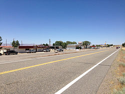
Orovada is a census-designated place in Humboldt County, Nevada. [2] The population was 155 at the 2010 census. [3]

Contents

History

The first permanent settlement at Orovada was made in 1918. [4] The name is a combination of oro (Spanish "gold") and Nevada. [5] A post office has been in operation at Orovada since 1920. [6]

Geography

According to the United States Census Bureau, the Orovada CDP has an area of 45.3 square miles (117.3 km2), all land. [3] U.S. Route 95 runs through the CDP, leading south 43 miles (69 km) to Winnemucca and north 30 miles (48 km) to the Oregon state line at McDermitt.

Climate

According to the Köppen Climate Classification system, Orovada has a cold semi-arid climate, abbreviated "BSk" on climate maps. The hottest temperature recorded in Orovada was 115 °F (46.1 °C) on September 12, 1947, while the coldest temperature recorded was −35 °F (−37.2 °C) on December 19, 1924 and December 26, 1924. [7]

Climate data for Orovada, Nevada, 1991–2020 normals, extremes 1911–present
MonthJanFebMarAprMayJunJulAugSepOctNovDecYear
Record high °F (°C)67
(19)
71
(22)
81
(27)
92
(33)
105
(41)
107
(42)
109
(43)
108
(42)
115
(46)
94
(34)
80
(27)
68
(20)
115
(46)
Mean maximum °F (°C)54.0
(12.2)
61.1
(16.2)
71.2
(21.8)
79.7
(26.5)
89.2
(31.8)
96.8
(36.0)
102.3
(39.1)
101.0
(38.3)
94.8
(34.9)
82.4
(28.0)
68.3
(20.2)
56.0
(13.3)
103.3
(39.6)
Average high °F (°C)42.2
(5.7)
48.0
(8.9)
56.2
(13.4)
62.7
(17.1)
72.4
(22.4)
82.9
(28.3)
93.6
(34.2)
91.5
(33.1)
82.0
(27.8)
67.7
(19.8)
52.5
(11.4)
41.4
(5.2)
66.1
(18.9)
Daily mean °F (°C)30.7
(−0.7)
35.5
(1.9)
41.5
(5.3)
46.7
(8.2)
55.4
(13.0)
63.5
(17.5)
71.9
(22.2)
69.6
(20.9)
60.7
(15.9)
48.5
(9.2)
37.9
(3.3)
29.7
(−1.3)
49.3
(9.6)
Average low °F (°C)19.1
(−7.2)
23.0
(−5.0)
26.8
(−2.9)
30.8
(−0.7)
38.3
(3.5)
44.0
(6.7)
50.3
(10.2)
47.7
(8.7)
39.4
(4.1)
29.4
(−1.4)
23.3
(−4.8)
18.1
(−7.7)
32.5
(0.3)
Mean minimum °F (°C)−0.8
(−18.2)
7.0
(−13.9)
12.9
(−10.6)
17.2
(−8.2)
23.7
(−4.6)
31.5
(−0.3)
39.7
(4.3)
36.0
(2.2)
26.7
(−2.9)
15.2
(−9.3)
6.1
(−14.4)
−0.7
(−18.2)
−7.0
(−21.7)
Record low °F (°C)−30
(−34)
−26
(−32)
−1
(−18)
7
(−14)
15
(−9)
23
(−5)
32
(0)
25
(−4)
14
(−10)
−5
(−21)
−13
(−25)
−35
(−37)
−35
(−37)
Average precipitation inches (mm)1.26
(32)
0.83
(21)
1.04
(26)
1.28
(33)
1.31
(33)
0.77
(20)
0.21
(5.3)
0.26
(6.6)
0.51
(13)
0.89
(23)
0.72
(18)
1.14
(29)
10.22
(259.9)
Average snowfall inches (cm)4.9
(12)
2.5
(6.4)
1.4
(3.6)
1.4
(3.6)
0.1
(0.25)
0.0
(0.0)
0.0
(0.0)
0.0
(0.0)
0.0
(0.0)
0.3
(0.76)
1.1
(2.8)
4.0
(10)
15.7
(39.41)
Average precipitation days (≥ 0.01 in)6.56.16.66.56.93.51.91.82.33.75.06.757.5
Average snowy days (≥ 0.1 in)1.91.40.50.50.00.00.00.00.00.10.62.07.0
Source 1: NOAA [8]
Source 2: National Weather Service [7]

Education

The Humboldt County School District operates schools serving areas with Orovada addresses. Some areas are zoned to Orovada School, a K-8 school. Other areas are zoned to Kings River School, a K-8 school.

In 1954 the Orovada School had 22 students. [9] A new 3,200-square-foot (300 m2) building, designed by Alegre and Hanson and built by A.T. Costa, opened in 1958. [10] The two classroom facility and two teacher apartment facilities were made of pumice. [11] Orovada School had 50 students in the 1963-1964 school year. [12] In 1966 some parents stated that the district needed a new heating system in the school and they would prevent their children from attending if this was not done. [13]

Kings River School had 15 students in the 1963-1964 school year. [12]

Notable person

Rodeo announcer Bob Tallman lived on Willow Creek Ranch, eight miles north of Orovada, during his early childhood. [14]

Demographics

Historical population
CensusPop.Note
2020 117
U.S. Decennial Census [15]

Related Research Articles

<span class="mw-page-title-main">Humboldt County, Nevada</span> County in Nevada, United States

Humboldt County is a county in the U.S. state of Nevada. As of the 2020 Census, the population was 17,285. It is a largely rural county that is sparsely populated with the only major city being Winnemucca which has a population of 8,431. Humboldt County comprises the Winnemucca, NV Micropolitan Statistical Area and serves as an important crossroads in the national transportation network. Interstate 80 travels through the southeastern corner of the county, meeting US 95 in Winnemucca that serves as a primary freight corridor between Northern Nevada and Boise, Idaho and the Interstate 84 freight corridor that links much of the Pacific Northwest. The original transcontinental railway, constructed by the Central Pacific Railroad, reached Humboldt County on Sept. 16, 1868. The Western Pacific Railroad would reach Humboldt County by November 1909, providing two mainline rail links to California and the Eastern United States. Both railroads have since been acquired by the Union Pacific Railroad, who continues to serve the region today.

<span class="mw-page-title-main">Teec Nos Pos, Arizona</span> Census-designated place in Arizona, United States

Teec Nos Pos is a census-designated place (CDP) in Apache County, Arizona, United States. The population was 507 at the 2020 census. It is the western terminus of U.S. Route 64.

<span class="mw-page-title-main">Paradise, Nevada</span> Unincorporated town in Nevada, United States

Paradise is an unincorporated town and census-designated place (CDP) in Clark County, Nevada, United States, adjacent to the city of Las Vegas. It was formed on December 8, 1950. Its population was 191,238 at the 2020 census, making it the fifth-most-populous CDP in the United States; if it were an incorporated city, it would be the fifth-largest in Nevada. As an unincorporated town, it is governed by the Clark County Commission with input from the Paradise Town Advisory Board.

<span class="mw-page-title-main">Winchester, Nevada</span> Unincorporated town in the State of Nevada, United States

Winchester is an unincorporated town and census-designated place (CDP) in Clark County, Nevada, United States that contains part of the Las Vegas Strip. It is one of a number of CDPs in the unincorporated urbanized area directly south of Las Vegas. The population was 36,403 at the 2020 census. It is governed by the Clark County Commission with advice from the Winchester Town Advisory Board. "Winchester, NV" does not appear in postal addresses; the United States Postal Service has assigned "Las Vegas, NV" as the place name for the ZIP codes containing Winchester.

<span class="mw-page-title-main">Minden, Nevada</span> County seat in Nevada, United States

Minden is a census-designated place (CDP) in Douglas County, Nevada, United States. The population was 3,001 at the 2010 census. It is the county seat of Douglas County and is adjacent to the town of Gardnerville. The Douglas campus of the Western Nevada College is located in Minden.

<span class="mw-page-title-main">McDermitt, Nevada and Oregon</span> Unincorporated community in the state of Nevada, United States

McDermitt is an unincorporated community straddling the Nevada–Oregon border, in Humboldt County, Nevada, and Malheur County, Oregon, United States. McDermitt's economy has historically been based on mining, ranching, and farming. The last mining operation closed in 1990, resulting in a steady decline in population.

<span class="mw-page-title-main">Winnemucca, Nevada</span> City in Nevada, United States

Winnemucca is the only incorporated city in, and is the county seat of, Humboldt County, Nevada, United States. As of the 2020 census, the city had a total population of 8,431, up 14.0 percent from the 2010 census figure of 7,396. Interstate 80 passes through the city, where it meets U.S. Route 95.

<span class="mw-page-title-main">Incline Village, Nevada</span> Census-designated place in Nevada, United States

Incline Village is a census-designated place (CDP) on the north shore of Lake Tahoe in Washoe County, Nevada, United States. The population was 8,777 at the 2010 census. It is part of the Reno−Sparks Metropolitan Statistical Area. Until the 2010 census, the CDP Crystal Bay, Nevada was counted jointly with Incline Village.

Spanish Springs is a census-designated place (CDP) in Washoe County, Nevada, United States. It is located in the northeastern part of the Reno–Sparks Metropolitan Statistical Area. The population was 15,064 at the 2010 Census.

<span class="mw-page-title-main">Wadsworth, Nevada</span> CDP in Nevada, United States

Wadsworth is a census-designated place (CDP) in Washoe County, Nevada. The population was 834 at the time of the 2010 census. It is part of the Reno–Sparks Metropolitan Statistical Area and located entirely within the Pyramid Lake Indian Reservation. The town was named for General James S. Wadsworth, a Civil War general killed during the Battle of the Wilderness in 1864. It was given this name by Leland Stanford of the Central Pacific Railroad as a favor to General Irvin McDowell, whom Wadsworth had served under during the Civil War.

<span class="mw-page-title-main">Gerlach, Nevada</span> Census-designated place in Nevada, United States

Gerlach, Nevada is a census-designated place (CDP) in Washoe County, Nevada, United States. The population was 107 at the 2018 American Community Survey. It is part of the Reno–Sparks Metropolitan Statistical Area. Prior to 2010, Gerlach was part of the Gerlach–Empire census-designated place. The town of Empire is now a separate CDP. The next nearest town, Nixon, is 60 miles (100 km) to the south on a reservation owned by the Pyramid Lake Paiute Tribe. The Fly Geyser is located near Gerlach.

<span class="mw-page-title-main">Empire, Nevada</span> Place in Nevada, United States

Empire is an unincorporated community and census-designated place (CDP) in Washoe County, Nevada, with a population estimated at 65 (2021). It is part of the Reno–Sparks Metropolitan Statistical Area; before the 2010 census, it was part of the Gerlach–Empire census-designated place. The nearest town, Nixon, is 60 miles (97 km) to the south on a reservation owned by the Pyramid Lake Paiute Tribe.

Duckwater is an unincorporated community located in the central portion of the U.S. state of Nevada, in the Duckwater Valley at about the same latitude as Sacramento, California. It is in Nye County, at the eastern edge of the Duckwater Indian Reservation, near the Red Mountain Wilderness at the end of Nevada State Route 379. The city of Las Vegas is about 200 miles to the south-southeast.

<span class="mw-page-title-main">Paradise Valley, Nevada</span> Census-designated place in Nevada, United States

Paradise Valley is a census-designated place (CDP) in Humboldt County, Nevada, United States, near the Santa Rosa Ranger District of Humboldt National Forest. It is located at the northern terminus of Nevada State Route 290, about 19 miles (31 km) northeast of U.S. Highway 95 and a total of 40 miles (64 km) north of Winnemucca. The town is located in a broad valley, with the Santa Rosa Range of mountains just to the northwest. At the 2010 census, the population of the CDP was 109.

<span class="mw-page-title-main">Mina, Nevada</span> Census-designated place in Nevada, United States

Mina is a census-designated place in Mineral County in west-central Nevada, United States. It is located along U.S. Route 95 at an elevation of 4,560 feet (1,390 m). The 2010 population was 155.

<span class="mw-page-title-main">Crystal Bay, Nevada</span> Census-designated place in Nevada, United States

Crystal Bay is a census-designated place (CDP) on the north shore of Lake Tahoe in Washoe County, Nevada, United States. The population was 305 at the 2010 census. It is part of the Reno−Sparks Metropolitan Statistical Area. Prior to 2010, it was listed by the U.S. Census Bureau within the Incline Village–Crystal Bay CDP.

<span class="mw-page-title-main">Denio, Nevada</span> Unincorporated community in the state of Oregon, United States

Denio is a census-designated place (CDP) in Humboldt County, Nevada, along the Oregon state line in the United States. The Denio post office was originally north of the state line in Harney County, Oregon, but the residents moved the building into Nevada in the mid-20th century. The population of the CDP, which is entirely in Nevada, was 47 at the 2010 census; additional development considered to be Denio extends into Oregon. The CDP includes a post office, a community center, a library, and the Diamond Inn Bar, the center of the town's social life. Recreational activities in the Denio area include bird watching, photography, off road vehicle use, fishing, recreational black opal mining, rockhounding, hunting, visiting the hot springs, and camping on the Sheldon National Wildlife Refuge.

<span class="mw-page-title-main">Crane Union High School</span> Public school in Crane, , Oregon, United States

Crane Union High School is a public high school in Crane, Oregon, United States. It is a boarding school that serves students from a large geographic area.

The Humboldt County School District is a public school district serving K−12 education in Humboldt County, Nevada, in the northwestern part of the state.

McDermitt Combined School or McDermitt Combined Schools is a K-12 school in McDermitt, on the boundary of Nevada and Oregon, in the United States. The school is a part of Humboldt County School District of Nevada.

References

  1. "ArcGIS REST Services Directory". United States Census Bureau. Retrieved September 19, 2022.
  2. 1 2 3 U.S. Geological Survey Geographic Names Information System: Orovada, Nevada
  3. 1 2 "Geographic Identifiers: 2010 Demographic Profile Data (G001): Orovada CDP, Nevada". U.S. Census Bureau, American Factfinder. Archived from the original on February 12, 2020. Retrieved January 24, 2013.
  4. Federal Writers' Project (1941). Origin of Place Names: Nevada (PDF). W.P.A. p. 38.
  5. Carlson, Helen S. (1985). Nevada Place Names: A Geographical Dictionary. University of Nevada Press. ISBN   9780874174038 . Retrieved December 2, 2020.
  6. U.S. Geological Survey Geographic Names Information System: Orovada Post Office
  7. 1 2 "NOAA Online Weather Data – NWS Elko". National Weather Service. Retrieved May 24, 2023.
  8. "U.S. Climate Normals Quick Access – Station: Orovada 3 W, NV". National Oceanic and Atmospheric Administration. Retrieved May 24, 2023.
  9. "Orovada School Enrollment 22". Reno Gazette-Journal . Reno, Nevada. October 3, 1954. p. 3. - Clipping from Newspapers.com.
  10. "New School Dedicated". Reno Gazette-Journal . Reno, Nevada. March 11, 1958. p. 13. - Clipping from Newspapers.com.
  11. "Orovada School Contract Is Let". Reno Gazette-Journal . Reno, Nevada. July 25, 1957. p. 11. - Clipping from Newspapers.com.
  12. 1 2 "Humboldt School Enrollment Gains". Reno Gazette-Journal . September 11, 1963. p. 2. - Clipping from Newspapers.com.
  13. "Heat System At Orovada School Woe". Nevada State Journal . August 13, 1966. p. 7. - Clipping from Newspapers.com.
  14. Tribe, Kristen (February 27, 2005). "The Voice of Rodeo". American Profile. Franklin, TN. Archived from the original on December 5, 2010. Retrieved April 4, 2010.
  15. "Census of Population and Housing". Census.gov. Retrieved June 4, 2016.