Nevada State Route 292

Last updated

Nevada 292.svg

State Route 292

Denio Road
Nevada State Route 292
SR 292 highlighted in red
Route information
Maintained by NDOT
Length2.935 mi [1]  (4.723 km)
Existed1976–present
Major junctions
South endNevada 140.svg SR 140 at Denio Junction
North end CR 201 jct.svg Harney County Route 201 at Denio
Location
Country United States
State Nevada
Counties Humboldt
Highway system
  • Nevada State Highway System
Nevada 290.svg SR 290 Nevada 293.svg SR 293

State Route 292 (SR 292) is a short state highway on the northern edge of Humboldt County, Nevada, United States, that serves the community of Denio.

Contents

Looking north along SR 292 from near its south terminus in Denio Junction, with the Pueblo Mountains in the distance, July 2014 2014-07-06 14 43 59 First reassurance sign along northbound Nevada State Route 292 (Denio Road) near Denio, Nevada.JPG
Looking north along SR 292 from near its south terminus in Denio Junction, with the Pueblo Mountains in the distance, July 2014
Looking south along SR 292 from its northern terminus in Denio, July 2014 2014-07-06 14 53 38 View south along Nevada State Route 292 (Denio Road) at the end of Harney County Route 201 (Fields-Denio Road) at the Oregon border near Denio, Nevada.JPG
Looking south along SR 292 from its northern terminus in Denio, July 2014

Route description

SR 292 is a two-lane road entirely within the southern part of the Pueblo Valley. The route begins at a T intersection with State Route 140 (SR 140) in Denio Junction. (From the intersection, southbound SR 140 heads south and then east to end at U.S. Route 95 [US 95], east-northeast of Amos. Northbound SR 140 heads westerly to the Oregon state line to connect with Oregon Route 140.) From its southern terminus SR 292 heads north, but slightly to the west, a distance of nearly 3 miles (4.8 km) to serve the community of Denio (a census-designated place). [1] [2] The route ends at the Oregon state line. From SR 292's northern terminus, the road continues northward into Oregon as Harney County Route 201 (Fields-Denio Road), heading towards Fields. [3] [4]

History

SR 292 was originally part of the former State Route 8A. That route, established by 1929, connected State Route 8 (now US 95) to Vya via Denio. [5] SR 8A was realigned to bypass Denio by 1949, leaving the highway into Denio without a state highway number. [6] The road was designated as State Route 292 on July 1, 1976, as part of the renumbering of Nevada's state highway system. [7] However, the new route number was not seen on official Nevada highway maps until 1993. [8]

Major intersections

The entire route is in Humboldt County.

Locationmi [9]
[Note 1]
kmDestinationsNotes
Denio Junction 65.58105.54Nevada 140.svg SR 140  Winnemucca, McDermitt, Adel Southern terminus
Denio 68.52110.27 CR 201 jct.svg Harney County Route 201 (Fields-Denio Road)  Fields Northern terminus; Continuation north beyond Oregon state line
1.000 mi = 1.609 km; 1.000 km = 0.621 mi

See also

Notes

  1. Mileposts on SR 292 are a continuation of State Route 140 mileposts. [9]

Related Research Articles

<span class="mw-page-title-main">Nevada State Route 28</span> State highway in Nevada, United States

State Route 28 (SR 28) is a 16.3-mile (26.2 km) state highway in Douglas County, Carson City, and Washoe County in western Nevada, United States, that runs along the northeastern shore of Lake Tahoe. SR 28 connects U.S. Route 50 (US 50) in Douglas County with California State Route 28 at Crystal Bay. SR 28 has been part of the Nevada scenic byway system since June 1994 and the National Scenic Byway system since September 1996.

<span class="mw-page-title-main">Nevada State Route 140</span> State highway in Humboldt County, Nevada, United States

State Route 140 is a two-lane state highway in Humboldt County, Nevada. It serves a sparsely populated section of the state, connecting northwestern Nevada to southern Oregon. Most of the highway was originally part of State Route 8A, and was later improved through an effort to provide an all-weather highway linking northern Nevada to the Pacific Northwest.

<span class="mw-page-title-main">Nevada State Route 160</span> Highway in Nevada

State Route 160 is a state highway in southern Nevada, United States. It connects the southern Las Vegas Valley to U.S. Route 95 northwest of the city via the Pahrump Valley. The southern part of the route sees heavy traffic, mostly due to Pahrump's continued growth as a Las Vegas bedroom community.

<span class="mw-page-title-main">Denio, Nevada</span> Unincorporated community in the state of Nevada, United States

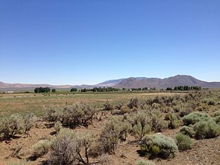
Denio is a census-designated place (CDP) in Humboldt County, Nevada, along the Oregon state line in the United States. The Denio post office was originally north of the state line in Harney County, Oregon, but the residents moved the building into Nevada in the mid-20th century. The population of the CDP, which is entirely in Nevada, was 47 at the 2010 census; additional development considered to be Denio extends into Oregon. The CDP includes a post office, a community center, a library, and the Diamond Inn Bar, the center of the town's social life. Recreational activities in the Denio area include bird watching, photography, off road vehicle use, fishing, recreational black opal mining, rockhounding, hunting, visiting the hot springs, and camping on the Sheldon National Wildlife Refuge.

<span class="mw-page-title-main">Nevada State Route 267</span> State highway in Nevada, United States

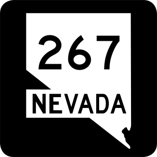
State Route 267 is a 21.427-mile (34.483 km) state highway in Nevada, United States. Known as Scotty's Castle Road, the highway connects Death Valley National Park to U.S. Route 95. The route was previously designated State Route 72.

<span class="mw-page-title-main">Nevada State Route 278</span> State highway in Nevada, United States

State Route 278 is a state highway in Nevada. It runs from U.S. Route 50 near Eureka north to Interstate 80 (I-80) in Carlin.

<span class="mw-page-title-main">Nevada State Route 290</span> State highway in Nevada, United States

State Route 290 is a state highway in Humboldt County, Nevada. It serves to connect U.S. Route 95 to the community of Paradise Valley. The road was originally established as State Route 8B by the early 1930s.

<span class="mw-page-title-main">Nevada State Route 293</span> State highway in Nevada, United States

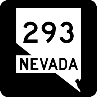
State Route 293 is a state highway in Humboldt County, Nevada. It connects the Kings River Valley to U.S. Route 95 at the town of Orovada.

<span class="mw-page-title-main">Nevada State Route 305</span> Highway in Nevada

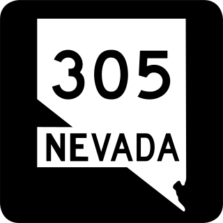
State Route 305 is a state highway in Lander County, Nevada. It is the only state highway to connect the southern and northern areas of the county. It runs north from U.S. Route 50 at Austin to Battle Mountain, where it crosses Interstate 80 and ends at State Route 304.

<span class="mw-page-title-main">Nevada State Route 338</span> Highway in Nevada

State Route 338 is a state highway in Lyon County, Nevada, United States. It connects the towns of Smith and Wellington to the California state line north of Bridgeport, California. Much of the route has served as a road through this section of Nevada since at least 1919, and was known as State Route 22 from the 1920s until the late 1970s.

<span class="mw-page-title-main">U.S. Route 95 Alternate (Schurz–Fernley, Nevada)</span> U.S. Highway between Schurz and Fernley, Nevada, United States

In the U.S. state of Nevada, U.S. Route 95 Alternate is an alternate route of U.S. Route 95 located in the western part of the state. It connects Schurz to Interstate 80 via the cities of Yerington and Fernley.

<span class="mw-page-title-main">Nevada State Route 359</span> Highway in Nevada

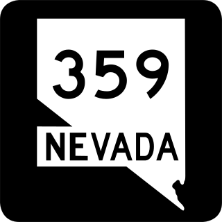
State Route 359 is a state highway in Mineral County, Nevada, in the United States. It starts from where California State Route 167 ends at the California stateline and continues the road on north to U.S. Route 95 in Hawthorne. Prior to the 1976 mass renumbering of Nevada State Routes SR 359 was numbered Nevada State Route 31.

<span class="mw-page-title-main">Nevada State Route 361</span> State highway in Nevada, United States

State Route 361, Gabbs Valley Road, is a 62.853-mile (101.152 km) state highway in Mineral, Nye, and Churchill counties in Nevada, United States. The highway serves the town of Gabbs following Gabbs Valley Road through the extreme northwestern tip of Nye County. Gabbs is isolated from the rest of the county, requiring travel on SR 361 through other counties in order to reach any other major town in Nye County. SR 361 was previously known as State Route 23.

<span class="mw-page-title-main">Nevada State Route 376</span> State highway in Nye and Lander counties in Nevada, United States

State Route 376 is a 100-mile (160 km) state highway in Nye and Lander counties in central Nevada, United States. It connects U.S. Route 6 near Tonopah north to U.S. Route 50 near Austin. The Tonopah–Austin Road existed as early as 1919, and was designated the southernmost segment of State Route 8A before being renumbered to SR 376 in 1976.

<span class="mw-page-title-main">Nevada State Route 8A</span> Former highway in Nevada

Former State Route 8A was a two-part state highway in the U.S. state of Nevada, running from California State Route 299 in a general easterly and southeasterly direction via Vya and Denio to US 95 north of Winnemucca, and south from US 40 at Battle Mountain via Austin to US 6 near Tonopah. It was a branch of State Route 8, which followed US 95 north from US 40 at Winnemucca to Oregon. The part northwest from US 95 towards the Oregon state line later became State Route 140, part of the Winnemucca to the Sea Highway. In the late 1970s renumbering, the north–south portion became State Route 305 and State Route 376, but the portion from SR 140 west to California did not remain in the state highway system. However, signs remain on that segment, and so SR 8A still de facto connects SR 140 with California.

<span class="mw-page-title-main">Nevada State Route 856</span> Highway in Nevada

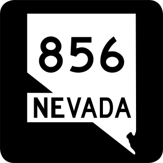
State Route 856 is a state highway in Pershing County, Nevada serving Lovelock. The western portion of the route is also signed as Interstate 80 Business.

<span class="mw-page-title-main">Oregon Route 205</span> Highway in Oregon

Oregon Route 205 (OR 205) is a state highway in Harney County, Oregon, running from Roaring Springs Ranch to OR 78 near Burns. OR 205 is known as the Frenchglen Highway No. 440 . It is 73.35 miles (118.05 km) long and runs north–south, connecting the Malheur National Wildlife Refuge to Burns. The highway has also been designated the High Desert Discovery Scenic Byway by the Bureau of Land Management. Part of OR 205 also is used in the Steens Mountain Back Country Byway, a loop road around Steens Mountain.

<span class="mw-page-title-main">Nevada State Route 795</span> State highway in Nevada, United States

State Route 795 is a short state highway in southern Humboldt County, Nevada, United States. One of Nevada's newest state routes, SR 795 primarily serves as a connector road north of Winnemucca.

References

  1. 1 2 "State Maintained Highways of Nevada: Descriptions and Maps". nevadadot.com. Nevada Department of Transportation. Jan 2017. Retrieved 17 Apr 2017.
  2. Official Highway Map of Nevada (Map) (Aug 2007 ed.). Nevada Department of Transportation. 2007. § A2-A3.
  3. Google (31 May 2010). "Nevada State Route 292" (Map). Google Maps . Google. Retrieved 31 May 2010.
  4. "Harney County Transportation System Plan" (PDF). Harney County. Jun 2001. Archived from the original (PDF) on 3 March 2016. Retrieved 16 Jul 2014.
  5. "Highway Map State of Nevada" (Map). library.unr.edu. Nevada Department of Highways. 1929. Retrieved 16 Feb 2010.
  6. Official Highway Map of Nevada (Map). Nevada Department of Highways. 1949. § A1-A2. Retrieved 16 Feb 2010.
  7. Nevada State Maintained Highways: Descriptions, Index and Maps. Nevada Department of Transportation. Jan 2001. p. 107.
  8. "Official Highway Map of Nevada" (Map). library.unr.edu. Nevada Department of Transportation. § A2. Retrieved 31 May 2010.
  9. 1 2 "State Maintained Highways of Nevada: Descriptions and Maps" (1st Quarter, 2010 ed.). Nevada Department of Transportation. Archived from the original on 23 September 2010. Retrieved 31 May 2010 via Wayback Machine.
Template:Attached KML/Nevada State Route 292
KML is not from Wikidata

Commons-logo.svg Media related to Nevada State Route 292 at Wikimedia Commons