
Johnson Lane is a census-designated place (CDP) in the south side of the Carson City metropolitan area in Douglas County, Nevada, United States. Its population was 6,490 at the 2010 census.

Spring Creek is a census-designated place (CDP) in central Elko County, in northeastern Nevada in the western United States. It mainly serves as a bedroom community for the businesses and industries in and around the nearby city of Elko. It is part of the Elko Micropolitan Statistical Area. The population was 12,361 at the 2010 census.

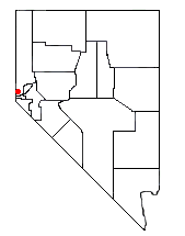
Silver Springs is a census-designated place (CDP) in Lyon County, Nevada, United States at the intersection of US 50 and US 95A. The population was 5,296 at the 2010 census. Lahontan Reservoir, Lahontan State Recreation Area and historic Fort Churchill State Historic Park are all located nearby. The area is served by the Silver Springs Airport.

Cold Springs is a census-designated place (CDP) in Washoe County, Nevada, United States. It is known as Eitse'ihpaa or Eitse'ippaa in Shoshoni. It is located just off U.S. Route 395 in the northwestern part of the Reno–Sparks Metropolitan Statistical Area, adjacent to the California state line. The population was 8,544 at the 2010 census.
Incline Village is a census-designated place (CDP) on the north shore of Lake Tahoe in Washoe County, Nevada, United States. The population was 8,777 at the 2010 census. It is part of the Reno−Sparks Metropolitan Statistical Area. Until the 2010 census, the CDP Crystal Bay, Nevada was counted jointly with Incline Village.
Spanish Springs is a census-designated place (CDP) in Washoe County, Nevada, United States. It is located in the northeastern part of the Reno–Sparks Metropolitan Statistical Area. The population was 15,064 at the 2010 Census.
Sun Valley is a census-designated place (CDP) in Washoe County, Nevada, United States. The population was 19,299 at the 2010 census. It is north of Reno and is part of the Reno–Sparks Metropolitan Statistical Area.
Lemmon Valley is a census-designated place (CDP) in Washoe County, Nevada, United States. The population was 5,040 at the 2010 census. It is a northern suburb of the city of Reno and is part of the Reno–Sparks Metropolitan Statistical Area. Prior to 2010 it was listed by the U.S. Census Bureau as part of the Lemmon Valley–Golden Valley CDP.

Crystal Bay is a census-designated place (CDP) on the north shore of Lake Tahoe in Washoe County, Nevada, United States. The population was 305 at the 2010 census. It is part of the Reno−Sparks Metropolitan Statistical Area. Prior to 2010, it was listed by the U.S. Census Bureau within the Incline Village–Crystal Bay CDP.

Glenbrook is a census-designated place (CDP) on the east shore of Lake Tahoe in Douglas County, Nevada, United States. The population was 215 at the 2010 census. Beach and Bay are for residents and renters living in Glenbrook's gated community. There is no public access to the beach or bay.
Topaz Lake is a census-designated place (CDP) in Douglas County, Nevada, United States. The population was 157 at the 2010 census.
Stagecoach is an unincorporated community and census-designated place (CDP) in Lyon County, Nevada, United States, located east of Reno. Its name is likely derived from its place as the Overland Stagecoach station at Desert Well. Typically, the mail that was heading towards California was delivered on a steamship through Panama. But in 1857, the Overland mail company was created, and the Desert Well station was a dual stop for both the stagecoach line and the Pony Express.

Double Spring is a census-designated place (CDP) in Douglas County, Nevada, United States. The population was 158 at the 2010 census.
East Valley is a census-designated place (CDP) in Douglas County, Nevada, United States. The population was 1,474 at the 2010 census.
Fish Springs is a census-designated place (CDP) in Douglas County, Nevada, United States. The population was 648 at the 2010 census.
Lakeridge is a census-designated place (CDP) in Douglas County, Nevada, United States. The population was 371 at the 2010 census.
Logan Creek is a census-designated place (CDP) on the east shore of Lake Tahoe in Douglas County, Nevada, United States. The population was 26 at the 2010 census.

Round Hill Village is a census-designated place (CDP) in northwestern Douglas County, Nevada, United States. The population was 759 at the 2010 census. Prior to 2010, the community was part of the Zephyr Cove–Round Hill Village CDP.
Skyland is a census-designated place (CDP) in Douglas County, Nevada, United States. The population was 376 at the 2010 census.
Bennett Springs is a census-designated place in Lincoln County, Nevada, United States. As of the 2010 census it had a population of 132.

