List of census-designated places in Nebraska

Last updated

Map of the United States with Nebraska highlighted Nebraska in United States.svg
Map of the United States with Nebraska highlighted

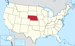
This is a list of census-designated places in Nebraska. The United States Census Bureau defines census-designated places as unincorporated communities lacking elected municipal officers and boundaries with legal status. [1]

Contents

As of the 2020 census, Nebraska has 61 census-designated places, [2] up from 50 in the 2010 census. [3] Most CDPs in the state are small rural communities, although the list also includes a few bigger communities and suburbs. A total of 24,617 people live in Nebraska's CDPs, or 1,26% of the population.

Census-designated places

Name County Population
(2020) [4]
Area (2020) [2] Coordinates [2]
sq mikm2
Agnew Lancaster 300.1880.5 41°00′51″N96°48′51″W / 41.014234°N 96.81427°W / 41.014234; -96.81427
Ames Dodge 140.3290.9 41°26′54″N96°37′35″W / 41.448457°N 96.626339°W / 41.448457; -96.626339
Archer Merrick 681.0022.6 41°10′00″N98°08′20″W / 41.166629°N 98.138864°W / 41.166629; -98.138864
Aten Cedar 1341.6994.4 42°50′12″N97°26′27″W / 42.836736°N 97.44081°W / 42.836736; -97.44081
Beacon View Sarpy 550.4321.1 41°04′16″N96°19′35″W / 41.071193°N 96.326474°W / 41.071193; -96.326474
Belmar Keith 1994.58211.9 41°18′20″N101°56′05″W / 41.305457°N 101.934626°W / 41.305457; -101.934626
Berea Box Butte 491.1933.1 42°12′44″N102°58′59″W / 42.212279°N 102.982984°W / 42.212279; -102.982984
Bow Valley Cedar 950.1430.4 42°42′56″N97°15′08″W / 42.715424°N 97.252206°W / 42.715424; -97.252206
Brownlee Cherry 130.1060.3 42°17′21″N100°37′27″W / 42.289207°N 100.624178°W / 42.289207; -100.624178
Chalco Sarpy 11,0642.8177.3 41°10′54″N96°08′07″W / 41.181645°N 96.135367°W / 41.181645; -96.135367
Champion Chase 1150.2460.6 40°28′15″N101°44′42″W / 40.470854°N 101.744895°W / 40.470854; -101.744895
Cheney Lancaster 1640.1410.4 40°43′34″N96°35′37″W / 40.726041°N 96.593604°W / 40.726041; -96.593604
Emerald Lancaster 450.5891.5 40°48′47″N96°50′07″W / 40.81313°N 96.835371°W / 40.81313; -96.835371
Enders Chase 370.1310.3 40°27′18″N101°32′08″W / 40.454919°N 101.535567°W / 40.454919; -101.535567
Fontanelle Washington 670.2520.7 41°32′18″N96°25′38″W / 41.538255°N 96.427187°W / 41.538255; -96.427187
Glenwood Buffalo 5032.4016.2 40°45′20″N99°04′52″W / 40.755459°N 99.081007°W / 40.755459; -99.081007
Harrisburg Banner 996.46916.8 41°33′02″N103°43′36″W / 41.550529°N 103.726684°W / 41.550529; -103.726684
Holmesville Gage 600.2250.6 40°12′05″N96°39′32″W / 40.201426°N 96.65885°W / 40.201426; -96.65885
Inavale Webster 660.3340.9 40°05′32″N98°38′54″W / 40.092266°N 98.648391°W / 40.092266; -98.648391
Inland Clay 580.1690.4 40°35′43″N98°13′24″W / 40.595358°N 98.223235°W / 40.595358; -98.223235
Keystone Keith 730.2010.5 41°13′07″N101°35′03″W / 41.21874°N 101.584122°W / 41.21874; -101.584122
King Lake Douglas 1141.1112.9 41°18′35″N96°18′08″W / 41.309669°N 96.302285°W / 41.309669; -96.302285
Kramer Lancaster 260.471.2 40°35′29″N96°52′24″W / 40.591319°N 96.873283°W / 40.591319; -96.873283
Lakeview Platte 3780.611.6 41°29′59″N97°22′39″W / 41.499721°N 97.377516°W / 41.499721; -97.377516
La Platte Sarpy 500.3070.8 41°04′20″N95°55′35″W / 41.072261°N 95.926508°W / 41.072261; -95.926508
Lemoyne Keith 440.511.3 41°16′36″N101°48′48″W / 41.276644°N 101.813356°W / 41.276644; -101.813356
Lindy Knox 130.9982.6 42°44′06″N97°45′00″W / 42.735114°N 97.749951°W / 42.735114; -97.749951
Linoma Beach Sarpy 430.7161.9 41°03′26″N96°18′51″W / 41.057297°N 96.314066°W / 41.057297; -96.314066
Lisco Garden 680.5951.5 41°29′55″N102°37′25″W / 41.498669°N 102.623647°W / 41.498669; -102.623647
Lorenzo Cheyenne 366.83617.7 41°03′27″N103°04′56″W / 41.057574°N 103.082098°W / 41.057574; -103.082098
Loretto Boone 500.2810.7 41°45′48″N98°04′54″W / 41.763444°N 98.081721°W / 41.763444; -98.081721
Macy Thurston 1,0451.5954.1 42°06′57″N96°22′00″W / 42.115881°N 96.366599°W / 42.115881; -96.366599
Martell Lancaster 1250.1910.5 40°38′20″N96°45′32″W / 40.638942°N 96.758794°W / 40.638942; -96.758794
Martin Keith 760.3590.9 41°15′29″N101°42′32″W / 41.258135°N 101.709005°W / 41.258135; -101.709005
Max Dundy 500.2210.6 40°06′52″N101°24′16″W / 40.11432°N 101.404489°W / 40.11432; -101.404489
Melia Sarpy 981.443.7 41°05′50″N96°16′35″W / 41.097166°N 96.276438°W / 41.097166; -96.276438
Odessa Buffalo 1321.8244.7 40°41′57″N99°15′16″W / 40.699108°N 99.25441°W / 40.699108; -99.25441
Offutt Air Force Base Sarpy 5,3634.16910.8 41°07′16″N95°55′16″W / 41.120993°N 95.921108°W / 41.120993; -95.921108
Overland Hamilton 2021.3153.4 41°04′49″N97°58′44″W / 41.08024°N 97.978905°W / 41.08024; -97.978905
Parks Dundy 120.1760.5 40°02′37″N101°43′30″W / 40.04362°N 101.725113°W / 40.04362; -101.725113
Poole Buffalo 222.7517.1 40°59′32″N98°57′38″W / 40.992269°N 98.960594°W / 40.992269; -98.960594
Prairie Home Lancaster 380.4571.2 40°51′43″N96°31′28″W / 40.862006°N 96.524538°W / 40.862006; -96.524538
Princeton Lancaster 510.290.8 40°34′34″N96°42′21″W / 40.576029°N 96.70595°W / 40.576029; -96.70595
Raeville Boone 180.050.1 41°53′44″N98°03′13″W / 41.895582°N 98.053616°W / 41.895582; -98.053616
Richfield Sarpy 421.5113.9 41°06′39″N96°04′35″W / 41.110763°N 96.076324°W / 41.110763; -96.076324
Roscoe Keith 440.1570.4 41°07′54″N101°35′07″W / 41.131613°N 101.585195°W / 41.131613; -101.585195
St. Libory Howard 2410.3320.9 41°04′56″N98°21′33″W / 41.08214°N 98.359077°W / 41.08214; -98.359077
Sarben Keith 310.1570.4 41°09′59″N101°18′16″W / 41.166277°N 101.304402°W / 41.166277; -101.304402
Seneca Thomas 490.2950.8 42°02′38″N100°49′55″W / 42.043949°N 100.832055°W / 42.043949; -100.832055
Sunol Cheyenne 572.1895.7 41°09′15″N102°45′46″W / 41.154105°N 102.762746°W / 41.154105; -102.762746
Tamora Seward 440.9952.6 40°53′40″N97°13′46″W / 40.894442°N 97.22952°W / 40.894442; -97.22952
Tryon McPherson 1071.193.1 41°33′30″N100°57′13″W / 41.558444°N 100.953594°W / 41.558444; -100.953594
Venice Douglas 750.61.6 41°14′21″N96°21′07″W / 41.239266°N 96.351907°W / 41.239266; -96.351907
Walton Lancaster 3513.5629.2 40°47′45″N96°33′57″W / 40.795958°N 96.565763°W / 40.795958; -96.565763
Wann Saunders 1021.493.9 41°08′31″N96°21′51″W / 41.141891°N 96.364161°W / 41.141891; -96.364161
Westerville Custer 310.1310.3 41°23′46″N99°22′54″W / 41.396196°N 99.381796°W / 41.396196; -99.381796
Whiteclay [a] Sheridan 80.0710.2 42°59′49″N102°33′18″W / 42.997019°N 102.555017°W / 42.997019; -102.555017
Willow Island Dawson 252.8147.3 40°53′24″N100°04′15″W / 40.890044°N 100.070711°W / 40.890044; -100.070711
Woodland Hills Otoe 2320.3660.9 40°45′06″N96°25′25″W / 40.751637°N 96.423603°W / 40.751637; -96.423603
Woodland Park Stanton 1,8301.5644.1 42°03′15″N97°20′43″W / 42.05424°N 97.345189°W / 42.05424; -97.345189
Yankee Hill Lancaster 2864.03910.5 40°45′55″N96°43′56″W / 40.765291°N 96.732217°W / 40.765291; -96.732217

See also

Notes

  1. Listed as "White Clay" by the United States Census Bureau.

References

  1. "Geographic Terms and Concepts– Place". United States Census Bureau. United States Department of Commerce.
  2. 1 2 3 "Places: Nebraska". 2020 United States Census . United States Census Bureau . Retrieved January 22, 2022.
  3. "2010 Census Gazetteer Files". 2010 United States Census . United States Census Bureau . Retrieved January 22, 2022.
  4. "Explore Census Data". United States Census Bureau . Retrieved January 22, 2022.