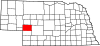
Keith County is a county in the U.S. state of Nebraska. As of the 2020 United States Census, the population was 8,335. Its county seat is Ogallala.

Lisco is a census-designated place (CDP) in Garden County, Nebraska, United States. The population was 64 at the 2010 census.

Snyder is an unincorporated town, a post office, and a census-designated place (CDP) located in and governed by Morgan County, Colorado, United States. The CDP is a part of the Fort Morgan, CO Micropolitan Statistical Area. The Snyder post office has the ZIP Code 80750. As of the 2020 census, the population of the Snyder CDP was 136.
Walton is an unincorporated community and census-designated place in Lancaster County, Nebraska, United States. Walton had a population of 306 as of the 2010 census. The headquarters of the Cornhusker Council of the Boy Scouts of America are located in Walton.

Keystone is an unincorporated community and census-designated place in central Keith County, Nebraska, United States. As of the 2010 census its population was 59.

Lemoyne is an unincorporated community and census-designated place in northwestern Keith County, Nebraska, United States. As of the 2010 census it had a population of 82.
Overland is a census-designated place (CDP) in Hamilton County, Nebraska, United States. The population was 153 at the 2010 census.
Poole is a census-designated place (CDP) in Buffalo County, Nebraska, United States. It is part of the Kearney, Nebraska Micropolitan Statistical Area. The population of the CDP was 19 at the 2010 census.

Holmesville is a census-designated place (CDP) in Gage County, Nebraska, United States. As of the 2010 census it had a population of 51.
Aten is an unincorporated community and census-designated place in Cedar County, Nebraska, United States. As of the 2010 census it had a population of 112.
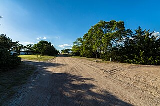
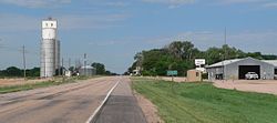
Belmar is an unincorporated community and census-designated place in Keith County, Nebraska, United States. As of the 2010 census it had a population of 216.

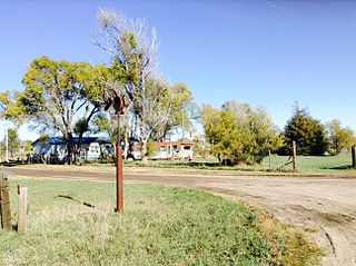
Martin is an unincorporated community and census-designated place in Keith County, Nebraska, United States. As of the 2010 census it had a population of 92. Martin Bay is one of the most popular recreation areas on Lake McConaughy.
Sarben is an unincorporated community and census-designated place in Keith County, Nebraska, United States. As of the 2010 census it had a population of 31.
La Platte is a census-designated place (CDP) in Sarpy County, Nebraska, United States.

Bow Valley is an unincorporated rural village in Cedar County, Nebraska, United States. It is also the name-source for a census-designated place (CDP) which includes the village. Although the 2010 United States Census provides no data for the community itself, the population of the entire CDP is given as 116.
Beacon View is a census-designated place (CDP) in Sarpy County, Nebraska, United States. It is in the southwest part of the county, on the east bank of the Platte River. It is bordered to the south, across U.S. Route 6 (US 6), by the CDP of Linoma Beach. US 6 leads northeast 7 miles (11 km) to Gretna and southwest 3.5 miles (5.6 km) to Nebraska. Omaha is 28 miles (45 km) to the northeast.
Linoma Beach is a census-designated place (CDP) in Sarpy County, Nebraska, United States, comprising the Linoma Beach historic district and adjacent land to the east. The community is in the southwest part of the county, on the east bank of the Platte River. It is bordered to the north, across [[{U.S. Route 6 in Nebraska|U.S. Route 6]] (US 6), by the CDP of Beacon View. US 6 leads northeast 7 miles (11 km) to Gretna and southwest 3.5 miles (5.6 km) to Nebraska. Omaha is 28 miles (45 km) to the northeast.
Platte Colony is a Hutterite colony and census-designated place (CDP) in Charles Mix County, South Dakota, United States. It was first listed as a CDP prior to the 2020 census. The population of the CDP was 299 at the 2020 census.
Swift Bird is a census-designated place (CDP) on the Cheyenne River Indian Reservation in Dewey County, South Dakota, United States. It was first listed as a CDP prior to the 2020 census. The population of the CDP was 117 at the 2020 census.
El Rancho is an unincorporated area and census-designated place (CDP) in Platte County, Wyoming, United States. As of the 2020 census, it had a population of 18.