Westerville, Nebraska

Last updated

Westerville, Nebraska
Westerville, Nebraska post office and IOOF.jpg
I.O.O.F. Hall and post office in Westerville
Country United States
State Nebraska
County Custer
Area
[1]
  Total0.13 sq mi (0.34 km2)
  Land0.13 sq mi (0.34 km2)
  Water0.00 sq mi (0.00 km2)
Elevation
[2]
2,326 ft (709 m)
Population
 (2020)
  Total31
  Density236.64/sq mi (91.22/km2)
Time zone UTC-6 (Central (CST))
  Summer (DST) UTC-5 (CDT)
ZIP code
68881 [3]
Area code 308
FIPS code 31-52330
GNIS ID 2583905 [2]

Westerville is an unincorporated community and census-designated place in Custer County, Nebraska, United States. It is located at the intersection of U.S. Route 183 and Nebraska Highway 70. As of the 2010 census it had a population of 39. [4]

Contents

Demographics

Historical population
CensusPop.Note
2020 31
U.S. Decennial Census [5]

History

Westerville was named for James Westervelt, a local storekeeper on whose land the townsite was platted August 11, 1880. [6] The Westerville post office was established in 1882. [7] County fairs were held in Westerville in 1883 and 1884. [8]

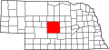
According to History Nebraska, Westerville was the first town in Custer County. It was home to the first frame church in the county; the first newspaper, The Custer Leader, and the first doctor, lawyer, banker, school teachers, monument cutter, and general stores in the county. Along with the post office, the town was home to sod houses, a hotel, blacksmith shop, livery barn, and flour mill. The Custer County County Agricultural Society was in Westerville, and the first two county fairs were held in town in 1881 and 1882. When a railroad was built farther south of Westerville in 1886, the town gradually declined. It became unincorporated in the 1960s. [9]

Westerville was the nearest town to John W. Speese (1866-1914), an African American farmer who homesteaded there in 1881. After 18 years of running his place, Speese wrote an account of farm life for the Omaha World-Herald about life on his 238 acre farm, which included a timber lot, alfalfa, cattle and more. At that time, he reported he was out of debt and was reasonably successful. [10]

Related Research Articles

<span class="mw-page-title-main">Alexander County, North Carolina</span> County in North Carolina, United States

Alexander County is a county established in the U.S. state of North Carolina in 1847. As of the 2020 census, the population was 36,444. Its county seat is Taylorsville. Alexander County is part of the Hickory-Lenoir-Morganton, NC Metropolitan Statistical Area.

<span class="mw-page-title-main">Custer County, Nebraska</span> County in Nebraska, United States

Custer County is a county in the U.S. state of Nebraska. As of the 2020 United States Census, the population was 10,545. Its county seat is Broken Bow. The county was formed in 1877 and named after General George Armstrong Custer, who was killed at the Battle of Little Bighorn.

<span class="mw-page-title-main">Buffalo County, Nebraska</span> County in Nebraska, United States

Buffalo County is a county located in the U.S. state of Nebraska in the Midwestern United States. As of the 2020 United States Census, the population was 50,084, making it Nebraska's fifth-most populous county. Its county seat is Kearney. The county was created in 1855 and was organized in 1870. It was named after the once-prevalent bison herds of the Great Plains.

<span class="mw-page-title-main">Felch Township, Michigan</span> Civil township in Michigan, United States

Felch Township is a civil township of Dickinson County in the U.S. state of Michigan, named in honor of Alpheus Felch. The population was 687 at the 2020 census.

<span class="mw-page-title-main">Broken Bow, Nebraska</span> City in Nebraska

Broken Bow is a city in Custer County, Nebraska, United States. The population was 3,559 at the 2010 census. It is the county seat of Custer County.

<span class="mw-page-title-main">Sargent, Nebraska</span> City in Nebraska, United States

Sargent is a city in Custer County, Nebraska, United States. The population was 525 at the 2010 census.

<span class="mw-page-title-main">Radnor, Ohio</span> Census-designated place in Ohio, United States

Radnor is an unincorporated community and census-designated place (CDP) in central Radnor Township, Delaware County, Ohio, United States. As of the 2020 census it had a population of 180. Radnor has a post office with the ZIP code of 43066. It lies along State Route 203 at its intersection with Radnor Road.

Walton is an unincorporated community and census-designated place in Lancaster County, Nebraska, United States. Walton had a population of 306 as of the 2010 census. The headquarters of the Cornhusker Council of the Boy Scouts of America are located in Walton.

<span class="mw-page-title-main">Sims, Indiana</span> Census-designated place in Indiana, United States

Sims is an unincorporated community and census-designated place (CDP) in Sims Township, Grant County, Indiana. In 2010 it had a population of 156.

<span class="mw-page-title-main">Lillian Township, Custer County, Nebraska</span> Township in Nebraska, United States

Lillian Township is one of thirty-one townships in Custer County, Nebraska, United States. The population was 130 at the 2020 census. A 2021 estimate placed the township's population at 129.

<span class="mw-page-title-main">Westerville Township, Custer County, Nebraska</span> Township in Nebraska, United States

Westerville Township is one of thirty-one townships in Custer County, Nebraska, United States. The population was 130 at the 2020 census. A 2021 estimate placed the township's population at 129.

<span class="mw-page-title-main">Parks, Nebraska</span> Census-designated place in Dundy County, Nebraska, United States

Parks is a namesake census-designated place in southern Dundy County, Nebraska, United States. As of the 2020 census, its population was 12.

Barronett is an unincorporated census-designated place located in the town of Lakeland, Barron County, Wisconsin, United States. Barronett is located on U.S. Route 63 7.5 miles (12.1 km) north-northeast of Cumberland. Barronett has a post office with ZIP code 54813. As of the 2010 census, its population is 111.

Batavia Township is one of 20 current townships in Boone County, Arkansas, USA. As of the 2010 census, its total population was 911. Batavia, Arkansas was settled in 1881 by Roswell Emerson Underwood, who spent four years as a Genesee County, New York, surveyor for the Holland Land Company. He was impressed by the beauty of this site which is located in the foothills of the Ozark Mountains. He was the first postmaster, and named the town for Batavia, New York, his former residence.

<span class="mw-page-title-main">Loretto, Nebraska</span> Census-designated place in Nebraska, United States

Loretto is an unincorporated community and census-designated place in Boone County, Nebraska, United States. As of the 2010 census, the community had a population of 42.

<span class="mw-page-title-main">Kramer, Nebraska</span> Unincorporated community in Nebraska, United States

Kramer is an unincorporated rural village in Lancaster County, Nebraska, United States. There is a grainary there, a restaurant, and a community hall, and no other businesses or services. The population was 26 at the 2020 census.

<span class="mw-page-title-main">Prairie Home, Nebraska</span> Unincorporated community in Nebraska, U.S.

Prairie Home is an unincorporated community in Lancaster County, Nebraska, United States.

Aten is an unincorporated community and census-designated place in Cedar County, Nebraska, United States. As of the 2010 census it had a population of 112.

Lodi is an unincorporated community in Custer County, Nebraska, United States.

<span class="mw-page-title-main">Landess, Indiana</span> Census-designated place in Indiana, United States

Landess is an unincorporated community and census-designated place (CDP) in Washington and Van Buren townships, Grant County, Indiana, in the United States. As of the 2010 census it had a population of 188.

References

  1. "ArcGIS REST Services Directory". United States Census Bureau. Retrieved September 18, 2022.
  2. 1 2 U.S. Geological Survey Geographic Names Information System: Westerville, Nebraska
  3. "Westerville NE ZIP Code". zipdatamaps.com. 2024. Retrieved February 5, 2024.
  4. "Geographic Identifiers: 2010 Demographic Profile Data (G001): Westerville CDP, Nebraska". U.S. Census Bureau, American actfinder. Archived from the original on February 12, 2020. Retrieved October 15, 2014.
  5. "Census of Population and Housing". Census.gov. Retrieved June 4, 2016.
  6. Fitzpatrick, Lillian L. (1960). Nebraska Place-Names. University of Nebraska Press. p. 48. ISBN   0803250606. A 1925 edition is available for download at University of Nebraska—Lincoln Digital Commons.
  7. "Custer County". Jim Forte Postal History. Retrieved August 25, 2014.
  8. Burr, George L. (1921). History of Hamilton and Clay Counties, Nebraska, Volume 1. S.J. Clarke Publishing Company. p. 105.
  9. "Westerville 1880-1980", History Nebraska. Retrieved December 10, 2022.
  10. Hornsby, Alton (2011) Black America: A State-by-State Historical Encyclopedia. ABC-CLIO. p. 484.