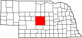
Custer County, Nebraska

Last updated

Custer County
Custer County, Nebraska courthouse from E.JPG
Custer County Courthouse in Broken Bow
Map of Nebraska highlighting Custer County.svg
Location within the U.S. state of Nebraska
Nebraska in United States.svg
Nebraska's location within the U.S.
Coordinates: 41°23′N99°44′W / 41.39°N 99.73°W / 41.39; -99.73
CountryFlag of the United States.svg United States
StateFlag of Nebraska.svg  Nebraska
Founded17 February 1877
Named for George Armstrong Custer
Seat Broken Bow
Largest cityBroken Bow
Area
  Total2,576 sq mi (6,670 km2)
  Land2,576 sq mi (6,670 km2)
  Water0.4 sq mi (1 km2)  0.01%
Population
  Estimate 
(2021)
10,460 [1]
  Density4.06/sq mi (1.57/km2)
Time zone UTC−6 (Central)
  Summer (DST) UTC−5 (CDT)
Congressional district 3rd
Website www.co.custer.ne.us
Custer County Custer County Map.png
Custer County

Custer County is a county in the U.S. state of Nebraska. As of the 2020 United States Census, the population was 10,545. [1] Its county seat is Broken Bow. [2] The county was formed in 1877 [3] and named after General George Armstrong Custer, [4] who was killed at the Battle of Little Bighorn.

Contents

In the Nebraska license plate system, Custer County is represented by the prefix 4 (it had the fourth-largest number of vehicles registered in the county when the license plate system was established in 1922).

Geography

According to the US Census Bureau, the county has a total area of 2,576 square miles (6,670 km2), of which 2,576 square miles (6,670 km2) is land and 0.4 square miles (1.0 km2) (0.01%) is water. [5] In area, it is the second largest county in Nebraska, behind only Cherry County.

Major highways

Adjacent counties

Demographics

Historical population
CensusPop.Note
1880 2,211
1890 21,677880.4%
1900 19,758−8.9%
1910 25,66829.9%
1920 26,4072.9%
1930 26,189−0.8%
1940 22,591−13.7%
1950 19,170−15.1%
1960 16,517−13.8%
1970 14,092−14.7%
1980 13,877−1.5%
1990 12,270−11.6%
2000 11,793−3.9%
2010 10,939−7.2%
2020 10,545−3.6%
2021 (est.)10,460 [1] −0.8%
US Decennial Census [6]
1790-1960 [7] 1900-1990 [8]
1990-2000 [9] 2010-2013 [10]

As of the 2000 United States Census, [11] there were 11,793 people, 4,826 households, and 3,320 families in the county. The population density was 5 people per square mile (1.9 people/km2). There were 5,585 housing units at an average density of 2 units per square mile (0.77/km2). The racial makeup of the county was 98.63% White, 0.07% Black or African American, 0.41% Native American, 0.15% Asian, 0.20% from other races, and 0.55% from two or more races. 0.92% of the population were Hispanic or Latino of any race. 37.3% were of German, 11.9% English, 10.6% Irish and 8.9% American ancestry.

There were 4,826 households, out of which 30.30% had children under the age of 18 living with them, 60.90% were married couples living together, 5.40% had a female householder with no husband present, and 31.20% were non-families. 28.90% of all households were made up of individuals, and 15.00% had someone living alone who was 65 years of age or older. The average household size was 2.39 and the average family size was 2.95.

The county population contained 26.30% under the age of 18, 5.50% from 18 to 24, 23.50% from 25 to 44, 23.70% from 45 to 64, and 21.10% who were 65 years of age or older. The median age was 41 years. For every 100 females there were 96.10 males. For every 100 females age 18 and over, there were 91.70 males.

The median income for a household in the county was $30,677, and the median income for a family was $37,063. Males had a median income of $24,609 versus $19,732 for females. The per capita income for the county was $16,171. About 9.10% of families and 12.40% of the population were below the poverty line, including 16.20% of those under age 18 and 9.10% of those age 65 or over.

Communities

Cities

Villages

Census-designated place

Unincorporated communities

Townships

Politics

Custer County voters are reliably Republican. In no national election since 1936 has the county selected the Democratic Party candidate.

United States presidential election results for Custer County, Nebraska [12]
Year Republican Democratic Third party
No.%No.%No.%
2020 5,09084.69%78613.08%1342.23%
2016 4,69583.07%64111.34%3165.59%
2012 4,29678.14%1,08319.70%1192.16%
2008 4,30177.11%1,19221.37%851.52%
2004 4,51880.51%1,04018.53%540.96%
2000 4,24578.41%97618.03%1933.56%
1996 3,45364.15%1,29324.02%63711.83%
1992 3,18054.64%1,12619.35%1,51426.01%
1988 4,20373.40%1,49626.13%270.47%
1984 4,74980.94%1,09018.58%280.48%
1980 4,56376.90%1,01117.04%3606.07%
1976 3,93563.72%1,98532.15%2554.13%
1972 4,83680.83%1,14719.17%00.00%
1968 4,32570.52%1,40722.94%4016.54%
1964 3,91652.98%3,47547.02%00.00%
1960 5,71670.87%2,35029.13%00.00%
1956 5,79870.51%2,42529.49%00.00%
1952 7,14377.17%2,11322.83%00.00%
1948 4,05754.73%3,35645.27%00.00%
1944 5,33061.61%3,32138.39%00.00%
1940 6,26959.66%4,23840.34%00.00%
1936 5,25045.67%5,90751.39%3382.94%
1932 3,95335.66%6,84461.74%2892.61%
1928 8,37976.40%2,50622.85%820.75%
1924 3,83339.95%2,57526.84%3,18733.22%
1920 4,97459.31%2,73932.66%6748.04%
1916 2,04734.24%3,60960.37%3225.39%
1912 1,05118.20%2,39541.46%2,33040.34%
1908 2,78847.01%2,89848.86%2454.13%
1904 2,65859.61%50911.42%1,29228.98%
1900 2,14547.24%2,15947.54%2375.22%

See also

Related Research Articles

<span class="mw-page-title-main">Custer County, South Dakota</span> County in South Dakota, United States

Custer County is a county in the U.S. state of South Dakota. As of the 2020 census, the population was 8,318. Its county seat is Custer. The county was created in 1875, and was organized in 1877.

<span class="mw-page-title-main">Valley County, Nebraska</span> County in Nebraska, United States

Valley County is a county in the U.S. state of Nebraska. As of the 2020 United States Census, the population was 4,059. Its county seat is Ord.

<span class="mw-page-title-main">Sherman County, Nebraska</span> County in Nebraska, United States

Sherman County is a county in the U.S. state of Nebraska. As of the 2020 United States Census, the population was 2,959. Its county seat is Loup City. The county was created in 1870, and was organized in 1872. It was named for American Civil War General William Tecumseh Sherman.

<span class="mw-page-title-main">Loup County, Nebraska</span> County in Nebraska, United States

Loup County is a county in the U.S. state of Nebraska. As of the 2020 United States Census, the population was 607, making it Nebraska's fifth-least populous county and the tenth-least populous county in the United States. Its county seat is Taylor. The county was named after the Pawnee Loup Indians.

<span class="mw-page-title-main">Logan County, Nebraska</span> County in Nebraska, United States

Logan County is a county in the U.S. state of Nebraska. As of the 2020 census, the population was 716. Its county seat is Stapleton.

<span class="mw-page-title-main">Lincoln County, Nebraska</span> County in Nebraska, United States

Lincoln County is a county located in the U.S. state of Nebraska. As of the 2020 census, the population was 34,676. Its county seat is North Platte. Despite the county's name, the state capital city of Lincoln is not in or near Lincoln County.

<span class="mw-page-title-main">Grant County, Nebraska</span> County in Nebraska, United States

Grant County is a county in the U.S. state of Nebraska. As of the 2020 United States Census, the population was 611, making it the fourth-least populous county in Nebraska and the ninth-least populous county in the United States. Its county seat is Hyannis. The county was founded in 1887 and named for Ulysses S. Grant, 18th President of the United States.

<span class="mw-page-title-main">Garfield County, Nebraska</span> County in Nebraska, United States

Garfield County is a county in the U.S. state of Nebraska. As of the 2020 United States Census, the population was 1,813. Its county seat is Burwell. The county was organized in 1884; it was named for James A. Garfield, 20th President of the United States.

<span class="mw-page-title-main">Deuel County, Nebraska</span> County in Nebraska, United States

Deuel County is a county located in the U.S. State of Nebraska. As of the 2020 United States Census, the population was 1,838. Its county seat is Chappell. The county was formed in 1889 and named for Harry Porter Deuel, superintendent of the Union Pacific Railroad.

<span class="mw-page-title-main">Cuming County, Nebraska</span> County in Nebraska, United States

Cuming County is a county in the U.S. state of Nebraska. As of the 2020 United States Census, the population was 9,013. Its county seat is West Point.

<span class="mw-page-title-main">Burt County, Nebraska</span> County in Nebraska, United States

Burt County is a county in the U.S. state of Nebraska, bordering the west bank of the upper Missouri River. As of the 2020 United States Census, the population was 6,722. Its county seat is Tekamah. The county was formed in 1854 and named after Francis Burt, the first governor of Nebraska Territory.

<span class="mw-page-title-main">Boone County, Nebraska</span> County in Nebraska, United States

Boone County is a county in the U.S. state of Nebraska. As of the 2020 United States Census, the population was 5,386. Its county seat is Albion. The county was organized in 1871 and named after Daniel Boone.

<span class="mw-page-title-main">Blaine County, Nebraska</span> County in Nebraska, United States

Blaine County is a county in the U.S. state of Nebraska. As of the 2020 United States Census, the population was 431, making it Nebraska's second-least populous county and the sixth-least populous in the United States. Its county seat is Brewster. The county was formed in 1885 and organized in 1886. It is named after presidential candidate James G. Blaine.

<span class="mw-page-title-main">Antelope County, Nebraska</span> County in Nebraska, United States

Antelope County is a county located in the U.S. state of Nebraska. As of the 2020 United States Census, the population was 6,295. Its county seat is Neligh. The county was formed in 1871. It received its name after a group of early settlers killed and ate several pronghorn. Although these are not true antelope, they are colloquially known by that name.

<span class="mw-page-title-main">Carlisle County, Kentucky</span> County in Kentucky, United States

Carlisle County is a county located in the U.S. state of Kentucky. As of the 2020 census, the population was 4,826, making it the fourth-least populous county in Kentucky. Its county seat is Bardwell. The county was founded in 1886 and named for John Griffin Carlisle, a Speaker of the United States House of Representatives from Kentucky. It remains a prohibition or dry county. Carlisle County is included in the Paducah, KY-IL, Metropolitan Statistical Area.

<span class="mw-page-title-main">Ansley, Nebraska</span> Village in Nebraska, United States

Ansley is a village in Custer County, Nebraska, United States. The population was 441 at the 2010 census.

<span class="mw-page-title-main">Arnold, Nebraska</span> Village in Nebraska, United States

Arnold is a village in Custer County, Nebraska, United States. The population was 597 at the 2010 census. The village was named for George Arnold, a pioneer settler.

<span class="mw-page-title-main">Berwyn, Nebraska</span> Village in Custer County, Nebraska, United States

Berwyn is a village in Custer County, Nebraska, United States. The population was 83 at the 2010 census.

<span class="mw-page-title-main">Broken Bow, Nebraska</span> City in Nebraska

Broken Bow is a city in Custer County, Nebraska, United States. The population was 3,559 at the 2010 census. It is the county seat of Custer County.

<span class="mw-page-title-main">Oconto, Nebraska</span> Village in Nebraska, United States

Oconto is a village in Custer County, Nebraska, United States. The population was 151 at the 2010 census.

References

  1. 1 2 3 "City and Town Population Totals: 2020—2021". Census.gov. US Census Bureau. Retrieved October 31, 2022.
  2. "Find a County". National Association of Counties. Archived from the original on May 31, 2011. Retrieved June 7, 2011.
  3. Burr, George L. (1921). History of Hamilton and Clay Counties, Nebraska, Vol. 1. S.J. Clarke Pub. Co. p. 105.
  4. "Nebraska Association of County Officials : Home". Archived from the original on July 16, 2011. Retrieved March 14, 2008.
  5. "2010 Census Gazetteer Files". US Census Bureau. August 22, 2012. Archived from the original on November 13, 2013. Retrieved December 6, 2014.
  6. "US Decennial Census". US Census Bureau. Retrieved December 6, 2014.
  7. "Historical Census Browser". University of Virginia Library. Archived from the original on August 11, 2012. Retrieved December 6, 2014.
  8. "Population of Counties by Decennial Census: 1900 to 1990". US Census Bureau. Retrieved December 6, 2014.
  9. "Census 2000 PHC-T-4. Ranking Tables for Counties: 1990 and 2000" (PDF). US Census Bureau. Archived (PDF) from the original on March 27, 2010. Retrieved December 6, 2014.
  10. "State & County QuickFacts". US Census Bureau. Archived from the original on June 7, 2011. Retrieved September 18, 2013.
  11. "U.S. Census website". US Census Bureau. Retrieved May 31, 2008.
  12. Election Results

41°23′N99°44′W / 41.39°N 99.73°W / 41.39; -99.73