Seward County, Nebraska

Last updated

Seward County
County of Seward
Seward County, Nebraska courthouse from S 1.JPG
Seward County, Nebraska
Interactive map of Seward County
Map of Nebraska highlighting Seward County.svg
Location within the U.S. state of Nebraska
CountryFlag of the United States.svg  United States
State Flag of Nebraska.svg  Nebraska
EstablishedMarch 16, 1855
OrganizedOctober 1865
Named for William H. Seward
County seat Seward
Largest citySeward
Area
  Total576 sq mi (1,490 km2)
  Land571 sq mi (1,480 km2)
  Water4.5 sq mi (12 km2)  0.8%
Highest elevation
1,598 ft (487 m)
Lowest elevation
938 ft (286 m)
Population
 (2020)
  Total17,609
  Density31/sq mi (12/km2)
Time zone UTC−6 (Central)
  Summer (DST) UTC−5 (CDT)
Area code 402/531
FIPS code31159
GNIS feature ID 835901
Website countyofsewardne.com

Seward County is a county in the U.S. state of Nebraska, United States. As of the 2020 United States Census, the population was 17,609. [1] Its county seat is Seward. [2] The county was formed in 1855, [3] and was organized in 1867. [4] [5] It was originally called Greene County, and in 1862 it was renamed for William H. Seward, Secretary of State under Abraham Lincoln and Andrew Johnson. Seward County is part of the Lincoln, NE Metropolitan Statistical Area.

Contents

In the Nebraska license plate system, Seward County is represented by the prefix 16 (it had the sixteenth-largest number of vehicles registered in the county when the license plate system was established in 1922).
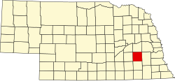
Geography

The Seward County terrain consists of low rolling hills, largely dedicated to agriculture including center pivot irrigation. The Big Blue River flows south-southeasterly through the central part of the county. [6] The county has a total area of 576 square miles (1,490 km2), of which 571 square miles (1,480 km2) is land and 4.5 square miles (12 km2) (0.8%) is water. [7]

Demographics

Historical population
CensusPop.Note
1870 2,953
1880 11,147277.5%
1890 16,14044.8%
1900 15,690−2.8%
1910 15,8951.3%
1920 15,867−0.2%
1930 15,9380.4%
1940 14,167−11.1%
1950 13,155−7.1%
1960 13,5813.2%
1970 14,4606.5%
1980 15,7899.2%
1990 15,450−2.1%
2000 16,4966.8%
2010 16,7501.5%
2020 17,6095.1%
US Decennial Census [8]
1790-1960 [9] 1900-1990 [10]
1990-2000 [11] 2010 [12]

As of the 2000 United States Census, [13] there were 16,496 people, 6,013 households, and 4,215 families in the county. The population density was 29 inhabitants per square mile (11/km2). There were 6,428 housing units at an average density of 11 units per square mile (4.2/km2). The racial makeup of the county was 98.05% White, 0.28% Black or African American, 0.21% Native American, 0.29% Asian, 0.05% Pacific Islander, 0.40% from other races, and 0.72% from two or more races. 1.09% of the population were Hispanic or Latino of any race.

There were 6,013 households, out of which 32.80% had children under the age of 18 living with them, 61.50% were married couples living together, 5.60% had a female householder with no husband present, and 29.90% were non-families. 24.90% of all households were made up of individuals, and 12.10% had someone living alone who was 65 years of age or older. The average household size was 2.53 and the average family size was 3.04.

The county population contained 24.70% under the age of 18, 14.30% from 18 to 24, 24.60% from 25 to 44, 21.20% from 45 to 64, and 15.20% who were 65 years of age or older. The median age was 36 years. For every 100 females, there were 103.20 males. For every 100 females age 18 and over, there were 102.50 males.

The median income for a household in the county was $42,700, and the median income for a family was $51,813. Males had a median income of $32,218 versus $22,329 for females. The per capita income for the county was $18,379. About 4.10% of families and 7.00% of the population were below the poverty line, including 6.20% of those under age 18 and 6.80% of those age 65 or over.

Protected areas

Transportation

Major highways

Civil Asset Forfeiture

The county engages in extensive civil asset forfeiture, as the county of less than 18,000 people accounts for a third of all Nebraska civil forfeitures. From 2018 to 2023, the county obtained $7.5 million in forfeited cash. Nearly all of the civil forfeitures stem from traffic stops of out-of-state drivers on Interstate 80 where Seward County police give stopped drivers a choice to give up cash or go to jail. The routine seizures of money never result in convictions of drivers, raising questions about the intent of the forfeitures. [19] This practice continues despite 2016 state law LB 1106 [20] meant to stop it. [19]

Communities

Cities

Villages

Census-designated place

Unincorporated communities

Ghost town

Adjacent counties

Politics

Seward County voters are reliably Republican. In only one national election since 1936 has the county selected the Democratic Party candidate (as of 2020).

United States presidential election results for Seward County, Nebraska [21]
Year Republican Democratic Third party
No.%No.%No.%
2020 6,49070.55%2,43826.50%2712.95%
2016 5,45468.85%1,87523.67%5937.49%
2012 5,00366.06%2,38631.51%1842.43%
2008 4,64761.72%2,70335.90%1792.38%
2004 5,35370.76%2,11427.94%981.30%
2000 4,45763.53%2,25032.07%3094.40%
1996 3,47951.86%2,43236.25%79811.89%
1992 3,06044.12%2,12130.58%1,75525.30%
1988 3,47255.89%2,69043.30%500.80%
1984 3,98367.09%1,91132.19%430.72%
1980 3,52759.13%1,80330.23%63510.65%
1976 3,22054.12%2,61043.87%1202.02%
1972 3,70763.98%2,08736.02%00.00%
1968 2,93960.59%1,65834.18%2545.24%
1964 2,22139.89%3,34760.11%00.00%
1960 3,58863.14%2,09536.86%00.00%
1956 3,68865.88%1,91034.12%00.00%
1952 4,25771.64%1,68528.36%00.00%
1948 2,91656.18%2,27443.82%00.00%
1944 3,72164.11%2,08335.89%00.00%
1940 4,11761.95%2,52938.05%00.00%
1936 3,12344.37%3,86654.92%500.71%
1932 2,29834.97%4,20864.04%650.99%
1928 3,53959.68%2,36739.92%240.40%
1924 2,79749.21%1,84832.51%1,03918.28%
1920 3,69069.98%1,49728.39%861.63%
1916 1,85550.11%1,79748.54%501.35%
1912 78823.29%1,57346.48%1,02330.23%
1908 1,93048.21%2,02950.69%441.10%
1904 2,24361.64%1,02728.22%36910.14%
1900 1,93750.30%1,86548.43%491.27%

See also

Related Research Articles

<span class="mw-page-title-main">Clay County, Nebraska</span> County in Nebraska, United States

Clay County is a county in the U.S. state of Nebraska. As of the 2020 United States Census, the population was 6,104. Its county seat is Clay Center. The county was formed in 1855, and was organized in 1871. It was named for Henry Clay, a member of the United States Senate from Kentucky, who went on to become United States Secretary of State.

<span class="mw-page-title-main">Lancaster County, Nebraska</span> County in Nebraska, United States

Lancaster County is a county located in the U.S. state of Nebraska. As of the 2020 United States Census, the population was 322,608, making it the second-most populous county in Nebraska. Its county seat is Lincoln, the state capital. The county was created in 1859.

<span class="mw-page-title-main">York County, Nebraska</span> County in Nebraska, United States

York County is a county in the U.S. state of Nebraska. As of the 2020 United States Census, the population was 14,125. Its county seat is York.

<span class="mw-page-title-main">Thayer County, Nebraska</span> County in Nebraska, United States

Thayer County is a county in the U.S. state of Nebraska. As of the 2020 United States Census, the population was 5,034. The county was created in 1856 and originally named Jefferson County. It was organized in 1870-1871 and renamed for General and Governor John Milton Thayer.

<span class="mw-page-title-main">Stanton County, Nebraska</span> County in Nebraska, United States

Stanton County is a county in the U.S. state of Nebraska. As of the 2020 United States Census, the population was 5,842. Its county seat is Stanton. The county was formed in 1856 and organized in 1867. It was first called Izard County until 1862, when it was renamed for Edwin M. Stanton, Secretary of War during the administration of President Abraham Lincoln.

<span class="mw-page-title-main">Scotts Bluff County, Nebraska</span> County in Nebraska, United States

Scotts Bluff County is a county on the western border of the U.S. state of Nebraska. As of the 2020 United States Census, the population was 36,084. Its county seat is Gering, and its largest city is Scottsbluff.

<span class="mw-page-title-main">Saunders County, Nebraska</span> County in Nebraska, United States

Saunders County is a county in the U.S. state of Nebraska. As of the 2020 United States Census, the population was 22,278. Its county seat is Wahoo.

<span class="mw-page-title-main">Rock County, Nebraska</span> County in Nebraska, United States

Rock County is a county in the U.S. state of Nebraska. As of the 2020 United States Census, the population was 1,262. Its county seat is Bassett.

<span class="mw-page-title-main">Phelps County, Nebraska</span> County in Nebraska, United States

Phelps County is a county in the U.S. state of Nebraska. As of the 2020 United States Census, the population was 8,968. Its county seat is Holdrege. The county was formed in 1873, and was named for William Phelps (1808–1889), a steamboat captain and early settler.

<span class="mw-page-title-main">Pawnee County, Nebraska</span> County in Nebraska, United States

Pawnee County is a county in the U.S. state of Nebraska. As of the 2020 United States Census, the population was 2,544. Its county seat is Pawnee City.

<span class="mw-page-title-main">Madison County, Nebraska</span> County in Nebraska, United States

Madison County is a county in the U.S. state of Nebraska. As of the 2020 United States Census, the population was 35,585. Its county seat is Madison and its largest city is Norfolk. Madison County was named for James Madison, fourth President of the United States.

<span class="mw-page-title-main">Lincoln County, Nebraska</span> County in Nebraska, United States

Lincoln County is a county located in the U.S. state of Nebraska. As of the 2020 census, the population was 34,676. Its county seat is North Platte. Despite the county's name, the state capital city of Lincoln is not in or near Lincoln County. The city of Lincoln is, instead, located more than 200 miles further to the east in Lancaster County.

<span class="mw-page-title-main">Keith County, Nebraska</span> County in Nebraska, United States

Keith County is a county in the U.S. state of Nebraska. As of the 2020 United States Census, the population was 8,335. Its county seat is Ogallala.

<span class="mw-page-title-main">Kearney County, Nebraska</span> County in Nebraska, United States

Kearney County is a county located in the U.S. state of Nebraska. As of the 2020 United States Census, the population was 6,688. Its county seat is Minden. The county was formed in 1860. It was named for Fort Kearny, which in turn was named for Brigade General Stephen W. Kearny.

<span class="mw-page-title-main">Hamilton County, Nebraska</span> County in Nebraska, United States

Hamilton County is a county in the U.S. state Nebraska. As of the 2020 United States Census, the population was 9,429. Its county seat is Aurora. The county was named for Alexander Hamilton, the first Secretary of the Treasury in the new United States government.

<span class="mw-page-title-main">Hall County, Nebraska</span> County in Nebraska, United States

Hall County is a county in the U.S. state of Nebraska. As of the 2020 United States Census, the population was 62,895, making it Nebraska's fourth-most populous county. Its county seat is Grand Island. The county was formed in 1858; it was named for Augustus Hall, an early judge of this territory.

<span class="mw-page-title-main">Gosper County, Nebraska</span> County in Nebraska, United States

Gosper County is a county located in the U.S. state of Nebraska. As of the 2020 United States census, the population was 1,893. Its county seat is Elwood. The county was formed in 1873, and was organized in 1881. It was named for John J. Gosper, a Nebraska Secretary of State.

<span class="mw-page-title-main">Garfield County, Nebraska</span> County in Nebraska, United States

Garfield County is a county in the U.S. state of Nebraska. As of the 2020 United States Census, the population was 1,813. Its county seat is Burwell. The county was organized in 1884; it was named for James A. Garfield, 20th President of the United States.

<span class="mw-page-title-main">Dawson County, Nebraska</span> County in Nebraska, United States

Dawson County is a county in the U.S. state of Nebraska. As of the 2020 United States Census, the population was 24,111. Its county seat is Lexington.

<span class="mw-page-title-main">Cedar County, Nebraska</span> County in Nebraska, United States

Cedar County is a county in the U.S. state of Nebraska. As of the 2020 United States Census, the population was 8,380. The county seat is Hartington. The county was formed in 1857, and was named for the Cedar tree groves in the area.

References

  1. "Seward County, Nebraska". United States Census Bureau . Retrieved June 24, 2023.
  2. "Find a County". National Association of Counties. Retrieved June 7, 2011.
  3. Fitzpatrick, Lilian Linder (1925). Nebraska Place-Names. Lincoln: University of Nebraska Studies in Language, Literature, and Criticism. p. 131. Retrieved December 19, 2014.
  4. "Seward County Nebraska Historic Buildings Survey" (PDF). Nebraska State Historical Society. August 2007. Archived from the original on May 16, 2008. Retrieved December 19, 2014.{{cite web}}: CS1 maint: unfit URL (link)
  5. Andreas, A. T. (1882). "Andreas' History of the State of Nebraska". The Kansas Collection. Archived from the original on July 29, 2003. Retrieved December 19, 2014.
  6. Seward County NE Google Maps (accessed 26 January 2019)
  7. "2010 Census Gazetteer Files". US Census Bureau. August 22, 2012. Archived from the original on November 13, 2013. Retrieved December 11, 2014.
  8. "US Decennial Census". US Census Bureau. Retrieved December 11, 2014.
  9. "Historical Census Browser". University of Virginia Library. Retrieved December 11, 2014.
  10. "Population of Counties by Decennial Census: 1900 to 1990". US Census Bureau. Retrieved December 11, 2014.
  11. "Census 2000 PHC-T-4. Ranking Tables for Counties: 1990 and 2000" (PDF). US Census Bureau. Archived (PDF) from the original on March 27, 2010. Retrieved December 11, 2014.
  12. "State & County QuickFacts". United States Census Bureau . Retrieved September 22, 2013.
  13. "U.S. Census website". US Census Bureau. Retrieved January 31, 2008.
  14. Bur Oak State Wildlife Management Area, Seward NE Google Maps (accessed 26 January 2019)
  15. Freeman Lakes Waterfowl Production Area, Waco NE Google Maps (accessed 26 January 2019)
  16. North Lake Basin State Wildlife Management Area, Utica NE Google Maps (accessed 26 January 2019)
  17. Oak Glen State Wildlife Management Area, Garland NE Google Maps (accessed 26 January 2019)
  18. Tamora Waterfowl Production Area, Alvo Rd, Seward NE Google Maps (accessed 26 January 2019)
  19. 1 2 Alamdari, Natalia (June 16, 2023). "Using loophole, Seward County seizes millions from motorists without convicting them of crimes". Nebraska Public Media. Flatwater Free Press. Retrieved June 17, 2023.
  20. "Policing for Profit".
  21. Election Results

40°52′N97°08′W / 40.87°N 97.14°W / 40.87; -97.14