Pine Ridge (region)

Last updated
The Pine Ridge region has forested hills. Pine ridge nebraska.jpg
The Pine Ridge region has forested hills.

The Pine Ridge is an escarpment between the Niobrara River and the White River in far northwestern Nebraska (a small section extends into South Dakota). The high tableland between the rivers has been eroded into a region of forested buttes, ridges and canyons.

Escarpment Steep slope or cliff separating two relatively level regions

An escarpment, or scarp, is a steep slope or long cliff that forms as a result of faulting or erosion and separates two relatively level areas having different elevations. Usually scarp and scarp face are used interchangeably with escarpment.

Niobrara River river in the United States of America

The Niobrara River is a tributary of the Missouri River, approximately 568 miles (914 km) long, running through the U.S. states of Wyoming and Nebraska. The river drains one of the most arid sections of the Great Plains, and has a low flow for a river of its length. The Niobrara's watershed includes the northern tier of Nebraska Sandhills, a small south-central section of South Dakota, as well as a small area of eastern Wyoming.

Nebraska U.S. state in the United States

Nebraska is a state that lies in both the Great Plains and the Midwestern United States. It is bordered by South Dakota to the north; Iowa to the east and Missouri to the southeast, both across the Missouri River; Kansas to the south; Colorado to the southwest; and Wyoming to the west. It is the only triply landlocked U.S. state.

Contents

Ecology

The plant and animal life in the Pine Ridge is atypical for Nebraska; the ecology is very similar to the Black Hills, 50 miles (80 km) to the north. The dominant tree in the Pine Ridge is the ponderosa pine; deciduous trees (such as cottonwoods) are also present in canyon bottoms. The Pine Ridge is one of two regions in Nebraska that support bighorn sheep; elk, river otters, mule deer, and wild turkeys are also common.

Black Hills mountain range in South Dakota and Wyoming

The Black Hills are a small and isolated mountain range rising from the Great Plains of North America in western South Dakota and extending into Wyoming, United States. Black Elk Peak, which rises to 7,244 feet (2,208 m), is the range's highest summit. The Black Hills encompass the Black Hills National Forest. The name "Black Hills" is a translation of the Lakota Pahá Sápa. The hills were so-called because of their dark appearance from a distance, as they were covered in trees.

Bighorn sheep species of sheep native to North America

The bighorn sheep is a species of sheep native to North America. The species is named for its large horns. A pair of horns might weigh up to 14 kg (30 lb); the sheep weigh up to 140 kg (300 lb). Recent genetic testing indicates three distinct subspecies of Ovis canadensis, one of which is endangered: O. c. sierrae. Sheep originally crossed to North America over the Bering Land Bridge from Siberia; the population in North America peaked in the millions, and the bighorn sheep entered into the mythology of Native Americans. By 1900, the population had crashed to several thousand, due to diseases introduced through European livestock and overhunting.

Rocky Mountain elk the only living subspecies of elk in the Rocky Mountains

The Rocky Mountain elk is a subspecies of elk found in the Rocky Mountains and adjacent ranges of Western North America. The winter ranges are most common in open forests and floodplain marshes in the lower elevations. In the summer it migrates to the subalpine forests and alpine basins. Elk have a diverse habitat range that they can reside in but are most often found in forest and forest edge habitat and in mountain regions they often stay in higher elevations during warmer months and migrate down lower in the winter. They may even come down the mountain and leave the forest into some grassland for part of the day but head back into the timber in the evening. The total wild population is about one million individuals.

History

The Pine Ridge region was the setting of the closing chapters of the Indian Wars. The region was home to several bands of Lakota; several skirmishes between the Lakota and the U.S. Army took place in the 1860s and 1870s. Crazy Horse was killed at Fort Robinson in 1877. In 1879, Dull Knife led the Cheyenne Outbreak from Fort Robinson.

Lakota people Indigenous people of the Great Plains

The Lakota are a Native American tribe. Also known as the Teton Sioux, they are one of the three Sioux tribes of Plains. Their current lands are in North and South Dakota. They speak Lakȟótiyapi—the Lakota language, the westernmost of three closely related languages that belong to the Siouan language family.

United States Army Land warfare branch of the United States Armed Forces

The United States Army (USA) is the land warfare service branch of the United States Armed Forces. It is one of the seven uniformed services of the United States, and is designated as the Army of the United States in the United States Constitution. As the oldest and most senior branch of the U.S. military in order of precedence, the modern U.S. Army has its roots in the Continental Army, which was formed to fight the American Revolutionary War (1775–1783)—before the United States of America was established as a country. After the Revolutionary War, the Congress of the Confederation created the United States Army on 3 June 1784 to replace the disbanded Continental Army. The United States Army considers itself descended from the Continental Army, and dates its institutional inception from the origin of that armed force in 1775.

Crazy Horse Oglala Sioux chief

Crazy Horse was a Lakota war leader of the Oglala band in the 19th century. He took up arms against the United States federal government to fight against encroachment by white American settlers on Native American territory and to preserve the traditional way of life of the Lakota people. His participation in several famous battles of the Black Hills War on the northern Great Plains, among them the Fetterman Fight in 1866 in which he acted as a decoy and the Battle of the Little Bighorn in 1876 in which he led a war party to victory, earned him great respect from both his enemies and his own people.

Protected areas

A large portion of the Pine Ridge is owned or managed by either the Nebraska Game and Parks Commission or by various U.S. Government agencies for preservation and recreation uses. These areas include:

Nebraska Game and Parks Commission

The Nebraska Game and Parks Commission (NGPC) is the State of Nebraska's State agency charged with stewardship of the state's fish, wildlife, state park, and outdoor recreation resources. The agency is led by a governor-appointed member commission consisting of 9 commissioners which directs agency management. The commission is also charged with issuing of state hunting licenses, fishing licenses, and boat registrations. The agency also manages State Parks and recreation areas throughout the state. It conducts public education programs for hunting and boating safety. The agency is headquartered in Lincoln, Nebraska.

Federal government of the United States National government of the United States

The federal government of the United States is the national government of the United States, a federal republic in North America, composed of 50 states, a federal district, five major self-governing territories and several island possessions. The federal government is composed of three distinct branches: legislative, executive and judicial, whose powers are vested by the U.S. Constitution in the Congress, the president and the federal courts, respectively. The powers and duties of these branches are further defined by acts of Congress, including the creation of executive departments and courts inferior to the Supreme Court.

Chadron State Park state park in Kansas, United States

Chadron State Park is a public recreation area located within Nebraska National Forest, nine miles (14 km) south of Chadron, Nebraska, in the northwestern portion of the state. The park's 973 acres (394 ha) include a portion of the Pine Ridge escarpment and Chadron Creek. The park is wooded with ponderosa pine throughout and cottonwood trees near the creek and lagoon.

Fort Robinson

Fort Robinson is a former U.S. Army fort and now a major feature of Fort Robinson State Park, a 22,000-acre (8,900 ha) public recreation and historic preservation area located 2 miles (3.2 km) west of Crawford on U.S. Route 20 in the Pine Ridge region of northwest Nebraska.

Nebraska National Forest

The Nebraska National Forest is a United States National Forest located within the U.S. state of Nebraska. The total area of the national forest is 141,864 acres, or 222 sq miles. The forest is managed by the U.S. Forest Service's Nebraska Forests and Grasslands Supervisor's Office in Chadron, Nebraska. The national forest includes two ranger districts, the Bessey Ranger District and the Pine Ridge Ranger District. In descending order of land, the forest lies in parts of Thomas, Dawes, Blaine, and Sioux counties.

See also

Coordinates: 42°45′01″N103°00′05″W / 42.75028°N 103.00139°W / 42.75028; -103.00139 (Pine Ridge)

Related Research Articles

Angeles National Forest

The Angeles National Forest (ANF) of the U.S. Forest Service is located in the San Gabriel Mountains and Sierra Pelona Mountains, primarily within Los Angeles County in southern California. The ANF manages a majority of the San Gabriel Mountains National Monument.

Nebraska Panhandle

The Nebraska Panhandle is an area in the western part of the state of Nebraska and one of several U.S. state panhandles, or elongated geographical regions that extend from their main political entity.

Niobrara National Scenic River

The Niobrara National Scenic River is in north-central Nebraska, United States, approximately 300 miles (480 km) northwest of Omaha. In 1991, Congress set aside 76 miles (120 km) for preservation under the management of the National Park Service with assistance from the local Niobrara Council. Several "outstandingly remarkable values" have been designated to be protected along the Niobrara National Scenic River, including: Fish and Wildlife, Scenery, Fossil Resources, Geology, and Recreation. The river was designated by Backpacker magazine as one of the 10 best rivers for canoeing in the United States.

Shasta–Trinity National Forest

The Shasta–Trinity National Forests are federally designated forests in northern California, USA. Combined, they are the largest National Forest in California and are managed by the U.S. Forest Service. The 2,210,485 acre combined-forest encompasses five wilderness areas, hundreds of mountain lakes and 6,278 miles (10,103 km) of streams and rivers. Major features include Shasta Lake, the largest man-made lake in California and Mount Shasta, elevation 14,179 feet (4,322 m).

Wildcat Hills

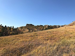
The Wildcat Hills are an escarpment between the North Platte River and Pumpkin Creek in the western Panhandle, in the state of Nebraska in the Great Plains region of the United States. Located in Banner, Morrill, and Scotts Bluff counties, the high tableland between the streams has been eroded by wind and water into a region of forested buttes, ridges and canyons that rise 150 to 300 m above the surrounding landscape.

Hells Canyon Wilderness (Oregon and Idaho)

The Hells Canyon Wilderness is a wilderness area in the western United States, in Idaho and Oregon. Created 44 years ago in 1975, the Wilderness is managed by both the U.S. Bureau of Land Management and the U.S. Forest Service and contains some of the most spectacular sections of the Snake River as it winds its way through Hells Canyon, North America's deepest river gorge and one of the deepest gorges on Earth. The Oregon Wilderness Act of 1984 added additional acreage and currently the area protects a total area of 217,927 acres (88,192 ha). It lies entirely within the Hells Canyon National Recreation Area except for a small 946-acre (383 ha) plot in southeastern Wallowa County, Oregon which is administered by the Bureau of Land Management. The area that is administered by the Forest Service consists of portions of the Wallowa, Nez Perce, Payette, and Whitman National Forests.

The Potomac Highlands of West Virginia centers on five West Virginian counties in the upper Potomac River watershed in the western portion of the state's Eastern Panhandle, bordering Maryland and Virginia. Because of geographical proximity, similar topography and landscapes, and shared culture and history, the Potomac Highlands region also includes Pocahontas, Randolph, and Tucker counties, even though they are in the Monongahela River or New River watersheds and not that of the Potomac River.

Samuel R. McKelvie National Forest

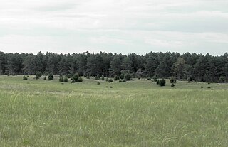
The Samuel R. McKelvie National Forest is a United States National Forest located in the north-central Sandhills region of the U.S. state of Nebraska. The total area of the national forest is 116,079 acres (181.373 sq mi). The forest is managed by the U.S. Forest Service's Nebraska Forests and Grasslands Supervisor's Office in Chadron, Nebraska. The national forest is located entirely within Cherry County, Nebraska. There is a local ranger district office located in Nenzel.

Pine Flat Lake artificial lake/reservoir in the Sierra Nevada foothills of eastern Fresno County, California

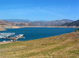
Pine Flat Lake is an artificial lake or reservoir in the Sierra Nevada foothills of eastern Fresno County, California on the western north-south border to the Sierra- and Sequoia National Forests, about 30 mi (48 km) east of Fresno. The lake is managed by the U.S. Army Corps of Engineers (USACE) and is open to boaters, campers & hikers.

Turnbull National Wildlife Refuge

The Turnbull National Wildlife Refuge is located six miles (10 km) south of Cheney, Washington, on the eastern edge of the Columbia Basin in Spokane County in northeastern Washington. Turnbull NWR encompasses more than 18,000 acres (7,300 ha) of the Channeled Scablands. The ecosystem that predominates the refuge is unique within the National Wildlife Refuge System and has characteristics that distinguish it from natural reserves worldwide. The combination of basalt outcrops, channeled canyons, and ponderosa pine forests infused in a diverse landscape of over 130 marshes, wetlands, and lakes creates an environment of aesthetic beauty as well as high quality wildlife habitat. The refuge is named for Cyrus Turnbull who lived on the site in the 1880s.

Wood River (Oregon) river in the United States of America

The Wood River is a short river in the southern region of the U.S. state of Oregon, and part of the Klamath Basin drainage. It flows 18 miles (29 km) through the Fremont-Winema National Forests, Bureau of Land Management land, and private property in southern Oregon. Its watershed consists of 220 square miles (570 km2) of conifer forest, rural pasture land, and marsh. The river provides habitat for many species of wildlife including an adfluvial (migratory) and resident populations of native Great Basin redband trout.

Little Belt Mountains

The Little Belt Mountains are a section of the Rocky Mountains in the U.S. state of Montana. Situated mainly in the Lewis and Clark National Forest, the mountains are used for logging and recreation for the residents of Great Falls, Montana. Showdown is a ski area located within the mountains located off US Highway 89 which splits the mountains in half connecting White Sulphur Springs and Belt, MT. The highest point in the Little Belt Range is Big Baldy Mountain at 9,175 feet (2,797 m).

Idaho Batholith ecoregion

The Idaho Batholith ecoregion is a Level III ecoregion designated by the United States Environmental Protection Agency (EPA) in the U.S. states of Idaho and Montana. It is contained within the following biomes designated by the World Wild Fund for Nature (WWF): Temperate coniferous forests; Temperate grasslands, savannas, and shrublands; and Deserts and xeric shrublands.

Box Butte Reservoir State Recreation Area park in the United States of America

Box Butte Reservoir State Recreation Area (SRA) is a state park in northwestern Nebraska, United States. The recreation area is located on the 1,600 acre Box Butte Reservoir, a reservoir on the Niobrara River, approximately 9.5 miles (15.3 km) north of Hemingford, or about 31 miles (50 km) southeast of Crawford. The recreation area is managed by the Nebraska Game and Parks Commission. There are camping, fishing, swimming, and other recreational opportunities available.