Wheeler County, Nebraska

Last updated

Wheeler County
Wheeler County Courthouse (Nebraska) from NW.JPG
Wheeler County Courthouse in Bartlett
Map of Nebraska highlighting Wheeler County.svg
Location within the U.S. state of Nebraska
Nebraska in United States.svg
Nebraska's location within the U.S.
Coordinates: 41°55′N98°32′W / 41.92°N 98.53°W / 41.92; -98.53
CountryFlag of the United States.svg United States
StateFlag of Nebraska.svg  Nebraska
Founded1877 (created)
April 11, 1881 (organized)
Named for Daniel H. Wheeler
Seat Bartlett
Largest villageBartlett
Area
  Total576 sq mi (1,490 km2)
  Land575 sq mi (1,490 km2)
  Water0.4 sq mi (1 km2)  0.07%
Population
 (2020)
  Total774
  Density1.3/sq mi (0.52/km2)
Time zone UTC−6 (Central)
  Summer (DST) UTC−5 (CDT)
Congressional district 3rd
Website www.wheelercounty.ne.gov

Wheeler County is a county in the U.S. state of Nebraska. As of the 2020 United States Census, the population was 774. [1] Its county seat is Bartlett. [2] The county was formed in 1877 and organized in 1881. [3] [4] [5] The county was named for Major Daniel H. Wheeler, longtime secretary of the Nebraska State Board of Agriculture.

Contents

In the Nebraska license plate system, Wheeler County is represented by the prefix 84 (it had the 84th-largest number of vehicles registered in the state when the license plate system was established in 1922).

Geography

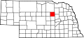
The terrain of Wheeler County consists of low rolling hills, sloping to the east. A local drainage, Beaver Creek, flows to the SE and east through the upper part of the county, exiting near the midpoint of the county's east boundary line. The county has an area of 576 square miles (1,490 km2), of which 575 square miles (1,490 km2) is land and 0.4 square miles (1.0 km2) (0.07%) is water. [6]

Major highways

Adjacent counties

Protected areas

History

Wheeler County was authorized in 1877. It was organized in 1881, following the establishment and rapid growth of the town of Cumminsville, in anticipation of a Union Pacific Railroad line through that town. Cedar City (now disbanded) was the site of the first seat of government for the county, which covered an area of 48 miles west to east and 25 miles north to south. On November 25, 1884, this area was halved, with the western portion becoming Garfield County, leaving the remainder as Wheeler County with its present boundaries.

The county's government was overseen by three commissioners, two from two districts in the more heavily populated southern half of the county, the third from the North. In 1885, the government was deemed to be outgrowing its small courthouse in Cedar City [8] and two men, Cumminsville school superintendent Begelow and Ezra Bartlett Mitchell offered land options outside of Cedar City to build a new courthouse. In a heated election, Mitchell's site was chosen over Begelow's by a vote of 193 to 90, and the new courthouse led to the establishment of a surrounding town, named Bartlett (Mitchell's middle name), to serve as the seat of government. Cedar City collapsed shortly after the government offices there were abandoned.

In 1886, a spur line of the C.B.& Q. railroad was built into the county, ending at a point where the town of Ericson was established.

In 1895, while attempting to construct a ditchway to irrigate farm land between Ericson and Spalding, a dam was built across Clear Creek. Though the ditch construction was ultimately not successful, the dam created present-day Pibel Lake.

Wheeler County's population began to wane after the turn of the 20th century, but in 1904, with the enactment of the Kinkaid Act, a new round of settlers reinvigorated the population.

Demographics

Historical population
CensusPop.Note
1880 644
1890 1,683161.3%
1900 1,362−19.1%
1910 2,29268.3%
1920 2,53110.4%
1930 2,335−7.7%
1940 2,170−7.1%
1950 1,526−29.7%
1960 1,297−15.0%
1970 1,051−19.0%
1980 1,0600.9%
1990 948−10.6%
2000 886−6.5%
2010 818−7.7%
2020 774−5.4%
2022 (est.)7851.4%
US Decennial Census [9]
1790-1960 [10] 1900-1990 [11]
1990-2000 [12] 2010 [13] 2020 2022 [14]

As of the 2000 United States Census, [15] there were 886 people, 352 households, and 243 families in the county. The population density was 1.5 people per square mile (0.58 people/km2). There were 561 housing units at an average density of 1 units per square mile (0.39/km2). The racial makeup of the county was 99.10% White, 0.23% Native American, 0.56% from other races, and 0.11% from two or more races. 0.56% of the population were Hispanic or Latino of any race. 47.4% were of German, 9.4% Irish, 7.8% English, 7.2% Swedish and 7.0% American ancestry.

There were 352 households, out of which 31.80% had children under the age of 18 living with them, 62.80% were married couples living together, 3.10% had a female householder with no husband present, and 30.70% were non-families. 29.00% of all households were made up of individuals, and 14.80% had someone living alone who was 65 years of age or older. The average household size was 2.52 and the average family size was 3.10.

The county population contained 29.10% under the age of 18, 6.40% from 18 to 24, 21.90% from 25 to 44, 25.70% from 45 to 64, and 16.80% who were 65 years of age or older. The median age was 40 years. For every 100 females there were 96.00 males. For every 100 females age 18 and over, there were 100.00 males.

The median income for a household in the county was $26,771, and the median income for a family was $33,750. Males had a median income of $21,563 versus $17,083 for females. The per capita income for the county was $14,355. About 15.40% of families and 20.90% of the population were below the poverty line, including 27.80% of those under age 18 and 16.70% of those age 65 or over.

Communities

Villages

Former communities

Politics

Wheeler County voters have been reliably Republican for decades. In no national election since 1948 has the county selected the Democratic Party candidate (as of 2020).

United States presidential election results for Wheeler County, Nebraska [16] [17]
Year Republican Democratic Third party
No.%No.%No.%
2020 43887.08%5911.73%61.19%
2016 37781.08%6213.33%265.59%
2012 34577.01%9320.76%102.23%
2008 33475.91%9621.82%102.27%
2004 36680.79%8117.88%61.32%
2000 35177.48%8518.76%173.75%
1996 24157.66%10625.36%7116.99%
1992 24653.02%8818.97%13028.02%
1988 30967.91%14130.99%51.10%
1984 36578.49%9720.86%30.65%
1980 37474.65%9318.56%346.79%
1976 27462.84%14633.49%163.67%
1972 36181.12%8418.88%00.00%
1968 32364.21%13126.04%499.74%
1964 31756.11%24843.89%00.00%
1960 42463.95%23936.05%00.00%
1956 39164.20%21835.80%00.00%
1952 45566.33%23133.67%00.00%
1948 26444.67%32755.33%00.00%
1944 39255.84%31044.16%00.00%
1940 49553.69%42746.31%00.00%
1936 35838.91%48452.61%788.48%
1932 21924.17%65872.63%293.20%
1928 53464.18%29335.22%50.60%
1924 20527.01%14519.10%40953.89%
1920 35257.52%16526.96%9515.52%
1916 16333.00%27054.66%6112.35%
1912 7014.49%19440.17%21945.34%
1908 23645.65%25248.74%295.61%
1904 18752.97%5615.86%11031.16%
1900 13842.86%18055.90%41.24%

See also

Related Research Articles

<span class="mw-page-title-main">Webster County, Nebraska</span> County in Nebraska, United States

Webster County is a county in the U.S. state of Nebraska. As of the 2020 United States Census, the population was 3,411. Its county seat is Red Cloud. The county was formed in 1871, and was named for Daniel Webster.

<span class="mw-page-title-main">Valley County, Nebraska</span> County in Nebraska, United States

Valley County is a county in the U.S. state of Nebraska. As of the 2020 United States Census, the population was 4,059. Its county seat is Ord.

<span class="mw-page-title-main">Thayer County, Nebraska</span> County in Nebraska, United States

Thayer County is a county in the U.S. state of Nebraska. As of the 2020 United States Census, the population was 5,034. Its county seat is Hebron. The county was created in 1856 and originally named Jefferson County. It was organized in 1870-1871 and renamed for General and Governor John Milton Thayer.

<span class="mw-page-title-main">Saline County, Nebraska</span> County in Nebraska, United States

Saline County is a county in the U.S. state of Nebraska. As of the 2020 United States Census, the population was 14,292. Its county seat is Wilber.

<span class="mw-page-title-main">Pierce County, Nebraska</span> County in Nebraska, United States

Pierce County is a county in the U.S. state of Nebraska. As of the 2020 United States Census, the population was 7,317. Its county seat is Pierce. The county was formed in 1859, and was named for US President Franklin Pierce.

<span class="mw-page-title-main">Nuckolls County, Nebraska</span> County in Nebraska, United States

Nuckolls County is a county located in the U.S. state of Nebraska. As of the 2020 United States Census, the population was 4,095. Its county seat is Nelson.

<span class="mw-page-title-main">Madison County, Nebraska</span> County in Nebraska, United States

Madison County is a county in the U.S. state of Nebraska. As of the 2020 United States Census, the population was 35,585. Its county seat is Madison and its largest city is Norfolk. Madison County was likely named for Madison, Wisconsin, which is where many of the county’s residents came from; the city was named for James Madison, fourth President of the United States.

<span class="mw-page-title-main">Jefferson County, Nebraska</span> County in Nebraska, United States

Jefferson County is a county in the U.S. state of Nebraska. As of the 2020 United States Census, the population was 7,240. Its county seat is Fairbury. The county was named for Thomas Jefferson, third President of the United States of America.

<span class="mw-page-title-main">Howard County, Nebraska</span> County in Nebraska, United States

Howard County is a county in the state of Nebraska. As of the 2020 United States Census, the population was 6,475. Its county seat is St. Paul. The county was formed in 1871 and named after Civil War General Oliver Otis Howard.

<span class="mw-page-title-main">Greeley County, Nebraska</span> County in Nebraska, United States

Greeley County is a county in the U.S. state of Nebraska. As of the 2020 census, the population was 2,188. Its county seat is Greeley.

<span class="mw-page-title-main">Frontier County, Nebraska</span> County in Nebraska, United States

Frontier County is a county in the U.S. state of Nebraska. As of the 2020 United States Census, the population was 2,519. Its county seat is Stockville.

<span class="mw-page-title-main">Franklin County, Nebraska</span> County in Nebraska, United States

Franklin County is a county in the U.S. state of Nebraska. As of the 2020 census, the population was 2,889. Its county seat is Franklin. The county was formed in 1867 and organized in 1871. It was named for Benjamin Franklin.

<span class="mw-page-title-main">Cuming County, Nebraska</span> County in Nebraska, United States

Cuming County is a county in the U.S. state of Nebraska. As of the 2020 United States Census, the population was 9,013. Its county seat is West Point.

<span class="mw-page-title-main">Cedar County, Nebraska</span> County in Nebraska, United States

Cedar County is a county in the U.S. state of Nebraska. As of the 2020 United States Census, the population was 8,380. The county seat is Hartington. The county was formed in 1857, and was named for the Cedar tree groves in the area.

<span class="mw-page-title-main">Boone County, Nebraska</span> County in Nebraska, United States

Boone County is a county in the U.S. state of Nebraska. As of the 2020 United States Census, the population was 5,386. Its county seat is Albion. The county was organized in 1871 and named after Daniel Boone.

<span class="mw-page-title-main">Antelope County, Nebraska</span> County in Nebraska, United States

Antelope County is a county located in the U.S. state of Nebraska. As of the 2020 United States Census, the population was 6,295. Its county seat is Neligh. The county was formed in 1871. It received its name after a group of early settlers killed and ate several pronghorn. Although these are not true antelope, they are colloquially known by that name.

<span class="mw-page-title-main">Cherokee County, Iowa</span> County in Iowa, United States

Cherokee County is a county located in the U.S. state of Iowa. As of the 2020 census, the population was 11,658. The county seat is Cherokee. The county was formed on January 15, 1851, from open territory. It was named after the Cherokee people.

<span class="mw-page-title-main">Hartington, Nebraska</span> City in Nebraska, United States

Hartington is a city in Cedar County, Nebraska, United States. The population was 1,514 at the 2020 census.

<span class="mw-page-title-main">Bartlett, Nebraska</span> Village in and county seat of Wheeler County, Nebraska, United States

Bartlett is a village in, and the county seat of, Wheeler County, Nebraska, United States. The population was 117 at the 2010 census.

<span class="mw-page-title-main">Ericson, Nebraska</span> Village in Wheeler County, Nebraska, United States

Ericson is a village in Wheeler County, Nebraska, United States. The population was 92 at the 2010 census.

References

  1. "Wheeler County, Nebraska". United States Census Bureau . Retrieved June 24, 2023.
  2. "Find a County". National Association of Counties. Retrieved June 7, 2011.
  3. Fitzpatrick, Lilian Linder (1925). Nebraska Place-Names. Lincoln: University of Nebraska Studies in Language, Literature, and Criticism. p. 145. Retrieved December 17, 2014.
  4. Andreas, A. T. (1882). "Andreas' History of the State of Nebraska". The Kansas Collection. Archived from the original on May 10, 2003. Retrieved December 17, 2014.
  5. "Wheeler County". Nebraska Association of County Officials. Retrieved December 17, 2014.
  6. "2010 Census Gazetteer Files". US Census Bureau. August 22, 2012. Archived from the original on November 13, 2013. Retrieved December 12, 2014.
  7. Pibel Lake, Wheeler County NE Google Maps (accessed 24 January 2019)
  8. (Cedar City plat, showing "Court Square" as the central focus of the development's layout (accessed January 24, 2019)]
  9. "U.S. Decennial Census". US Census Bureau. Retrieved December 12, 2014.
  10. "Historical Census Browser". University of Virginia Library. Retrieved December 12, 2014.
  11. "Population of Counties by Decennial Census: 1900 to 1990". US Census Bureau. Retrieved December 12, 2014.
  12. "Census 2000 PHC-T-4. Ranking Tables for Counties: 1990 and 2000" (PDF). US Census Bureau. Archived (PDF) from the original on March 27, 2010. Retrieved December 12, 2014.
  13. "QuickFacts: Wheeler County, Nebraska". www.census.gov. United States Census Bureau . Retrieved June 3, 2023.
  14. "State & County QuickFacts". United States Census Bureau. Archived from the original on June 7, 2011. Retrieved September 22, 2013.
  15. "U.S. Census website". US Census Bureau. Retrieved January 31, 2008.
  16. Election Results
  17. The leading "other" candidate, Progressive Theodore Roosevelt, received 179 votes, while Socialist candidate Eugene Debs received 37 votes and Prohibition Eugene Chafin received 3 votes.

41°55′N98°32′W / 41.92°N 98.53°W / 41.92; -98.53