
U.S. Highway 26 is an east–west United States Numbered Highway that runs from Seaside, Oregon, to Ogallala, Nebraska. When the U.S. Numbered Highway System was first defined, it was limited to Nebraska and Wyoming; by the 1950s, it continued into Idaho and Oregon. The highway's eastern terminus is in Ogallala at an intersection with Interstate 80 (I-80). Its western terminus is south of Seaside at an intersection with US 101. Prior to 2004, the route's last 20 miles (32 km) were cosigned with US 101 from the highways' junction south of Seaside north to Astoria where its intersection with US 30 was also US 30's western terminus. Long segments of the highway follow the historic Oregon Trail. At its peak, immediately before the establishment of the Interstate Highway System, US 26 was 1,557 miles (2,506 km) in length and terminated in Astoria.

State Trunk Highway 33 is a Wisconsin state highway running east–west across central Wisconsin. It is 200.84 miles (323.22 km) in length.
The International Selkirk Loop is a 280-mile-long (450 km) scenic highway in the U.S. states of Idaho and Washington, as well as the Canadian province of British Columbia. The loop encircles the Selkirk Mountain Range, and offers several side trips aside from the main route. Included on the loop is the Kootenay Lake Ferry, the longest free ferry in the world. The portion of the loop in the United States has been designated an All-American Road by the United States Department of Transportation.

North Carolina Highway 58 (NC 58) is a primary state highway in the U.S. state of North Carolina that traverses the state's Coastal Plain. The route links many of the Crystal Coast communities along its eastern segment. Its southern terminus is at the visitor center parking lot for Fort Macon State Park in Atlantic Beach and its northern terminus is at the intersection of US 401 and US 158 Business in Warrenton. The highway traverses nearly the entire length of the Bogue Banks and serves the major cities of Kinston, Snow Hill, and Wilson.

State Trunk Highway 72 is a 29.44-mile (47.38 km) state highway state highway in Pierce and Dunn counties in Wisconsin, United States. It runs in west central Wisconsin from US Highway 10 (US 10) and US 63 east of Ellsworth east to WIS 25 in Downsville. The road is maintained by the Wisconsin Department of Transportation (WisDOT).

Nebraska Highway 12 is a highway in northern and northeastern Nebraska. It has a western terminus at U.S. Highway 83 in Valentine and an eastern terminus at U.S. Highway 20 west of Jackson. The highway largely lies within 10 miles (16 km) of the South Dakota border its entire length. The highway has been designated the Outlaw Trail Scenic Byway.

In Oklahoma, U.S. Highway 62 (US 62) runs diagonally across the state, from the Texas state line in far southwestern Oklahoma to the Arkansas state line near Fayetteville. US-62 spends a total of 402.48 miles (647.73 km) in the Sooner State. The highway passes through fifteen of Oklahoma's counties. Along the way the route serves two of Oklahoma's largest cities, Lawton and Oklahoma City, as well as many regionally important cities, like Altus, Chickasha, Muskogee, and Tahlequah. Despite this, US-62 has no lettered spur routes like many other U.S. routes in Oklahoma do.

Nebraska Highway 84 is a highway in the northeastern part of the U.S. state of Nebraska. Its western terminus is at Nebraska Highway 14 in Verdigre. Its eastern terminus is at an intersection with Nebraska Highway 15 east of Hartington.

Nebraska Highway 97 is a highway in western Nebraska. It has a southern terminus north of North Platte at an intersection with U.S. Highway 83. The northern terminus is at U.S. Highway 20 in Valentine.

Nebraska Highway 89 is a highway in southern Nebraska. Its western terminus is at U.S. Highway 83 west of Danbury. Its eastern terminus is at an intersection with U.S. Highway 183 south of Alma.

Nebraska Highway 103 is a highway in southeastern Nebraska. It is a discontinuous highway with two segments. The southern segment begins at Nebraska Highway 8 south of Diller and ends at U.S. Highway 136 north of Diller. The northern segment begins at Nebraska Highway 4 east of Plymouth and ends at Interstate 80 north of Pleasant Dale.

Nebraska Highway 105 (N-105) is a 32.85-mile (52.87 km) state highway in Richardson, Pawnee, and Nemaha counties in Nebraska, United States. Its southern terminus is at an intersection with Nebraska Highway 8 south of Humboldt. Its northern terminus is at an intersection with Nebraska Highway 67 west of Brock.

Nebraska Highway 121 is a highway in northeastern Nebraska. It is a discontinuous highway with three segments:
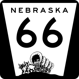
Nebraska Highway 66 is a highway in central and eastern Nebraska. It is a discontinuous highway with four segments heading in a west-to-east direction. The first segment begins at Nebraska Highway 14 south of Central City and ends at U.S. Highway 81 south of Stromsburg. The second segment begins at Nebraska Highway 15 west of Dwight and ends at Nebraska Highway 79 in Valparaiso. The third segment begins at U.S. Highway 77 south of Wahoo and ends at Main Street in Louisville. The fourth and final segment begins at the intersection with Walnut Street and Koop Avenue in Louisville, and ends at U.S. Highway 34 and U.S. Highway 75 west of Plattsmouth.
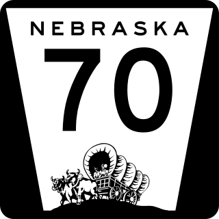
Nebraska Highway 70 is a highway in central Nebraska. Its western terminus is at an intersection with Nebraska Highway 2 and Nebraska Highway 92 east of Broken Bow. Its eastern terminus is at Nebraska Highway 14 in Elgin.
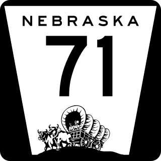
Nebraska Highway 71 is a highway in western Nebraska. Its southern terminus is at the Colorado border south of Kimball, as a continuation of Colorado State Highway 71. Its northern terminus is at the South Dakota border northwest of Crawford, where it continues as South Dakota Highway 71.
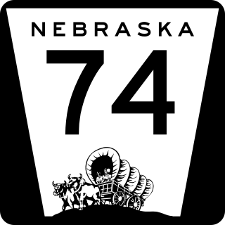
Nebraska Highway 74 is a highway in southern Nebraska. Its western terminus is at an intersection with Nebraska Highway 10 in Minden. Its eastern terminus is at an intersection with Nebraska Highway 15 east of Tobias.

U.S. Highway 24 (US-24) in the state of Kansas runs east–west across the northern half of the state for 435.95 miles (701.59 km). The route mostly connects rural communities across the High Plains of Kansas, while also later providing an Interstate alternate between Topeka, Lawrence, and Kansas City. US-24 both enters and exits the state running concurrently with Interstate 70 (I-70). Along with US-40, the road has largely been replaced by the more modern Interstate in its functionality as a long-distance route.

U.S. Route 20 (US 20) runs its easternmost 153 miles (246 km) in the U.S. state of Massachusetts. The highway crosses the state border from New Lebanon, New York, into Hancock and runs eastward to Boston, where it ends at Route 2 in Kenmore Square. It spends the vast majority of its journey paralleling I-90, which has largely superseded US 20 for through travel. Still, US 20 directly serves many towns and local business areas which the turnpike bypasses.

State Route 141 is an east–west highway in Middle Tennessee. The road begins southeast of Westmoreland and ends in Silver Point. The current length is 67.0 mi (107.8 km).

