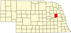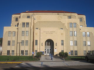
Colfax County | |
---|---|
Coordinates: 41°35′N97°05′W / 41.58°N 97.09°W | |
Country | United States |
State | Nebraska |
Founded | 1869 |
Named for | Schuyler Colfax |
Seat | Schuyler |
Largest city | Schuyler |
Area | |
• Total | 417 sq mi (1,080 km2) |
• Land | 412 sq mi (1,070 km2) |
• Water | 4.9 sq mi (13 km2) 1.2% |
Population (2020) | |
• Total | 10,582 |
• Density | 25/sq mi (9.8/km2) |
Time zone | UTC−6 (Central) |
• Summer (DST) | UTC−5 (CDT) |
Congressional district | 1st |
Website | www |
Colfax County is a county in the U.S. state of Nebraska. As of the 2020 United States Census, the population was 10,582. [1] Its county seat is Schuyler. [2] The county and its seat are named after US Vice President (1869-1873) Schuyler Colfax. [3]
In the Nebraska license plate system, Colfax County is represented by the prefix 43 (it had the 43rd largest number of vehicles registered in the county when the license plate system was established in 1922).
Colfax County was established by the Nebraska legislature in 1869, as part of the division of Platte County into three parts. The new county was named for Schuyler Colfax, then the vice-president of the United States. The site of Shell Creek Station on the Union Pacific Railroad was chosen as the county seat, and renamed Schuyler also after Colfax. [4] Schuyler was incorporated in 1870, and the county's first courthouse was constructed in 1872. [5] [6]
Colfax County in May 2020 had the sixth-highest per capita COVID-19 infection rate of any American county. About one of every 23 residents has tested positive, with 467 cases. [7] As of October 2020, one in every 13 residents has tested positive, with 798 cases. [8]
According to the US Census Bureau, the county has an area of 417 square miles (1,080 km2), of which 412 square miles (1,070 km2) is land and 4.9 square miles (13 km2) (1.2%) is water. [9]
Census | Pop. | Note | %± |
---|---|---|---|
1870 | 1,424 | — | |
1880 | 6,588 | 362.6% | |
1890 | 10,453 | 58.7% | |
1900 | 11,211 | 7.3% | |
1910 | 11,610 | 3.6% | |
1920 | 11,624 | 0.1% | |
1930 | 11,434 | −1.6% | |
1940 | 10,627 | −7.1% | |
1950 | 10,010 | −5.8% | |
1960 | 9,595 | −4.1% | |
1970 | 9,498 | −1.0% | |
1980 | 9,890 | 4.1% | |
1990 | 9,139 | −7.6% | |
2000 | 10,441 | 14.2% | |
2010 | 10,515 | 0.7% | |
2020 | 10,582 | 0.6% | |
US Decennial Census [10] 1790-1960 [11] 1900-1990 [12] 1990-2000 [13] 2010 [14] |
Race / Ethnicity | Pop 2000 [15] | Pop 2010 [16] | Pop 2020 [17] | % 2000 | % 2010 | % 2020 |
---|---|---|---|---|---|---|
White alone (NH) | 7,617 | 6,031 | 5,018 | 72.95% | 57.36% | 47.42% |
Black or African American alone (NH) | 5 | 49 | 375 | 0.05% | 0.47% | 3.54% |
Native American or Alaska Native alone (NH) | 17 | 33 | 26 | 0.16% | 0.31% | 0.25% |
Asian alone (NH) | 14 | 24 | 50 | 0.13% | 0.23% | 0.47% |
Pacific Islander alone (NH) | 3 | 4 | 2 | 0.03% | 0.04% | 0.02% |
Some Other Race alone (NH) | 11 | 17 | 16 | 0.11% | 0.16% | 0.15% |
Mixed Race/Multi-Racial (NH) | 42 | 42 | 102 | 0.4% | 0.4% | 0.96% |
Hispanic or Latino (any race) | 2,732 | 4,315 | 4,993 | 26.17% | 41.04% | 47.18% |
Total | 10,441 | 10,515 | 10,582 | 100.00% | 100.00% | 100.00% |
As of the 2000 United States census, [18] there were 10,441 people, 3,682 households, and 2,592 families in the county. The population density was 25 people per square mile (9.7 people/km2). There were 4,088 housing units at an average density of 10 units per square mile (3.9/km2). The racial makeup of the county was 81.73% White, 0.07% Black or African American, 0.19% Native American, 0.20% Asian, 0.14% Pacific Islander, 15.94% from other races, and 1.73% from two or more races. 26.17% of the population were Hispanic or Latino of any race. 28.8% were of German and 24.2% Czech ancestry.
The 2020 United States census said that the county was 47.4% non-Hispanic white, 3.5% black African-American, .5% Asian and 47.2% Hispanic.
There were 3,682 households, out of which 35.60% had children under the age of 18 living with them, 58.90% were married couples living together, 7.10% had a female householder with no husband present, and 29.60% were non-families. 25.70% of all households were made up of individuals, and 15.40% had someone living alone who was 65 years of age or older. The average household size was 2.80 and the average family size was 3.31.
The county population contained 28.90% under the age of 18, 8.50% from 18 to 24, 27.90% from 25 to 44, 18.70% from 45 to 64, and 16.00% who were 65 years of age or older. The median age was 35 years. For every 100 females there were 106.40 males. For every 100 females age 18 and over, there were 105.70 males.
The median income for a household in the county was $35,849, and the median income for a family was $40,936. Males had a median income of $25,656 versus $20,485 for females. The per capita income for the county was $15,148. About 7.20% of families and 10.80% of the population were below the poverty line, including 13.80% of those under age 18 and 7.90% of those age 65 or over.
Colfax County voters are reliably Republican. In only one national election since 1936 did the county select the Democratic Party candidate.
Year | Republican | Democratic | Third party(ies) | |||
---|---|---|---|---|---|---|
No. | % | No. | % | No. | % | |
2024 | 2,636 | 74.91% | 845 | 24.01% | 38 | 1.08% |
2020 | 2,636 | 70.75% | 1,025 | 27.51% | 65 | 1.74% |
2016 | 2,171 | 67.55% | 859 | 26.73% | 184 | 5.72% |
2012 | 2,051 | 66.83% | 969 | 31.57% | 49 | 1.60% |
2008 | 2,018 | 63.00% | 1,125 | 35.12% | 60 | 1.87% |
2004 | 2,589 | 71.26% | 990 | 27.25% | 54 | 1.49% |
2000 | 2,338 | 70.53% | 863 | 26.03% | 114 | 3.44% |
1996 | 1,954 | 55.23% | 1,065 | 30.10% | 519 | 14.67% |
1992 | 1,915 | 46.21% | 1,011 | 24.40% | 1,218 | 29.39% |
1988 | 2,329 | 59.75% | 1,542 | 39.56% | 27 | 0.69% |
1984 | 2,999 | 74.68% | 981 | 24.43% | 36 | 0.90% |
1980 | 3,259 | 73.17% | 893 | 20.05% | 302 | 6.78% |
1976 | 2,364 | 57.34% | 1,666 | 40.41% | 93 | 2.26% |
1972 | 2,799 | 71.66% | 1,107 | 28.34% | 0 | 0.00% |
1968 | 2,264 | 64.48% | 932 | 26.55% | 315 | 8.97% |
1964 | 1,972 | 47.19% | 2,207 | 52.81% | 0 | 0.00% |
1960 | 2,504 | 55.91% | 1,975 | 44.09% | 0 | 0.00% |
1956 | 2,843 | 65.07% | 1,526 | 34.93% | 0 | 0.00% |
1952 | 3,332 | 69.56% | 1,458 | 30.44% | 0 | 0.00% |
1948 | 1,928 | 50.41% | 1,897 | 49.59% | 0 | 0.00% |
1944 | 2,314 | 51.51% | 2,178 | 48.49% | 0 | 0.00% |
1940 | 2,587 | 52.28% | 2,361 | 47.72% | 0 | 0.00% |
1936 | 1,644 | 32.39% | 3,210 | 63.25% | 221 | 4.35% |
1932 | 648 | 13.56% | 4,076 | 85.29% | 55 | 1.15% |
1928 | 1,432 | 34.14% | 2,746 | 65.47% | 16 | 0.38% |
1924 | 1,450 | 39.02% | 1,293 | 34.80% | 973 | 26.18% |
1920 | 1,992 | 66.29% | 957 | 31.85% | 56 | 1.86% |
1916 | 897 | 34.78% | 1,628 | 63.13% | 54 | 2.09% |
1912 | 620 | 29.52% | 998 | 47.52% | 482 | 22.95% |
1908 | 1,159 | 46.68% | 1,267 | 51.03% | 57 | 2.30% |
1904 | 1,180 | 53.03% | 768 | 34.52% | 277 | 12.45% |
1900 | 1,033 | 42.63% | 1,357 | 56.00% | 33 | 1.36% |
Colfax County is a county in the U.S. state of New Mexico. As of the 2020 census, the population was 12,387. Its county seat is Raton. It is south from the Colorado state line. This county was named for Schuyler Colfax (1823–1885), seventeenth Vice President of the United States under U.S. President Ulysses S. Grant.
Saunders County is a county in the U.S. state of Nebraska. As of the 2020 United States Census, the population was 22,278. Its county seat is Wahoo.
Platte County is a county located in the U.S. state of Nebraska. As of the 2020 United States Census, the population was 34,296. Its county seat is Columbus. The county was created in 1855.
Douglas County is a county located in the U.S. state of Nebraska. As of the 2020 United States Census, the population is 584,526. It is the state's most populous county, home to just under 30% of Nebraska's residents. Its county seat is Omaha, the state's largest city. The county was established in 1854 and named after Stephen A. Douglas (1813–1861), who was then serving as a U.S. senator from Illinois.
Dodge County is a county in the U.S. state of Nebraska. As of the 2020 United States Census, the population was 37,167. Its county seat is Fremont. The county was formed in 1855 and named after Iowa Senator Augustus C. Dodge.
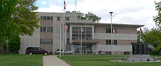
Cuming County is a county in the U.S. state of Nebraska. As of the 2020 United States Census, the population was 9,013. Its county seat is West Point. In the Nebraska license plate system, Cuming County is represented by the prefix 24 since it had the 24th largest number of vehicles registered in the state when the license plate system was established in 1922.
Cass County is a county in the U.S. state of Nebraska. As of the 2020 United States Census, the population was 26,598. Its county seat and largest city is Plattsmouth. The county was formed in 1855, and was named for General Lewis Cass, an American military officer, politician, and statesman.
Buffalo County is a county located in the U.S. state of Nebraska in the Midwestern United States. As of the 2020 United States Census, the population was 50,084, making it Nebraska's fifth-most populous county. Its county seat is Kearney. The county was created in 1855 and was organized in 1870. It was named after the once-prevalent bison herds of the Great Plains.
Page County is a county located in the U.S. state of Iowa. As of the 2020 census, the population was 15,211. The county seat is Clarinda. The county is named in honor of Captain John Page of the 4th U.S. Infantry, who was mortally wounded in the Battle of Palo Alto.
Colfax is a town in Perry Township, Clinton County, Indiana, United States. The population was 691 at the 2010 census. The town was originally known as Midway since it was a half-way point on the IC&L Railroad between Chicago & Louisville. Railways intersected North/South & East/West making Colfax a popular transfer destination. The town was renamed to honor Vice President Schuyler Colfax in 1857.
Colfax is a city in Jasper County, Iowa, United States. Colfax is located approximately 24 miles east of Des Moines. The town was founded in 1866, and was named after Schuyler Colfax, vice president under Ulysses S. Grant. The population was 2,255 at the time of the 2020 census. Newton is the county seat; both were named after Revolutionary War soldiers.
Colfax Township is a township in Kandiyohi County, Minnesota, United States. The population was 557 at the 2000 census.
Elm Creek is a village in Buffalo County, Nebraska, United States. It is part of the Kearney, Nebraska Micropolitan Statistical Area. The population was 979 at the 2020 census.
Clarkson is a city in Colfax County, Nebraska, United States. The population was 658 at the 2010 census.
Howells is a village in Colfax County, Nebraska, United States. The population was 561 at the 2010 census.
Rogers is a village in Colfax County, Nebraska, United States. The population was 95 at the 2010 census.
Schuyler is a city in Colfax County, Nebraska, United States. The population was 6,211 at the 2010 census. It is the county seat of Colfax County. The city is named after former Vice President of the United States, Schuyler Colfax.
Dix is a village in Kimball County, Nebraska, United States. The population was 187 at the 2020 census.
Newman Grove is a city in Madison and Platte counties in Nebraska, United States. The population was 667 at the 2020 census.
Colfax is a village in Dunn County, Wisconsin, United States. The population was 1,182 at the 2020 census. The village is surrounded by the Town of Colfax.