Pawnee County, Nebraska

Last updated

Pawnee County
Pawnee County, Nebraska courthouse from NW 1.JPG
Pawnee County Courthouse in Pawnee City
Map of Nebraska highlighting Pawnee County.svg
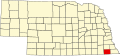
Location within the U.S. state of Nebraska
Nebraska in United States.svg
Nebraska's location within the U.S.
Coordinates: 40°08′N96°14′W / 40.13°N 96.24°W / 40.13; -96.24
CountryFlag of the United States.svg United States
StateFlag of Nebraska.svg  Nebraska
Founded1854
Named for Pawnee people
Seat Pawnee City
Largest cityPawnee City
Area
  Total433 sq mi (1,120 km2)
  Land431 sq mi (1,120 km2)
  Water1.9 sq mi (5 km2)  0.4%
Population
 (2020)
  Total2,544
  Density5.9/sq mi (2.3/km2)
Time zone UTC−6 (Central)
  Summer (DST) UTC−5 (CDT)
Congressional district 3rd

Pawnee County is a county in the U.S. state of Nebraska. As of the 2020 United States Census, the population was 2,544. [1] Its county seat is Pawnee City. [2]

Contents

In the Nebraska license plate system, Pawnee County is represented by the prefix 54 (it had the fifty-fourth-largest number of vehicles registered in the county when the license plate system was established in 1922).

History

Pawnee County was formed in 1854. [3] It was named for the Pawnee Native American tribe. [4]

On May 30, 1879, the "Irving, Kansas Tornado" passed through Pawnee County. This tornado measured F4 on the Fujita scale, and had a damage path 800 yards wide and 100 miles. [5]

Geography

Pawnee County lies on the south line of Nebraska. Its south boundary line abuts the north boundary line of the state of Kansas. The Big Nemaha River flows southeastward through the NE corner of the county, and smaller local drainages flow upward through the county to discharge into the Big Nemaha. The county's terrain consists of rolling hills, with its planar areas largely devoted to agriculture. [6] The county has an area of 433 square miles (1,120 km2), of which 431 square miles (1,120 km2) is land and 1.9 square miles (4.9 km2) (0.4%) is water. [7]

Major highways

Adjacent counties

Protected areas

  • Bowwood State Wildlife Management Area [8]
  • Burchard State Wildlife Management Area [9]
  • Mayberry State Wildlife Management Area [10]
  • Pawnee Prairie State Wildlife Management Area [11]
  • Prairie Knoll State Wildlife Management Area [12]
  • Table Rock State Wildlife Management Area [13]

Demographics

Historical population
CensusPop.Note
1860 882
1870 4,171372.9%
1880 6,92065.9%
1890 10,34049.4%
1900 11,77013.8%
1910 10,582−10.1%
1920 9,578−9.5%
1930 9,423−1.6%
1940 8,514−9.6%
1950 6,744−20.8%
1960 5,356−20.6%
1970 4,473−16.5%
1980 3,937−12.0%
1990 3,317−15.7%
2000 3,087−6.9%
2010 2,773−10.2%
2020 2,544−8.3%
2022 (est.)2,528−0.6%
US Decennial Census [14]
1790-1960 [15] 1900-1990 [16]
1990-2000 [17] 2010 [18] 2020 [1] 2022 [19]

As of the 2000 United States Census, [20] there were 3,087 people, 1,339 households, and 850 families in the county. The population density was 7 people per square mile (2.7 people/km2). There were 1,587 housing units at an average density of 4 units per square mile (1.5/km2). The racial makeup of the county was 98.87% White, 0.19% Native American, 0.26% Asian, 0.03% from other races, and 0.65% from two or more races. 0.68% of the population were Hispanic or Latino of any race.

There were 1,339 households, out of which 24.40% had children under the age of 18 living with them, 54.80% were married couples living together, 5.60% had a female householder with no husband present, and 36.50% were non-families. 32.90% of all households were made up of individuals, and 20.20% had someone living alone who was 65 years of age or older. The average household size was 2.27 and the average family size was 2.86.

The county population contained 22.70% under the age of 18, 5.10% from 18 to 24, 21.00% from 25 to 44, 24.20% from 45 to 64, and 27.10% who were 65 years of age or older. The median age was 46 years. For every 100 females there were 92.50 males. For every 100 females age 18 and over, there were 91.30 males.

The median income for a household in the county was $29,000, and the median income for a family was $36,326. Males had a median income of $24,770 versus $17,976 for females. The per capita income for the county was $16,687. About 6.80% of families and 11.00% of the population were below the poverty line, including 13.60% of those under age 18 and 11.80% of those age 65 or over.

Communities

Cities

Villages

Politics

Pawnee County voters have been Republican-leaning for decades. In no national election since 1936 has the county selected a Democratic Party candidate.

United States presidential election results for Pawnee County, Nebraska [21]
Year Republican Democratic Third party
No.%No.%No.%
2020 1,07174.95%32222.53%362.52%
2016 97473.40%27921.02%745.58%
2012 89967.04%40029.83%423.13%
2008 85962.07%48334.90%423.03%
2004 98666.49%48132.43%161.08%
2000 93761.69%52234.36%603.95%
1996 76648.82%58036.97%22314.21%
1992 67037.06%56631.31%57231.64%
1988 97555.46%76743.63%160.91%
1984 1,30669.32%55229.30%261.38%
1980 1,41871.15%43121.63%1447.23%
1976 99052.86%84545.11%382.03%
1972 1,29971.26%52428.74%00.00%
1968 1,20960.30%58329.08%21310.62%
1964 1,16651.21%1,11148.79%00.00%
1960 1,72863.13%1,00936.87%00.00%
1956 1,83064.17%1,02235.83%00.00%
1952 2,43275.02%81024.98%00.00%
1948 1,72557.58%1,27142.42%00.00%
1944 2,25463.87%1,27536.13%00.00%
1940 2,64362.35%1,59637.65%00.00%
1936 2,07447.09%2,29752.16%330.75%
1932 1,56836.90%2,64162.16%400.94%
1928 2,82564.29%1,54735.21%220.50%
1924 2,14755.85%1,36535.51%3328.64%
1920 2,51069.88%97227.06%1103.06%
1916 1,22849.66%1,17147.35%742.99%
1912 59325.06%95840.49%81534.45%
1908 1,46854.94%1,11541.73%893.33%
1904 1,73968.38%56222.10%2429.52%
1900 1,63256.90%1,12139.09%1154.01%

See also

Related Research Articles

<span class="mw-page-title-main">Clay County, Nebraska</span> County in Nebraska, United States

Clay County is a county in the U.S. state of Nebraska. As of the 2020 United States Census, the population was 6,104. Its county seat is Clay Center. The county was formed in 1855, and was organized in 1871. It was named for Henry Clay, a member of the United States Senate from Kentucky, who went on to become United States Secretary of State.

<span class="mw-page-title-main">Lancaster County, Nebraska</span> County in Nebraska, United States

Lancaster County is a county located in the U.S. state of Nebraska. As of the 2020 United States Census, the population was 322,608, making it the second-most populous county in Nebraska. Its county seat is Lincoln, the state capital. The county was created in 1859.

<span class="mw-page-title-main">York County, Nebraska</span> County in Nebraska, United States

York County is a county in the U.S. state of Nebraska. As of the 2020 United States Census, the population was 14,125. Its county seat is York.

<span class="mw-page-title-main">Webster County, Nebraska</span> County in Nebraska, United States

Webster County is a county in the U.S. state of Nebraska. As of the 2020 United States Census, the population was 3,411. Its county seat is Red Cloud. The county was formed in 1871, and was named for Daniel Webster.

<span class="mw-page-title-main">Thayer County, Nebraska</span> County in Nebraska, United States

Thayer County is a county in the U.S. state of Nebraska. As of the 2020 United States Census, the population was 5,034. Its county seat is Hebron. The county was created in 1856 and originally named Jefferson County. It was organized in 1870-1871 and renamed for General and Governor John Milton Thayer.

<span class="mw-page-title-main">Stanton County, Nebraska</span> County in Nebraska, United States

Stanton County is a county in the U.S. state of Nebraska. As of the 2020 United States Census, the population was 5,842. Its county seat is Stanton. The county was formed in 1856 and organized in 1867. It was first called Izard County until 1862, when it was renamed for Edwin M. Stanton, Secretary of War during the administration of President Abraham Lincoln.

<span class="mw-page-title-main">Seward County, Nebraska</span> County in Nebraska, United States

Seward County is a county in the U.S. state of Nebraska, United States. As of the 2020 United States Census, the population was 17,609. Its county seat is Seward. The county was formed in 1855, and was organized in 1867. It was originally called Greene County, and in 1862 it was renamed for William H. Seward, Secretary of State under Abraham Lincoln and Andrew Johnson. Seward County is part of the Lincoln, NE Metropolitan Statistical Area.

<span class="mw-page-title-main">Saunders County, Nebraska</span> County in Nebraska, United States

Saunders County is a county in the U.S. state of Nebraska. As of the 2020 United States Census, the population was 22,278. Its county seat is Wahoo.

<span class="mw-page-title-main">Richardson County, Nebraska</span> County in Nebraska, United States

Richardson County is the easternmost county in the U.S. state of Nebraska. As of the 2020 census, the population was 7,871. Its county seat is Falls City.

<span class="mw-page-title-main">Red Willow County, Nebraska</span> County in Nebraska, United States

Red Willow County is a county located in the U.S. state of Nebraska. As of the 2020 United States Census, the population was 10,702. Its county seat is McCook.

<span class="mw-page-title-main">Phelps County, Nebraska</span> County in Nebraska, United States

Phelps County is a county in the U.S. state of Nebraska. As of the 2020 United States Census, the population was 8,968. Its county seat is Holdrege. The county was formed in 1873, and was named for William Phelps (1808–1889), a steamboat captain and early settler.

<span class="mw-page-title-main">Nemaha County, Nebraska</span> County in Nebraska, United States

Nemaha County is a county in the U.S. state of Nebraska. As of the 2020 United States Census, the population was 7,074. Its county seat is Auburn.

<span class="mw-page-title-main">Lincoln County, Nebraska</span> County in Nebraska, United States

Lincoln County is a county located in the U.S. state of Nebraska. As of the 2020 census, the population was 34,676. Its county seat is North Platte. Despite the county's name, the state capital city of Lincoln is not in or near Lincoln County.

<span class="mw-page-title-main">Harlan County, Nebraska</span> County in Nebraska, United States

Harlan County is a county in the U.S. state of Nebraska. As of the 2020 United States Census, the population was 3,073. Its county seat is Alma. The county is home to the Harlan County Reservoir.

<span class="mw-page-title-main">Hamilton County, Nebraska</span> County in Nebraska, United States

Hamilton County is a county in the U.S. state Nebraska. As of the 2020 United States Census, the population was 9,429. Its county seat is Aurora. The county was named for Alexander Hamilton, the first Secretary of the Treasury in the new United States government.

<span class="mw-page-title-main">Hall County, Nebraska</span> County in Nebraska, United States

Hall County is a county in the U.S. state of Nebraska. As of the 2020 United States Census, the population was 62,895, making it Nebraska's fourth-most populous county. Its county seat is Grand Island. The county was formed in 1858; it was named for Augustus Hall, an early judge of this territory.

<span class="mw-page-title-main">Gage County, Nebraska</span> County in Nebraska, United States

Gage County is a county in the U.S. state of Nebraska. As of the 2020 United States Census, the population was 21,704. Its county seat is Beatrice. The county was created in 1855 and organized in 1857. It was formed from land taken from the Otoe in an 1854 treaty. The county was named for William D. Gage, a Methodist minister who served as the first chaplain of the Nebraska Territorial Legislature.

<span class="mw-page-title-main">Dawson County, Nebraska</span> County in Nebraska, United States

Dawson County is a county in the U.S. state of Nebraska. As of the 2020 United States Census, the population was 24,111. Its county seat is Lexington.

<span class="mw-page-title-main">Cedar County, Nebraska</span> County in Nebraska, United States

Cedar County is a county in the U.S. state of Nebraska. As of the 2020 United States Census, the population was 8,380. The county seat is Hartington. The county was formed in 1857, and was named for the Cedar tree groves in the area.

<span class="mw-page-title-main">Nemaha County, Kansas</span> County in Kansas, United States

Nemaha County is a county located in the northeastern part of the U.S. state of Kansas. Its county seat is Seneca. As of the 2020 census, the county population was 10,273. The county was named for the Nemaha River.

References

  1. 1 2 "Pawnee County, Nebraska". United States Census Bureau . Retrieved June 19, 2023.
  2. "Find a County". National Association of Counties. Archived from the original on May 31, 2011. Retrieved June 7, 2011.
  3. "Pawnee County". Archived from the original on July 4, 2008. Retrieved March 30, 2010.
  4. Swanton, John Reed (1952). The Indian Tribes of North America. US Government Printing Office. p. 290. ISBN   978-0-8063-1730-4.
  5. "File Not Found". www.kansas.net. Retrieved March 14, 2008.
  6. "Pawnee County · Nebraska". Pawnee County · Nebraska.
  7. "2010 Census Gazetteer Files". US Census Bureau. August 22, 2012. Archived from the original on November 13, 2013. Retrieved December 11, 2014.
  8. "Google Maps". Google Maps.
  9. "Google Maps". Google Maps.
  10. "Google Maps". Google Maps.
  11. "Google Maps". Google Maps.
  12. "Google Maps". Google Maps.
  13. "Google Maps". Google Maps.
  14. "US Decennial Census". US Census Bureau. Retrieved December 11, 2014.
  15. "Historical Census Browser". University of Virginia Library. Retrieved December 11, 2014.
  16. "Population of Counties by Decennial Census: 1900 to 1990". US Census Bureau. Retrieved December 11, 2014.
  17. "Census 2000 PHC-T-4. Ranking Tables for Counties: 1990 and 2000" (PDF). US Census Bureau. Archived (PDF) from the original on March 27, 2010. Retrieved December 11, 2014.
  18. "State & County QuickFacts". United States Census Bureau. Archived from the original on June 7, 2011. Retrieved September 21, 2013.
  19. "QuickFacts Pawnee County, Nebraska". United States Census Bureau . Retrieved February 1, 2024.
  20. "U.S. Census website". US Census Bureau. Retrieved January 31, 2008.
  21. "Dave Leip's Atlas of U.S. Presidential Elections". uselectionatlas.org.

40°08′N96°14′W / 40.13°N 96.24°W / 40.13; -96.24