North Platte, Nebraska

Last updated

North Platte
Golden Spike Tower, North Platte.JPG
Golden Spike Tower and visitor center at Union Pacific's Bailey Yards
Lincoln County Nebraska Incorporated and Unincorporated areas North Platte Highlighted.svg
Location of North Platte within Lincoln County and Nebraska
Coordinates: 41°08′10″N100°45′47″W / 41.13611°N 100.76306°W / 41.13611; -100.76306
Country United States
State Nebraska
County Lincoln
Government
   Mayor Brandon Kelliher [1]
Area
[2]
  Total13.71 sq mi (35.50 km2)
  Land13.52 sq mi (35.02 km2)
  Water0.19 sq mi (0.48 km2)
Elevation
[3]
2,802 ft (854 m)
Population
 (2020)
  Total23,390
  Density1,729.90/sq mi (667.93/km2)
Time zone UTC−6 (Central (CST))
  Summer (DST) UTC−5 (CDT)
ZIP codes
69101, 69103
Area code 308
FIPS code 31-35000
GNIS feature ID2395260 [3]
Website www.ci.north-platte.ne.us

North Platte is a city in and the county seat of Lincoln County, Nebraska, United States. [4] It is located in the west-central part of the state, along Interstate 80, at the confluence of the North and South Platte Rivers forming the Platte River. The population was 23,390 at the 2020 census, making it the 11th most populous city in Nebraska. [5]

Contents

North Platte is a railroad town; Union Pacific Railroad's large Bailey Yard is located within the city. Today, North Platte is served only by freight trains, but during World War II the city was known for the North Platte Canteen, a volunteer organization serving food to millions of traveling soldiers.

North Platte is the principal city of the North Platte Micropolitan Statistical Area, which includes Lincoln, Logan, and McPherson counties.

History

Aerial view of Downtown North Platte in 1925 Nebraska - North Platte - NARA - 23942163 (cropped).jpg
Aerial view of Downtown North Platte in 1925

North Platte was established in 1866 when the Union Pacific Railroad was extended to that point. [6] It derives its name from the North Platte River. [7] [8]

North Platte was the western terminus of the Union Pacific Railway from December 1866 until the next section to Ogallala was opened the following year. [9] Even though Congress had authorized the building of the Transcontinental Railroad in 1862, it had been extended only as far as Fremont, Nebraska by the end of the 1865 construction season. The 275-mile (443 km) section from Fremont to North Platte was completed in 1866. [10]

House at Scout's Rest Ranch Cody House, view to the northwest.jpg
House at Scout's Rest Ranch

In the 1880s, Buffalo Bill Cody established his ranch, known as Scout's Rest Ranch, just north of town. It is now a National Historic Landmark. [11]

On July 13, 1929, a black man shot and killed a white police officer. The black man reportedly took his own life, being trapped by a mob. [12] [13] This led to the formation of white mobs combing the city, and ordering black residents to leave North Platte. Fearing mob violence, most of North Platte's black residents fled. [14]

External videos
Nuvola apps kaboodle.svg Lincoln County Museum, North Platte, Nebraska, Jim Griffin, 1:57, 27 July 2014
Nuvola apps kaboodle.svg History Bookshelf - Once Upon a Town, C-SPAN with Bob Greene, 50:06, 24 June 2002

The North Platte Canteen was one of the largest volunteer efforts of World War II, originating in 1941. [15] [16] Tens of thousands of volunteers from North Platte and surrounding towns met the troop trains passing through North Platte, offering coffee, sandwiches, dessert, and hospitality to nearly seven million servicemen. [17] [18]

Geography

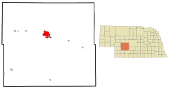
According to the United States Census Bureau, the city has a total area of 13.39 square miles (34.68 km2), of which 13.20 square miles (34.19 km2) is land and 0.19 square miles (0.49 km2) is water. [19]

Climate

Climate chart for North Platte Monthly Climate Normals (1991-2020) - North Platte Area, NE(ThreadEx).svg
Climate chart for North Platte

North Platte experiences a dry continental climate similar to that of the Nebraska High Plains, classified as hot-summer humid continental (Köppen Dwa), and, with an annual average precipitation of 21.08 inches (535 mm), barely avoids semi-arid classification; it is part of USDA Hardiness zone 5a. [20] The normal monthly mean temperature ranges from 26.3 °F (−3.2 °C) in January to 75.6 °F (24.2 °C) in July. [21] On an average year, there are 3.8 afternoons that reach 100 °F (37.8 °C) or higher, 39 afternoons that reach 90 °F (32.2 °C) or higher, 31.4 afternoons that do not climb above freezing, and 12.2 mornings with a low of 0 °F (−17.8 °C) or below. [21] The average window for freezing temperatures is September 30 thru May 13, [21] allowing a growing season of 139 days. Extreme temperatures officially range from −35 °F (−37.2 °C) on January 15, 1888, and February 12, 1899, up to 112 °F (44.4 °C) on July 11, 1954; the record cold daily maximum is −15 °F (−26.1 °C) on January 14, 1888, while, conversely, the record warm daily minimum is 80 °F (26.7 °C) on July 25, 1940. [21]

Precipitation is greatest in May and June and has ranged from 10.01 inches (254.3 mm) in 1931 to 33.44 inches (849.4 mm) in 1951. [21] Snowfall averages 29.6 inches (0.75 m) per season, and has historically ranged from 3.0 inches (0.08 m) in 1903–04 to 66.3 inches (1.68 m) in 1979–80; [21] the average window for measurable (≥0.1 inches or 0.0025 metres) snowfall is November 1 thru April 12, with May and October snow being rare. [21]

Climate data for North Platte Regional Airport, Nebraska (1991–2020 normals, [lower-alpha 1] extremes 1874–present) [lower-alpha 2]
MonthJanFebMarAprMayJunJulAugSepOctNovDecYear
Record high °F (°C)74
(23)
79
(26)
91
(33)
98
(37)
99
(37)
108
(42)
112
(44)
108
(42)
105
(41)
96
(36)
87
(31)
76
(24)
112
(44)
Mean maximum °F (°C)62.6
(17.0)
66.7
(19.3)
77.9
(25.5)
84.8
(29.3)
90.0
(32.2)
96.9
(36.1)
100.6
(38.1)
97.9
(36.6)
95.3
(35.2)
86.3
(30.2)
73.9
(23.3)
63.7
(17.6)
102.0
(38.9)
Mean daily maximum °F (°C)40.7
(4.8)
43.9
(6.6)
55.2
(12.9)
63.2
(17.3)
72.8
(22.7)
84.0
(28.9)
89.7
(32.1)
87.2
(30.7)
80.0
(26.7)
66.0
(18.9)
52.6
(11.4)
42.0
(5.6)
64.8
(18.2)
Daily mean °F (°C)26.3
(−3.2)
29.4
(−1.4)
39.6
(4.2)
48.2
(9.0)
58.5
(14.7)
69.7
(20.9)
75.6
(24.2)
73.0
(22.8)
64.2
(17.9)
50.2
(10.1)
37.0
(2.8)
27.5
(−2.5)
49.9
(9.9)
Mean daily minimum °F (°C)11.9
(−11.2)
14.8
(−9.6)
23.9
(−4.5)
33.2
(0.7)
44.2
(6.8)
55.4
(13.0)
61.4
(16.3)
58.8
(14.9)
48.3
(9.1)
34.3
(1.3)
21.4
(−5.9)
13.1
(−10.5)
35.1
(1.7)
Mean minimum °F (°C)−8.2
(−22.3)
−5.1
(−20.6)
4.6
(−15.2)
17.1
(−8.3)
27.5
(−2.5)
41.4
(5.2)
49.5
(9.7)
46.9
(8.3)
31.7
(−0.2)
17.0
(−8.3)
4.3
(−15.4)
−5.1
(−20.6)
−14.5
(−25.8)
Record low °F (°C)−35
(−37)
−35
(−37)
−25
(−32)
−3
(−19)
18
(−8)
29
(−2)
39
(4)
35
(2)
17
(−8)
4
(−16)
−25
(−32)
−34
(−37)
−35
(−37)
Average precipitation inches (mm)0.39
(9.9)
0.57
(14)
1.00
(25)
2.29
(58)
3.35
(85)
3.54
(90)
3.18
(81)
2.56
(65)
1.61
(41)
1.65
(42)
0.49
(12)
0.45
(11)
21.08
(535)
Average snowfall inches (cm)5.1
(13)
6.9
(18)
4.2
(11)
3.6
(9.1)
0.0
(0.0)
0.0
(0.0)
0.0
(0.0)
0.0
(0.0)
0.1
(0.25)
2.2
(5.6)
3.0
(7.6)
4.5
(11)
29.6
(75)
Average extreme snow depth inches (cm)3.5
(8.9)
4.3
(11)
2.7
(6.9)
1.8
(4.6)
0.0
(0.0)
0.0
(0.0)
0.0
(0.0)
0.0
(0.0)
0.0
(0.0)
0.9
(2.3)
2.0
(5.1)
2.8
(7.1)
6.8
(17)
Average precipitation days (≥ 0.01 in)4.45.36.59.011.510.810.28.96.76.84.23.788.0
Average snowy days (≥ 0.1 in)4.34.33.42.20.10.00.00.00.10.92.13.621.0
Average relative humidity (%)69.368.264.459.663.363.963.064.163.861.566.969.664.8
Average dew point °F (°C)11.7
(−11.3)
16.3
(−8.7)
23.2
(−4.9)
32.2
(0.1)
43.9
(6.6)
53.8
(12.1)
58.8
(14.9)
56.8
(13.8)
46.8
(8.2)
34.2
(1.2)
23.0
(−5.0)
14.0
(−10.0)
34.5
(1.4)
Mean monthly sunshine hours 185.0180.2227.4257.5290.8322.9352.9319.2259.5236.2174.0170.02,975.6
Percent possible sunshine 62606164657177756969595967
Source: NOAA (relative humidity and sun 1961–1990) [21] [23] [24]

See or edit raw graph data.

Demographics

Historical population
CensusPop.Note
1880 363
1890 3,055741.6%
1900 3,64019.1%
1910 4,79331.7%
1920 10,466118.4%
1930 12,06115.2%
1940 12,4293.1%
1950 15,43324.2%
1960 17,18411.3%
1970 19,44713.2%
1980 24,50926.0%
1990 22,605−7.8%
2000 23,8785.6%
2010 24,7333.6%
2020 23,390−5.4%
U.S. Decennial Census [25]

2020 census

The 2020 United States census [26] counted 23,390 people, 10,188 households, and 6,061 families in North Platte. The population density was 1,730.0 per square mile (667.9/km2). There were 11,409 housing units at an average density of 843.9 per square mile (325.8/km2). The racial makeup was 86.54% (20,242) white, 1.64% (384) black or African-American, 0.79% (184) Native American, 1.15% (268) Asian, 0.03% (6) Pacific Islander, 3.1% (725) from other races, and 6.76% (1,581) from two or more races. Hispanic or Latino of any race was 10.0% (2,558) of the population.

Of the 10,188 households, 27.6% had children under the age of 18; 43.7% were married couples living together; 25.2% had a female householder with no husband present. 34.7% of households consisted of individuals and 14.1% had someone living alone who was 65 years of age or older. The average household size was 2.3 and the average family size was 2.9.

24.6% of the population was under the age of 18, 7.9% from 18 to 24, 25.2% from 25 to 44, 26.1% from 45 to 64, and 17.7% who were 65 years of age or older. The median age was 38.9 years. For every 100 females, the population had 97.2 males. For every 100 females ages 18 and older, there were 95.7 males.

The 2016-2020 5-year American Community Survey [27] estimates show that the median household income was $52,653 (with a margin of error of +/- $5,357) and the median family income $67,702 (+/- $5,175). Males had a median income of $39,363 (+/- $4,731) versus $25,799 (+/- $1,263) for females. The median income for those above 16 years old was $31,772 (+/- $1,712). Approximately, 6.7% of families and 11.9% of the population were below the poverty line, including 11.8% of those under the age of 18 and 15.3% of those ages 65 or over.

2010 census

As of the census [28] of 2010, there were 24,733 people, 10,560 households, and 6,290 families residing in the city. The population density was 1,873.7 inhabitants per square mile (723.4/km2). There were 11,450 housing units at an average density of 867.4 per square mile (334.9/km2). The racial makeup of the city was 93.1% White, 1.0% African American, 0.7% Native American, 0.7% Asian, 2.8% from other races, and 1.7% from two or more races. Hispanic or Latino of any race were 8.8% of the population.

There were 10,560 households, of which 30.4% had children under the age of 18 living with them, 44.5% were married couples living together, 10.7% had a female householder with no husband present, 4.3% had a male householder with no wife present, and 40.4% were non-families. 34.8% of all households were made up of individuals, and 13.9% had someone living alone who was 65 years of age or older. The average household size was 2.29 and the average family size was 2.95.

The median age in the city was 37.1 years. 24.9% of residents were under the age of 18; 9% were between the ages of 18 and 24; 25% were from 25 to 44; 25.6% were from 45 to 64; and 15.5% were 65 years of age or older. The gender makeup of the city was 48.8% male and 51.2% female.

2000 census

As of the census of 2000, there were 23,878 people, 9,944 households, and 6,224 families residing in the city. The population density was 2,281.5 people per square mile (880.9 people/km2). There were 10,718 housing units at an average density of 1,024.1 per square mile (395.4/km2). The racial makeup of the city was 93.47% White, 0.71% African American, 0.64% Native American, 0.39% Asian, 0.03% Pacific Islander, 3.30% from other races, and 1.45% from two or more races. Hispanic or Latino of any race were 6.68% of the population.

There were 9,944 households, out of which 31.0% had children under the age of 18 living with them, 49.8% were married couples living together, 9.6% had a female householder with no husband present, and 37.4% were non-families. 31.9% of all households were made up of individuals, and 13.0% had someone living alone who was 65 years of age or older. The average household size was 2.34 and the average family size was 2.97.

In the city, the population was spread out, with 26.0% under the age of 18, 9.5% from 18 to 24, 26.8% from 25 to 44, 21.9% from 45 to 64, and 15.8% who were 65 years of age or older. The median age was 36 years. For every 100 females, there were 94.5 males. For every 100 females age 18 and over, there were 90.0 males.

As of 2000 the median income for a household in the city was $34,181, and the median income for a family was $42,753. Males had a median income of $36,445 versus $20,157 for females. The per capita income for the city was $18,306. About 7.8% of families and 10.5% of the population were below the poverty line, including 13.2% of those under age 18 and 9.8% of those age 65 or over.

Arts and culture

Lincoln County Historical Museum contains a display detailing the history of the North Platte Canteen. It also contains a Prairie Village with local landmark homes and other buildings, including a Pony Express station and pioneer church among many others. [29]

Buffalo Bill Ranch State Historical Park is located near North Platte, a Nebraska living history park about "Buffalo Bill" Cody. The park includes his actual house known as Scout's Rest Ranch. The park is two miles west of U.S. Highway 83 along U.S. Highway 30. [30]

Every June, North Platte hosts the annual "Nebraskaland Days". The event includes parades, art shows, rodeos, concerts, and food events. It draws over 100,000 attendees every year. [31]

North Platte is host to the annual Miss Nebraska pageant, an official preliminary for the Miss America Organization. [32]

Infrastructure

Bailey Yard at night Bailey Yard at night.JPG
Bailey Yard at night

Transportation

North Platte is home to the world's largest rail yard, Bailey Yard. The Golden Spike Tower and Visitor Center is an eight-story building which overlooks the expansive classification yard and engine facilities. The tower and visitor center are open to the public year-round. [33] Passenger train service was discontinued in 1971. [34]

North Platte is home to North Platte Regional Airport. United Express serves the airport with twice-daily service to Denver International Airport. There is also a door-to-door bus system available for residents of the town. [35]

Intercity bus service to the city is provided by Burlington Trailways and Express Arrow. [36] [37]

North Platte is served by 2 major cross country US Highways and Interstate 80. I-80 runs south of the South Platte River through the outer edge of town. Much of the town's commercial area has moved to the intersection of I-80 and U.S. Route 83, which runs north to downtown, and continues to points as far north as Canada or south to Mexico. US 30 intersects with US 83 downtown and follows the north side of the Platte/South Platte River from east to west.

Media

Notable people

See also

Explanatory notes

  1. Mean monthly maxima and minima (i.e. the expected highest and lowest temperature readings at any point during the year or given month) calculated based on data at said location from 1991 to 2020.
  2. Official records for North Platte kept at downtown from September 1874 to December 1947 and at North Platte Regional Airport since January 1948. [22]

Related Research Articles

<span class="mw-page-title-main">Platte County, Nebraska</span> County in Nebraska, United States

Platte County is a county located in the U.S. state of Nebraska. As of the 2020 United States Census, the population was 34,296. Its county seat is Columbus. The county was created in 1855.

<span class="mw-page-title-main">Merrick County, Nebraska</span> County in Nebraska, United States

Merrick County is a county in the U.S. state of Nebraska. As of the 2020 United States Census, the population was 7,668. Its county seat is Central City.

<span class="mw-page-title-main">Lincoln County, Nebraska</span> County in Nebraska, United States

Lincoln County is a county located in the U.S. state of Nebraska. As of the 2020 census, the population was 34,676. Its county seat is North Platte. Despite the county's name, the state capital city of Lincoln is not in or near Lincoln County.

<span class="mw-page-title-main">Dodge County, Nebraska</span> County in Nebraska, United States

Dodge County is a county in the U.S. state of Nebraska. As of the 2020 United States Census, the population was 37,167. Its county seat is Fremont. The county was formed in 1855 and named after Iowa Senator Augustus C. Dodge.

<span class="mw-page-title-main">Platte City, Missouri</span> City in Missouri, United States

Platte City is a city in and the county seat of Platte County, Missouri within the United States. The population was 4,784 at the 2020 census. The city is part of the Kansas City metropolitan area.

<span class="mw-page-title-main">Kearney, Nebraska</span> City in the United States

Kearney is the county seat of Buffalo County, Nebraska, United States. The population was 33,790 in the 2020 census, making it the 5th most populous city in Nebraska. It is home to the University of Nebraska at Kearney. The westward push of the railroad as the Civil War ended gave new birth to the community.

<span class="mw-page-title-main">Plattsmouth, Nebraska</span> City in Nebraska, United States

Plattsmouth is a city and county seat of Cass County, Nebraska, United States. The population was 6,620 at the 2020 census.

<span class="mw-page-title-main">Lexington, Nebraska</span> City in Nebraska, United States

Lexington is a city in Dawson County, Nebraska, United States. The population was 10,348 at the 2020 census, making it the 16th most populous city in Nebraska. It is the county seat of Dawson County. Lexington is located in southern Nebraska, on the Platte River, southeast of North Platte. It sits along the route of U.S. Route 30 and the Union Pacific Railroad. In the 1860s, Lexington was the location of a stop along the Pony Express.

<span class="mw-page-title-main">Fremont, Nebraska</span> City in Nebraska, United States

Fremont is a city and county seat of Dodge County in the eastern portion of the state of Nebraska in the Midwestern United States. The population was 27,141 at the 2020 census, making it the 6th most populous city in Nebraska. Fremont is the home of Midland University.

<span class="mw-page-title-main">North Bend, Nebraska</span> City in Nebraska, United States

North Bend is a city in Dodge County, Nebraska, United States. The population was 1,177 at the 2010 census.

<span class="mw-page-title-main">Bayard, Nebraska</span> City in Nebraska, United States

Bayard is a city in Morrill County, Nebraska, United States. The population was 1,209 at the 2010 census.

<span class="mw-page-title-main">Cornlea, Nebraska</span> Village in Platte County, Nebraska, United States

Cornlea is a village in Platte County, Nebraska, United States. The population was 36 at the 2010 census.

<span class="mw-page-title-main">Humphrey, Nebraska</span> City in Platte County, Nebraska, United States

Humphrey is a city in Platte County, Nebraska, United States. The population was 760 at the 2010 census.

<span class="mw-page-title-main">Tarnov, Nebraska</span> Village in Platte County, Nebraska, United States

Tarnov is a village in Platte County, Nebraska, United States. The population was 46 at the 2010 census.

<span class="mw-page-title-main">Ashland, Nebraska</span> City in Saunders County, Nebraska, United States

Ashland is a city in Saunders County, Nebraska, United States. The population was 3,086 at the 2020 census.

<span class="mw-page-title-main">Gering, Nebraska</span> City in and county seat of Scotts Bluff County, Nebraska, United States

Gering is a city in and the county seat of Scotts Bluff County, Nebraska, United States, in the Panhandle region of the state. The population was 8,564 at the 2020 census, making it the 17th most populous city in Nebraska.

<span class="mw-page-title-main">Scottsbluff, Nebraska</span> City in Scotts Bluff County, Nebraska, United States

Scottsbluff is a city in Scotts Bluff County, Nebraska, United States, in the Great Plains region. The population was 14,436 at the 2020 census. Scottsbluff is the largest city in the Nebraska Panhandle, and the 13th-most-populous city in Nebraska.

<span class="mw-page-title-main">Terrytown, Nebraska</span> City in Nebraska, United States

Terrytown is a city in Scotts Bluff County, Nebraska, United States. The population was 1,057 at the 2020 census. It is part of the Scottsbluff, Nebraska Micropolitan Statistical Area. Terrytown is located on the bank of the North Platte River between the cities of Scottsbluff and Gering, Nebraska. Separated only by the river, Scottsbluff and Gering have grown together to form the 7th largest urban area in Nebraska, which incorporates the city of Terrytown as well.

<span class="mw-page-title-main">Camden Point, Missouri</span> City in Missouri, United States

Camden Point is a city in Platte County, Missouri, United States and is part of the Kansas City metropolitan area. The population was 457 at the 2020 census.

<span class="mw-page-title-main">Dearborn, Missouri</span> City in Missouri, United States

Dearborn is a city in Buchanan and Platte counties in the U.S. state of Missouri and is part of the Kansas City metropolitan area. The population was 482 at the 2020 census.

References

  1. von Kampen, Todd (November 3, 2020). "Brandon Kelliher wins North Platte mayoral contest". The North Platte Telegraph.
  2. "ArcGIS REST Services Directory". United States Census Bureau. Retrieved September 18, 2022.
  3. 1 2 U.S. Geological Survey Geographic Names Information System: North Platte, Nebraska
  4. "Find a County". National Association of Counties. Retrieved June 7, 2011.
  5. "Explore Census Data". data.census.gov. Retrieved September 20, 2021.
  6. "North Platte, Lincoln County". Center for Advanced Land Management Information Technologies. University of Nebraska. Archived from the original on August 19, 2014. Retrieved August 19, 2014.
  7. "Profile for North Platte, NE". ePodunk. Archived from the original on August 20, 2014. Retrieved August 19, 2014.
  8. Fitzpatrick, Lillian L. (1960). Nebraska Place-Names. University of Nebraska Press. p. 96. ISBN   0-8032-5060-6. A 1925 edition is available for download at University of Nebraska—Lincoln Digital Commons.
  9. "The Union Pacific Railroad". The New York Times. No. 4901 Vol XVI. New York, New York. June 11, 1867. p. 5. Retrieved November 13, 2023. North Platte... is at present the terminus of passenger travel over the Union Pacific and the overland stages make it their starting point for Denver and California.
  10. "UPRR End of Track Dateline, 1865-1869" (PDF). Union Pacific. Union Pacific Railroad. Retrieved November 12, 2023.
  11. "NPGallery Asset Detail". npgallery.nps.gov. Retrieved December 15, 2021.
  12. Dales, David (1979). "North Platte Racial Incident: Black-White Confrontation, 1929". Nebraska History. 60: 424–446 via history.nebraska.gov.
  13. "Jul. 13, 1929 | White Mob Forces 200 Black People Out of North Platte, Nebraska". calendar.eji.org. Equal Justice Initiative . Retrieved October 7, 2021.
  14. Dales, David G (1979). "North Platte Racial Incident: Black-White Confrontation, 1929" (PDF). Nebraska History (60): 426–446. Archived from the original on May 22, 2013.{{cite journal}}: CS1 maint: unfit URL (link)
  15. Greene, Bob (2003). Once upon a town : the miracle of the North Platte Canteen (1st Perennial ed.). New York: Perennial. ISBN   0-06-008197-X. OCLC   52242740.
  16. Reisdorff, James J. (1986). North Platte canteen. Service Press). David City, Neb.: South Platte Press. ISBN   0-9609568-5-9. OCLC   14639915.
  17. Spencer, Matthew. "NORTH PLATTE CANTEEN". www.nebraskalife.com. Retrieved April 8, 2021.
  18. "North Platte Canteen: Where The Heartland Opened Its Heart In WWII". NPR.org. Retrieved April 7, 2021.
  19. "US Gazetteer files 2010". United States Census Bureau. Archived from the original on July 2, 2012. Retrieved June 24, 2012.
  20. "USDA Plant Hardiness Zone Map". United States Department of Agriculture. Archived from the original on February 27, 2014. Retrieved June 1, 2014.
  21. 1 2 3 4 5 6 7 8 "NOWData - NOAA Online Weather Data". National Oceanic and Atmospheric Administration. Retrieved November 27, 2021.
  22. "Threaded Extremes". threadex.rcc-acis.org. Retrieved March 31, 2018.
  23. "Station: North Platte RGNL AP, NE". U.S. Climate Normals 2020: U.S. Monthly Climate Normals (1991–2020). National Oceanic and Atmospheric Administration. Archived from the original on December 31, 2023. Retrieved November 27, 2021.
  24. "WMO Climate Normals for North Platte/Lee Bird FLD, NE 1961–1990". National Oceanic and Atmospheric Administration. Archived from the original on December 31, 2023. Retrieved November 27, 2021.
  25. United States Census Bureau. "Census of Population and Housing" . Retrieved October 16, 2013.
  26. "Explore Census Data". data.census.gov. Retrieved December 18, 2023.
  27. "Explore Census Data". data.census.gov. Retrieved December 18, 2023.
  28. "U.S. Census website". United States Census Bureau . Retrieved June 24, 2012.
  29. Description from Lincolncountymuseum.org. Retrieved on 2015-10-23.
  30. Description from visitnorthplatte.com. Retrieved on 2015-10-23.
  31. "About Us". Archived 2011-07-14 at the Wayback Machine Nebraskaland Days website. Archived 2011-07-28 at the Wayback Machine Retrieved 2011-07-27.
  32. "Events". Archived 2016-06-06 at the Wayback Machine VisitNorthPlatte.com. Retrieved May 31, 2016.
  33. Description from goldenspiketower.com Archived 2009-03-29 at the Wayback Machine . Retrieved on 2009-03-15.
  34. "The Work of Giants". Golden Spike Tower. Archived from the original on February 7, 2012. Retrieved October 30, 2021.
  35. "Transportation". Visit North Platte. Retrieved March 13, 2021.
  36. "Nebraska Bus Stops". March 23, 2017. Retrieved July 20, 2023.
  37. "Locations" . Retrieved July 20, 2023.
  38. "Buffalo Bill Ranch State Historical Park". Visit North Platte. Retrieved March 14, 2017.
  39. "Nathan Enderle #4 QB". NFL Enterprises LLC. Retrieved October 22, 2012.
  40. "Paul Faulkner-Was NFA artist", The Day (New London, Connecticut), January 6, 1997, p.B4
  41. "Biography of Senator Chuck Hagel". Official website of Senator Chuck Hagel. Archived from the original on May 19, 2008. Retrieved February 20, 2008.
  42. https://www.apa.org/monitor/2011/02/myth-buster.{{cite web}}: Missing or empty |title= (help)title=The myth buster
  43. "John Howell". databaseFootball.com. Archived from the original on October 25, 2012. Retrieved October 22, 2012.
  44. "Sandhill highway to be named after Glenn Miller". McCook Daily Gazette. 1999-09-01. Retrieved 2012-10-22.
  45. "Nebraska Governor Keith M. Neville". National Governors Association. Retrieved September 29, 2012.
  46. "Red Cloud". New Perspectives of the West. Retrieved October 22, 2012.
  47. "Northern Colorado's Premier MMA Gym". Trials Martial Arts and Fitness. Archived from the original on December 25, 2011. Retrieved October 22, 2012.
  48. reports, Telegraph staff (April 24, 2015). "Legion announces 2015 Hall of Fame". North Platte Nebraska's Newspaper. Retrieved April 8, 2021.
  49. "Danny Woodhead #39 RB". NFL Enterprises LLC. Retrieved October 22, 2012.

Further reading