Boyd County, Nebraska

Last updated

Boyd County
Boyd County, Nebraska courthouse from SW.JPG
Boyd County Courthouse in Butte
Map of Nebraska highlighting Boyd County.svg
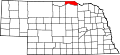
Location within the U.S. state of Nebraska
Nebraska in United States.svg
Nebraska's location within the U.S.
Coordinates: 42°54′N98°46′W / 42.9°N 98.77°W / 42.9; -98.77
CountryFlag of the United States.svg United States
StateFlag of Nebraska.svg  Nebraska
FoundedMarch 20, 1891
Named for James E. Boyd
Seat Butte
Largest village Spencer
Area
  Total
545 sq mi (1,410 km2)
  Land540 sq mi (1,400 km2)
  Water4.6 sq mi (12 km2)  0.8%
Population
 (2020)
  Total
1,810
  Estimate 
(2022)
1,741 Decrease2.svg
  Density3.3/sq mi (1.3/km2)
Time zone UTC−6 (Central)
  Summer (DST) UTC−5 (CDT)
Congressional district 3rd
Website www.boydcounty.ne.gov

Boyd County is a county in the U.S. state of Nebraska. As of the 2020 United States Census, the population was 1,810. [1] Its county seat is Butte. [2] The county was formed in 1891 [3] and named after James E. Boyd, the governor of Nebraska at the time. [4]

Contents

In the Nebraska license plate system, Boyd County is represented by the prefix 63, as it had the 63rd-largest number of vehicles registered in the county when the license plate system was established in 1922.

In the 2010 United States Census, three incorporated villages had populations of fewer than 10 people: Anoka, population 6, Gross, population 2, and Monowi, population 1. Monowi was the only incorporated city in the United States with only one resident at the 2010 census. [5]

All land north of the Keya Paha River (which includes most of Boyd County and a smaller portion of neighboring Keya Paha County) was not originally part of Nebraska at the time of statehood, but was transferred from Dakota Territory in 1882.

Geography

According to the US Census Bureau, the county has an area of 545 square miles (1,410 km2), of which 540 square miles (1,400 km2) is land and 4.6 square miles (12 km2) (0.8%) is water. [6]

Boyd County is in Nebraska's Outback region. [7]

Major highways

Adjacent counties

National protected areas

Demographics

Historical population
CensusPop.Note
1890 695
1900 7,332955.0%
1910 8,82620.4%
1920 8,243−6.6%
1930 7,169−13.0%
1940 6,060−15.5%
1950 4,911−19.0%
1960 4,513−8.1%
1970 3,752−16.9%
1980 3,331−11.2%
1990 2,835−14.9%
2000 2,438−14.0%
2010 2,099−13.9%
2020 1,810−13.8%
2022 (est.)1,741−3.8%
US Decennial Census [8]
1790-1960 [9] 1900-1990 [10]
1990-2000 [11] 2010 [12] 2020-2022 [13]

As of the 2000 United States Census, there were 2,438 people, 1,014 households, and 670 families in the county. The population density was 4 people per square mile (1.5 people/km2). There were 1,406 housing units at an average density of 3 units per square mile (1.2/km2). The racial makeup of the county was 98.89% White, 0.57% Native American, 0.16% Asian, and 0.37% from two or more races. 0.08% of the population were Hispanic or Latino of any race. 45.2% were of German, 10.0% American, 9.3% Czech, 7.8% Irish, 6.9% English and 5.9% Swedish ancestry.

There were 1,014 households, out of which 29.00% had children under the age of 18 living with them, 59.40% were married couples living together, 3.70% had a female householder with no husband present, and 33.90% were non-families. 32.00% of all households were made up of individuals, and 19.60% had someone living alone who was 65 years of age or older. The average household size was 2.36 and the average family size was 2.98.

The county population contained 25.00% under the age of 18, 5.40% from 18 to 24, 21.20% from 25 to 44, 24.10% from 45 to 64, and 24.30% who were 65 years of age or older. The median age was 44 years. For every 100 females there were 93.30 males. For every 100 females age 18 and over, there were 94.60 males.

The median income for a household in the county was $26,075, and the median income for a family was $32,000. Males had a median income of $20,859 versus $17,688 for females. The per capita income for the county was $13,840. About 12.90% of families and 15.20% of the population were below the poverty line, including 19.60% of those under age 18 and 11.20% of those age 65 or over.

Communities

Villages

Townships

Ghost towns

Politics

United States presidential election results for Boyd County, Nebraska [14]
Year Republican Democratic Third party(ies)
No.%No.%No.%
2024 93887.17%13212.27%60.56%
2020 1,01087.45%13511.69%100.87%
2016 98385.03%12811.07%453.89%
2012 87381.51%18817.55%100.93%
2008 83975.59%25022.52%211.89%
2004 91179.36%22819.86%90.78%
2000 93174.96%26521.34%463.70%
1996 77857.97%37227.72%19214.31%
1992 74447.36%35322.47%47430.17%
1988 96765.92%48032.72%201.36%
1984 1,17578.54%30820.59%130.87%
1980 1,26172.76%37621.70%965.54%
1976 1,00455.13%79243.49%251.37%
1972 1,41973.71%50626.29%00.00%
1968 1,25064.63%43722.60%24712.77%
1964 1,10054.78%90845.22%00.00%
1960 1,39364.46%76835.54%00.00%
1956 1,41462.51%84837.49%00.00%
1952 1,65668.63%75731.37%00.00%
1948 1,06050.60%1,03549.40%00.00%
1944 1,45661.93%89538.07%00.00%
1940 1,73462.13%1,05737.87%00.00%
1936 1,29044.48%1,55553.62%551.90%
1932 80827.32%2,09870.95%511.72%
1928 1,65358.72%1,14340.60%190.67%
1924 99137.57%52219.79%1,12542.65%
1920 1,48270.04%52724.91%1075.06%
1916 80946.98%85249.48%613.54%
1912 28116.90%65139.15%73143.96%
1908 95450.05%89146.75%613.20%
1904 1,23364.35%32817.12%35518.53%
1900 77147.45%79548.92%593.63%
1896 50041.53%65754.57%473.90%
1892 52844.44%18415.49%47640.07%

See also

References

  1. "Boyd County, Nebraska". United States Census Bureau . Retrieved June 16, 2023.
  2. "Find a County". National Association of Counties. Archived from the original on May 31, 2011. Retrieved June 7, 2011.
  3. Fitzpatrick, Lillian L. (1960). Nebraska Place-Names. University of Nebraska Press. p. 21. ISBN   0803250606.
  4. History of the Origin of the Place Names in Nine Northwestern States. 1908. p. 12.
  5. Reuters, Monowi, Nebraska, Population: 1.
  6. "2010 Census Gazetteer Files". US Census Bureau. August 22, 2012. Archived from the original on November 13, 2013. Retrieved December 6, 2014.
  7. "About" Archived October 3, 2008, at the Wayback Machine , North Central RC&D.
  8. "US Decennial Census". US Census Bureau. Archived from the original on April 26, 2015. Retrieved December 6, 2014.
  9. "Historical Census Browser". University of Virginia Library. Retrieved December 6, 2014.
  10. "Population of Counties by Decennial Census: 1900 to 1990". US Census Bureau. Retrieved December 6, 2014.
  11. "Census 2000 PHC-T-4. Ranking Tables for Counties: 1990 and 2000" (PDF). US Census Bureau. Archived (PDF) from the original on March 27, 2010. Retrieved December 6, 2014.
  12. https://www.census.gov/quickfacts/fact/table/boydcountynebraska/PST045222.{{cite web}}: Missing or empty |title= (help)
  13. "State & County QuickFacts". US Census Bureau. Archived from the original on June 7, 2011. Retrieved September 17, 2013.
  14. "Dave Leip's Atlas of U.S. Presidential Elections".

Further reading

42°54′N98°46′W / 42.90°N 98.77°W / 42.90; -98.77