Lincoln County, Nebraska

Last updated

Lincoln County
Lincoln Co Courthouse NE.JPG
Lincoln County Courthouse in North Platte
Map of Nebraska highlighting Lincoln County.svg
Location within the U.S. state of Nebraska
Nebraska in United States.svg
Nebraska's location within the U.S.
Coordinates: 41°03′N100°45′W / 41.05°N 100.75°W / 41.05; -100.75
CountryFlag of the United States.svg United States
StateFlag of Nebraska.svg  Nebraska
Founded1866
Named for Abraham Lincoln [1]
Seat North Platte
Largest cityNorth Platte
Area
  Total2,575 sq mi (6,670 km2)
  Land2,564 sq mi (6,640 km2)
  Water11 sq mi (30 km2)  0.4%
Population
 (2020)
  Total34,676
  Density14.1/sq mi (5.4/km2)
Time zone UTC−6 (Central)
  Summer (DST) UTC−5 (CDT)
Congressional district 3rd
Website www.co.lincoln.ne.us

Lincoln County is a county located in the U.S. state of Nebraska. As of the 2020 census, the population was 34,676. [2] Its county seat is North Platte. [3] Despite the county's name, the state capital city of Lincoln is not in or near Lincoln County.

Contents

Lincoln County is one of the three counties in the North Platte Micropolitan Statistical Area.

In the Nebraska license plate system, Lincoln County is represented by the prefix 15 (it had the fifteenth-largest number of vehicles registered for a state county when the license plate system was established in 1922).

Geography

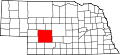
Lincoln County is located in the Nebraska Sandhills, a region of mixed-grass prairie on grass-stabilized dunes. The land is generally given to agriculture, with considerable center pivot irrigation and cattle ranching. The North Platte River and the South Platte River flow eastward from Keith County, joining to form the Platte River east of the city of North Platte in central Lincoln County. The Platte then flows ESE out of the county. [4] The county has a total area of 2,575 square miles (6,670 km2), of which 2,564 square miles (6,640 km2) is land and 11 square miles (28 km2) (0.4%) is water. [5] It is the third-largest county in Nebraska by area.

Most of Nebraska's 93 counties (the eastern 2/3, including Lincoln County) observe Central Time; the western counties observe Mountain Time. Lincoln County is the westernmost of the Nebraska counties to observe Central Time. [6]

Major highways

Transit

Adjacent counties

Protected areas

  • Birdwood Lake State Wildlife Management Area [7]
  • East Hershey State Wildlife Management Area [8]
  • East Sutherland State Wildlife Management Area [9]
  • Fort McPherson National Cemetery [10]
  • Jeffrey Canyon State Wildlife Management Area [11]
  • Maloney Reservoir State Recreation Area [12]
  • Muskrat Run State Wildlife Management Area [13]
  • Platte State Wildlife Management Area [14]
  • Sutherland Reservoir State Recreation Area [15]

Demographics

Historical population
CensusPop.Note
1870 17
1880 3,63221,264.7%
1890 10,441187.5%
1900 11,4169.3%
1910 15,68437.4%
1920 23,42049.3%
1930 25,6279.4%
1940 25,425−0.8%
1950 27,3807.7%
1960 28,4914.1%
1970 29,5383.7%
1980 36,45523.4%
1990 32,508−10.8%
2000 34,6326.5%
2010 36,2884.8%
2020 34,676−4.4%
US Decennial Census [16]
1790-1960 [17] 1900-1990 [18]
1990-2000 [19] 2010-2013 [20]

As of the 2000 United States Census [21] there were 34,632 people, 14,076 households, and 9,444 families in the county. The population density was 14 people per square mile (5.4 people/km2). There are 15,438 housing units in Lincoln: 6 units per square mile (2.3/km2). The racial makeup of the county was 94.70% White, 0.54% Black or African American, 0.51% Native American, 0.37% Asian, 0.02% Pacific Islander, 2.65% from other races, and 1.21% from two or more races. 5.43% of the population were Hispanic or Latino of any race.

There were 14,076 households, out of which 32.00% had children under the age of 18 living with them, 55.90% were married couples living together, 8.00% had a female householder with no husband present, and 32.90% were non-families. 28.30% of all households were made up of individuals, and 11.60% had someone living alone who was 65 years of age or older. The average household size was 2.41 and the average family size was 2.97.

The county population contained 26.20% under the age of 18, 8.30% from 18 to 24, 26.60% from 25 to 44, 23.80% from 45 to 64, and 15.10% who were 65 years of age or older. The median age was 38 years. For every 100 females, there were 96.50 males. For every 100 females age 18 and over, there were 93.40 males.

The median income for a household in the county was $36,568, and the median income for a family was $45,185. Males had a median income of $36,244 versus $20,252 for females. The per capita income for the county was $18,696. About 7.20% of families and 9.70% of the population were below the poverty line, including 12.10% of those under age 18 and 9.30% of those age 65 or over.

Communities

Rural highway in Lincoln County Lincolncounty nebraska.jpg
Rural highway in Lincoln County

City

Villages

Unincorporated communities

Politics

Lincoln County voters generally vote Republican. In only three national elections since 1916 has the county selected the Democratic Party candidate, most recently in 1964 in the midst of Lyndon B. Johnson's national landslide victory.

United States presidential election results for Lincoln County, Nebraska [22] [23]
Year Republican Democratic Third party
No.%No.%No.%
2020 13,07176.16%3,69221.51%4002.33%
2016 12,16475.41%2,91318.06%1,0546.53%
2012 10,72868.53%4,45028.43%4773.05%
2008 10,81766.46%5,04631.00%4142.54%
2004 11,05668.25%4,90530.28%2381.47%
2000 9,22061.00%5,20534.44%6894.56%
1996 7,48250.54%5,16534.89%2,15714.57%
1992 7,05445.04%5,15832.94%3,44922.02%
1988 8,42557.57%6,11841.81%910.62%
1984 10,71770.01%4,50929.46%810.53%
1980 9,64366.60%3,76826.02%1,0687.38%
1976 7,07655.55%5,35542.04%3082.42%
1972 7,50269.97%3,22030.03%00.00%
1968 5,99658.39%3,49134.00%7827.62%
1964 4,81142.74%6,44657.26%00.00%
1960 7,68561.49%4,81238.51%00.00%
1956 7,52362.70%4,47537.30%00.00%
1952 8,29269.00%3,72631.00%00.00%
1948 4,41951.68%4,13148.32%00.00%
1944 5,96957.88%4,34442.12%00.00%
1940 5,90854.36%4,96045.64%00.00%
1936 3,85735.73%6,74262.45%1971.82%
1932 3,08232.68%6,04764.12%3023.20%
1928 5,94670.58%2,38128.26%981.16%
1924 2,85740.94%1,37319.67%2,74939.39%
1920 3,34257.40%1,89632.57%58410.03%
1916 1,30934.61%2,19257.96%2817.43%
1912 69021.63%1,12935.39%1,37142.98%
1908 1,54148.43%1,38243.43%2598.14%
1904 1,44963.89%32814.46%49121.65%
1900 1,38653.06%1,16944.75%572.18%

Notable people

See also

Related Research Articles

<span class="mw-page-title-main">Clay County, Nebraska</span> County in Nebraska, United States

Clay County is a county in the U.S. state of Nebraska. As of the 2020 United States Census, the population was 6,104. Its county seat is Clay Center. The county was formed in 1855, and was organized in 1871. It was named for Henry Clay, a member of the United States Senate from Kentucky, who went on to become United States Secretary of State.

<span class="mw-page-title-main">Lancaster County, Nebraska</span> County in Nebraska, United States

Lancaster County is a county located in the U.S. state of Nebraska. As of the 2020 United States Census, the population was 322,608, making it the second-most populous county in Nebraska. Its county seat is Lincoln, the state capital. The county was created in 1859.

<span class="mw-page-title-main">York County, Nebraska</span> County in Nebraska, United States

York County is a county in the U.S. state of Nebraska. As of the 2020 United States Census, the population was 14,125. Its county seat is York.

<span class="mw-page-title-main">Thayer County, Nebraska</span> County in Nebraska, United States

Thayer County is a county in the U.S. state of Nebraska. As of the 2020 United States Census, the population was 5,034. Its county seat is Hebron. The county was created in 1856 and originally named Jefferson County. It was organized in 1870-1871 and renamed for General and Governor John Milton Thayer.

<span class="mw-page-title-main">Stanton County, Nebraska</span> County in Nebraska, United States

Stanton County is a county in the U.S. state of Nebraska. As of the 2020 United States Census, the population was 5,842. Its county seat is Stanton. The county was formed in 1856 and organized in 1867. It was first called Izard County until 1862, when it was renamed for Edwin M. Stanton, Secretary of War during the administration of President Abraham Lincoln.

<span class="mw-page-title-main">Seward County, Nebraska</span> County in Nebraska, United States

Seward County is a county in the U.S. state of Nebraska, United States. As of the 2020 United States Census, the population was 17,609. Its county seat is Seward. The county was formed in 1855, and was organized in 1867. It was originally called Greene County, and in 1862 it was renamed for William H. Seward, Secretary of State under Abraham Lincoln and Andrew Johnson. Seward County is part of the Lincoln, NE Metropolitan Statistical Area.

<span class="mw-page-title-main">Scotts Bluff County, Nebraska</span> County in Nebraska, United States

Scotts Bluff County is a county on the western border of the U.S. state of Nebraska. As of the 2020 United States Census, the population was 36,084. Its county seat is Gering, and its largest city is Scottsbluff.

<span class="mw-page-title-main">Saunders County, Nebraska</span> County in Nebraska, United States

Saunders County is a county in the U.S. state of Nebraska. As of the 2020 United States Census, the population was 22,278. Its county seat is Wahoo.

<span class="mw-page-title-main">Platte County, Nebraska</span> County in Nebraska, United States

Platte County is a county located in the U.S. state of Nebraska. As of the 2020 United States Census, the population was 34,296. Its county seat is Columbus. The county was created in 1855.

<span class="mw-page-title-main">Madison County, Nebraska</span> County in Nebraska, United States

Madison County is a county in the U.S. state of Nebraska. As of the 2020 United States Census, the population was 35,585. Its county seat is Madison and its largest city is Norfolk. Madison County was likely named for Madison, Wisconsin, which is where many of the county’s residents came from; the city was named for James Madison, fourth President of the United States.

<span class="mw-page-title-main">Knox County, Nebraska</span> County in Nebraska, United States

Knox County is a county in the U.S. state of Nebraska. As of the 2020 United States Census, the population was 8,391. Its county seat is Center. Knox County was named for Continental and U.S. Army Major General Henry Knox.

<span class="mw-page-title-main">Keith County, Nebraska</span> County in Nebraska, United States

Keith County is a county in the U.S. state of Nebraska. As of the 2020 United States Census, the population was 8,335. Its county seat is Ogallala.

<span class="mw-page-title-main">Kearney County, Nebraska</span> County in Nebraska, United States

Kearney County is a county located in the U.S. state of Nebraska. As of the 2020 United States Census, the population was 6,688. Its county seat is Minden. The county was formed in 1860. It was named for Fort Kearny, which in turn was named for Brigade General Stephen W. Kearny.

<span class="mw-page-title-main">Harlan County, Nebraska</span> County in Nebraska, United States

Harlan County is a county in the U.S. state of Nebraska. As of the 2020 United States Census, the population was 3,073. Its county seat is Alma. The county is home to the Harlan County Reservoir.

<span class="mw-page-title-main">Hamilton County, Nebraska</span> County in Nebraska, United States

Hamilton County is a county in the U.S. state Nebraska. As of the 2020 United States Census, the population was 9,429. Its county seat is Aurora. The county was named for Alexander Hamilton, the first Secretary of the Treasury in the new United States government.

<span class="mw-page-title-main">Hall County, Nebraska</span> County in Nebraska, United States

Hall County is a county in the U.S. state of Nebraska. As of the 2020 United States Census, the population was 62,895, making it Nebraska's fourth-most populous county. Its county seat is Grand Island. The county was formed in 1858; it was named for Augustus Hall, an early judge of this territory.

<span class="mw-page-title-main">Gosper County, Nebraska</span> County in Nebraska, United States

Gosper County is a county located in the U.S. state of Nebraska. As of the 2020 United States census, the population was 1,893. Its county seat is Elwood. The county was formed in 1873, and was organized in 1881. It was named for John J. Gosper, a Nebraska Secretary of State.

<span class="mw-page-title-main">Garfield County, Nebraska</span> County in Nebraska, United States

Garfield County is a county in the U.S. state of Nebraska. As of the 2020 United States Census, the population was 1,813. Its county seat is Burwell. The county was organized in 1884; it was named for James A. Garfield, 20th President of the United States.

<span class="mw-page-title-main">Frontier County, Nebraska</span> County in Nebraska, United States

Frontier County is a county in the U.S. state of Nebraska. As of the 2020 United States Census, the population was 2,519. Its county seat is Stockville.

<span class="mw-page-title-main">Dawson County, Nebraska</span> County in Nebraska, United States

Dawson County is a county in the U.S. state of Nebraska. As of the 2020 United States Census, the population was 24,111. Its county seat is Lexington.

References

  1. Gannett, Henry (1905). The Origin of Certain Place Names in the United States. Government Printing Office. p.  187.
  2. "U.S. Census Bureau: Lincoln County, Nebraska". www.census.gov. United States Census Bureau. Retrieved March 22, 2022.
  3. "Find a County". National Association of Counties. Retrieved June 7, 2011.
  4. Lincoln County NE Google Maps (accessed 23 January 2019)
  5. "2010 Census Gazetteer Files". US Census Bureau. August 22, 2012. Archived from the original on November 13, 2013. Retrieved December 9, 2014.
  6. Map of Time Zone Line through Nebraska (accessed 22 January 2019)
  7. Birdwood Lake State Wildlife Management Area, North Platte NE Google Maps (accessed 23 January 2019)
  8. East Hershey State Wildlife Management Area, North Platte NE Google Maps (accessed 23 January 2019)
  9. East Sutherland State Wildlife Management Area Google Maps (accessed 23 January 2019)
  10. Fort McPherson National Cemetery Google Maps (accessed 23 January 2019)
  11. Jeffrey Canyon State Wildlife Management Area, Brady NE Google Maps (accessed 23 January 2019)
  12. Maloney Reservoir State Recreation Area, North Platte NE Google Maps (accessed 23 January 2019)
  13. Muskrat Run State Wildlife Management Area, North Platte NE Google Maps (accessed 23 January 2019)
  14. Platte State Wildlife Management Area Google Maps (accessed 23 January 2019)
  15. Sutherland Reservoir State Recreation Area Google Maps (accessed 23 January 2019)
  16. "US Decennial Census". US Census Bureau. Retrieved December 9, 2014.
  17. "Historical Census Browser". University of Virginia Library. Retrieved December 9, 2014.
  18. "Population of Counties by Decennial Census: 1900 to 1990". US Census Bureau. Retrieved December 9, 2014.
  19. "Census 2000 PHC-T-4. Ranking Tables for Counties: 1990 and 2000" (PDF). US Census Bureau. Archived (PDF) from the original on March 27, 2010. Retrieved December 9, 2014.
  20. "State & County QuickFacts". US Census Bureau. Archived from the original on June 7, 2011. Retrieved September 21, 2013.
  21. "U.S. Census website". United States Census Bureau . Retrieved January 31, 2008.
  22. Election Results
  23. The leading "other" candidate, Progressive Theodore Roosevelt, received 911 votes, while Socialist candidate Eugene Debs received 400 votes and Prohibition Eugene Chafin received 60 votes.

41°03′N100°45′W / 41.05°N 100.75°W / 41.05; -100.75

Lincoln County, NE Map Lincoln County, NE.png
Lincoln County, NE Map