U.S. Route 83 (US 83) is a major north–south United States Numbered Highway that extends 1,885 miles (3,034 km) in the central United States. Only four other north–south routes are longer: US 1, US 41, US 59, and US 87. The highway's northern terminus is north of Westhope, North Dakota, at the Canadian border, where it continues as Manitoba Highway 83. The southern terminus is in Brownsville, Texas.

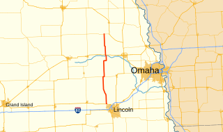
Nebraska Highway 31 is a highway in Nebraska. The southern terminus is near Louisville at an intersection with Nebraska Highway 50. The northern terminus is near Kennard at an intersection with U.S. Highway 30. The highway serves as a main north–south highway in the western portion of the Omaha Metro Area.

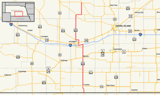
Nebraska Highway 50 (N-50) is a north–south highway in the state of Nebraska. The southern terminus is at the Nebraska-Kansas border near Du Bois. The northern terminus is in the Millard neighborhood of Omaha at an intersection with U.S. Highway 275 (US 275) and N-92. It is a two lane highway except for the section from Springfield north to the southern edge of the Millard neighborhood in Omaha, which is a divided highway.
Nebraska Highway 10 is a highway in Nebraska. Its southern terminus is at the Kansas border south of Franklin. Its northern terminus is at an intersection with Nebraska Highway 58, Nebraska Highway 92, and Recreation Road 82B in Loup City.

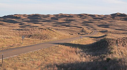
Nebraska Highway 12 is a highway in northern and northeastern Nebraska. It has a western terminus at U.S. Highway 83 in Valentine and an eastern terminus at U.S. Highway 20 west of Jackson. The highway largely lies within 10 miles (16 km) of the South Dakota border its entire length. The highway has been designated the Outlaw Trail Scenic Byway.

Nebraska Highway 14 (N-14) is a highway in the U.S. state of Nebraska. It has a southern terminus at the Kansas border, where it continues south as K-14, southwest of Superior and a northern terminus east of Niobrara at the South Dakota border.

Nebraska Highway 15 (N-15) is a highway in eastern Nebraska, United States. It has a southern terminus at the Kansas border south of Fairbury and a northern terminus northeast of Maskell at the South Dakota border.

Nebraska Highway 16 is a highway in northeastern Nebraska. Its southern terminus is southeast of Bancroft at an intersection with NE 51. Its northern terminus is at NE 35 south of Wakefield.
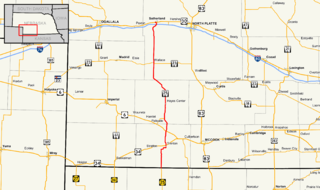
Nebraska Highway 25 is a highway in southwestern Nebraska. It runs for 87 miles (140 km). Its southern terminus is at the Kansas border south of Trenton. Its northern terminus is at U.S. Highway 30 in Sutherland.

Nebraska Highway 39 is a highway in central Nebraska. It runs for a length of 42.05 miles (67.67 km). It has a southern terminus west of Osceola at an intersection with Nebraska Highway 92. Its northern terminus is at an intersection with Nebraska Highway 14 southeast of Albion.
Nebraska Highway 79 is a highway in eastern Nebraska. It is a north–south highway which has a length of 60.28 miles (97.01 km). The southern terminus of Highway 79 is northwest of Lincoln near Lincoln Airport at U.S. Highway 34. The northern terminus of Highway 79 is in Snyder.

Nebraska Highway 61 is a highway in western Nebraska. It is a north–south highway with a length of 234.82 miles (377.91 km). The southern terminus of Nebraska Highway 61 is at the Kansas border south of Benkelman, where the highway continues south as K-161. The northern terminus is at the South Dakota border north of Merriman, where the highway continues north as South Dakota Highway 73.

Nebraska Highway 69 is a highway in southeastern Nebraska. Its southern terminus is at an intersection with U.S. Highway 34 east of Waco. Its northern terminus is at an intersection with U.S. Highway 81 and Nebraska Highway 92 in Shelby.

Nebraska Highway 87 is a highway in northwestern Nebraska. It has a southern terminus at Nebraska Highway 2 in Alliance. Its northern terminus is at the South Dakota border where it continues in northward as South Dakota Highway 407.
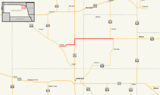
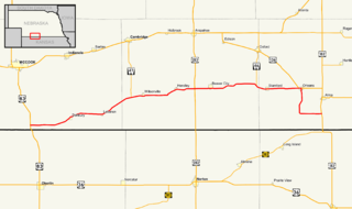
Nebraska Highway 98 is a highway in the northeastern part of the U.S. state of Nebraska. Its western terminus is at an intersection with Nebraska Highway 13 in Pierce. Its eastern terminus is at an intersection with Nebraska Highway 35 west of Wayne.
Nebraska Highway 89 is a highway in southern Nebraska. Its western terminus is at U.S. Highway 83 west of Danbury. Its eastern terminus is at an intersection with U.S. Highway 183 south of Alma.

Nebraska Highway 137 is a highway in northern Nebraska. Its southern terminus is at U.S. Highway 20 in Newport. Its northern terminus is at the South Dakota border where it continues as South Dakota Highway 47.

Nebraska Highway 91 is a highway in central and eastern Nebraska. Its western terminus is at an intersection with Nebraska Highway 2 north of Dunning. Its eastern terminus is at an intersection with U.S. Highway 30 and U.S. Highway 75 in Blair.

Nebraska Highway 70 is a highway in central Nebraska. Its western terminus is at an intersection with Nebraska Highway 2 and Nebraska Highway 92 east of Broken Bow. Its eastern terminus is at Nebraska Highway 14 in Elgin.

Nebraska Highway 71 is a highway in western Nebraska. Its southern terminus is at the Colorado border south of Kimball, as a continuation of Colorado State Highway 71. Its northern terminus is at the South Dakota border northwest of Crawford, where it continues as South Dakota Highway 71.