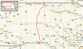
Nebraska Highway 7 is a highway in Nebraska. Its southern terminus is at Nebraska Highway 91 in Brewster. Its northern terminus is at U.S. Highway 183 near Springview.

Nebraska Highway 9 is a highway in northeastern Nebraska. The southern terminus is located just north of West Point at an intersection with U.S. Highway 275. Its northern terminus is at an intersection with Nebraska Highway 12 just south of Ponca.

Nebraska Highway 109 is a highway in eastern Nebraska. Its southern terminus is at U.S. Highway 77 and Nebraska Highway 92 at Wahoo, Nebraska. Its northern terminus is at U.S. Highway 77 near Fremont, Nebraska.

Nebraska Highway 11 is a highway in central and northern Nebraska. Its southern terminus is at Interstate 80 south of Wood River. Its northern terminus is at the South Dakota border north of Butte. The highway goes through the eastern portion of the Sand Hills.

Nebraska Highway 12 is a highway in northern and northeastern Nebraska. It has a western terminus at U.S. Highway 83 in Valentine and an eastern terminus at U.S. Highway 20 west of Jackson. The highway largely lies within 10 miles (16 km) of the South Dakota border its entire length. The highway has been designated the Outlaw Trail Scenic Byway.

Nebraska Highway 99 is a highway in southeastern Nebraska. It has a southern terminus at the Kansas border south of Burchard and just north of Summerfield, Kansas. Its northern terminus is north of Burchard at an intersection with Nebraska Highway 4. It lies entirely in Pawnee County. It is a part of a three-state "Highway 99" which includes K-99 in Kansas and Oklahoma State Highway 99.

Nebraska Highway 15 (N-15) is a highway in eastern Nebraska, United States. It has a southern terminus at the Kansas border south of Fairbury and a northern terminus northeast of Maskell at the South Dakota border.

Nebraska Highway 27 is a highway in Nebraska. It is divided into three segments. The southernmost segment begins at the Kansas border and goes north to Haigler. The middle segment begins at Interstate 80 near Chappell and goes north to Oshkosh. The northernmost segment begins at Ellsworth and goes north to the South Dakota border.

Nebraska Highway 40 is a highway in central Nebraska. It has a length of 85.73 miles (137.97 km). It has a western terminus at Nebraska Highway 92 in Arnold and an eastern terminus north of Kearney at an intersection with Nebraska Highway 10.

Nebraska Highway 45 is a highway in Nebraska. It runs in a south-to-north direction for 27 miles (43 km). It has a southern terminus at Nebraska Highway 91 south of Newman Grove. It has a northern terminus in Tilden at an intersection with U.S. Highway 275.

Nebraska Highway 52 is a highway in central Nebraska. It is 25.89 miles (41.67 km) in length and runs at a southeast-to-northwest angle, though signed north–south. The south terminus is at an intersection with Nebraska Highway 14 north of Fullerton. The northern terminus is located north of Primrose at an intersection with Nebraska Highway 91.

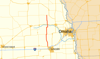
Nebraska Highway 79 is a highway in eastern Nebraska. It is a north–south highway which has a length of 60.28 miles (97.01 km). The southern terminus of Highway 79 is northwest of Lincoln near Lincoln Airport at U.S. Highway 34. The northern terminus of Highway 79 is in Snyder.

Nebraska Highway 68 is a highway in central Nebraska. Its western terminus is at an intersection with Nebraska Highway 2 just south of Ravenna. Its eastern terminus is at an intersection with Nebraska Highway 58 in Rockville.

Nebraska Highway 87 is a highway in northwestern Nebraska. It has a southern terminus at Nebraska Highway 2 in Alliance. Its northern terminus is at the South Dakota border where it continues in northward as South Dakota Highway 407.

Nebraska Highway 97 is a highway in western Nebraska. It has a southern terminus north of North Platte at an intersection with U.S. Highway 83. The northern terminus is at U.S. Highway 20 in Valentine.

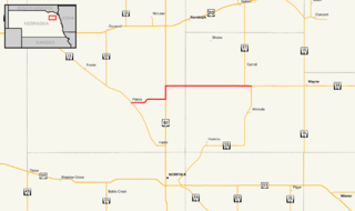
Nebraska Highway 98 is a highway in the northeastern part of the U.S. state of Nebraska. Its western terminus is at an intersection with Nebraska Highway 13 in Pierce. Its eastern terminus is at an intersection with Nebraska Highway 35 west of Wayne.

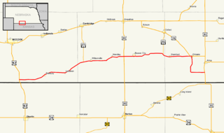
Nebraska Highway 89 is a highway in southern Nebraska. Its western terminus is at U.S. Highway 83 west of Danbury. Its eastern terminus is at an intersection with U.S. Highway 183 south of Alma.

Nebraska Highway 91 is a highway in central and eastern Nebraska. Its western terminus is at an intersection with Nebraska Highway 2 north of Dunning. Its eastern terminus is at an intersection with U.S. Highway 30 and U.S. Highway 75 in Blair.

Nebraska Highway 70 is a highway in central Nebraska. Its western terminus is at an intersection with Nebraska Highway 2 and Nebraska Highway 92 east of Broken Bow. Its eastern terminus is at Nebraska Highway 14 in Elgin.

Nebraska Highway 74 is a highway in southern Nebraska. Its western terminus is at an intersection with Nebraska Highway 10 in Minden. Its eastern terminus is at an intersection with Nebraska Highway 15 east of Tobias.


