Loup County, Nebraska

Last updated

Loup County
Loup County, Nebraska courthouse 2.JPG
Loup County Courthouse in Taylor
Map of Nebraska highlighting Loup County.svg
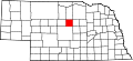
Location within the U.S. state of Nebraska
Nebraska in United States.svg
Nebraska's location within the U.S.
Coordinates: 41°56′N99°27′W / 41.93°N 99.45°W / 41.93; -99.45
CountryFlag of the United States.svg United States
StateFlag of Nebraska.svg  Nebraska
Founded1883
Seat Taylor
Largest villageTaylor
Area
  Total
571 sq mi (1,480 km2)
  Land568 sq mi (1,470 km2)
  Water2.8 sq mi (7 km2)  0.13%
Population
 (2020)
  Total
607
  Density1.1/sq mi (0.41/km2)
Time zone UTC−6 (Central)
  Summer (DST) UTC−5 (CDT)
Congressional district 3rd
Website www.co.loup.ne.us

Loup County is a county in the U.S. state of Nebraska. As of the 2020 United States census, the population was 607, [1] making it Nebraska's fifth-least populous county and the tenth-least populous county in the United States. Its county seat is Taylor. [2] The county was named after the Pawnee Loup Indians. [3]

Contents

In the Nebraska license plate system, Loup County is represented by the prefix 88 (it had the eighty-eighth-largest number of vehicles registered in the county when the license plate system was established in 1922).

Geography

The terrain of Loup County consists of low corrugated flatland, sparsely used for agricultural purposes at present. The ground slopes to the southeast. The Calamus River runs southeastward through the upper center of the county, feeding into the Calamus Reservoir which lies on the county's east border. The North Loup River also runs southeastward through the lower center of the county, exiting eastward near the SE corner to run to its junction with the Calamus River at a point east of Loup County. [4] The county has an area of 571 square miles (1,480 km2), of which 568 square miles (1,470 km2) is land and 2.8 square miles (7.3 km2) (0.5%) is water. [5]

Major highways

Adjacent counties

Protected area

Demographics

Historical population
CensusPop.Note
1890 1,662
1900 1,305−21.5%
1910 2,18867.7%
1920 1,946−11.1%
1930 1,818−6.6%
1940 1,777−2.3%
1950 1,348−24.1%
1960 1,097−18.6%
1970 854−22.2%
1980 8590.6%
1990 683−20.5%
2000 7124.2%
2010 632−11.2%
2020 607−4.0%
2022 (est.)599−1.3%
US Decennial Census [7]
1790-1960 [8] 1900-1990 [9]
1990-2000 [10] 2010 [11] 2020 2022 [12]

As of the 2000 United States Census, [13] there were 632 people, 289 households, and 206 families in the county. The population density was 1.1 people per square mile (0.42 people/km2). There were 377 housing units at an average density of 0.7 units per square mile (0.27/km2). The racial makeup of the county was 98.88% White, 0.28% Native American, 0.14% Asian, 0.42% from other races, and 0.28% from two or more races. 1.69% of the population were Hispanic or Latino of any race.

There were 289 households, out of which 31.80% had children under the age of 18 living with them, 64.70% were married couples living together, 4.20% had a female householder with no husband present, and 28.40% were non-families. 27.00% of all households were made up of individuals, and 17.00% had someone living alone who was 65 years of age or older. The average household size was 2.46 and the average family size was 2.99.

The county population contained 26.70% under the age of 18, 4.50% from 18 to 24, 22.30% from 25 to 44, 27.00% from 45 to 64, and 19.50% who were 65 years of age or older. The median age was 43 years. For every 100 females, there were 108.80 males. For every 100 females age 18 and over, there were 100.00 males.

The median income for a household in the county was $26,250, and the median income for a family was $27,788. Males had a median income of $20,515 versus $20,972 for females. The per capita income for the county was $12,427. About 14.20% of families and 17.70% of the population were below the poverty line, including 22.90% of those under age 18 and 11.60% of those age 65 or over.

Communities

Village

Unincorporated communities

Ghost towns

Politics

Loup County voters have been strongly Republican since the beginning. In only two national elections since 1900 has the county selected the Democratic Party candidate.

United States presidential election results for Loup County, Nebraska [14]
Year Republican Democratic Third party(ies)
No.%No.%No.%
2024 35482.71%7317.06%10.23%
2020 37081.50%7516.52%91.98%
2016 32383.90%4812.47%143.64%
2012 29081.01%6217.32%61.68%
2008 30276.84%8621.88%51.27%
2004 31481.35%6817.62%41.04%
2000 28475.13%8422.22%102.65%
1996 22968.77%7422.22%309.01%
1992 23459.69%5915.05%9925.26%
1988 29573.75%9824.50%71.75%
1984 32379.95%7919.55%20.50%
1980 36878.30%7415.74%285.96%
1976 29965.57%14030.70%173.73%
1972 34585.61%5814.39%00.00%
1968 33176.44%6414.78%388.78%
1964 34866.41%17633.59%00.00%
1960 44577.53%12922.47%00.00%
1956 44176.03%13923.97%00.00%
1952 50782.31%10917.69%00.00%
1948 29452.78%26347.22%00.00%
1944 48872.84%18227.16%00.00%
1940 53965.10%28934.90%00.00%
1936 43855.65%33542.57%141.78%
1932 28740.83%38955.33%273.84%
1928 59483.78%10614.95%91.27%
1924 28547.98%10517.68%20434.34%
1920 34366.73%11722.76%5410.51%
1916 16438.05%21950.81%4811.14%
1912 13128.60%11324.67%21446.72%
1908 24853.91%17036.96%429.13%
1904 22366.57%236.87%8926.57%
1900 14951.56%13747.40%31.04%

See also

References

  1. "Loup County, Nebraska". United States Census Bureau . Retrieved June 19, 2023.
  2. "Find a County". National Association of Counties. Retrieved June 7, 2011.
  3. Gannett, Henry (1905). The Origin of Certain Place Names in the United States. Government Printing Office. p.  191.
  4. Loup County NE Google Maps (accessed 23 January 2019)
  5. "2010 Census Gazetteer Files". US Census Bureau. August 22, 2012. Archived from the original on November 13, 2013. Retrieved December 9, 2014.
  6. Calamus Reservoir State Recreation Area Google Maps (accessed 23 January 2019)
  7. "US Decennial Census". US Census Bureau. Retrieved December 9, 2014.
  8. "Historical Census Browser". University of Virginia Library. Retrieved December 9, 2014.
  9. "Population of Counties by Decennial Census: 1900 to 1990". US Census Bureau. Retrieved December 9, 2014.
  10. "Census 2000 PHC-T-4. Ranking Tables for Counties: 1990 and 2000" (PDF). US Census Bureau. Archived (PDF) from the original on March 27, 2010. Retrieved December 9, 2014.
  11. https://www.census.gov/quickfacts/fact/table/loupcountynebraska/PST045222.{{cite web}}: Missing or empty |title= (help)
  12. "State & County QuickFacts". US Census Bureau. Archived from the original on June 7, 2011. Retrieved September 21, 2013.
  13. "U.S. Census website". United States Census Bureau . Retrieved January 31, 2008.
  14. Election Results

41°56′N99°27′W / 41.93°N 99.45°W / 41.93; -99.45