Banner County, Nebraska

Last updated

Banner County
Banner County Courthouse in Harrisburg
Map of Nebraska highlighting Banner County.svg
Location within the U.S. state of Nebraska
Nebraska in United States.svg
Nebraska's location within the U.S.
Coordinates: 41°32′N103°43′W / 41.54°N 103.72°W / 41.54; -103.72
CountryFlag of the United States.svg United States
StateFlag of Nebraska.svg  Nebraska
Founded1888
Seat Harrisburg
Largest communityHarrisburg
Area
  Total746 sq mi (1,930 km2)
  Land746 sq mi (1,930 km2)
  Water0.2 sq mi (0.5 km2)  0.02%
Population
 (2020)
  Total674
  Density0.90/sq mi (0.35/km2)
Time zone UTC−7 (Mountain)
  Summer (DST) UTC−6 (MDT)
Congressional district 3rd
Website bannercountyne.gov

Banner County is a county in the western part of the U.S. state of Nebraska in the Great Plains region of the United States. As of the 2020 United States Census, its population was 674. [1] Its county seat is the unincorporated community of Harrisburg; there are no incorporated municipalities within the county.

Contents

In the Nebraska license plate system, Banner County is represented by the prefix 85 (it had the eighty-fifth largest number of vehicles registered in the county when the license plate system was established in 1922).

Banner County is part of the Scottsbluff, NE Micropolitan Statistical Area.

History

When Nebraska became a state in 1867, a single county encompassed the entire Panhandle. [2] In 1870, the Panhandle's southern half was organized as Cheyenne County. The arrival of increasing numbers of settlers led to the partitioning of the county in 1888: the eastern third became Deuel County; the middle third became present-day Cheyenne County; and the western third became Kimball, Scotts Bluff, and Banner Counties. [3] The last of these was named by citizens who declared it would become the state's "banner county", and "the brightest star in the constellation of Nebraska counties". [4]

Upon the county's organization, the settlement of Ashford was chosen as the temporary county seat. Four communities aspired to be chosen as the permanent county seat: Ashford, Harrisburg, Freeport, and Banner. Two special elections proved necessary before Harrisburg was chosen. [5]

The initial settlement of the area was by cattle ranchers, drawn by good pastures in the Pumpkin Creek valley. In the late 1880s, these open-range ranchers were displaced by an influx of settlers; by 1890, almost every quarter-section (160 acres, or 65 ha) was claimed by homesteaders. However, the good moisture years that had attracted these settlers were followed by a severe drought in 1893 and 1894, which drove many of the new settlers away; the number of farms in the county declined by more than half, from 565 in 1890 to 226 in 1900. The land thus vacated was again used by ranchers, who raised both crops and cattle. The 1904 passage of the Kinkaid Act, which allowed homesteaders to claim 640 acres (260 ha) brought a new wave of settlers; however, even these larger tracts were often insufficient to support a family, and many of the Kinkaid claims were eventually sold to established cattle ranchers. [2] [6]

The county's growth was hindered by the absence of railroads: the nearest lines ran through Kimball, 11 miles (18 km) to the south, and Gering, 8 miles (13 km) to the north. Roads were also slow to develop in the county: in 1921, only dirt roads existed. The difficulty of reaching markets tended to discourage commercial crop farming in the county. [7]

Corn growing near the base of Gabe Rock, west of Harrisburg Gabe Rock from NW 1.JPG
Corn growing near the base of Gabe Rock, west of Harrisburg

Irrigation

Rainfall in Banner County is light and variable; the average yearly precipitation at the Harrisburg weather station is 14.3 inches (360 mm). [8] Farmers responded by resorting to irrigation. The first irrigation well was drilled by the late 1920s, and others quickly followed. By the late 20th century, center-pivot irrigation systems were in use through much of the county. [2] By 2000, the Pumpkin Creek basin had approximately 500 registered irrigation wells. [9] Groundwater pumping combined with drought conditions ended surface flow in Pumpkin Creek by 1993, and significantly reduced the valley's groundwater levels. [10] In 2001, the North Platte Natural Resources District, which regulates water use in the watershed, declared a moratorium on the drilling of new wells, and limited existing operations to 14 inches (360 mm) of irrigation water per year. [9] Complicating matters, lawsuits were filed contending water use in the Pumpkin Creek valley depleted flows into Lake McConaughy and interfered with the prior water rights of downstream irrigators. [11]

ICBMs

ICBM silo on southern slope of Wildcat Hills in Banner County ICBM Wrights Gap Banner Co NE.JPG
ICBM silo on southern slope of Wildcat Hills in Banner County

Beginning in the early 1960s, intercontinental ballistic missiles (ICBMs), based at Warren Air Force Base near Cheyenne, Wyoming, were installed in western Nebraska, Wyoming, and Colorado. From 1960 to 1963, 90 Atlas sites were constructed in Nebraska. Construction of the launch sites, and upgrading of the roads leading to them, led to an economic boom in western Nebraska. Beginning in 1963, the Atlas series was replaced by Minuteman missiles, which used solid instead of liquid fuel, and which were launched from underground silos. In the 1970s, there were 82 Minuteman III sites in the Panhandle, of which 20 were located in Banner County. [2]

Geography

Cattle grazing near buttes on north side of Pumpkin Creek Valley

According to the US Census Bureau, the county has an area of 746 square miles (1,930 km2), of which 746 square miles (1,930 km2) is land and 0.2 square miles (0.52 km2) (0.02%) is water. [12]

Banner County lies on what was once a tableland sloping away from the Rocky Mountains. Over geologic history, it was eroded by Pumpkin Creek and other watercourses, and much of the county now lies below the original High Plains level. The county can be divided into four major geographic divisions: the low-lying and relatively flat valley of Pumpkin Creek, which occupies about 40% of the county's area; a tableland, in places smooth and in others deeply dissected, occupying the southern one-third of the county; the Wildcat Hills, a highly dissected escarpment that crosses the county's northwestern portion; and a small portion of the North Platte River valley in the county's northeastern corner. [13]

Adjacent counties

The western edge of Banner County abuts the eastern border of the state of Wyoming.

Highways

Demographics

Historical population
CensusPop.Note
1890 2,435
1900 1,114−54.3%
1910 1,44429.6%
1920 1,435−0.6%
1930 1,67616.8%
1940 1,403−16.3%
1950 1,325−5.6%
1960 1,269−4.2%
1970 1,034−18.5%
1980 918−11.2%
1990 852−7.2%
2000 819−3.9%
2010 690−15.8%
2020 674−2.3%
2022 (est.)660 [15] −2.1%
US Decennial Census [16]
1790-1960 [17] 1900-1990 [18]
1990-2000 [19] 2010 [20]

Banner County's population peaked at 2,435 in 1890 and has since steadily declined. It is one of the least populated counties of Nebraska.

As of the 2000 United States Census, [21] there were 819 people, 311 households, and 237 families in the county. The population density was 1 person per square mile (0.39 person/km2). There were 375 housing units at an average density of 0 units per square mile (0/km2). The racial makeup of the county was 95.85% White, 0.12% Black or African American, 0.24% Native American, 0.12% Asian, 3.05% from other races, and 0.61% from two or more races. 5.62% of the population were Hispanic or Latino of any race. 31.2% were of German, 14.4% English, 14.1% American, 8.0% Swedish, 6.8% Irish and 5.0% Norwegian ancestry.

There were 311 households, out of which 30.20% had children under the age of 18 living with them, 70.10% were married couples living together, 4.20% had a female householder with no husband present, and 23.50% were non-families. 19.90% of all households were made up of individuals, and 9.60% had someone living alone who was 65 years of age or older. The average household size was 2.63 and the average family size was 3.06.

The county population contained 28.80% under the age of 18, 3.70% from 18 to 24, 24.30% from 25 to 44, 27.20% from 45 to 64, and 16.00% who were 65 years of age or older. The median age was 40 years. For every 100 females there were 108.40 males. For every 100 females age 18 and over, there were 101.00 males.

The median income for a household in the county was $31,339, and the median income for a family was $41,538. Males had a median income of $25,250 versus $18,750 for females. The per capita income for the county was $17,149. About 12.30% of families and 13.60% of the population were below the poverty line, including 19.00% of those under age 18 and 11.10% of those age 65 or over.

Economy

C. C. Hampton homestead machine shed C. C. Hampton homestead machine shed from NW 2.JPG
C. C. Hampton homestead machine shed

About 60% of Banner County is given over to farming: chiefly winter wheat and rangeland, [22] but also corn, beans, sugar beets, potatoes, sunflowers, rapeseed, and millet. [2] In response to groundwater depletion and drought, the Natural Resources Conservation Service has developed a system of cash incentives for farmers in the Pumpkin Creek watershed who convert irrigated cropland to dryland farming. [10]

Oil was discovered in Banner County in 1919, but the deposits were too deep to be commercially viable at that time. Petroleum production in Banner County began in 1951, and peaked in 1960, when 7,000,000 barrels (1,100,000 m3) [2] was produced from 397 wells. By 2009, the number of wells had fallen to about 200; [22] but new discoveries in Weld County, Colorado prompted interest in exploring the Niobrara shale, which lies beneath western Nebraska, northeastern Colorado, and southeastern Wyoming. A 2010 sale of oil leases yielded record prices in Banner and Kimball counties. [23]

Education

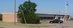
Banner County is covered by a single school district, with a K–12 school located in Harrisburg. As of 2017, the school's enrollment was 151. [24]

Community

Census-designated place

It is the only community in Banner County and the county seat; it is one of two unincorporated county seats in Nebraska. [5]

Politics

Banner County voters are strongly Republican. In only three national elections since 1900 has the county selected the Democratic Party candidate. This has only strengthened in recent years, with Republicans winning over 80% of the vote in each of the past six elections, dating back to 2000.

United States presidential election results for Banner County, Nebraska [25]
Year Republican Democratic Third party
No.%No.%No.%
2020 36288.08%4310.46%61.46%
2016 35788.81%194.73%266.47%
2012 34684.18%5513.38%102.43%
2008 34883.65%6214.90%61.44%
2004 37986.73%5612.81%20.46%
2000 39084.42%6514.07%71.52%
1996 30976.11%6215.27%358.62%
1992 28459.17%6814.17%12826.67%
1988 36175.68%11223.48%40.84%
1984 45787.55%5811.11%71.34%
1980 48190.41%336.20%183.38%
1976 28154.78%21040.94%224.29%
1972 40480.80%9619.20%00.00%
1968 35071.28%7214.66%6914.05%
1964 35764.56%19635.44%00.00%
1960 42466.77%21133.23%00.00%
1956 32964.01%18535.99%00.00%
1952 48477.69%13922.31%00.00%
1948 30957.43%22942.57%00.00%
1944 37871.05%15428.95%00.00%
1940 45066.57%22633.43%00.00%
1936 27742.62%36756.46%60.92%
1932 28543.78%35754.84%91.38%
1928 54886.30%8112.76%60.94%
1924 24549.80%8817.89%15932.32%
1920 25872.47%6919.38%298.15%
1916 14242.77%16650.00%247.23%
1912 5319.41%5620.51%16460.07%
1908 17565.30%7427.61%197.09%
1904 15581.58%189.47%178.95%
1900 18669.92%7126.69%93.38%

See also

Notes

  1. "Banner County, Nebraska". United States Census Bureau . Retrieved June 16, 2023.
  2. 1 2 3 4 5 6 Nebraska Historic Buildings Survey—Banner County. Archived February 22, 2006, at the Wayback Machine Nebraska State Historical Society. [usurped] Retrieved June 22, 2010.
  3. Nebraska Historic Buildings Survey—Reconnaissance Final Report of Cheyenne County, Nebraska. [usurped] Nebraska State Historical Society. [usurped] Retrieved June 22, 2010.
  4. Fitzpatrick, Lilian Linder (1925). "Banner County". Nebraska Place-Names. Retrieved June 29, 2010.
  5. 1 2 "About Us". Banner County official website. Retrieved December 11, 2017.
  6. Hayes and Bedell (1921), p. 11.
  7. Hayes and Bedell (1921), p. 9.
  8. "Harrisburg 10NW, Banner County, Nebraska USA". WorldClimate.com Retrieved August 31, 2010.
  9. 1 2 "Pumpkin Creek Basin (PCB) Sub-Area". Archived July 27, 2011, at the Wayback Machine North Platte Natural Resources District. Archived July 27, 2011, at the Wayback Machine Retrieved August 31, 2010.
  10. 1 2 Pope, Joanna. "Conservation Takes Pressure Off Pumpkin Creek". [ permanent dead link ] NRCS-Nebraska. Retrieved August 31, 2010.
  11. Hansen, Sandra. "Lawsuit roils waters in Platte River irrigation fight". Scottsbluff Star-Herald. March 10, 2009. Retrieved August 31, 2010.
  12. "2010 Census Gazetteer Files". US Census Bureau. August 22, 2012. Archived from the original on November 13, 2013. Retrieved December 6, 2014.
  13. Hayes and Bedell (1921), pp. 5–6.
  14. Nebraska Atlas & Gazetteer. Delorme; Freeport, Maine. First edition, 1996. pp. 42-43.
  15. "QuickFacts". United States Census Bureau. Retrieved March 2, 2024.
  16. "US Decennial Census". US Census Bureau. Retrieved December 6, 2014.
  17. "Historical Census Browser". University of Virginia Library. Retrieved December 6, 2014.
  18. "Population of Counties by Decennial Census: 1900 to 1990". US Census Bureau. Retrieved December 6, 2014.
  19. "Census 2000 PHC-T-4. Ranking Tables for Counties: 1990 and 2000" (PDF). US Census Bureau. Archived (PDF) from the original on March 27, 2010. Retrieved December 6, 2014.
  20. "State & County QuickFacts". US Census Bureau. Archived from the original on June 7, 2011. Retrieved September 17, 2013.
  21. "U.S. Census website". US Census Bureau. Retrieved January 31, 2008.
  22. 1 2 "Banner County". Scottsbluff Star-Herald. November 18, 2009. Retrieved August 31, 2010.
  23. Jenkins, Nate. "Oil frenzy spills into Nebraska; schools get the money". Lincoln Journal-Star. June 3, 2010. Retrieved August 31, 2010.
  24. Banner County Schools website Retrieved January 15, 2019.
  25. "Dave Leip's Atlas of U.S. Presidential Elections".

Related Research Articles

<span class="mw-page-title-main">Laramie County, Wyoming</span> County in Wyoming, United States

Laramie County is a county located at the southeast corner of the state of Wyoming. As of the 2020 United States Census, the population was 100,512 or 17.4% of the state's total 2020 population, making it the most populous county in Wyoming, but the least populous county in the United States to be the most populous in its state.

<span class="mw-page-title-main">Goshen County, Wyoming</span> County in Wyoming, United States

Goshen County is a county in the U.S. state of Wyoming. As of the 2020 United States Census, the population was 12,498. Its county seat is Torrington. The eastern boundary of the County borders the Nebraska state line.

<span class="mw-page-title-main">Sioux County, Nebraska</span> County in Nebraska, United States

Sioux County is a county in the U.S. state of Nebraska. As of the 2020 United States Census, the population was 1,135. Its county seat is Harrison.

<span class="mw-page-title-main">Scotts Bluff County, Nebraska</span> County in Nebraska, United States

Scotts Bluff County is a county on the western border of the U.S. state of Nebraska. As of the 2020 United States Census, the population was 36,084. Its county seat is Gering, and its largest city is Scottsbluff.

<span class="mw-page-title-main">Morrill County, Nebraska</span> County in Nebraska, United States

Morrill County is a county in the U.S. state of Nebraska. As of the 2020 United States Census, the population was 4,555. Its county seat is Bridgeport.

<span class="mw-page-title-main">Kimball County, Nebraska</span> County in Nebraska, United States

Kimball County is a county in the U.S. state of Nebraska. As of the 2020 United States Census, the population was 3,434. Its county seat is Kimball. The county was formed in 1888 and named after railroad pioneer Thomas Lord Kimball.

<span class="mw-page-title-main">Cheyenne County, Nebraska</span> County in Nebraska, United States

Cheyenne County is a county in the U.S. state of Nebraska. As of the 2020 United States Census, the population was 9,468. Its county seat is Sidney. The county was formed in 1871 and named for the Cheyenne Native American tribe.

<span class="mw-page-title-main">Scouting in Nebraska</span> Scouting in Nebraska

Scouting in Nebraska has a long history, from the 1910s to the present day, serving thousands of youth in programs that suit the environment in which they live.

<span class="mw-page-title-main">Harrisburg, Nebraska</span> Census-designated place in Nebraska, United States

Harrisburg is a census-designated place in, and the county seat of, Banner County, Nebraska, United States. The population was 100 at the 2010 census.

<span class="mw-page-title-main">Sidney, Nebraska</span> City in Nebraska, United States

Sidney is a city in and the county seat of Cheyenne County, Nebraska, United States. The city is nine miles (14 km) north of the Colorado state line. The population was 6,410 at the 2020 census.

<span class="mw-page-title-main">Gering, Nebraska</span> City in and county seat of Scotts Bluff County, Nebraska, United States

Gering is a city in and the county seat of Scotts Bluff County, Nebraska, United States, in the Panhandle region of the state. The population was 8,564 at the 2020 census, making it the 17th most populous city in Nebraska.

<span class="mw-page-title-main">Lyman, Nebraska</span> Village in Scotts Bluff County, Nebraska, United States

Lyman is a village in Scotts Bluff County, Nebraska, United States. It is part of the Scottsbluff, Nebraska Micropolitan Statistical Area. The population was 341 at the 2010 census.

<span class="mw-page-title-main">Scottsbluff, Nebraska</span> City in Scotts Bluff County, Nebraska, United States

Scottsbluff is a city in Scotts Bluff County, Nebraska, United States, in the Great Plains region. The population was 14,436 at the 2020 census. Scottsbluff is the largest city in the Nebraska Panhandle, and the 13th-most-populous city in Nebraska.

<span class="mw-page-title-main">Torrington, Wyoming</span> City in Wyoming, United States

Torrington is a city in, and the county seat of, Goshen County, Wyoming, United States. The population was 6,501 at the 2010 census.

<span class="mw-page-title-main">Chugwater, Wyoming</span> Town in Wyoming, United States

Chugwater is a town in Platte County, Wyoming, United States. As of the 2020 census, the town population was 175. The High Plains town, located 45 miles north of Cheyenne and 25 miles south of Wheatland.

<span class="mw-page-title-main">Wheatland, Wyoming</span> Town in Wyoming, United States

Wheatland is a town in and the county seat of Platte County in southeastern Wyoming, United States. The population was 3,627 at the 2010 census.

<span class="mw-page-title-main">North Platte River</span> River in the Western United States

The North Platte River is a major tributary of the Platte River and is approximately 716 miles (1,152 km) long, counting its many curves. In a straight line, it travels about 550 miles (890 km), along its course through the U.S. states of Colorado, Wyoming, and Nebraska.

<span class="mw-page-title-main">Nebraska panhandle</span> Place

The Nebraska panhandle is an area in the western part of the state of Nebraska and one of several U.S. state panhandles, or elongated geographical regions that extend from their main political entity.

<span class="mw-page-title-main">Lodgepole Creek</span> River

Lodgepole Creek is a tributary of the South Platte River, approximately 278 miles (447 km) long, in the U.S. states of Wyoming, Nebraska and Colorado. Lodgepole Creek drains a basin in the interior of a low plateau which lies between the South Platte Basin and the North Platte Basin in the southeastern corner of Wyoming, the southern edge of the Nebraska Panhandle and several small portions of northeastern Colorado. As its name implies, Lodgepole Creek is a very small stream; for nearly all of its length it flows through the semiarid High Plains. The Lodgepole Creek Valley has been a major transportation route for over 100 years; the line of the original transcontinental railroad, the Lincoln Highway/U.S. Highway 30 and Interstate 80 all run along the stream for much of its length.

<span class="mw-page-title-main">Cheyenne, Wyoming</span> Capital of Wyoming, United States

Cheyenne is the capital and most populous city of the U.S. state of Wyoming, as well as the county seat of Laramie County, with 65,132 residents, per the 2020 census. It is the principal city of the Cheyenne metropolitan statistical area which encompasses all of Laramie County and had 100,512 residents as of the 2020 census. Local residents named the town for the Cheyenne Native American people in 1867 when it was founded in the Dakota Territory. Along with Oklahoma City, Oklahoma and Topeka, Kansas, Cheyenne is one of three state capitals with an indigenous name in a state with an indigenous name.

References

41°32′N103°43′W / 41.54°N 103.72°W / 41.54; -103.72