Logan County | |
|---|---|
 Logan County Courthouse in Stapleton | |
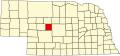
 Location within the U.S. state of Nebraska | |
 Nebraska's location within the U.S. | |
| Coordinates: 41°34′N100°29′W / 41.56°N 100.48°W | |
| Country | |
| State | |
| Founded | 1885 |
| Named after | John A. Logan |
| Seat | Stapleton |
| Largest village | Stapleton |
| Area | |
• Total | 571 sq mi (1,480 km2) |
| • Land | 571 sq mi (1,480 km2) |
| • Water | 0.5 sq mi (1.3 km2) 0.08% |
| Population (2020) | |
• Total | 716 |
| • Density | 1.35/sq mi (0.52/km2) |
| Time zone | UTC−6 (Central) |
| • Summer (DST) | UTC−5 (CDT) |
| Congressional district | 3rd |
| Website | logancounty |
Logan County is a county in the U.S. state of Nebraska. As of the 2020 census, the population was 716. [1] Its county seat is Stapleton. [2]
Contents
- History
- Geography
- Major highways
- Adjacent counties
- Demographics
- Communities
- Villages
- Unincorporated communities
- Politics
- References
Logan County is part of the North Platte Micropolitan Statistical Area.
In the Nebraska license plate system, Logan County is represented by the prefix 87 (it had the 87th-most registered vehicles when the license plate system was established in 1922).