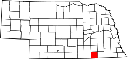
Thayer County, Nebraska

Last updated

Thayer County
Thayer County, Nebraska courthouse from E 1.JPG
Thayer County Courthouse in Hebron
Thayer County, Nebraska
Interactive map of Thayer County
Map of Nebraska highlighting Thayer County.svg
Location within the U.S. state of Nebraska
CountryFlag of the United States (23px).png  United States
State Flag of Nebraska.svg  Nebraska
EstablishedMay 9, 1871
Named for John Milton Thayer
County seat Hebron
Largest cityHebron
Area
  Total575 sq mi (1,490 km2)
  Land574 sq mi (1,490 km2)
  Water1.2 sq mi (3 km2)  0.2%
Highest elevation
1,545 ft (471 m)
Lowest elevation
1,142 ft (348 m)
Population
  Estimate 
(2021)
4,913
  Density8.8/sq mi (3.4/km2)
Time zone UTC−6 (Central)
  Summer (DST) UTC−5 (CDT)
Area code 402/531
FIPS code31169
GNIS feature ID 835906
Website thayercountyne.gov

Thayer County is a county in the U.S. state of Nebraska. As of the 2020 United States Census, the population was 5,034. [1] Its county seat is Hebron. The county was created in 1856 and originally named Jefferson County. It was organized in 1870-1871 and renamed for General and Governor John Milton Thayer. [2] [3] [4] [5]

Contents

In the Nebraska license plate system, Thayer County is represented by the prefix 32 (it had the thirty-second-largest number of vehicles registered in the state when the license plate system was established in 1922).

Geography

Thayer County lies on the south line of Nebraska. Its south boundary line abuts the north boundary line of the state of Kansas. Its terrain consists of rolling hills, sloped toward the east. A local drainage, Big Sandy Creek, flows southeast and east through the northern part of the county, and another drainage, Rose Creek, flows northeastward through the SE corner of the county (they converge east of Thayer County's east boundary line). The planar portions of the terrain are partially used for agriculture. [6]

Thayer County has an area of 575 square miles (1,490 km2), of which 574 square miles (1,490 km2) is land and 1.2 square miles (3.1 km2) (0.2%) is water. [7]

Major highways

Adjacent counties

Protected areas

Demographics

Historical population
CensusPop.Note
1880 6,113
1890 12,738108.4%
1900 14,32512.5%
1910 14,7753.1%
1920 13,976−5.4%
1930 13,684−2.1%
1940 12,262−10.4%
1950 10,563−13.9%
1960 9,118−13.7%
1970 7,779−14.7%
1980 7,582−2.5%
1990 6,635−12.5%
2000 6,055−8.7%
2010 5,228−13.7%
2020 5,034−3.7%
2021 (est.)4,913 [1] −2.4%
US Decennial Census [10]
1790-1960 [11] 1900-1990 [12]
1990-2000 [13] 2010-2013 [14] Its county seat is Hebron. [15]

As of the 2000 United States Census, [16] there were 6,055 people, 2,541 households, and 1,689 families in the county. The population density was 10 people per square mile (3.9 people/km2). There were 2,828 housing units at an average density of 5 units per square mile (1.9/km2). The racial makeup of the county was 98.70% White, 0.02% Black or African American, 0.28% Native American, 0.12% Asian, 0.33% from other races, and 0.56% from two or more races. 1.01% of the population were Hispanic or Latino of any race.

There were 2,541 households, out of which 27.70% had children under the age of 18 living with them, 58.80% were married couples living together, 5.00% had a female householder with no husband present, and 33.50% were non-families. 31.50% of all households were made up of individuals, and 18.20% had someone living alone who was 65 years of age or older. The average household size was 2.31 and the average family size was 2.90.

The county population contained 24.10% under the age of 18, 4.90% from 18 to 24, 22.30% from 25 to 44, 24.20% from 45 to 64, and 24.50% who were 65 years of age or older. The median age was 44 years. For every 100 females there were 95.80 males. For every 100 females age 18 and over, there were 92.80 males.

The median income for a household in the county was $30,740, and the median income for a family was $38,346. Males had a median income of $26,964 versus $18,275 for females. The per capita income for the county was $17,043. About 7.60% of families and 10.70% of the population were below the poverty line, including 14.80% of those under age 18 and 11.00% of those age 65 or over.

Communities

Cities

Villages

Politics

Thayer County voters are reliably Republican. In only one national election since 1936 has the county selected the Democratic Party candidate (as of 2020).

United States presidential election results for Thayer County, Nebraska [17]
Year Republican Democratic Third party
No.%No.%No.%
2020 2,30877.22%62420.88%571.91%
2016 2,05176.25%49918.55%1405.20%
2012 1,87470.48%72827.38%572.14%
2008 1,74965.78%86032.34%501.88%
2004 2,07572.10%76426.55%391.36%
2000 2,09669.73%82127.31%892.96%
1996 1,69856.81%93331.21%35811.98%
1992 1,39140.79%92427.10%1,09532.11%
1988 1,98159.56%1,32239.75%230.69%
1984 2,58072.66%94626.64%250.70%
1980 2,51468.88%92625.37%2105.75%
1976 1,99459.35%1,31539.14%511.52%
1972 2,27469.93%97830.07%00.00%
1968 2,33165.31%1,06129.73%1774.96%
1964 2,13248.13%2,29851.87%00.00%
1960 3,20267.38%1,55032.62%00.00%
1956 3,34669.81%1,44730.19%00.00%
1952 3,99275.92%1,26624.08%00.00%
1948 2,60157.39%1,93142.61%00.00%
1944 3,55468.37%1,64431.63%00.00%
1940 3,89365.21%2,07734.79%00.00%
1936 2,62842.91%3,41855.80%791.29%
1932 1,87832.33%3,84166.12%901.55%
1928 3,55261.80%2,17337.80%230.40%
1924 2,84752.73%1,71931.84%83315.43%
1920 3,45673.31%1,12023.76%1382.93%
1916 1,77251.26%1,58145.73%1043.01%
1912 70321.37%1,49045.29%1,09733.34%
1908 1,71449.07%1,70348.75%762.18%
1904 1,93062.48%81226.29%34711.23%
1900 1,82554.09%1,51644.93%330.98%

See also

Related Research Articles

<span class="mw-page-title-main">Clay County, Nebraska</span> County in Nebraska, United States

Clay County is a county in the U.S. state of Nebraska. As of the 2020 United States Census, the population was 6,104. Its county seat is Clay Center. The county was formed in 1855, and was organized in 1871. It was named for Henry Clay, a member of the United States Senate from Kentucky, who went on to become United States Secretary of State.

<span class="mw-page-title-main">Lancaster County, Nebraska</span> County in Nebraska, United States

Lancaster County is a county located in the U.S. state of Nebraska. As of the 2020 United States Census, the population was 322,608, making it the second-most populous county in Nebraska. Its county seat is Lincoln, the state capital. The county was created in 1859.

<span class="mw-page-title-main">York County, Nebraska</span> County in Nebraska, United States

York County is a county in the U.S. state of Nebraska. As of the 2020 United States Census, the population was 14,125. Its county seat is York.

<span class="mw-page-title-main">Webster County, Nebraska</span> County in Nebraska, United States

Webster County is a county in the U.S. state of Nebraska. As of the 2020 United States Census, the population was 3,411. Its county seat is Red Cloud. The county was formed in 1871, and was named for Daniel Webster.

<span class="mw-page-title-main">Stanton County, Nebraska</span> County in Nebraska, United States

Stanton County is a county in the U.S. state of Nebraska. As of the 2020 United States Census, the population was 5,842. Its county seat is Stanton. The county was formed in 1856 and organized in 1867. It was first called Izard County until 1862, when it was renamed for Edwin M. Stanton, Secretary of War during the administration of President Abraham Lincoln.

<span class="mw-page-title-main">Saunders County, Nebraska</span> County in Nebraska, United States

Saunders County is a county in the U.S. state of Nebraska. As of the 2020 United States Census, the population was 22,278. Its county seat is Wahoo.

<span class="mw-page-title-main">Saline County, Nebraska</span> County in Nebraska, United States

Saline County is a county in the U.S. state of Nebraska. As of the 2020 United States Census, the population was 14,292. Its county seat is Wilber.

<span class="mw-page-title-main">Richardson County, Nebraska</span> County in Nebraska, United States

Richardson County is the easternmost county in the U.S. state of Nebraska. As of the 2020 census, the population was 7,871. Its county seat is Falls City.

<span class="mw-page-title-main">Red Willow County, Nebraska</span> County in Nebraska, United States

Red Willow County is a county located in the U.S. state of Nebraska. As of the 2020 United States Census, the population was 10,702. Its county seat is McCook.

<span class="mw-page-title-main">Pawnee County, Nebraska</span> County in Nebraska, United States

Pawnee County is a county in the U.S. state of Nebraska. As of the 2020 United States Census, the population was 2,544. Its county seat is Pawnee City.

<span class="mw-page-title-main">Nuckolls County, Nebraska</span> County in Nebraska, United States

Nuckolls County is a county located in the U.S. state of Nebraska. As of the 2020 United States Census, the population was 4,095. Its county seat is Nelson.

<span class="mw-page-title-main">Merrick County, Nebraska</span> County in Nebraska, United States

Merrick County is a county in the U.S. state of Nebraska. As of the 2020 United States Census, the population was 7,668. Its county seat is Central City.

<span class="mw-page-title-main">Madison County, Nebraska</span> County in Nebraska, United States

Madison County is a county in the U.S. state of Nebraska. As of the 2020 United States Census, the population was 35,585. Its county seat is Madison and its largest city is Norfolk. Madison County was likely named for Madison, Wisconsin, which is where many of the county’s residents came from; the city was named for James Madison, fourth President of the United States.

<span class="mw-page-title-main">Lincoln County, Nebraska</span> County in Nebraska, United States

Lincoln County is a county located in the U.S. state of Nebraska. As of the 2020 census, the population was 34,676. Its county seat is North Platte. Despite the county's name, the state capital city of Lincoln is not in or near Lincoln County.

<span class="mw-page-title-main">Kearney County, Nebraska</span> County in Nebraska, United States

Kearney County is a county located in the U.S. state of Nebraska. As of the 2020 United States Census, the population was 6,688. Its county seat is Minden. The county was formed in 1860. It was named for Fort Kearny, which in turn was named for Brigade General Stephen W. Kearny.

<span class="mw-page-title-main">Jefferson County, Nebraska</span> County in Nebraska, United States

Jefferson County is a county in the U.S. state of Nebraska. As of the 2020 United States Census, the population was 7,240. Its county seat is Fairbury. The county was named for Thomas Jefferson, third President of the United States of America.

<span class="mw-page-title-main">Harlan County, Nebraska</span> County in Nebraska, United States

Harlan County is a county in the U.S. state of Nebraska. As of the 2020 United States Census, the population was 3,073. Its county seat is Alma. The county is home to the Harlan County Reservoir.

<span class="mw-page-title-main">Hamilton County, Nebraska</span> County in Nebraska, United States

Hamilton County is a county in the U.S. state Nebraska. As of the 2020 United States Census, the population was 9,429. Its county seat is Aurora. The county was named for Alexander Hamilton, the first Secretary of the Treasury in the new United States government.

<span class="mw-page-title-main">Dixon County, Nebraska</span> County in Nebraska, United States

Dixon County is a county in the U.S. state of Nebraska. As of the 2020 United States Census, the population was 5,606. Its county seat is Ponca. The county was created in 1856 and attached to Dakota County. It was organized in 1858.

<span class="mw-page-title-main">Cedar County, Nebraska</span> County in Nebraska, United States

Cedar County is a county in the U.S. state of Nebraska. As of the 2020 United States Census, the population was 8,380. The county seat is Hartington. The county was formed in 1857, and was named for the Cedar tree groves in the area.

References

  1. 1 2 "County Population Totals: 2020-2021". Census.gov. US Census Bureau. Retrieved October 21, 2022.
  2. Fitzpatrick, Lilian Linder (1925). Nebraska Place-Names. Lincoln: University of Nebraska Studies in Language, Literature, and Criticism. p. 138. Retrieved December 17, 2014.
  3. "Nebraska Historic Buildings Survey Reconnaissance Survey Final Report of Thayer County, Nebraska" (PDF). Nebraska State Historical Society. August 1, 1991. Archived from the original on November 16, 2006. Retrieved December 17, 2014.{{cite web}}: CS1 maint: unfit URL (link)
  4. Andreas, A. T. (1882). "Andreas' History of the State of Nebraska". The Kansas Collection. Archived from the original on January 29, 2003. Retrieved December 17, 2014.
  5. "Thayer County". Nebraska Association of County Officials. Retrieved December 17, 2014.
  6. Thayer County NE Google Maps (accessed 25 January 2019)
  7. "2010 Census Gazetteer Files". United States Census Bureau. August 22, 2012. Archived from the original on November 13, 2013. Retrieved December 12, 2014.
  8. Prairie Marsh State Wildlife Management Area, Bruning NE Google Maps (accessed 25 January 2019)
  9. Prairie Marsh West State Wildlife Management Area, Carleton NE Google Maps (accessed 25 January 2019)
  10. "US Decennial Census". US Census Bureau. Retrieved December 12, 2014.
  11. "Historical Census Browser". University of Virginia Library. Retrieved December 12, 2014.
  12. "Population of Counties by Decennial Census: 1900 to 1990". US Census Bureau. Retrieved December 12, 2014.
  13. "Census 2000 PHC-T-4. Ranking Tables for Counties: 1990 and 2000" (PDF). US Census Bureau. Archived (PDF) from the original on March 27, 2010. Retrieved December 12, 2014.
  14. "State & County QuickFacts". US Census Bureau. Retrieved September 22, 2013.
  15. "Find a County". National Association of Counties. Retrieved June 7, 2011.
  16. "U.S. Census website". US Census Bureau. Retrieved January 31, 2008.
  17. Election Results

Official website

40°11′N97°35′W / 40.18°N 97.59°W / 40.18; -97.59