David City, Nebraska

Last updated

David City, Nebraska
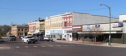
David City, Nebraska E from 5th.JPG
Downtown David City: E Street
Butler County Nebraska Incorporated and Unincorporated areas David City Highlighted.svg
Location of David City, Nebraska
USA Nebraska relief location map.svg
Red pog.svg
David City
Location within Nebraska
Usa edcp relief location map.png
Red pog.svg
David City
Location within the United States
Coordinates: 41°15′16″N97°07′35″W / 41.25444°N 97.12639°W / 41.25444; -97.12639
Country United States
State Nebraska
County Butler
Township Franklin
Founded1873
Named for Possibly David Butler or Phoebe Davids Miles
Area
[1]
  Total2.03 sq mi (5.27 km2)
  Land2.02 sq mi (5.22 km2)
  Water0.02 sq mi (0.05 km2)
Elevation
[2]
1,624 ft (495 m)
Population
 (2020)
  Total2,995
  Density1,486.35/sq mi (573.83/km2)
Time zone UTC-6 (Central (CST))
  Summer (DST) UTC-5 (CDT)
ZIP code
68632
Area code 402
FIPS code 31-12315
GNIS feature ID837956 [2]
Website davidcityne.com

David City is a city and the county seat of Butler County, Nebraska, United States. The population was 2,995 at the 2020 census. [3] David City was founded in 1873 to serve as the county seat when county residents desired a more centrally located county seat than Savannah. [4]

Contents

Name

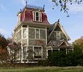
Butler County Museum Butler County Museum, David City, Nebraska 01.jpg
Butler County Museum

The origin of the name of David City is disputed. [5] One source claims that David City was named after the first Governor of Nebraska, David Butler. [6] [5] Another source says that David City was named in honor of Phoebe Miles, whose maiden name was either "David" or "Davids," because she had deeded a large tract of land for the townsite on which the courthouse now sits. [7] [5] [8] A third source indicates that David City may have been named for a "Mr. Davids," a relative of William Miles, who was part owner of the townsite, and that the "s" at the end of "Davids" was dropped for convenience. [5] Because details are unclear, this third explanation may be just another version of the second explanation. On its official website, David City claims the second of these explanations as the official explanation of its name. [8]

Geography

According to the United States Census Bureau, the city has a total area of 2.07 square miles (5.36 km2), of which 2.06 square miles (5.34 km2) is land and 0.01 square miles (0.03 km2) is water. [9]

Climate

Climate data for David City 4E, Nebraska (1991–2020 normals, extremes 1897–present)
MonthJanFebMarAprMayJunJulAugSepOctNovDecYear
Record high °F (°C)71
(22)
79
(26)
89
(32)
96
(36)
105
(41)
106
(41)
114
(46)
111
(44)
104
(40)
96
(36)
85
(29)
76
(24)
114
(46)
Mean daily maximum °F (°C)31.1
(−0.5)
36.1
(2.3)
49.0
(9.4)
61.1
(16.2)
71.9
(22.2)
81.8
(27.7)
85.9
(29.9)
83.8
(28.8)
77.2
(25.1)
63.7
(17.6)
48.0
(8.9)
34.8
(1.6)
60.4
(15.8)
Daily mean °F (°C)21.4
(−5.9)
25.7
(−3.5)
37.4
(3.0)
48.7
(9.3)
60.4
(15.8)
70.7
(21.5)
75.0
(23.9)
72.7
(22.6)
64.9
(18.3)
51.6
(10.9)
37.1
(2.8)
25.4
(−3.7)
49.2
(9.6)
Mean daily minimum °F (°C)11.7
(−11.3)
15.3
(−9.3)
25.7
(−3.5)
36.4
(2.4)
48.9
(9.4)
59.6
(15.3)
64.0
(17.8)
61.7
(16.5)
52.6
(11.4)
39.5
(4.2)
26.2
(−3.2)
16.0
(−8.9)
38.1
(3.4)
Record low °F (°C)−30
(−34)
−30
(−34)
−17
(−27)
5
(−15)
22
(−6)
33
(1)
43
(6)
35
(2)
18
(−8)
5
(−15)
−13
(−25)
−27
(−33)
−30
(−34)
Average precipitation inches (mm)0.78
(20)
0.90
(23)
1.72
(44)
3.02
(77)
4.53
(115)
4.88
(124)
3.09
(78)
4.00
(102)
2.79
(71)
2.16
(55)
1.35
(34)
1.15
(29)
30.37
(771)
Average snowfall inches (cm)8.0
(20)
7.4
(19)
5.1
(13)
1.9
(4.8)
0.0
(0.0)
0.0
(0.0)
0.0
(0.0)
0.0
(0.0)
0.0
(0.0)
0.9
(2.3)
2.4
(6.1)
6.1
(15)
31.8
(81)
Average precipitation days (≥ 0.01 in)5.66.07.79.712.011.19.19.67.87.05.15.996.6
Average snowy days (≥ 0.1 in)4.44.32.90.80.00.00.00.00.00.42.04.219.0
Source: NOAA [10] [11]

Demographics

Historical population
CensusPop.Note
1880 1,000
1890 2,028102.8%
1900 1,845−9.0%
1910 2,17718.0%
1920 2,2161.8%
1930 2,3335.3%
1940 2,272−2.6%
1950 2,3212.2%
1960 2,304−0.7%
1970 2,3803.3%
1980 2,5145.6%
1990 2,5220.3%
2000 2,5973.0%
2010 2,90611.9%
2020 2,9953.1%
U.S. Decennial Census [12]
2012 Estimate [13]

2010 census

As of the census [14] of 2010, there were 2,906 people, 1,153 households, and 706 families living in the city. The population density was 1,410.7 inhabitants per square mile (544.7/km2). There were 1,274 housing units at an average density of 618.4 per square mile (238.8/km2). The racial makeup of the city was 96.1% White, 0.6% African American, 0.1% Native American, 0.7% Asian, 1.8% from other races, and 0.8% from two or more races. Hispanic or Latino of any race were 3.5% of the population.

There were 1,153 households, of which 30.6% had children under the age of 18 living with them, 47.0% were married couples living together, 10.5% had a female householder with no husband present, 3.7% had a male householder with no wife present, and 38.8% were non-families. 33.4% of all households were made up of individuals, and 18.1% had someone living alone who was 65 years of age or older. The average household size was 2.37 and the average family size was 3.05.

The median age in the city was 42.1 years. 25.9% of residents were under the age of 18; 6.4% were between the ages of 18 and 24; 21.2% were from 25 to 44; 24.8% were from 45 to 64; and 21.7% were 65 years of age or older. The gender makeup of the city was 47.5% male and 52.5% female.

2000 census

As of the census of 2000, there were 2,597 people, 1,082 households, and 641 families living in the city. The population density was 1,724.6 inhabitants per square mile (665.9/km2). There were 1,203 housing units at an average density of 798.9 per square mile (308.5/km2). The racial makeup of the city was 98.58% White, 0.15% African American, 0.15% Native American, 0.23% Asian, 0.12% Pacific Islander, 0.50% from other races, and 0.27% from two or more races. Hispanic or Latino of any race were 1.00% of the population.

There were 1,082 households, out of which 29.6% had children under the age of 18 living with them, 49.0% were married couples living together, 7.1% had a female householder with no husband present, and 40.7% were non-families. 37.2% of all households were made up of individuals, and 22.6% had someone living alone who was 65 years of age or older. The average household size was 2.31 and the average family size was 3.06.

In the city, the population was spread out, with 26.2% under the age of 18, 5.7% from 18 to 24, 23.2% from 25 to 44, 20.4% from 45 to 64, and 24.5% who were 65 years of age or older. The median age was 41 years. For every 100 females, there were 91.5 males. For every 100 females age 18 and over, there were 85.8 males.

As of 2000 the median income for a household in the city was $34,583, and the median income for a family was $48,098. Males had a median income of $28,185 versus $21,179 for females. The per capita income for the city was $16,550. About 3.1% of families and 8.1% of the population were below the poverty line, including 8.0% of those under age 18 and 10.1% of those age 65 or over.
Education

High schools

David City has two high schools. The largest is David City Secondary School. Its athletic teams are the Scouts. [15] The second is Aquinas High School. The Catholic school is named after Thomas Aquinas. Its teams are the Monarchs.

David City Public Schools

David City Public Schools operates a secondary school and two elementary schools: Bellwood and David City. [15]

Media

David City has one newspaper, The Banner-Press. The newspaper is published once a week. [16]

Notable people

Related Research Articles

<span class="mw-page-title-main">York County, Nebraska</span> County in Nebraska, United States

York County is a county in the U.S. state of Nebraska. As of the 2020 United States Census, the population was 14,125. Its county seat is York.

<span class="mw-page-title-main">Butler County, Nebraska</span> County in Nebraska, United States

Butler County is a county in the U.S. state of Nebraska. As of the 2020 United States Census, the population was 8,369. Its county seat is David City. The county was created in 1856 and organized in 1868.

<span class="mw-page-title-main">Allison, Iowa</span> City in Iowa, United States

Allison is a city in, and the county seat of, Butler County, Iowa, United States. The population was 966 at the 2020 census. Allison is home to the Butler County Fair. The city was named for U.S. Senator William B. Allison in 1881.

<span class="mw-page-title-main">Hastings, Nebraska</span> City in and county seat of Adams County, Nebraska, United States

Hastings is a city and the county seat of Adams County, Nebraska, United States. The population was 25,152 at the 2020 census, making it the 8th most populous city in Nebraska.

<span class="mw-page-title-main">Bellwood, Nebraska</span> Village in Nebraska, United States

Bellwood is a village in Butler County, Nebraska, United States. The population was 435 at the 2010 census.

<span class="mw-page-title-main">Brainard, Nebraska</span> Village in Nebraska, United States

Brainard is a village in Butler County, Nebraska, United States. The population was 330 at the 2010 census.

<span class="mw-page-title-main">Octavia, Nebraska</span> Village in Nebraska, United States

Octavia is a village in Butler County, Nebraska, United States. The city had 127 residents as of 2010 census, according to the United States Census Bureau.

<span class="mw-page-title-main">Rising City, Nebraska</span> Village in Nebraska, United States

Rising City is a village in Butler County, Nebraska, United States. The population was 374 at the 2010 census.

<span class="mw-page-title-main">Surprise, Nebraska</span> Village in Nebraska, United States

Surprise is a village in southwestern Butler County, Nebraska, United States. The population was 43 at the 2010 census, and 37 at the 2020 census.

<span class="mw-page-title-main">Dalton, Nebraska</span> Village in Nebraska, United States

Dalton is a village in Cheyenne County, Nebraska, United States. The population was 315 at the 2010 census.

<span class="mw-page-title-main">North Bend, Nebraska</span> City in Nebraska, United States

North Bend is a city in Dodge County, Nebraska, United States. The population was 1,177 at the 2010 census.

<span class="mw-page-title-main">Valley, Nebraska</span> City in Douglas County, Nebraska, United States

Valley is a city in Douglas County, Nebraska, United States. The population was 3,037 at the 2020 census.

<span class="mw-page-title-main">Aurora, Nebraska</span> City in Nebraska, United States

Aurora is a city in Hamilton County, Nebraska, United States. The population was 4,479 at the 2010 census. It is the county seat of Hamilton County.

<span class="mw-page-title-main">Ogallala, Nebraska</span> City in Nebraska, United States

Ogallala is a city in and the county seat of Keith County, Nebraska, United States. The population was 4,878 at the 2020 census, up from 4,737 at the 2010 census. In the days of the Nebraska Territory, the city was a stop on the Pony Express and later along the transcontinental railroad. The Ogallala Formation that carries the Ogallala Aquifer was named after the city.

<span class="mw-page-title-main">Pawnee City, Nebraska</span> City in and county seat of Pawnee County, Nebraska, United States

Pawnee City is a city in and the county seat of Pawnee County, Nebraska, United States. The population was 878 at the 2010 census.

<span class="mw-page-title-main">Pierce, Nebraska</span> City in Nebraska, United States

Pierce is a city in and county seat of Pierce County, Nebraska, United States. The population was 1,767 at the 2010 census.

<span class="mw-page-title-main">Bassett, Nebraska</span> City in and county seat of Rock County, Nebraska, United States

Bassett is a city and county seat of Rock County, Nebraska, United States. The population was 538 at the 2020 census.

<span class="mw-page-title-main">Belvidere, Nebraska</span> Village in Thayer County, Nebraska, United States

Belvidere is a village in Thayer County, Nebraska, United States. The population was 51 at the 2020 census.

<span class="mw-page-title-main">Fort Calhoun, Nebraska</span> City in Washington County, Nebraska, United States

Fort Calhoun is a city in Washington County, Nebraska, United States. The population was 1,108 at the 2020 census. The city includes Fort Atkinson, the first fort built west of the Missouri River.

<span class="mw-page-title-main">York, Nebraska</span> City in and county seat of York County, Nebraska, United States

York is a city in and the county seat of York County, Nebraska, United States. At the 2010 census, the city population was 7,766. It is the home of York University and the Nebraska Correctional Center for Women.

References

  1. "ArcGIS REST Services Directory". United States Census Bureau. Retrieved September 18, 2022.
  2. 1 2 U.S. Geological Survey Geographic Names Information System: David City, Nebraska
  3. "Find a County". National Association of Counties. Archived from the original on May 31, 2011. Retrieved June 7, 2011.
  4. "David City, Butler County". Center for Advanced Land Management Information Technologies. University of Nebraska. Retrieved July 31, 2014.
  5. 1 2 3 4 Elton A. Perkey (2003). Perkey's Nebraska Place Names (4th ed.). Nebraska State Historical Society. p. 22.
  6. Gannett, Henry (1905). The Origin of Certain Place Names in the United States. Govt. Print. Off. pp.  100.
  7. Fitzpatrick, Lilian L. (1960). Nebraska Place-Names. University of Nebraska Press. p. 28. ISBN   0803250606 . Retrieved December 13, 2014.
  8. 1 2 "History", David City, Nebraska, The courthouse site was owned by Mrs. Phoebe Davids Miles, who donated the land for the structure. The town was named in honor of her late father, William Davids of Marion, Ohio. The "s" in the name was dropped and the town became David City, the only town in the world with this name.
  9. "US Gazetteer files 2010". United States Census Bureau. Archived from the original on January 12, 2012. Retrieved June 24, 2012.
  10. "NOWData - NOAA Online Weather Data". National Oceanic and Atmospheric Administration. Retrieved April 2, 2024.
  11. "Summary of Monthly Normals 1991-2020". National Oceanic and Atmospheric Administration. Retrieved April 2, 2024.
  12. United States Census Bureau. "Census of Population and Housing" . Retrieved October 19, 2013.
  13. "Annual Estimates of the Resident Population: April 1, 2010 to July 1, 2012". Archived from the original on October 19, 2013. Retrieved October 19, 2013.
  14. "U.S. Census website". United States Census Bureau . Retrieved June 24, 2012.
  15. 1 2 "David City Public Schools". www.davidcitypublicschools.org. Retrieved January 26, 2019.
  16. Telegram, Columbus. "Banner-press". Columbus Telegram. Retrieved January 26, 2019.