Central City, Nebraska

Last updated

Central City, Nebraska
Central City, Nebraska G St from B Ave.JPG
Downtown Central City: G Street
Merrick County Nebraska Incorporated and Unincorporated areas Central City Highlighted.svg
Location of Central City, Nebraska
Coordinates: 41°06′49″N97°59′26″W / 41.11361°N 97.99056°W / 41.11361; -97.99056
Country United States
State Nebraska
County Merrick
Established1866
Current name1875
Area
[1]
  Total2.42 sq mi (6.27 km2)
  Land2.42 sq mi (6.27 km2)
  Water0.00 sq mi (0.00 km2)
Elevation
[2]
1,696 ft (517 m)
Population
 (2020)
  Total3,039
  Density1,254.75/sq mi (484.43/km2)
Time zone UTC-6 (Central (CST))
  Summer (DST) UTC-5 (CDT)
ZIP code
68826
Area code 308
FIPS code 31-08535
GNIS feature ID837913 [2]
Website cc-ne.com

Central City is a city and the county seat of Merrick County, Nebraska, United States. [3] It is part of the Grand Island, Nebraska Metropolitan Statistical Area. The population was 2,934 at the 2010 census.

Contents

History

Early inhabitants

The inhabitants just prior to the establishment of Lone Tree (Central City) were the Pawnee. In the late 1700s, the Chaui (Cáwiiʾi) had a village on the current location of Central City. An account that an old Chaui man gave to Major Frank North in 1875 about a battle that took place between two divisions of the Pawnee (the Chaui, Pitahauerit, and Kitkehahki, jointly known as the Southern Pawnee, on one side; and the Skidi on the other) in the late 1700s illustrates the political complexities of the early inhabitants of what would come to be Central City. [4]

There had been considerable rivalry between the Chaui and the Skidi, which eventually led to an unprovoked attack by the Skidi on a group of Chaui hunting buffalo. It was estimated that 200 Chaui were killed. All were men from the Chaui village, which was near Lone Tree and where Central City is now located. The surviving Chaui returned to their village (this was thought to have occurred during winter). The Chaui did not believe they were strong enough to attack the Skidi, so they held councils with two other Southern Pawnee bands and told them what happened. The Pitahauerit and Kitkehahki decided to help the Chaui against the Skidi. [4]

The men of the three villages crossed the Platte River and made a night march to the Skidi village. Some of the men dressed as buffaloes in order to entice the Skidi out of their village to hunt buffalo. The rest of the men hid along the river and behind the ridge of sandhills next to the river. The Skidi charged between the men hiding along the river and behind the sandhill ridge thinking that they were chasing buffalo; the Southern Pawnees attacked them there. [4]

All of the Skidi men who had not gone out to hunt the buffaloes came out of the village and joined buffalo hunters who had initially escaped, preparing to make a last stand. Grinnell's Chaui informant estimated that more than 400 Skidi men were killed. The Chaui and the Pitahauerat wanted to exterminate the Skidi, but the Kitkehaki disagreed, arguing that the Skidi were the same people as they and should not be eradicated. The three bands argued for some time, but the Kitkehaki won the argument. They told the Skidi that they wanted to talk and Skidi subsequently agreed to their terms. The Southern Pawnees took much of the Skidi property, including many horses. Many of the Skidi women were forced to marry into the other villages to establish family ties among villages of Pawnee. [4]

Founding of Lone Tree

The first pioneers passed by what would eventually become Central City on the Mormon Trail in 1847 and later on the Oregon Trail and the California Trail. This location was close to a huge cottonwood tree, called Lone Tree, that the pioneers used on these trails as a landmark. In 1858, the Nebraska Territorial Legislature establish Merrick county named after Elvira Merrick, the wife of a Dodge County Nebraska Territorial legislator who introduced the bill creating Merrick County. A yet to be established county seat was called "Elvira" and was said to be located under Lone Tree. [5]

It was not until 1866 that an actual county seat was created near the mythical location of Elvira and renamed "Lone Tree." It was established as the Union Pacific Railroad was laying tracks through Merrick County. In 1868, J.H. Berryman built the first substantial building, which functioned as a general store, hotel, bar, courthouse, [6] revival meeting hall, and his home. The first courthouse was built in 1871 and was replaced by the current court house in 1912. [5] [7] [8] [9]

Nebraska Christian High school main building, formerly Nebraska Central College main building Nebraska Christian Highschool 12-26-2012.JPG
Nebraska Christian High school main building, formerly Nebraska Central College main building

Name change

In 1875 a petition was presented to the Merrick County Court requesting a name change for Lone Tree to "Central City". Proponents of change argued that the name "Lone Tree", gave the impression that the area was desolate and the inhabitants were poor and uncivilized, which would not bring in new settlers and thereby limit the growth of the area. Opponents to change countered that "Lone Tree" portrayed a "beautiful spot and is a name dear to the pioneers." The proponents of change won out and on July 1, 1875, the name was officially changed from "Lone Tree" to "Central City." [7] [8] [9] Central City was meant to designate the city's key location within the state's agricultural belt. [10]

Boom town

By the 1880s, Central City was a "boom" town after the arrival of a second railroad, the Burlington & Missouri River. During this time of peak growth, three banks were built, in addition to a hardware store, a roller mill, two newspapers, three lumberyards, a cracker factory, a cigar factory, a new brick school, nine churches, and Nebraska Central College, which opened in 1885 as a Methodist college. [7] [8] [9] [11]

The first newspaper in Central City was The Merrick County News, which published its first addition on March 21, 1872; it would become the Courier in 1874. Several attempts were made to establish a second paper, starting with the Sentinel, a "railroad" paper, on April 10, 1873; it lasted only a short time. In 1880, the Merrick County Item was first published, but only lasted until 1881. In 1882, the Nonpareil opened and Central City again had two newspapers. [12] [13]

By the 1890s, economic growth had slowed. The Courier closed in 1890, and Nebraska Central College closed in 1891. A flood washed out both the Union Pacific and Burlington railroad tracks. By the mid-1890s, economic conditions were improving. Two new newspapers opened: the Record in 1895 (which would close in 1908) and the Republican in 1896 (which would merge with the Nonpareil to form the current Republican-Nonpareil in 1953). [13] The Society of Friends (Quakers) reopened Nebraska Central College in 1899. [5] [7] [8] [9]

The early 1900s saw the construction of a new courthouse (1911–1913), the historic Martha Ellen Auditorium (1916, earlier an opera house), and a new high school. [14] Economic growth was aided in the 1920s by the opening of a branch of Omaha Cold Storage in 1927, allowing farmers to sell their poultry and eggs locally at better prices. Perhaps the most notable citizen of Central City, Wright Morris, lived here from 1910 to 1919. [7] [8] [9]

1930s to the present

A library was built just before the Great Depression, but little construction took place during the 1930s. In the 1940s, construction resumed when a hospital was built and a gymnasium was added for the high school. In the 1950s, Nebraska Central College closed (1953), but a new hospital was built in 1959. In 1975, an explosion and fire destroyed an entire city block, but Central City still reached its largest population to date at 3,083 people in 1980. Central City's population has declined slightly since then. [7] [8] [9]

Historic places and buildings

National Register of Historic Places

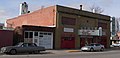
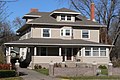
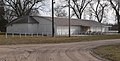
Six places in or near Central City are listed in the National Register of Historic Places. [5] To qualify for listing in the National Register of Historic Places, a place (e.g., building, landmark, or location) must be at least 50 years old and have one or more of the following characteristics or associations: historic events, notable people, and/or architecture.

[15] Name on the RegisterImageDate listed [16] Location City or townDescription
1 Martha Ellen Auditorium
Martha Ellen Auditorium State Theater, Central City, Nebraska from SE 1.JPG
Martha Ellen Auditorium
September 28, 1988
(#88000944)
706 C Ave.
41°06′53″N98°00′09″W / 41.114722°N 98.0025°W / 41.114722; -98.0025 (Martha Ellen Auditorium)
Central City
2 Heber Hord House
Heber Hord House Heber Hord House 1.JPG
Heber Hord House
December 7, 1987
(#87002096)
1505 16th St.
41°06′58″N97°59′18″W / 41.116111°N 97.988333°W / 41.116111; -97.988333 (Heber Hord House)
Central City
3 Wright Morris Boyhood House
Wright Morris Boyhood House Wright Morris house from SE 2.JPG
Wright Morris Boyhood House
October 22, 1980
(#80002457)
304 D St.
41°07′02″N98°01′38″W / 41.117222°N 98.027222°W / 41.117222; -98.027222 (Wright Morris Boyhood House)
Central City
4 Nelson Farm
Nelson Farm Nelson Farm (Merrick County, Nebraska) barn from SE 1.JPG
Nelson Farm
August 26, 2009
(#09000650)
1139 M Rd.
41°06′22″N98°05′27″W / 41.106111°N 98.090833°W / 41.106111; -98.090833 (Nelson Farm)
Central City
5 Patterson Law Office
Patterson Law Office Patterson Law Office 3.jpg
Patterson Law Office
March 13, 1979
(#79001451)
1517 18th St.
41°06′51″N97°59′57″W / 41.114167°N 97.999167°W / 41.114167; -97.999167 (Patterson Law Office)
Central City
6 Riverside Park Dance Pavilion
Riverside Park Dance Pavilion Riverside Park Dance Pavilion from NW 1.JPG
Riverside Park Dance Pavilion
December 31, 1998
(#98001564)
Riverside Rd. in Riverside Park
41°05′57″N97°57′58″W / 41.099167°N 97.966111°W / 41.099167; -97.966111 (Riverside Park Dance Pavilion)
Central City

Former listing

[15] Name on the RegisterImageDate listedDate removedLocationCity or townDescription
1 Merrick County Courthouse
Merrick County Courthouse Merrick County Courthouse 7.jpg
Merrick County Courthouse
January 10, 1990
(#89002211)
January 2, 201418th St. between 15th and 16th Aves.
41°06′50″N97°59′57″W / 41.113889°N 97.999167°W / 41.113889; -97.999167 (Merrick County Courthouse)
Central City

Nebraska State Historic Places

A number of significant events, people, places, sites, movements, and traditions in Nebraska history are marked by the Nebraska State Historical Society. By law, a marker cannot be erected without permission of the Nebraska State Historical Society. [17] There are currently two such locations marked in Central City: Lone Tree and the Mormon Trail, which passed near the historical location of Lone Tree.
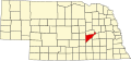
Nebraska State Historical Sites in Central City
Mormon Trail Marker in Central City, NE.JPG
Mormon Trail Marker, Central City

Geography

According to the United States Census Bureau, the city has a total area of 2.32 square miles (6.01 km2), all land. [18]

Demographics

Historical population
CensusPop.Note
1880 648
1890 1,368111.1%
1900 1,57114.8%
1910 2,42854.6%
1920 2,410−0.7%
1930 2,4742.7%
1940 2,460−0.6%
1950 2,394−2.7%
1960 2,4060.5%
1970 2,80316.5%
1980 3,08310.0%
1990 2,868−7.0%
2000 2,9984.5%
2010 2,934−2.1%
2020 3,0393.6%
U.S. Decennial Census [19]
2012 Estimate [20]

2010 census

As of the census [21] of 2010, there were 2,934 people, 1,240 households, and 762 families residing in the city. The population density was 1,264.7 inhabitants per square mile (488.3/km2). There were 1,419 housing units at an average density of 611.6 per square mile (236.1/km2). The racial makeup of the city was 96.5% white, 0.1% African American, 0.4% Native American, 0.2% Asian, 0.2% Pacific Islander, 1.2% from other races, and 1.4% from two or more races. Hispanic or Latino of any race were 3.5% of the population.

There were 1,240 households, of which 28.8% had children under the age of 18 living with them, 48.9% were married couples living together, 9.3% had a female householder with no husband present, 3.3% had a male householder with no wife present, and 38.5% were non-families. 33.9% of all households were made up of individuals, and 16.3% had someone living alone who was 65 years of age or older. The average household size was 2.28 and the average family size was 2.94.

The median age in the city was 42.4 years. 24% of residents were under the age of 18; 7% were between the ages of 18 and 24; 22.3% were from 25 to 44; 25.7% were from 45 to 64; and 20.8% were 65 years of age or older. The gender makeup of the city was 46.9% male and 53.1% female.

2000 census

As of the census of 2000, there were 2,998 people, 1,212 households, and 812 families residing in the city. The population density was 1,507.1 inhabitants per square mile (581.9/km2). There were 1,352 housing units at an average density of 679.6 per square mile (262.4/km2). The racial makeup of the city was 98.20% white, 0.40% African American, 0.10% Native American, 0.50% Asian, 0.03% Pacific Islander, 0.27% from other races, and 0.50% from two or more races. Hispanic or Latino of any race were 1.30% of the population.

There were 1,212 households, out of which 31.6% had children under the age of 18 living with them, 53.9% were married couples living together, 8.7% had a female householder with no husband present, and 33.0% were non-families. 30.4% of all households were made up of individuals, and 16.9% had someone living alone who was 65 years of age or older. The average household size was 2.40 and the average family size was 2.96.

In the city, the population was spread out, with 26.5% under the age of 18, 6.7% from 18 to 24, 23.2% from 25 to 44, 22.4% from 45 to 64, and 21.2% who were 65 years of age or older. The median age was 40 years. For every 100 females, there were 87.8 males. For every 100 females age 18 and over, there were 85 males.

As of 2000 the median income for a household in the city was $50,000 and the median income for a family was $39,118. Males had a median income of $27,250 versus $19,750 for females. The per capita income for the city was $16,943. About 6.3% of families and 8.2% of the population were below the poverty line, including 8.2% of those under age 18 and 11.9% of those age 65 or over.

Notable people

Related Research Articles

<span class="mw-page-title-main">Pawnee people</span> Indigenous people of the Great Plains

The Pawnee are a Central Plains Indian tribe that historically lived in Nebraska and northern Kansas but today are based in Oklahoma. They are the federally recognized Pawnee Nation of Oklahoma, who are headquartered in Pawnee, Oklahoma. Their Pawnee language belongs to the Caddoan language family, and their name for themselves is Chatiks si chatiks or "Men of Men".

<span class="mw-page-title-main">Pawnee County, Oklahoma</span> County in Oklahoma, United States

Pawnee County is a county located in the U.S. state of Oklahoma. As of the 2020 census, the population was 15,553. Its county seat is Pawnee. The county is named after the Pawnee Nation, whose reservation used to encompass the county prior to allotment in 1893.

<span class="mw-page-title-main">Pawnee County, Nebraska</span> County in Nebraska, United States

Pawnee County is a county in the U.S. state of Nebraska. As of the 2020 United States Census, the population was 2,544. Its county seat is Pawnee City.

<span class="mw-page-title-main">Nance County, Nebraska</span> County in Nebraska, United States

Nance County is a county in the U.S. state of Nebraska. As of the 2020 census, the population was 3,380. Its county seat is Fullerton.

<span class="mw-page-title-main">Merrick County, Nebraska</span> County in Nebraska, United States

Merrick County is a county in the U.S. state of Nebraska. As of the 2020 United States Census, the population was 7,668. Its county seat is Central City.

<span class="mw-page-title-main">Johnson County, Nebraska</span> County in Nebraska, United States

Johnson County is a county in the U.S. state of Nebraska. As of the 2020 United States Census, the population was 5,290. Its county seat is Tecumseh. The county was formed in 1855, and was organized in 1857. It was named after Richard Mentor Johnson, who was Vice President of the United States from 1837 to 1841.

<span class="mw-page-title-main">Box Butte County, Nebraska</span> County in Nebraska, United States

Box Butte County is a county in the U.S. state of Nebraska. As of the 2020 United States Census, the population was 10,604. Its county seat is Alliance. The county was formed in 1886; it took its name from a large box-shaped butte north of Alliance.

Pawnee mythology is the body of oral history, cosmology, and myths of the Pawnee people concerning their gods and heroes. The Pawnee are a federally recognized tribe of Native Americans, originally located on the Great Plains along tributaries of the Missouri and Platte Rivers in Nebraska and Kansas and currently located in Oklahoma. They traditionally speak Pawnee, a Caddoan language. The Pawnees lived in villages of earth lodges. They grew corn and went on long bison hunts on the open plains twice a year. The tribe has four bands: the Skidi and "the South Bands" consisted of the Chawi, the Kitkahahki and the Pitahawirata Pawnee.

<span class="mw-page-title-main">Washington County, Kansas</span> County in Kansas, United States

Washington County is a county located in the U.S. state of Kansas. Its county seat and largest city is Washington. As of the 2020 census, the county population was 5,530. The county was named for George Washington, the 1st president of the United States.

<span class="mw-page-title-main">Pawnee County, Kansas</span> County in Kansas, United States

Pawnee County is a county located in the U.S. state of Kansas. Its county seat and largest city is Larned. As of the 2020 census, the county population was 6,253. The county is named after the Pawnee tribe.

<span class="mw-page-title-main">Nemaha County, Kansas</span> County in Kansas, United States

Nemaha County is a county located in the northeastern part of the U.S. state of Kansas. Its county seat is Seneca. As of the 2020 census, the county population was 10,273. The county was named for the Nemaha River.

<span class="mw-page-title-main">Lone Tree, Iowa</span> City in Iowa, United States

Lone Tree is a city in southeastern Johnson County, Iowa, United States. It is part of the Iowa City, Iowa Metropolitan Statistical Area. The population was 1,357 at the time of the 2020 census.

<span class="mw-page-title-main">Fullerton, Nebraska</span> City in and county seat of Nance County, Nebraska, United States

Fullerton is a city in, and the county seat of, Nance County, Nebraska, United States. The population was 1,307 as of the 2010 Census.

<span class="mw-page-title-main">Du Bois, Nebraska</span> Village in Nebraska, United States

Du Bois( doo-BOYZ) is a village in the southeast corner of Pawnee County, Nebraska, United States. The population was 124 at the 2020 census.

<span class="mw-page-title-main">Pawnee City, Nebraska</span> City in and county seat of Pawnee County, Nebraska, United States

Pawnee City is a city in and the county seat of Pawnee County, Nebraska, United States. The population was 878 at the 2010 census.

<span class="mw-page-title-main">Pawnee, Oklahoma</span> City in Oklahoma, United States

Pawnee is a city and county seat of Pawnee County, Oklahoma, United States. The town is northeast of Stillwater at the junction of U.S. Route 64 and State Highway 18.

<span class="mw-page-title-main">Palmer Site</span> United States historic place

The Palmer Site, also known as the Skidi Pawnee Village and designated by the Smithsonian trinomial 25HW1, is a prehistoric and historic archeological site near Palmer, Nebraska in Howard and Merrick Counties. The site is a Native American habitation site associated with the Skidi people, a branch of the Pawnee people, which may have been documented by an American exploratory expedition led by Stephen H. Long in 1820. It was declared a National Historic Landmark in 1964. The site is located on private property.

<span class="mw-page-title-main">Pike-Pawnee Village Site</span> United States historic place

The Pike-Pawnee Village Site, or Hill Farm Site, designated 25WT1 by archaeologists, is a site near the village of Guide Rock in Webster County, in the south central portion of the state of Nebraska, in the Great Plains region of the United States. It was the location of a village of the Kitkehahki band of the Pawnee people, in a region of the Republican River valley that they occupied intermittently from the 1770s to the 1820s.

<span class="mw-page-title-main">Pahuk</span> United States historic place

Pahuk, also written Pahaku, or Pahuk Hill, is a bluff on the Platte River in eastern Nebraska in the United States. In the traditional Pawnee religion, it was one of five dwellings of spirit animals with miraculous powers. The Pawnee occupied three villages near Pahuk in the decade prior to their removal to the Pawnee Reservation on the Loup River in 1859.

<span class="mw-page-title-main">Lone Tree Monument</span>

The Lone Tree Monument is on the site once occupied by a large tree in central Nebraska. Native Americans held council under it, early pioneers used it as a landmark, and it was the first official name of the county seat of Merrick county. It is marked as a historical location by the Nebraska State Historical Society.

References

  1. "ArcGIS REST Services Directory". United States Census Bureau. Retrieved September 18, 2022.
  2. 1 2 U.S. Geological Survey Geographic Names Information System: Central City, Nebraska
  3. "Find a County". National Association of Counties. Archived from the original on May 31, 2011. Retrieved June 7, 2011.
  4. 1 2 3 4 Grinnell, George Bird (April–June 1920). "Grinnell writes about the Pawnee". Nebraska History and Record of Pioneer Days. III (2).
  5. 1 2 3 4 Kay, John, Lonnie Dickson, Robert Kay, and Kathleen Fimple (1992). "Nebraska Historic Buildings Survey Reconnaissance Survey Final Report of Merrick County, Nebraska" (PDF). Nebraska State Historical Society: State Historic Preservation Office. Archived from the original on November 16, 2006.{{cite web}}: CS1 maint: multiple names: authors list (link) CS1 maint: unfit URL (link)
  6. "Nebraska national Register Sites in Merrick County". Archived from the original on April 9, 2000.{{cite web}}: CS1 maint: unfit URL (link)
  7. 1 2 3 4 5 6 7 Johnson, Nancy B. "Central City -- Merrick County".
  8. 1 2 3 4 5 6 Merrick County Historical Society (1981). History of Merrick County, Dallas. Dallas, TX: Taylor publishing Company.
  9. 1 2 3 4 5 6 Merrick County Historical Society. History of Merrick County-Volume II. Dallas, TX: Taylor Publishing Company.
  10. Fitzpatrick, Lillian L. (1960). Nebraska Place-Names. University of Nebraska Press. p. 102. ISBN   0-8032-5060-6. A 1925 edition is available for download at University of Nebraska—Lincoln Digital Commons.
  11. The Nebraska State Historical Society (1939). Nebraska: A Guide to the Cornhusker State (WPA Guide). The Viking Press: New York. p. 424.
  12. Andreas, A. T. (1882). History of the State of Nebraska. Chicago: The Western Historical Company. Archived from the original on October 29, 2002.
  13. 1 2 "Merrick County Lookups". Archived from the original on March 14, 2013.
  14. Nebraska State Gazetteer and Business Directory, Vol. XVI. Omaha, Nebraska: Polk-McAvoy Directory Co. 1917.
  15. 1 2 Numbers represent an alphabetical ordering by significant words. Various colorings, defined here, differentiate National Historic Landmarks and historic districts from other NRHP buildings, structures, sites or objects.
  16. The eight-digit number below each date is the number assigned to each location in the National Register Information System database, which can be viewed by clicking the number.
  17. "Nebraska Historical Marker Program". Archived from the original on February 9, 1999. Retrieved January 21, 2013.{{cite web}}: CS1 maint: unfit URL (link)
  18. "US Gazetteer files 2010". United States Census Bureau. Archived from the original on January 25, 2012. Retrieved June 24, 2012.
  19. United States Census Bureau. "Census of Population and Housing" . Retrieved October 19, 2013.
  20. "Annual Estimates of the Resident Population: April 1, 2010 to July 1, 2012". Archived from the original on October 19, 2013. Retrieved October 19, 2013.
  21. "U.S. Census website". United States Census Bureau . Retrieved June 24, 2012.