Palmer, Nebraska

Last updated

Palmer, Nebraska
Palmer, Nebraska Commercial St 1.JPG
Downtown Palmer: Commercial Street
Merrick County Nebraska Incorporated and Unincorporated areas Palmer Highlighted.svg
Location in Merrick County and the state of Nebraska
Coordinates: 41°13′21″N98°15′35″W / 41.22250°N 98.25972°W / 41.22250; -98.25972
Country United States
State Nebraska
County Merrick
Area
[1]
  Total0.53 sq mi (1.38 km2)
  Land0.53 sq mi (1.38 km2)
  Water0.00 sq mi (0.00 km2)
Elevation
[2]
1,795 ft (547 m)
Population
 (2020) [3]
  Total439
  Density823.64/sq mi (317.77/km2)
Time zone UTC-6 (Central (CST))
  Summer (DST) UTC-5 (CDT)
ZIP code
68864
Area code 308
FIPS code 31-38160 [4]
GNIS feature ID2399613 [2]
Website www.villageofpalmer.com

Palmer is a village in Merrick County, Nebraska, United States. The population was 439 at the 2020 census. [3] It is part of the Grand Island metropolitan area.

Contents

History

Palmer got its start in the 1880s, following construction of the Lincoln and Black Hills Railroad through the territory. It was named for H. E. Palmer, a railroad official. [5]

Geography

Palmer is in northwestern Merrick County, 20 miles (32 km) by road northwest of Central City, the county seat, and 12 miles (19 km) east of St. Paul. It is 2 miles (3 km) north of Nebraska Highway 92.

According to the U.S. Census Bureau, the village has a total area of 0.53 square miles (1.37 km2), all land. [1] Land in the village drains toward the Loup River, 4 miles (6 km) to the north.

Demographics

Historical population
CensusPop.Note
1910 373
1920 57754.7%
1930 5881.9%
1940 516−12.2%
1950 434−15.9%
1960 418−3.7%
1970 391−6.5%
1980 48724.6%
1990 75354.6%
2000 472−37.3%
2010 4720.0%
2020 439−7.0%
U.S. Decennial Census [6]

2010 census

As of the census [7] of 2010, there were 472 people, 171 households, and 115 families residing in the village. The population density was 890.6 inhabitants per square mile (343.9/km2). There were 192 housing units at an average density of 362.3 per square mile (139.9/km2). The racial makeup of the village was 95.6% White, 0.8% African American, 0.4% Native American, 0.4% Asian, 2.3% from other races, and 0.4% from two or more races. Hispanic or Latino of any race were 4.7% of the population.

There were 171 households, of which 32.2% had children under the age of 18 living with them, 52.6% were married couples living together, 8.2% had a female householder with no husband present, 6.4% had a male householder with no wife present, and 32.7% were non-families. 27.5% of all households were made up of individuals, and 16.4% had someone living alone who was 65 years of age or older. The average household size was 2.44 and the average family size was 2.94.

The median age in the village was 40.5 years. 21.2% of residents were under the age of 18; 8.6% were between the ages of 18 and 24; 25.7% were from 25 to 44; 31% were from 45 to 64; and 13.6% were 65 years of age or older. The gender makeup of the village was 50.4% male and 49.6% female.

2000 census

As of the census [4] of the year 2000, there were 472 people, 189 households, and 122 families residing in the village. The population density was 891.8 inhabitants per square mile (344.3/km2). There were 202 housing units at an average density of 381.7 per square mile (147.4/km2). The racial makeup of the village was 98.94% White, 0.21% Asian, 0.64% from other races, and 0.21% from two or more races. Hispanic or Latino of any race were 1.69% of the population.

There were 189 households, out of which 30.7% had children under the age of 18 living with them, 56.6% were married couples living together, 6.9% had a female householder with no husband present, and 35.4% were non-families. 30.7% of all households were made up of individuals, and 16.4% had someone living alone who was 65 years of age or older. The average household size was 2.37 and the average family size was 2.98.

In the village the population was spread out, with 26.1% under the age of 18, 6.1% from 18 to 24, 24.2% from 25 to 44, 20.8% from 45 to 64, and 22.9% who were 65 years of age or older. The median age was 40 years. For every 100 females, there were 91.9 males. For every 100 females age 18 and over, there were 87.6 males.

As of 2000 the median income for a household in the village was $33,676, and the median income for a family was $37,969. Males had a median income of $25,673 versus $19,000 for females. The per capita income for the village was $16,589. About 9.3% of families and 8.1% of the population were below the poverty line, including 11.9% of those under age 18 and 8.5% of those age 65 or over.

Related Research Articles

<span class="mw-page-title-main">Merrick County, Nebraska</span> County in Nebraska, United States

Merrick County is a county in the U.S. state of Nebraska. As of the 2020 United States Census, the population was 7,668. Its county seat is Central City.

<span class="mw-page-title-main">Avoca, Nebraska</span> Village in Nebraska, United States

Avoca is a village in Cass County, Nebraska, United States. The population was 178 at the 2020 census.

<span class="mw-page-title-main">Cedar Creek, Nebraska</span> Village in Nebraska, United States

Cedar Creek is a village in Cass County, Nebraska, United States. The population was 465 at the 2020 census.

<span class="mw-page-title-main">Eagle, Nebraska</span> Village in Nebraska, United States

Eagle is a village in southwest Cass County, Nebraska, United States. As of the 2020 census, the village population was 1,065.

<span class="mw-page-title-main">Elmwood, Nebraska</span> Village in Nebraska, United States

Elmwood is a village in southeast Cass County, Nebraska, United States. The population was 654 at the 2020 census.

<span class="mw-page-title-main">Greenwood, Nebraska</span> Village in Nebraska, United States

Greenwood is a village in northwest Cass County, Nebraska, United States. The population was 595 at the 2020 census.

<span class="mw-page-title-main">Manley, Nebraska</span> Village in Nebraska, United States

Manley is a village in Cass County, Nebraska, United States. The population was 167 at the 2020 census.

<span class="mw-page-title-main">Murray, Nebraska</span> Village in Nebraska, United States

Murray is a village in Cass County, Nebraska, United States. The population was 480 at the 2020 census.

<span class="mw-page-title-main">Callaway, Nebraska</span> Village in Nebraska, United States

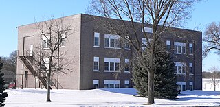
Callaway is a village in Custer County, Nebraska, United States. The population was 539 at the 2010 census.

<span class="mw-page-title-main">Boys Town, Nebraska</span> Village in Douglas County, Nebraska, United States

Boys Town is a village in Douglas County, Nebraska, United States. The population was 410 at the 2020 census. Boys Town is an enclave and a suburb of Omaha.

<span class="mw-page-title-main">Waterloo, Nebraska</span> Village in Douglas County, Nebraska, United States

Waterloo is a village in Douglas County, Nebraska, United States. The population was 935 at the 2020 census.

<span class="mw-page-title-main">Liberty, Nebraska</span> Village in Nebraska, United States

Liberty is a village in Gage County, Nebraska, United States. The population was 37 at the 2020 census.

<span class="mw-page-title-main">Alda, Nebraska</span> Village in Hall County, Nebraska, United States

Alda is a village in Hall County, Nebraska, United States. The population was 642 at the 2010 census. It is part of the Grand Island, Nebraska Micropolitan Statistical Area.

<span class="mw-page-title-main">Center, Nebraska</span> Village in and county seat of Knox County, Nebraska, United States

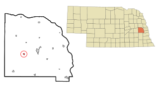
Center is a village in, and county seat of, Knox County, Nebraska, United States. The population was 73 at the 2020 census.

<span class="mw-page-title-main">Chapman, Nebraska</span> Village in Nebraska, United States

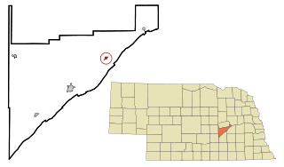
Chapman is a village in Merrick County, Nebraska, United States. The population was 260 at the 2020 census. It is part of the Grand Island metropolitan area.

<span class="mw-page-title-main">Clarks, Nebraska</span> Village in Nebraska, United States

Clarks is a village in Merrick County, Nebraska, United States. The population was 344 at the 2020 census. It is part of the Grand Island, Nebraska Micropolitan Statistical Area.

<span class="mw-page-title-main">Silver Creek, Nebraska</span> Village in Nebraska, United States

Silver Creek is a village in Merrick County, Nebraska, United States. The population was 320 at the 2020 census. It is part of the Grand Island metropolitan area.

<span class="mw-page-title-main">Valparaiso, Nebraska</span> Village in Saunders County, Nebraska, United States

Valparaiso is a village in Saunders County, Nebraska, United States. The population was 595 at the 2020 census.

<span class="mw-page-title-main">Weston, Nebraska</span> Village in Saunder County, Nebraska, United States

Weston is a village in Saunders County, Nebraska, United States. The population was 250 at the 2020 census.

<span class="mw-page-title-main">Winnebago, Nebraska</span> Village in Thurston County, Nebraska, United States

Winnebago is a village in Thurston County, Nebraska, United States. The population was 916 at the 2020 census.

References

  1. 1 2 "2023 U.S. Gazetteer Files: Nebraska". United States Census Bureau. Retrieved June 20, 2024.
  2. 1 2 U.S. Geological Survey Geographic Names Information System: Palmer, Nebraska
  3. 1 2 "P1. Race – Palmer village, Nebraska: 2020 DEC Redistricting Data (PL 94-171)". U.S. Census Bureau. Retrieved June 20, 2024.
  4. 1 2 "U.S. Census website". United States Census Bureau . Retrieved January 31, 2008.
  5. "Palmer, Merrick County". Center for Advanced Land Management Information Technologies. University of Nebraska. Retrieved August 19, 2014.
  6. "Census of Population and Housing". Census.gov. Retrieved June 4, 2015.
  7. "U.S. Census website". United States Census Bureau . Retrieved June 24, 2012.