Blair was platted in 1869 when the Sioux City and Pacific Railroad was extended to that point.[5] It was named for railroad magnate John Insley Blair, who was credited with bringing the railroad to town.[6] Blair was incorporated as a city in 1872.[7] Within its first year, Blair was designated county seat.[5]
In 1874, during the Panic of 1873, a grasshopper storm enveloped the region. Many Nebraskans were faced with starvation. An organization, the Nebraska Relief and Aid Society was formed in order to help affected persons. A law was passed by congress awarding $100,000 relief, and many Blair citizens were awarded money. Both the newspapers and the railroads in the region helped transport supplies free of charge. Both the Nebraska State Guard and the United States Army helped distribute food and clothing.
Construction of the Chicago and Northwestern Bridge across the Missouri River was authorized by an Act of Congress on June 27, 1882. Construction began in September 1882, and it was open for rail traffic in November 1883. The total cost of the bridge was $1.13 Million ($34.2 Million in 2023).[8] The first automobile bridge was opened to traffic in 1929.[9][10]
In 1916, Blair was awarded a $10,000 grant to build a Carnegie Library. Unfortunately, an electrical fire occurred on the night of July 23, 1973, and the historic library was deemed a total loss.
On April 26, 2024, portions of Blair were struck by a large EF4 tornado, destroying or damaging dozens of homes.[11]
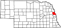
Geography
According to the United States Census Bureau, the city has a total area of 5.51 square miles (14.27km2), of which 5.49 square miles (14.22km2) is land and 0.02 square miles (0.05km2) is water.[12]
Blair is located in the Loess Hills, surrounded on all sides by rolling hills and the Missouri river valley.
The 2020 United States census[17] counted 7,790 people, 3,157 households, and 2,015 families in Blair. The population density was 1,413.8 per square mile (545.9/km2). There were 3,299 housing units at an average density of 598.7 unitsper square mile (231.2 units/km2). The racial makeup was 92.62% (7,215) white, 0.41% (32) black or African-American, 0.15% (12) Native American, 0.53% (41) Asian, 0.04% (3) Pacific Islander, 1.27% (99) from other races, and 4.98% (388) from two or more races. Hispanic or Latino of any race was 2.0% (170) of the population.
Of the 3,157 households, 36.5% had children under the age of 18; 51.2% were married couples living together; 28.5% had a female householder with no husband present. 31.8% of households consisted of individuals and 14.4% had someone living alone who was 65 years of age or older. The average household size was 2.4 and the average family size was 3.0.
27.6% of the population was under the age of 18, 8.0% from 18 to 24, 23.6% from 25 to 44, 23.7% from 45 to 64, and 17.6% who were 65 years of age or older. The median age was 39.2 years. For every 100 females, the population had 91.4 males. For every 100 females ages 18 and older, there were 83.3 males.
The 2016-2020 5-year American Community Survey[18] estimates show that the median household income was $57,274 (with a margin of error of +/- $7,379) and the median family income $76,838 (+/- $17,661). Males had a median income of $51,769 (+/- $5,822) versus $29,811 (+/- $7,842) for females. The median income for those above 16 years old was $39,382 (+/- $3,150). Approximately, 11.6% of families and 13.6% of the population were below the poverty line, including 18.7% of those under the age of 18 and 7.9% of those ages 65 or over.
2010 census
At the 2010 census there were 7,990 people, 3,110 households, and 2,005 families living in the city. The population density was 1,455.4 inhabitants per square mile (561.9/km2). There were 3,351 housing units at an average density of 610.4 unitsper square mile (235.7 units/km2). The racial makeup of the city was 96.4% White, 0.8% African American, 0.3% Native American, 0.3% Asian, 0.1% Pacific Islander, 1.0% from other races, and 1.1% from two or more races. Hispanic or Latino of any race were 2.9%.[19]
Of the 3,110 households 33.3% had children under the age of 18 living with them, 50.5% were married couples living together, 10.6% had a female householder with no husband present, 3.3% had a male householder with no wife present, and 35.5% were non-families. 30.3% of households were one person and 13.4% were one person aged 65 or older. The average household size was 2.40 and the average family size was 3.01.
The median age was 36 years. 24.9% of residents were under the age of 18; 11.7% were between the ages of 18 and 24; 23.9% were from 25 to 44; 24.3% were from 45 to 64; and 15.3% were 65 or older. The gender makeup of the city was 47.9% male and 52.1% female.
2000 census
At the 2000 census, there were 7,512 people, 2,871 households, and 1,891 families living in the city. The population density was 1,617.3 inhabitants per square mile (624.4/km2). There were 3,033 housing units at an average density of 653.0 unitsper square mile (252.1 units/km2). The racial makeup of the city was 97.43% White, 0.44% African American, 0.29% Native American, 0.33% Asian, 0.27% Pacific Islander, 0.33% from other races, and 0.91% from two or more races. Hispanic or Latino of any race were 1.34% of the population.
Entrance to Blair Cemetery 2007
Of the 2,871 households 33.9% had children under the age of 18 living with them, 52.8% were married couples living together, 10.1% had a female householder with no husband present, and 34.1% were non-families. 29.1% of households were one person and 14.4% were one person aged 65 or older. The average household size was 2.43 and the average family size was 3.02.
The age distribution was 24.9% under the age of 18, 13.8% from 18 to 24, 25.6% from 25 to 44, 20.4% from 45 to 64, and 15.4% 65 or older. The median age was 35 years. For every 100 females, there were 90.9 males. For every 100 females age 18 and over, there were 88.2 males.
The median household income was $41,214, and the median family income was $52,114. Males had a median income of $36,839 versus $25,452 for females. The per capita income for the city was $19,240. About 6.2% of families and 8.4% of the population were below the poverty line, including 11.4% of those under age 18 and 10.5% of those age 65 or over.
Media
Blair is served by the local weekly newspaper Pilot-Tribune & Enterprise.[20] Blair is also served by Walnut Radio Station 97.3 KOBM-FM and FM 94.7 KYTF-LP Blair Radio.[21]
12"Blair, Washington County". Center for Advanced Land Management Information Technologies. University of Nebraska. Archived from the original on February 23, 2019. Retrieved August 24, 2014.
This page is based on this Wikipedia article Text is available under the CC BY-SA 4.0 license; additional terms may apply. Images, videos and audio are available under their respective licenses.