Fontanelle, Nebraska

Last updated

Fontanelle, Nebraska
Fontanelle Town Hall from SW.JPG
Fontanelle Township Hall, November 2010
USA Nebraska location map.svg
Red pog.svg
Fontanelle
Location in Nebraska
Usa edcp location map.svg
Red pog.svg
Fontanelle
Location in the United States
Coordinates: 41°32′18″N96°25′38″W / 41.53833°N 96.42722°W / 41.53833; -96.42722
Country United States
State Nebraska
County Washington
Area
[1]
  Total0.25 sq mi (0.65 km2)
  Land0.25 sq mi (0.65 km2)
  Water0.00 sq mi (0.00 km2)
Elevation
[2]
1,342 ft (409 m)
Population
 (2020)
  Total67
  Density265.87/sq mi (102.48/km2)
ZIP code
68044 [3]
Area code(s) 402 and 531
FIPS code 31-17040
GNIS feature ID2583880 [2]

Fontanelle is a census-designated place (CDP) in Washington County, Nebraska, United States. [2]

Contents

History

The site of repeated incursions by the neighboring Pawnee tribe, Fontanelle was an early boom town in the Nebraska Territory, but waned in importance after failing to secure a railroad connection in the late 19th century. The 1860 Federal Census showed the town having dozens of residents, including farmers, carpenters, blacksmiths, clergymen, lawyers, and other professions. [4] The town dwindled from a population of 500 to a few dozen after an early university left in the 1870s, it failed to get a railroad connection, and the nation suffered a financial depression. [5]

A misspelling of the name of Logan Fontenelle, this town was named in honor of the Omaha Tribe leader, who was killed in 1855 by Sioux. He had served as interpreter to a delegation of Omaha chiefs in negotiation with the United States when they agreed to cede most of their land in Nebraska to the US. The town was originally organized by the Nebraska Colonization Company, founded in Quincy, Illinois, in 1854. The company's goal in founding the town was to develop "a literary institution which shall be known as the Nebraska University." In spring 1855 a prospecting party chose the site about twelve miles from the present city of Fremont.

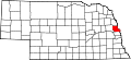
Fontanelle was the original seat of Dodge County, but later became a part of Washington County. It was originally promoted for the territorial capital, but lost to Omaha City to the south. [6] It had one of the first churches in the Nebraska Territory. [7] The Nebraska Territory Legislature awarded a charter to the Nebraska University, also called Fontanelle University, in 1855, and the first building was erected in 1856. Operated by the Congregational Church the University flourished for several years. When Fontanelle lost the county seat, leaders decided to move the university, and Doane College was organized in Crete, Nebraska in 1872. [8]

Located next to the Elkhorn River, the town was raided several times by the Pawnee in its early years. By August 1855 the United States Army established a post in the town to protect the area, with additional posts set up at Tekamah and Elkhorn City and a standing militia protected the region for several years after. [9] The New York Times sent a correspondent late in that year to confirm the safety of settlers to the Nebraska Territory. [10] In 1859 the Pawnee were encamped across the river during the Pawnee War. [11]

Voters in the town held their first annual meeting in 1884, and in 1896 they approved the construction of a one-story brick hall called the Fontanelle Township Hall to serve as a meeting hall and polling place. It stands today and is listed on the National Register of Historic Places. [12]

Failure to secure a railroad connection, financial depression, and other reverses led the town to fold in the 1890s. Today it is an unincorporated community.

Geography

Fontanelle is in western Washington County, 10 miles (16 km) northeast of Fremont, along Nebraska Highway 91. It is 4 miles (6 km) east of U.S. Routes 77 and 275.

Demographics

Historical population
CensusPop.Note
2020 67
U.S. Decennial Census [13]

See also

Related Research Articles

<span class="mw-page-title-main">Nebraska</span> U.S. state

Nebraska is a state in the Midwestern region of the United States. It borders South Dakota to the north; Iowa to the east and Missouri to the southeast, both across the Missouri River; Kansas to the south; Colorado to the southwest; and Wyoming to the west. Nebraska is the 16th largest state by land area, with just over 77,220 square miles (200,000 km2). With a population of over 1.9 million, it is the 37th most populous state and the 7th least densely populated. Its capital is Lincoln, and its most populous city is Omaha, which is on the Missouri River. Nebraska was admitted into the United States in 1867, two years after the end of the American Civil War. The Nebraska Legislature is unlike any other American legislature in that it is unicameral, and its members are elected without any official reference to political party affiliation.

<span class="mw-page-title-main">Omaha, Nebraska</span> Largest city in Nebraska, United States

Omaha is the most populous city in the U.S. state of Nebraska and the county seat of Douglas County. Omaha is in the Midwestern United States on the Missouri River, about 10 mi (15 km) north of the mouth of the Platte River. The nation's 40th-most populous city, Omaha's 2020 census population was 486,051.

<span class="mw-page-title-main">Washington County, Nebraska</span> County in Nebraska, United States

Washington County is a county in the U.S. state of Nebraska. As of the 2020 United States Census, the population was 20,865. Its county seat is Blair.

<span class="mw-page-title-main">Douglas County, Nebraska</span> County in Nebraska, United States

Douglas County is a county located in the U.S. state of Nebraska. As of the 2020 United States Census, the population is 584,526. It is the state's most populous county, home to well over one-fourth of Nebraska's residents. Its county seat is Omaha, the state's largest city. The county was established in 1854 and named after Stephen A. Douglas (1813–1861), who was then serving as Senator from Illinois.

<span class="mw-page-title-main">Dodge County, Nebraska</span> County in Nebraska, United States

Dodge County is a county in the U.S. state of Nebraska. As of the 2020 United States Census, the population was 37,167. Its county seat is Fremont. The county was formed in 1855 and named after Iowa Senator Augustus C. Dodge.

<span class="mw-page-title-main">Beemer, Nebraska</span> Village in Nebraska, United States

Beemer is a village in Cuming County, Nebraska, United States. The population was 678 at the 2010 census.

<span class="mw-page-title-main">West Point, Nebraska</span> City in Nebraska, United States

West Point is a city in and the county seat of Cuming County, Nebraska, United States. The population was 3,504 at the 2020 census.

<span class="mw-page-title-main">Fremont, Nebraska</span> City in Nebraska, United States

Fremont is a city and county seat of Dodge County in the eastern portion of the state of Nebraska in the Midwestern United States. The population was 27,141 at the 2020 census, making it the 6th most populous city in Nebraska. Fremont is the home of Midland University.

<span class="mw-page-title-main">Hooper, Nebraska</span> City in Nebraska, United States

Hooper is a city in Dodge County, Nebraska, United States. The population was 830 at the 2010 census.

<span class="mw-page-title-main">Elkhorn, Omaha, Nebraska</span> Former City in Nebraska, United States

Elkhorn is a neighborhood and former city on the western edge of the city of Omaha, Nebraska, United States. The population was 6,062 at the 2000 census and was estimated by the Census Bureau at 8,192 in 2005. It was named after the Elkhorn River. Elkhorn was once an independent city in Douglas County until it was annexed by Omaha in 2007.

<span class="mw-page-title-main">Columbus, Nebraska</span> City in and county seat of Platte County, Nebraska, United States

Columbus is a city in and the county seat of Platte County, in the state of Nebraska in the Midwestern United States. The population was 24,028 at the 2020 census, making it the 10th most populous city in Nebraska.

<span class="mw-page-title-main">Washington, Nebraska</span> Village in Washington County, Nebraska, United States

Washington is a village in Washington County, Nebraska, United States. The population was 150 at the 2010 census.

Elkhorn or Elk Horn may refer to:

<span class="mw-page-title-main">Nebraska Territory</span> Former organized incorporated territory of the United States (1854–1867)

The Territory of Nebraska was an organized incorporated territory of the United States that existed from May 30, 1854, until March 1, 1867, when the final extent of the territory was admitted to the Union as the state of Nebraska. The Nebraska Territory was created by the Kansas–Nebraska Act of 1854. The territorial capital was Omaha. The territory encompassed areas of what is today Nebraska, Wyoming, South Dakota, North Dakota, Colorado, and Montana.

The Fremont, Elkhorn and Missouri Valley Railroad (FE&MV), sometimes called "the Elkhorn," was a railroad established in 1869 in the state of Nebraska in the Midwestern United States.

<span class="mw-page-title-main">Logan Fontenelle</span> Omaha chief (1825–1855)

Logan Fontenelle, also known as Shon-ga-ska, was a trader of Omaha and French ancestry, who served for years as an interpreter to the US Indian agent at the Bellevue Agency in Nebraska. He was especially important during the United States negotiations with Omaha leaders in 1853–1854 about ceding land to the United States prior to settlement on a reservation. His mother was a daughter of Big Elk, the principal chief, and his father was a respected French-American fur trader.

Dodge Street is the main east–west street in Omaha, Nebraska. Numbered as U.S. Route 6 (US 6), the street starts in Downtown Omaha and connects to West Dodge Road just west of 78th Street. From there, it continues westward through the remainder of Douglas County.

<span class="mw-page-title-main">Native American tribes in Nebraska</span>

Native American tribes in the U.S. state of Nebraska have been Plains Indians, descendants of succeeding cultures of indigenous peoples who have occupied the area for thousands of years. More than 15 historic tribes have been identified as having lived in, hunted in, or otherwise occupied territory within the current state boundaries.

<span class="mw-page-title-main">Pahuk</span> United States historic place

Pahuk, also written Pahaku, or Pahuk Hill, is a bluff on the Platte River in eastern Nebraska in the United States. In the traditional Pawnee religion, it was one of five dwellings of spirit animals with miraculous powers. The Pawnee occupied three villages near Pahuk in the decade prior to their removal to the Pawnee Reservation on the Loup River in 1859.

References

  1. "ArcGIS REST Services Directory". United States Census Bureau. Retrieved September 19, 2022.
  2. 1 2 3 U.S. Geological Survey Geographic Names Information System: Fontanelle, Nebraska
  3. "Fontanelle NE ZIP Code". zipdatamaps.com. 2024. Retrieved February 5, 2024.
  4. 1860 Federal Census of Fontanelle, Nebraska Territory. Retrieved 3/26/08.
  5. Olson, J.C. and Naugle, R.C. (1997) History of Nebraska. University of Nebraska Press. p 99.
  6. "Nebraska Colonization Company" [usurped] , Nebraska State Historical Society. Retrieved 3/25/08.
  7. Sheldon, A.E. "Nebraska as a Territory", History and Stories of Nebraska. Retrieved 3/26/08.
  8. Federal Writers' Project. (1939) Nebraska: A Guide to the Cornhusker State. p 283.
  9. "The Indians of Nebraska--Tranquility Restored", New York Times. August 29, 1855. Retrieved 3/25/08.
  10. "From Nebraska--Affaire on the Frontier", New York Times. October 8, 1855. Retrieved 3/25/08.
  11. "Indian Troubles in Nebraska--History of the Pawnee War", New York Times. Retrieved 3/25/08.
  12. "National Register of Historic Places" Archived 2008-03-31 at the Wayback Machine , Washington County Historical Society. Retrieved 3/25/08.
  13. "Census of Population and Housing". Census.gov. Retrieved June 4, 2016.

Commons-logo.svg Media related to Fontanelle, Nebraska at Wikimedia Commons