Tecumseh, Nebraska

Last updated

Tecumseh, Nebraska
Tecumseh, Nebraska city hall from SW.JPG
Tecumseh City Hall
Johnson County Nebraska Incorporated and Unincorporated areas Tecumseh Highlighted.svg
Location within Johnson County (left) and Nebraska (right)
Coordinates: 40°22′19″N96°11′19″W / 40.37194°N 96.18861°W / 40.37194; -96.18861
Country United States
State Nebraska
County Johnson
Named for Tecumseh
Area
[1]
  Total1.51 sq mi (3.91 km2)
  Land1.51 sq mi (3.91 km2)
  Water0.00 sq mi (0.00 km2)
Elevation
[2]
1,129 ft (344 m)
Population
 (2020)
  Total1,694
  Density1,121.11/sq mi (432.87/km2)
Time zone UTC-6 (Central (CST))
  Summer (DST) UTC-5 (CDT)
ZIP code
68450
Area code 402
FIPS code 31-48480 [3]
GNIS feature ID2396036 [2]
Website tecumsehne.com

Tecumseh is a city in and the county seat of Johnson County, Nebraska, United States. [4] The population was 1,677 at the 2010 census.

Contents

History

Tecumseh was originally called Frances, and under the latter name was established in 1856. [5] The label of Frances has long been falsely attributed as the name of the wife of Col. Richard M Johnson, the namesake of Johnson County. Johnson's only marriage was to Julia Chinn, a common-law spouse. Julia Chinn, was an octoroon slave (one-eighth African, seven-eighths European in ancestry), born into slavery around 1790. [6] [7] Some historians have accepted the possibility that the legislature intended to name the county seat after Francis Burt, the first Governor of the Nebraska Territory. [8] Shortly after being founded, the name was changed to Tecumseh after the Native American Chief said to have been killed by Johnson during the Battle of the Thames. The Nebraska Territorial Legislature established Tecumseh as the county seat in February 1857. [9]

Geography

According to the United States Census Bureau, the city has a total area of 1.50 square miles (3.88 km2), all land. [10]

Climate

Climate data for Tecumseh 1S, Nebraska (1991–2020, extremes 1893–present)
MonthJanFebMarAprMayJunJulAugSepOctNovDecYear
Record high °F (°C)72
(22)
79
(26)
96
(36)
99
(37)
105
(41)
108
(42)
112
(44)
110
(43)
107
(42)
98
(37)
84
(29)
79
(26)
112
(44)
Mean maximum °F (°C)59.5
(15.3)
64.9
(18.3)
77.9
(25.5)
85.3
(29.6)
90.6
(32.6)
94.4
(34.7)
99.3
(37.4)
98.1
(36.7)
93.9
(34.4)
87.4
(30.8)
73.5
(23.1)
63.0
(17.2)
99.8
(37.7)
Mean daily maximum °F (°C)35.2
(1.8)
40.3
(4.6)
52.6
(11.4)
63.8
(17.7)
73.6
(23.1)
83.4
(28.6)
87.9
(31.1)
86.2
(30.1)
79.3
(26.3)
66.9
(19.4)
51.8
(11.0)
39.6
(4.2)
63.4
(17.4)
Daily mean °F (°C)24.0
(−4.4)
28.5
(−1.9)
40.3
(4.6)
51.0
(10.6)
62.0
(16.7)
72.1
(22.3)
76.5
(24.7)
74.3
(23.5)
65.9
(18.8)
53.1
(11.7)
39.6
(4.2)
28.5
(−1.9)
51.3
(10.7)
Mean daily minimum °F (°C)12.7
(−10.7)
16.8
(−8.4)
27.9
(−2.3)
38.3
(3.5)
50.3
(10.2)
60.8
(16.0)
65.0
(18.3)
62.5
(16.9)
52.5
(11.4)
39.3
(4.1)
27.4
(−2.6)
17.4
(−8.1)
39.2
(4.0)
Mean minimum °F (°C)−9.2
(−22.9)
−2.6
(−19.2)
8.0
(−13.3)
21.8
(−5.7)
34.6
(1.4)
47.1
(8.4)
53.4
(11.9)
50.8
(10.4)
36.1
(2.3)
22.5
(−5.3)
11.0
(−11.7)
−1.9
(−18.8)
−12.9
(−24.9)
Record low °F (°C)−27
(−33)
−34
(−37)
−22
(−30)
2
(−17)
21
(−6)
34
(1)
41
(5)
38
(3)
23
(−5)
0
(−18)
−10
(−23)
−29
(−34)
−34
(−37)
Average precipitation inches (mm)0.81
(21)
1.14
(29)
2.05
(52)
2.92
(74)
5.29
(134)
4.25
(108)
4.00
(102)
3.65
(93)
2.74
(70)
2.58
(66)
1.57
(40)
1.27
(32)
32.27
(820)
Average snowfall inches (cm)6.7
(17)
6.4
(16)
2.0
(5.1)
1.1
(2.8)
0.0
(0.0)
0.0
(0.0)
0.0
(0.0)
0.0
(0.0)
0.0
(0.0)
0.4
(1.0)
1.9
(4.8)
3.9
(9.9)
22.4
(57)
Average precipitation days (≥ 0.01 in)5.36.17.39.310.79.69.38.27.26.75.65.490.7
Average snowy days (≥ 0.1 in)3.13.01.30.30.00.00.00.00.00.21.02.211.1
Source: NOAA [11] [12]

Demographics

Historical population
CensusPop.Note
1880 1,268
1890 1,65430.4%
1900 2,00521.2%
1910 1,748−12.8%
1920 1,688−3.4%
1930 1,8298.4%
1940 2,10415.0%
1950 1,930−8.3%
1960 1,887−2.2%
1970 2,0589.1%
1980 1,926−6.4%
1990 1,702−11.6%
2000 1,7160.8%
2010 1,677−2.3%
2020 1,6941.0%
U.S. Decennial Census [13]

2010 census

As of the census [14] of 2010, 1,677 people, 722 households, and 447 families resided in the city. The population density was 1,118.0 inhabitants per square mile (431.7/km2). The 887 housing units averaged 591.3 per square mile (228.3/km2). The racial makeup of the city was 82.5% White, 0.4% African American, 0.1% Native American, 3.2% Asian, 12.9% from other races, and 0.8% from two or more races. Hispanics or Latinos of any race were 16.2% of the population.

Of the 722 households, 27.4% had children under the age of 18 living with them, 48.9% were married couples living together, 9.1% had a female householder with no husband present, 3.9% had a male householder with no wife present, and 38.1% were not families; 33.2% of all households were made up of individuals, and 17.6% had someone living alone who was 65 years of age or older. The average household size was 2.25 and the average family size was 2.86.

The median age in the city was 44.8 years; 22.1% of residents were under the age of 18; 6.5% were between the ages of 18 and 24; 21.5% were from 25 to 44; 26.5% were from 45 to 64; and 23.3% were 65 years of age or older. The gender makeup of the city was 47.9% male and 52.1% female.

2000 census

As of the census [3] of 2000, 1,716 people, 729 households, and 446 families resided in the city. The population density was 1,159.5 inhabitants per square mile (447.7/km2). The 854 housing units averaged 577.0 per square mile (222.8/km2). The racial makeup of the city was 86.36% White, 0.06% African American, 0.58% Native American, 5.59% Asian, 5.07% from other races, and 2.33% from two or more races. Hispanics or Latinos of any race were 6.53% of the population.

Of the 729 households, 28.8% had children under the age of 18 living with them, 50.9% were married couples living together, 7.0% had a female householder with no husband present, and 38.7% were not families. About 34.6% of all households were made up of individuals, and 21.1% had someone living alone who was 65 years of age or older. The average household size was 2.27 and the average family size was 2.93.

In the city, the population was distributed as 24.0% under the age of 18, 6.1% from 18 to 24, 24.4% from 25 to 44, 20.6% from 45 to 64, and 25.0% who were 65 years of age or older. The median age was 42 years. For every 100 females, there were 82.6 males. For every 100 females age 18 and over, there were 79.9 males.

As of 2000, the median income for a household in the city was $31,844, and for a family was $42,337. Males had a median income of $27,228 versus $19,896 for females. The per capita income for the city was $16,194. About 8.4% of families and 11.9% of the population were below the poverty line, including 17.0% of those under age 18 and 10.1% of those age 65 or over.

In the media

The town was used largely for the setting of the miniseries Amerika , which depicted life in a small American town after a successful takeover by the Soviet Union.

Tecumseh Airport

Tecumseh is home to the Tecumseh Airport, a private-use airport with one 3500 x 75 foot concrete runway that was resurfaced in 2008. In 2009, the airport expanded to include rent-able hangars. The airport can service any plane up to light twin-engine aircraft. [15]

Education

Tecumseh is in Johnson County Central Public Schools. [16]

It was in Tecumseh Public Schools until 2007. [17]

Notable people

See also

Related Research Articles

<span class="mw-page-title-main">Otoe County, Nebraska</span> County in Nebraska, United States

Otoe County is a county in the U.S. state of Nebraska. As of the 2020 United States Census, the population was 15,912. Its county seat is Nebraska City. The county was formed in 1854, and was named tor the Otoe Indian tribe.

<span class="mw-page-title-main">Johnson County, Nebraska</span> County in Nebraska, United States

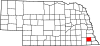
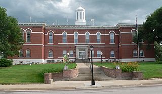
Johnson County is a county in the U.S. state of Nebraska. As of the 2020 United States Census, the population was 5,290. Its county seat is Tecumseh. The county was formed in 1855, and was organized in 1857. It was named after Richard Mentor Johnson, who was Vice President of the United States from 1837 to 1841.

<span class="mw-page-title-main">Johnson City, Kansas</span> City in Stanton County, Kansas

Johnson City is a city in and the county seat of Stanton County, Kansas, United States. As of the 2020 census, the population of the city was 1,464.

<span class="mw-page-title-main">Tecumseh Township, Michigan</span> Civil township in Michigan, United States

Tecumseh Township is a civil township of Lenawee County in the U.S. state of Michigan. The population was 1,881 at the 2000 census. The city of Tecumseh is surrounded by three sides by the Township. The township was first organized in 1827.

<span class="mw-page-title-main">Ainsworth, Nebraska</span> City in and county seat of Brown County, Nebraska, United States

Ainsworth is a city and county seat of Brown County, Nebraska, United States. The population was 1,728 at the 2010 census.

<span class="mw-page-title-main">Plattsmouth, Nebraska</span> City in Nebraska, United States

Plattsmouth is a city and county seat of Cass County, Nebraska, United States. The population was 6,620 at the 2020 census.

<span class="mw-page-title-main">South Sioux City, Nebraska</span> City in Dakota County, Nebraska, United States

South Sioux City is a city in Dakota County, Nebraska, United States. It is located immediately across the Missouri River from Sioux City, Iowa, and is part of the Sioux City, IA-NE-SD Metropolitan Statistical Area. As of the 2010 census, the city population was 13,353, making it the 14th most populous city in Nebraska.

<span class="mw-page-title-main">Bennington, Nebraska</span> City in Douglas County, Nebraska, United States

Bennington is a city in Douglas County, Nebraska, United States. The population was 2,026 at the 2020 U.S. Census.

<span class="mw-page-title-main">Burwell, Nebraska</span> City in Nebraska, United States

Burwell is a city in Garfield County, Nebraska, United States. The population was 1,210 at the 2010 census. It is the county seat of Garfield County.

<span class="mw-page-title-main">Wood River, Nebraska</span> Village in Hall County, Nebraska, United States

Wood River is a city in southwestern Hall County, Nebraska, United States. The population was 1,172 at the 2020 census. It is part of the Grand Island, Nebraska Metropolitan Statistical Area.

<span class="mw-page-title-main">Atkinson, Nebraska</span> City in Nebraska, United States

Atkinson is a city in Holt County, Nebraska, United States. The population was 1,245 at the 2010 census.

<span class="mw-page-title-main">Cook, Nebraska</span> Village in Nebraska, United States

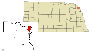
Cook is a village in Johnson County, Nebraska, United States. The population was 323 at the 2020 census.

<span class="mw-page-title-main">Bloomfield, Nebraska</span> City in Nebraska, United States

Bloomfield is a city in Knox County, Nebraska, United States. The population was 1,028 at the 2010 census.

<span class="mw-page-title-main">Johnson, Nebraska</span> Village in Nemaha County, Nebraska, United States

Johnson is a village in Nemaha County, Nebraska, United States. The population was 313 at the 2020 census.

<span class="mw-page-title-main">Burr, Nebraska</span> Village in Otoe County, Nebraska, United States

Burr is a village in Otoe County, Nebraska, United States. The population was 52 at the 2020 census.

<span class="mw-page-title-main">Lorton, Nebraska</span> Village in Nebraska, United States

Lorton is a village in Otoe County, Nebraska, United States. The population was 35 at the 2020 census.

<span class="mw-page-title-main">Talmage, Nebraska</span> Village in Nebraska, United States

Talmage is a village in Otoe County, Nebraska, United States. The population was 198 at the 2020 census.

<span class="mw-page-title-main">Bassett, Nebraska</span> City in and county seat of Rock County, Nebraska, United States

Bassett is a city in Rock County, Nebraska, United States. The population was 538 at the 2020 census. It is the county seat of Rock County.

<span class="mw-page-title-main">Fort Calhoun, Nebraska</span> City in Washington County, Nebraska, United States

Fort Calhoun is a city in Washington County, Nebraska, United States. The population was 1,108 at the 2020 census. The city includes Fort Atkinson, the first fort built west of the Missouri River.

<span class="mw-page-title-main">Valley View, Schuylkill County, Pennsylvania</span> CDP in Pennsylvania, United States

Valley View is a census-designated place (CDP) in Schuylkill County, Pennsylvania, United States. The population was 1,677 at the 2000 census.

References

  1. "ArcGIS REST Services Directory". United States Census Bureau. Retrieved September 18, 2022.
  2. 1 2 U.S. Geological Survey Geographic Names Information System: Tecumseh, Nebraska
  3. 1 2 "U.S. Census website". United States Census Bureau . Retrieved January 31, 2008.
  4. "Find a County". National Association of Counties. Retrieved June 7, 2011.
  5. Burr, George L.; Buck, O.O. (1921). History of Hamilton and Clay Counties, Nebraska, Volume 1. S.J. Clarke Publishing Company. p. 121.
  6. Richard M. Johnson (1837–1841)
  7. Snyder. Great Crossings. pp. 51–53.
  8. Publications of the Nebraska State Historical Society, Volume 17. Nebraska State Historical Society. p. 171.
  9. "Tecumseh, Hall County". Center for Advanced Land Management Information Technologies. University of Nebraska. Retrieved August 14, 2014.
  10. "US Gazetteer files 2010". United States Census Bureau. Archived from the original on January 25, 2012. Retrieved June 24, 2012.
  11. "NowData – NOAA Online Weather Data". National Oceanic and Atmospheric Administration. Retrieved November 27, 2021.
  12. "Station: Tecumseh 1S, NE". U.S. Climate Normals 2020: U.S. Monthly Climate Normals (1991-2020). National Oceanic and Atmospheric Administration. Retrieved November 27, 2021.
  13. "Census of Population and Housing". Census.gov. Retrieved June 4, 2015.
  14. "U.S. Census website". United States Census Bureau . Retrieved June 24, 2012.
  15. "Airport". City of Tecumseh, Nebraska. Retrieved December 30, 2021.
  16. "2020 CENSUS - SCHOOL DISTRICT REFERENCE MAP: Johnson County, NE" (PDF). U.S. Census Bureau . Retrieved November 28, 2022.
  17. "SCHOOL FINANCE AND ORGANIZATION SERVICES CUMULATIVE DISTRICT DISSOLUTIONS - 1990/91 thru 2021/22" (PDF). Nebraska Department of Education. p. 50/92. Retrieved November 28, 2022.