National Register of Historic Places listings in Pawnee County, Nebraska

Last updated

Location of Pawnee County in Nebraska Map of Nebraska highlighting Pawnee County.svg
Location of Pawnee County in Nebraska

This is a list of the National Register of Historic Places listings in Pawnee County, Nebraska.

Contents

This is intended to be a complete list of the properties and districts on the National Register of Historic Places in Pawnee County, Nebraska, United States. The locations of National Register properties and districts for which the latitude and longitude coordinates are included below, may be seen in a map. [1]

There are 14 properties and districts listed on the National Register in the county. Another 2 properties were once listed but have been removed.


    This National Park Service list is complete through NPS recent listings posted October 21, 2022. [2]

Map all coordinates using: OpenStreetMap  
Download coordinates as: KML

Current listings

[3] Name on the RegisterImageDate listed [4] Location City or townDescription
1 Farwell Archeological District March 4, 1997
(#97000132)
Address Restricted
Du Bois
2 E. F. Hempstead House
E. F. Hempstead House Hempstead house (Pawnee City) from E 1.JPG
E. F. Hempstead House
October 19, 1982
(#82000611)
14th and H St.
40°06′59″N96°09′08″W / 40.11651°N 96.1523°W / 40.11651; -96.1523 (E. F. Hempstead House)
Pawnee City
3 Lindsley House
Lindsley House Lindsley house (Table Rock, NE) from NW 1.JPG
Lindsley House
March 25, 1999
(#99000389)
706 Luzerne St.
40°10′41″N96°05′55″W / 40.17808°N 96.098697°W / 40.17808; -96.098697 (Lindsley House)
Table Rock
4 Harold Lloyd Birthplace
Harold Lloyd Birthplace Harold Lloyd birthplace from SE 2.JPG
Harold Lloyd Birthplace
December 22, 1993
(#93001403)
Northwestern corner of the junction of Pawnee and 4th Sts.
40°08′59″N96°20′57″W / 40.14966°N 96.34921°W / 40.14966; -96.34921 (Harold Lloyd Birthplace)
Burchard
5 Pawnee City Carnegie Library
Pawnee City Carnegie Library Pawnee City library from W 1.JPG
Pawnee City Carnegie Library
December 10, 2010
(#10001004)
730 G St.
40°06′36″N96°09′10″W / 40.11012°N 96.15278°W / 40.11012; -96.15278 (Pawnee City Carnegie Library)
Pawnee City Carnegie Libraries in Nebraska MPS
6 Pawnee City Historic Business District
Pawnee City Historic Business District Pawnee County, Nebraska courthouse from SW setting.JPG
Pawnee City Historic Business District
February 25, 1994
(#94000066)
Roughly bounded by 5th, 7th, F, and G Sts.
40°06′31″N96°09′12″W / 40.108611°N 96.153333°W / 40.108611; -96.153333 (Pawnee City Historic Business District)
Pawnee City
7 Pawnee County Courthouse
Pawnee County Courthouse Pawnee County, Nebraska courthouse from N.JPG
Pawnee County Courthouse
January 10, 1990
(#89002232)
625 6th St.
40°06′29″N96°09′12″W / 40.108056°N 96.153333°W / 40.108056; -96.153333 (Pawnee County Courthouse)
Pawnee City
8 Rad Jan Kollar cis 101 Z.C.B.J.
Rad Jan Kollar cis 101 Z.C.B.J. ZCBJ Rad Jan Kollar cis 101 from S.jpg
Rad Jan Kollar cis 101 Z.C.B.J.
April 5, 1990
(#90000567)
Address Restricted
40°03′33″N96°03′44″W / 40.059028°N 96.062333°W / 40.059028; -96.062333 (Rad Jan Kollar cis 101 Z.C.B.J.)
Du Bois
9 Rinne Farm
Rinne Farm Rinne Farm barn from SE 1.JPG
Rinne Farm
March 17, 2015
(#15000089)
71075 617 Ave.
40°07′45″N96°15′23″W / 40.129030°N 96.256429°W / 40.129030; -96.256429 (Rinne Farm)
Pawnee City
10 Steinauer Opera House
Steinauer Opera House Steinauer Opera House from NW 1.JPG
Steinauer Opera House
July 7, 1988
(#88000934)
215 Main
40°12′27″N96°14′04″W / 40.20739°N 96.23439°W / 40.20739; -96.23439 (Steinauer Opera House)
Steinauer
11 Table Rock Archeological Site July 12, 1974
(#74001135)
Address Restricted
Table Rock
12 Table Rock Opera House
Table Rock Opera House Table Rock, NE opera house 2.JPG
Table Rock Opera House
September 28, 1988
(#88000931)
Houston St.
40°10′43″N96°05′48″W / 40.1786°N 96.09654°W / 40.1786; -96.09654 (Table Rock Opera House)
Table Rock
13 Table Rock Public Square Historic District
Table Rock Public Square Historic District Table Rock, NE public square park W lampposts 2.JPG
Table Rock Public Square Historic District
July 8, 1994
(#94000655)
Roughly bounded by Pennsylvania, Nebraska, Luzerne, and Houston Sts.
40°10′44″N96°05′42″W / 40.178889°N 96.095°W / 40.178889; -96.095 (Table Rock Public Square Historic District)
Table Rock
14 US Post Office-Pawnee City
US Post Office-Pawnee City Pawnee City post office from E 1.JPG
US Post Office-Pawnee City
May 11, 1992
(#92000472)
703 G St.
40°06′35″N96°09′12″W / 40.10984°N 96.15327°W / 40.10984; -96.15327 (US Post Office-Pawnee City)
Pawnee City One of 12 Nebraska post offices featuring a Section of Fine Arts mural, "The Auction" (1942) by Kenneth Evett. [5]

Former listings

[3] Name on the RegisterImageDate listedDate removedLocationCity or townDescription
1 Cincinnati Bridge June 29, 1992
(#92000719)
November 16, 2015Closed county road over the South Fork of the Big Nemaha River, 1 mile south and 0.2 miles east of Du Bois
40°00′47″N96°02′40″W / 40.013056°N 96.044444°W / 40.013056; -96.044444 (Cincinnati Bridge)
Du Bois
2 Hotel Pawnee July 24, 1974
(#74002289)
March 31, 1978700 G St.
Pawnee City Demolished. [6] [7]

See also

Related Research Articles

<span class="mw-page-title-main">National Register of Historic Places listings in Webster County, Nebraska</span>

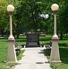
This is a list of the National Register of Historic Places listings in Webster County, Nebraska. It is intended to be a complete list of the properties and districts on the National Register of Historic Places in Webster County, Nebraska, United States. The locations of National Register properties and districts for which the latitude and longitude coordinates are included below, may be seen in a map.

<span class="mw-page-title-main">National Register of Historic Places listings in Platte County, Nebraska</span>

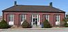
This is a list of the National Register of Historic Places listings in Platte County, Nebraska. It is intended to be a complete list of the properties and districts on the National Register of Historic Places in Platte County, Nebraska, United States. The locations of National Register properties and districts for which the latitude and longitude coordinates are included below, may be seen in a map.

<span class="mw-page-title-main">National Register of Historic Places listings in Saunders County, Nebraska</span>

This is a list of the National Register of Historic Places listings in Saunders County, Nebraska. It is intended to be a complete list of the properties and districts on the National Register of Historic Places in Saunders County, Nebraska, United States. The locations of National Register properties and districts for which the latitude and longitude coordinates are included below, may be seen in a map.

<span class="mw-page-title-main">National Register of Historic Places listings in Nemaha County, Nebraska</span>

This is a list of the National Register of Historic Places listings in Nemaha County, Nebraska. It is intended to be a complete list of the properties and districts on the National Register of Historic Places in Nemaha County, Nebraska, United States. The locations of National Register properties and districts for which the latitude and longitude coordinates are included below, may be seen in a map.

<span class="mw-page-title-main">National Register of Historic Places listings in Nance County, Nebraska</span>

This is a list of the National Register of Historic Places listings in Nance County, Nebraska. It is intended to be a complete list of the properties and districts on the National Register of Historic Places in Nance County, Nebraska, United States. The locations of National Register properties and districts for which the latitude and longitude coordinates are included below, may be seen in a map.

<span class="mw-page-title-main">National Register of Historic Places listings in Keith County, Nebraska</span>

This is a list of the National Register of Historic Places listings in Keith County, Nebraska. It is intended to be a complete list of the properties and districts on the National Register of Historic Places in Keith County, Nebraska, United States. The locations of National Register properties and districts for which the latitude and longitude coordinates are included below, may be seen in a map.

<span class="mw-page-title-main">National Register of Historic Places listings in Cherry County, Nebraska</span>

This is a list of the National Register of Historic Places listings in Cherry County, Nebraska. It is intended to be a complete list of the properties and districts on the National Register of Historic Places in Cherry County, Nebraska, United States. The locations of National Register properties and districts for which the latitude and longitude coordinates are included below, may be seen in a map.

<span class="mw-page-title-main">National Register of Historic Places listings in Cheyenne County, Nebraska</span>

This is a list of the National Register of Historic Places listings in Cheyenne County, Nebraska. It is intended to be a complete list of the properties and districts on the National Register of Historic Places in Cheyenne County, Nebraska, United States. The locations of National Register properties and districts for which the latitude and longitude coordinates are included below, may be seen in a map.

<span class="mw-page-title-main">National Register of Historic Places listings in Buffalo County, Nebraska</span>

This is a list of the National Register of Historic Places listings in Buffalo County, Nebraska.

<span class="mw-page-title-main">National Register of Historic Places listings in Butler County, Nebraska</span>

This is a list of the National Register of Historic Places listings in Butler County, Nebraska. It is intended to be a complete list of the properties and districts on the National Register of Historic Places in Butler County, Nebraska, United States. The locations of National Register properties and districts for which the latitude and longitude coordinates are included below, may be seen in a map.

<span class="mw-page-title-main">National Register of Historic Places listings in Dawes County, Nebraska</span>

This is a list of the National Register of Historic Places listings in Dawes County, Nebraska.

<span class="mw-page-title-main">National Register of Historic Places listings in Hall County, Nebraska</span>

This is a list of the National Register of Historic Places listings in Hall County, Nebraska.

<span class="mw-page-title-main">National Register of Historic Places listings in Fillmore County, Nebraska</span>

This is a list of the National Register of Historic Places listings in Fillmore County, Nebraska.

<span class="mw-page-title-main">National Register of Historic Places listings in Dodge County, Nebraska</span>

This is a list of the National Register of Historic Places listings in Dodge County, Nebraska.

<span class="mw-page-title-main">National Register of Historic Places listings in Colfax County, Nebraska</span>

This is a list of the National Register of Historic Places listings in Colfax County, Nebraska.

<span class="mw-page-title-main">National Register of Historic Places listings in Pawnee County, Oklahoma</span>

This is a list of the National Register of Historic Places listings in Pawnee County, Oklahoma.

<span class="mw-page-title-main">National Register of Historic Places listings in Merrick County, Nebraska</span>

This is a list of the National Register of Historic Places listings in Merrick County, Nebraska. It is intended to be a complete list of the properties and districts on the National Register of Historic Places in Merrick County, Nebraska, United States. The locations of National Register properties and districts for which the latitude and longitude coordinates are included below, may be seen in a map.

<span class="mw-page-title-main">National Register of Historic Places listings in Lincoln County, Nebraska</span>

This is a list of the National Register of Historic Places listings in Lincoln County, Nebraska. It is intended to be a complete list of the properties and districts on the National Register of Historic Places in Lincoln County, Nebraska, United States. The locations of National Register properties and districts for which the latitude and longitude coordinates are included below, may be seen in a map.

<span class="mw-page-title-main">National Register of Historic Places listings in Red Willow County, Nebraska</span>

This is a list of the National Register of Historic Places listings in Red Willow County, Nebraska.

<span class="mw-page-title-main">National Register of Historic Places listings in Dawson County, Nebraska</span>

This is a list of the National Register of Historic Places listings in Dawson County, Nebraska.

References

  1. The latitude and longitude information provided in this table was derived originally from the National Register Information System, which has been found to be fairly accurate for about 99% of listings. Some locations in this table may have been corrected to current GPS standards.
  2. National Park Service, United States Department of the Interior, "National Register of Historic Places: Weekly List Actions", retrieved October 21, 2022.
  3. 1 2 Numbers represent an alphabetical ordering by significant words. Various colorings, defined here, differentiate National Historic Landmarks and historic districts from other NRHP buildings, structures, sites or objects.
  4. The eight-digit number below each date is the number assigned to each location in the National Register Information System database, which can be viewed by clicking the number.
  5. Ahlgren, Carol (August 1991). "National Register of Historic Places Multiple Property Documentation Form: Nebraska Post Offices Which Contain Section Artwork (1938-1942)" (PDF). Archived from the original on May 13, 2013. Retrieved 2013-01-28.{{cite journal}}: Cite journal requires |journal= (help)CS1 maint: unfit URL (link)
  6. "Deteriorated Pawnee Hotel coming down". Beatrice Daily Sun . February 9, 1978. p. 1. Retrieved August 5, 2022 via Newspapers.com.
  7. [Usurped!]