This is a list of the National Register of Historic Places listings in Cherry County, Nebraska. It is intended to be a complete list of the properties and districts on the National Register of Historic Places in Cherry County, Nebraska, United States. The locations of National Register properties and districts for which the latitude and longitude coordinates are included below, may be seen in a map. [1]
There are 13 properties and districts listed on the National Register in the county, and one former listing.
This National Park Service list is complete through NPS recent listings posted December 15, 2023. [2]
[3] | Name on the Register | Image | Date listed [4] | Location | City or town | Description |
---|---|---|---|---|---|---|
1 | Bell Bridge | June 29, 1992 (#92000752) | County road over the Niobrara River, 11.9 miles northeast of Valentine 42°53′42″N100°19′20″W / 42.895°N 100.322222°W | Valentine | Bridge built in 1903; one of oldest surviving Pratt through truss bridges in Cherry County and the state; one of only four bridges in the county surviving ice melt flood of 1916. | |
2 | Berry State Aid Bridge | June 29, 1992 (#92000753) | County road over the Niobrara River, 10 miles northeast of Valentine 42°54′07″N100°21′44″W / 42.901944°N 100.362222°W | Valentine | Built 1920-21, replacing one of the four that survived. | |
3 | Borman Bridge | June 29, 1992 (#92000751) | County road over the Niobrara River, 2.3 miles southeast of Valentine 42°51′07″N100°31′15″W / 42.851944°N 100.520833°W | Valentine | Pinned Pratt through truss 1916 replacement for one of the bridges that was destroyed in the flood. | |
4 | Brewer Bridge | June 29, 1992 (#92000754) | County road over the Niobrara River, 14.7 miles east of Valentine 42°52′34″N100°15′58″W / 42.876111°N 100.266111°W | Valentine | ||
5 | Bryan Bridge | June 23, 1988 (#88000912) | U.S. Route 20 42°49′56″N100°31′41″W / 42.832222°N 100.528056°W | Valentine | ||
6 | Cherry County Courthouse | January 10, 1990 (#89002229) | 4th and Main Sts. 42°52′34″N100°33′04″W / 42.876111°N 100.551111°W | Valentine | ||
7 | County Line Bridge | July 13, 2018 (#100002660) | Private Rd. over Niobrara R. 42°50′49″N100°12′02″W / 42.8470°N 100.2005°W | Valentine vicinity | ||
8 | Dry Valley Church and Cemetery | July 3, 2007 (#07000660) | West of Nebraska Highway 97 north of Mullen [5] 42°15′50″N101°05′10″W / 42.263889°N 101.086111°W | Mullen | ||
9 | Spade Ranch | February 28, 1980 (#80002464) | Northwest of Ellsworth 42°18′23″N102°04′47″W / 42.306389°N 102.079722°W | Ellsworth | ||
10 | Twin Bridge | June 29, 1992 (#92000750) | North Loup River, 7.9 miles northwest of Brownlee 42°20′00″N100°45′45″W / 42.333332°N 100.762407°W | Brownlee | ||
11 | US Post Office-Valentine | December 13, 1991 (#91001750) | 348 N. Main St. 42°52′32″N100°33′01″W / 42.87564°N 100.55029°W | Valentine | One of 12 Nebraska post offices featuring a Section of Fine Arts mural. [6] The $700 mural in the post office was both praised and panned when it was originally produced. [7] Now the Valentine Media Center, operated by Educational Service Unit #17. [8] | |
12 | Valentine Public School | June 14, 1984 (#84002454) | 3rd and Macomb Sts. 42°52′31″N100°32′49″W / 42.87541°N 100.54702°W | Valentine | Now operated as a museum. [9] | |
13 | F.M. Walcott House | October 7, 1982 (#82000599) | 431 N. Hall St. 42°52′40″N100°32′58″W / 42.877694°N 100.549444°W | Valentine | Deemed locally significant architecturally "as an example of a vernacular Neo-Classical Revival dwelling, based upon earlier upright-with-wing or templeform houses common to the Greek Revival style in the eastern and midwestern states" and for association with F. M. Walcott, a county attorney and county judge who had one of the largest legal practices in Nebraska. [10] |
[3] | Name on the Register | Image | Date listed | Date removed | Location | City or town | Description |
---|---|---|---|---|---|---|---|
1 | Adamson Bridge | June 29, 1992 (#92000749) | March 25, 2019 | Nebraska Highway 97 over the Niobrara River, 7.8 miles southwest of Valentine 42°48′26″N100°40′20″W / 42.807222°N 100.672222°W | Valentine | Located on a different road alignment than the current crossing (a concrete beam bridge built c. 1994 [11] ), this bridge seems to be gone based on aerial photo view of its coordinates and on photos taken at the site in 2014. |
This is a list of the National Register of Historic Places listings in Douglas County, Nebraska.
This is a list of the National Register of Historic Places listings in Charleston County, South Carolina.
This is a list of the National Register of Historic Places listings in Marin County, California.
This is a list of the National Register of Historic Places listings in Geauga County, Ohio.
This is a list of the National Register of Historic Places listings in Webster County, Nebraska. It is intended to be a complete list of the properties and districts on the National Register of Historic Places in Webster County, Nebraska, United States. The locations of National Register properties and districts for which the latitude and longitude coordinates are included below, may be seen in a map.
This is a list of the National Register of Historic Places listings in Otoe County, Nebraska.
This is a list of the National Register of Historic Places listings in Washington County, Nebraska.
This is a list of the National Register of Historic Places listings in Saline County, Nebraska. It is intended to be a complete list of the properties and districts on the National Register of Historic Places in Saline County, Nebraska, United States. The locations of National Register properties and districts for which the latitude and longitude coordinates are included below, may be seen in a map.
This is a list of the National Register of Historic Places listings in Nemaha County, Nebraska. It is intended to be a complete list of the properties and districts on the National Register of Historic Places in Nemaha County, Nebraska, United States. The locations of National Register properties and districts for which the latitude and longitude coordinates are included below, may be seen in a map.
This is a list of the National Register of Historic Places listings in Keith County, Nebraska. It is intended to be a complete list of the properties and districts on the National Register of Historic Places in Keith County, Nebraska, United States. The locations of National Register properties and districts for which the latitude and longitude coordinates are included below, may be seen in a map.
This is a list of the National Register of Historic Places listings in Adams County, Nebraska.
This is a list of the National Register of Historic Places listings in Jefferson County, Nebraska. It is intended to be a complete list of the properties and districts on the National Register of Historic Places in Jefferson County, Nebraska, United States. The locations of National Register properties and districts for which the latitude and longitude coordinates are included below, may be seen in a map.
This is a list of the National Register of Historic Places listings in Custer County, Nebraska. It is intended to be a complete list of the properties and districts on the National Register of Historic Places in Custer County, Nebraska, United States. The locations of National Register properties and districts for which the latitude and longitude coordinates are included below, may be seen in a map.
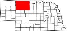
This is a list of the National Register of Historic Places listings in Dawes County, Nebraska.
This is a list of the National Register of Historic Places listings in Gage County, Nebraska.
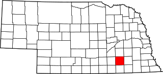
This is a list of the National Register of Historic Places listings in Fillmore County, Nebraska.
This is a list of the National Register of Historic Places listings in Lancaster County, Nebraska.
This is a list of the National Register of Historic Places listings in Colfax County, Nebraska.
This list includes properties and districts listed on the National Register of Historic Places in Wilson County, North Carolina. Click the "Map of all coordinates" link to the right to view a Google map of all properties and districts with latitude and longitude coordinates in the table below.
The U.S. Post Office-Valentine, at 348 N. Main St. in Valentine, Nebraska, was built in 1939. It has also been known as Cherry County Sawer Memorial Library Educational Service Unit 17, Media Center.
{{cite journal}}
: Cite journal requires |journal=
(help)CS1 maint: unfit URL (link)